Google deploys five-camera airplane sweeps to reconstruct cities in 3D
Nat and Friends
Google combines multi-angle aerial photography with computer vision algorithms to convert 2D flyover images into textured 3D meshes, bypassing satellite limitations to monitor planetary changes.
AI-assisted summary of Google Earth’s Incredible 3D Imagery, Explained — original source. Check the original for full context.
Source published:
Key ideas
- Google Earth operates as a photorealistic digital mirror world covering all 196.9 million square miles of the planet, pairing satellite data with low-altitude aerial photography. (0:00)
- To capture high-resolution 3D data, specialized aircraft fly systematic 5-hour lawnmower patterns equipped with five cameras recording downward and oblique angles simultaneously. (1:47)
- The seamless global satellite mosaic, dubbed 'Pretty Earth,' merges 700,000 Landsat scenes into an 800-billion-pixel canvas that would take 60 years for a single computer to process. (5:12)
- Google Earth Engine leverages the platform's multi-year historical archive as a planetary health monitor to analyze dynamic changes like Amazon deforestation and overfishing patterns. (6:18)
Detailed notes
## Background Published on YouTube by Nat and Friends on April 18, 2017, this behind-the-scenes video explores the technology and human effort behind Google Earth's photorealistic 3D imagery. The show notes explain how pixels, planes, and people collaborate to build and routinely update a digital mirror world of the planet.
## TL;DR The video breaks down how Google Earth constructs its detailed 3D environment, contrasting high-altitude 2D satellite views with low-flying camera planes that capture overlapping imagery in lawnmower-style flight paths. Through photogrammetry and computer vision, these multi-angle aerial photos are stripped of clouds and moving cars, converted into depth maps and 3D polygon meshes, and wrapped with texture mapping. Engineers also assemble the global cloud-free mosaic known as 'Pretty Earth' from Landsat data, spanning hundreds of billions of pixels across dozens of zoom tiers. Finally, the segment demonstrates how Google Earth Engine turns decades of historical imagery into an environmental health monitor, tracking dynamic changes like Amazonian deforestation and global fishing patterns over time.
## Atmosphere & style The piece carries an inquisitive, bright, and infectious curiosity driven by Nat's personable hosting and Google's engineers, Gopal and Kevin. It blends conversational tech explainer vibes with awe-inspiring reflections on space exploration, contrasting the historic, solitary snapshot of Apollo 8's 'Earthrise' with the sheer computational muscle of modern digital cartography. Visually and rhythmically, it feels like an energetic studio tour filled with playful metaphors—from street-view cars with wings to digital Russian nesting dolls—while remaining grounded in genuine reverence for Earth as a living, dynamic ecosystem.
## Bulletin - [00:00](https://www.youtube.com/watch?v=suo_aUTUpps&t=0s) Google Earth operates as a photorealistic digital mirror world covering all 196.9 million square miles of the planet, pairing satellite data with low-altitude aerial photography. - [01:47](https://www.youtube.com/watch?v=suo_aUTUpps&t=107s) To capture high-resolution 3D data, specialized aircraft fly systematic 5-hour lawnmower patterns equipped with five cameras recording downward and oblique angles simultaneously. - [05:12](https://www.youtube.com/watch?v=suo_aUTUpps&t=312s) The seamless global satellite mosaic, dubbed 'Pretty Earth,' merges 700,000 Landsat scenes into an 800-billion-pixel canvas that would take 60 years for a single computer to process. - [06:18](https://www.youtube.com/watch?v=suo_aUTUpps&t=378s) Google Earth Engine leverages the platform's multi-year historical archive as a planetary health monitor to analyze dynamic changes like Amazon deforestation and overfishing patterns.
## Key takeaways - [00:00](https://www.youtube.com/watch?v=suo_aUTUpps&t=0s) Google Earth and Google Maps serve opposite purposes: Maps is designed for navigation and utility, whereas Earth is built for open-ended exploration and getting lost. - [01:47](https://www.youtube.com/watch?v=suo_aUTUpps&t=107s) Satellites provide the global 2D base layer, but detailed 3D imagery requires low-altitude aerial photography captured by airplanes under clear atmospheric conditions. - [01:47](https://www.youtube.com/watch?v=suo_aUTUpps&t=107s) Aerial capture missions involve flying back-and-forth 'lawnmower' paths over five-hour stretches to achieve the required depth and overlap. - [01:47](https://www.youtube.com/watch?v=suo_aUTUpps&t=107s) Planes carry a five-camera array recording straight down (nadir) and in four oblique directions to capture buildings and landscapes from multiple viewpoints. - [03:20](https://www.youtube.com/watch?v=suo_aUTUpps&t=200s) Before 3D reconstruction, raw imagery is preprocessed to remove atmospheric haze, balance color, and clean moving vehicles off streets. - [03:20](https://www.youtube.com/watch?v=suo_aUTUpps&t=200s) Photogrammetry algorithms combine overlapping aerial images with precise GPS coordinates to calculate depth maps and generate 3D polygon meshes. - [03:20](https://www.youtube.com/watch?v=suo_aUTUpps&t=200s) Texture mapping slices and drapes 2D aerial photographs over the generated polygon geometry to construct realistic facades and landscapes. - [03:20](https://www.youtube.com/watch?v=suo_aUTUpps&t=200s) Sharp architectural structures and solid rock faces reconstruct cleanly, whereas organic foliage remains difficult and often defaults to simplified shapes. - [05:12](https://www.youtube.com/watch?v=suo_aUTUpps&t=312s) The 'Pretty Earth' satellite layer algorithmically chooses the clearest, cloudless pixel for every location, producing a globally uniform springtime appearance. - [05:12](https://www.youtube.com/watch?v=suo_aUTUpps&t=312s) Navigating Google Earth involves over 20 nested zoom levels structured like modular puzzle pieces rather than a single expanding map. - [06:18](https://www.youtube.com/watch?v=suo_aUTUpps&t=378s) Global satellite maps refresh every two to three years, while rapidly developing metropolitan areas are re-flown and updated in under twelve months. - [06:18](https://www.youtube.com/watch?v=suo_aUTUpps&t=378s) Google Earth Engine turns historical satellite catalogs into an analytical platform to diagnose ecological trends, tracking deforestation and commercial fishing.
## Detailed walkthrough ### [00:00](https://www.youtube.com/watch?v=suo_aUTUpps&t=0s) From "Earthrise" to a Digital Mirror World
Almost fifty years after the Apollo 8 mission headed to the Moon, Nat reflects on the famous moment when astronaut Bill Anders spotted our planet rising in lunar orbit and took an unscheduled photograph. Anders famously marveled over the headset, “Oh, my god, look at that picture over there. There's the earth coming up. Wow, is that pretty,” despite a crewmate warning that the shot was not on the checklist. That photograph, immortalized as "Earthrise," allowed humanity to gaze back at its home planet in a way never before possible. Traversing the 240,000-mile distance took three days in a spaceship, but today anyone can pull up an interactive, photorealistic representation of all 196.9 million square miles of the planet in roughly a single second.
Exploring how that digital globe exists, Nat and Lo visit Google to understand the mechanics and human effort powering Google Earth over its ten-plus years of development. Gopal explains the fundamental philosophy that differentiates the platform from Google Maps: “Google Maps is for finding your way. Google Earth is about getting lost.” While Maps prioritizes navigation and utility, Google Earth functions as the world's largest repository of geo-imagery, aiming to build a complete mirror world where users can explore everything from mountain peaks to cityscapes and ocean floors.
- **Apollo 8 vantage point:** A 240,000-mile journey requiring three days of spaceflight, captured impromptu in the 1968 "Earthrise" photo. - **Surface area captured:** The digital globe maps all 196.9 million square miles of Earth. - **Platform goal:** Creating a photorealistic "mirror world" repository of geo-imagery for free exploration.
---
[01:47](https://www.youtube.com/watch?v=suo_aUTUpps&t=107s) Planes, Cameras, and "Mowing the Lawn"
Satellites and airplanes perform distinct, complementary roles in assembling Google Earth. While satellites provide the global 2D imagery wrapped around the planetary sphere, high-resolution 3D models require aerial photography gathered by low-flying aircraft. Nat admits she originally assumed all overhead photography came strictly from orbit, jokingly reframing Google’s camera planes as "street view cars with wings." Capturing aerial photography for 3D generation is heavily constrained by environmental conditions, particularly cloud cover and haze. Kevin points out that clear skies are mandatory, while Gopal reveals that capturing a completely cloud-free model of London required flying repeat passes over the city across a prolonged period.
To acquire the required depth and overlap, planes fly systematic, five-hour missions over target areas. Instead of traveling point-to-point, pilots fly back-and-forth zigzag patterns across the target landscape. Kevin describes this flight geometry: “So it's north, and turn south. It's sort of like mowing the lawn.” Each aircraft is outfitted with an array of five specialized cameras—one pointing straight down, and four angled forward, backward, to the left, and to the right—so every surface feature is recorded simultaneously from multiple vantage points.
- **2D vs. 3D division:** Satellites provide 2D global wrap coverage, while airplane flights supply data for close-to-the-ground 3D reconstructions. - **Flight duration and path:** Standard photo runs last around five hours, flying lawnmower-style overlapping north-south passes. - **Camera setup:** Five simultaneous cameras per airplane capturing nadir (downward) and oblique (forward, backward, left, right) perspectives.
---
[03:20](https://www.youtube.com/watch?v=suo_aUTUpps&t=200s) Photogrammetry: From 2D Pixels to 3D Geometry
Turning overlapping aerial snapshots into interactive 3D spaces relies on photogrammetry, which Gopal defines as “just a fancy word for taking all of this imagery that we collect from the plane and constructing a 3D model.” Before building the geometry, the raw photography undergoes meticulous cleanup: teams color-correct the images, eliminate atmospheric haze and clouds, and remove moving vehicles from street grids so the cities appear undisturbed. Once prepped, computer vision algorithms take over, cross-referencing features visible across overlapping frames while incorporating precision data from onboard GPS antennas to determine exactly where each camera was positioned and angled in space.
```mermaid flowchart TD accTitle: Photogrammetry Pipeline accDescr: Diagram illustrating how Google Earth turns aerial photography into textured 3D meshes.
subgraph Acquisition["Data Capture & Preprocessing"] A["5-Camera Aerial Capture\n(Lawnmower flight paths)"] --> B["Image Cleanup\n(Haze/cloud removal, car extraction)"] end
subgraph Reconstruction["3D Geometry Generation"] B --> C["Computer Vision Feature Matching\n+ GPS Camera Positioning"] C --> D["Depth Map Calculation"] D --> E["Polygon Mesh Generation"] end
subgraph Texturing["Surface Application"] E --> F["Texture Mapping\n(Draping aerial photos over geometry)"] F --> G["Final 3D Mirror World"] end ```
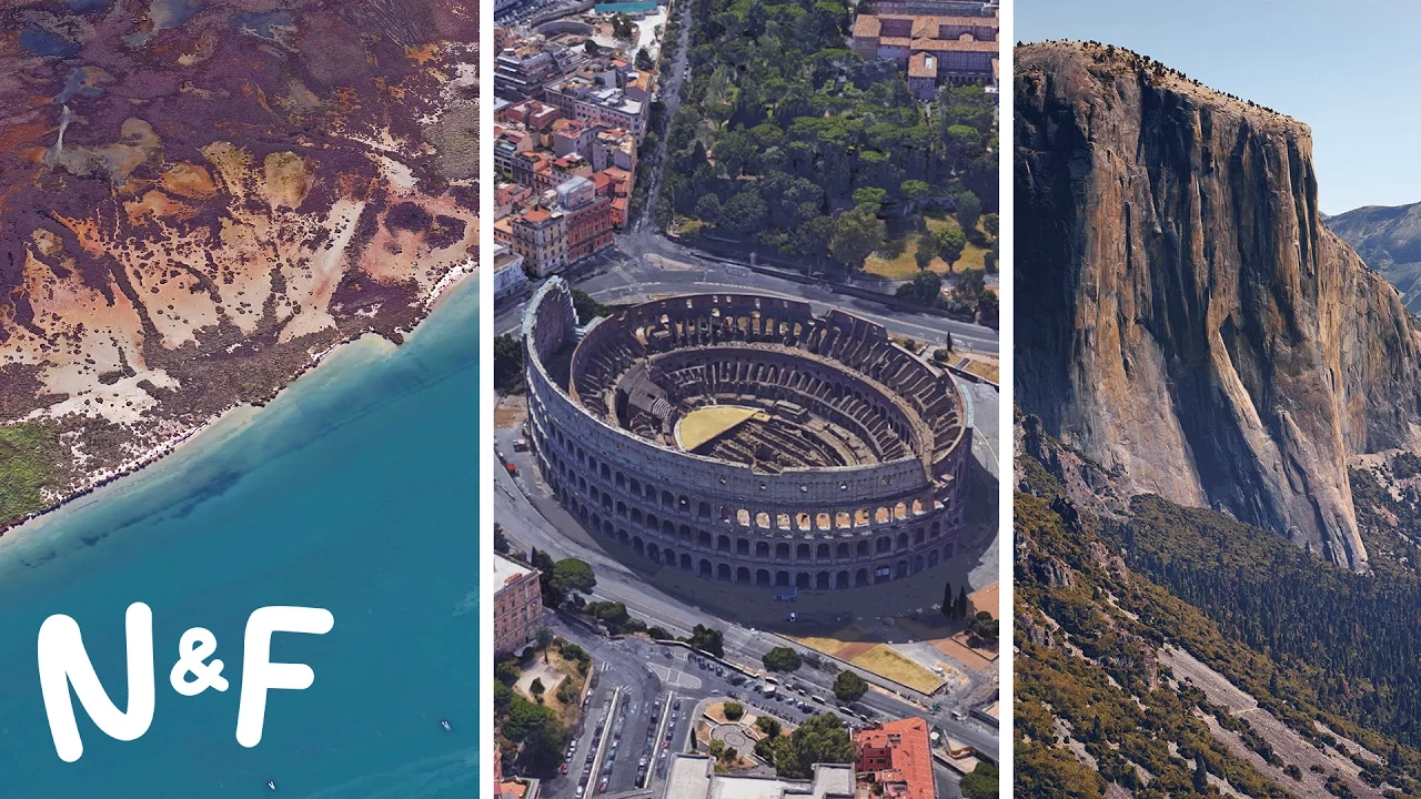
By calculating the visual displacement of matching features from known positions, the software creates depth maps that establish precise distances between objects and the lens. These depth maps are stitched together into a continuous 3D polygon mesh, representing the physical shape of structures and terrain. The aerial photographs are then sliced and projected onto the mesh through texture mapping, wrapping the photography over building facades like cut paper. Gopal notes that geometric, hard-edged structures resolve cleanly, but organic shapes remain difficult: trees often turn into simplistic "lollipop" shapes due to intricate leaf-and-branch layouts, though algorithms are improving, as shown in high-fidelity scans of Yosemite National Park capturing subtle rock contours.
- **Computer vision automation:** Matches identical features across overlapping photos using exact camera GPS coordinates and angles. - **Depth maps and meshes:** Translates optical feature parallax into depth maps, aggregating them into a unified structural mesh. - **Texture mapping:** Slices and projects aerial images onto the sides and roofs of 3D polygonal models. - **Organic rendering challenges:** Complex vegetation often renders as "lollipops," whereas sheer rock faces (like Yosemite) achieve high structural accuracy.
---
[05:12](https://www.youtube.com/watch?v=suo_aUTUpps&t=312s) Scale, Zoom Layers, and "Pretty Earth"
The volume of imagery underpinning Google Earth is staggering, totaling tens of millions of distinct images. For the seamless global satellite view alone—internally referred to as "Pretty Earth"—engineers combined data from approximately 700,000 Landsat scenes. The algorithm reviews overlapping passes to pick the single clearest, cloudless pixel for every location, standardizing vegetation so that across the entire digital globe, it appears to be springtime everywhere.
The resulting global mosaic contains roughly 800 billion pixels. If an individual attempted to print this image at native resolution using a standard household printer, the paper required would match the footprint of an entire city block. Gopal underscores the processing load behind that feat: “If you took a single computer, it would take 60 years to process that.” Because Google Earth offers more than twenty discrete zoom levels, navigating through the platform is not a single flat map expanding, but rather like opening a cascading series of Russian nesting dolls made entirely out of puzzle pieces.
- **Pretty Earth composite:** Built from around 700,000 Landsat scenes to create an uninterrupted, cloudless planetary surface. - **Springtime effect:** Algorithms select optimal pixels across seasons, creating an eternal springtime appearance worldwide. - **800-billion-pixel canvas:** Printing the global mosaic would require a sheet the size of a city block; computing it on one machine would take 60 years. - **Zoom architecture:** Features over 20 distinct zoom levels layered together seamlessly.
---
[06:18](https://www.youtube.com/watch?v=suo_aUTUpps&t=378s) Keeping the Planet Alive with Earth Engine
Because landscapes and human settlements evolve constantly, Google continuously refreshes its imagery archive. While the high-altitude global satellite view is updated roughly once every two to three years, high-density metropolitan areas with rapid development are re-flown and updated in under a year. This rolling temporal record allows researchers and engineers to track changes across the surface of the planet using Google Earth Engine, a planetary-scale analytical platform that pairs historical satellite catalogs with computer vision algorithms.
By identifying changes in tree coverage over time, Earth Engine tracks deforestation trends across the Amazon rainforest and generates predictive heat maps highlighting regions experiencing heavy logging. The same analytical framework tracks global commercial fishing patterns to identify overfished waters. Gopal describes this capability as a vital diagnostic tool: “Think about it as a health monitor for the planet.” He emphasizes that maintaining Google Earth is an ongoing commitment to mirroring dynamic ecosystems rather than creating a fixed museum piece: “It's not a static planet. It is fully alive at a macro scale.”
Nat wraps up by urging viewers to explore recent updates—including the "I'm Feeling Lucky" dice feature that teleports users to unexpected places across the globe—and teases upcoming episodes exploring virtual reality through Google Earth VR.
- **Update frequency:** Whole-globe satellite views refresh every two to three years; major urban centers update within twelve months. - **Google Earth Engine capabilities:** Uses computer vision over time-series data to map deforestation in the Amazon and identify overfished oceanic zones. - **Macro health monitor:** Serves as an environmental dashboard tracking dynamic natural cycles on a living planet. - **Exploration features:** Includes an "I'm Feeling Lucky" dice roll that teleports users to randomized locations.
## Notable quotes > [00:00](https://www.youtube.com/watch?v=suo_aUTUpps&t=0s) Google Maps is for finding your way. Google Earth is about getting lost. — Gopal
> [06:18](https://www.youtube.com/watch?v=suo_aUTUpps&t=378s) It's not a static planet. It is fully alive at a macro scale. — Gopal
## Mentioned Google Earth, Google Maps, Google Earth Engine, Google Earth VR, Google, Apollo 8, Bill Anders, Earthrise, Landsat, Amazon rainforest, Yosemite National Park, London, Nat and Friends, Gopal, Kevin
## Video description Google Earth is the most photorealistic, digital version of our planet. But how?! Where do the images come from? How are they they put together? And how often are they updated? In this video, learn about the pixels, planes, and people that create Google Earth’s 3D imagery.
Play with Google Earth → https://www.google.com/earth/ Share this video on Facebook → https://goo.gl/byTisB Follow us → https://twitter.com/NatAndFriends Subscribe → https://goo.gl/CEsJyN
Thanks to friends Vibe Mountain for the music in this video, and Freddy Arenas (http://www.freddyarenas.com) for the animations.
-------
Watch ALL the videos → https://goo.gl/8UyyHP
:) Nat & Friends http://youtube.com/natandfriends -- We make videos where we go behind the scenes at Google. What are you curious about? Let us know!
[Source](https://www.youtube.com/watch?v=suo_aUTUpps)