German Coal Mining Collapse Forces Ruhr Basin to Run Pumps Forever
Tom Scott
Because underground coal extraction permanently lowered the Ruhr Valley by up to 20 meters, drainage pumps must operate in perpetuity to prevent populated cities from submerging.
AI-assisted summary of If these pumps ever stop, part of Germany floods. — original source. Check the original for full context.
Source published:
Key ideas
- Extensive underground anthracite mining since 1850 has caused the Ruhr Valley to sink unevenly by up to 20 meters, disrupting natural drainage patterns. (1:24)
- A network of approximately 180 pumping stations managed by Emschergenossenschaft works continuously to lift surface water into elevated rivers to prevent catastrophic regional flooding. (2:39)
- In the engineer's 83-square-kilometer operational area, a total pump failure would flood nearly 60 percent of the land within five hours during severe storms or within four to five days during dry conditions. (1:24)
- These permanent operational drainage duties represent 'Ewigkeitslasten' (perpetual obligations), which coal mining companies are legally and financially required to fund indefinitely. (2:39)
Detailed notes
## Background Published by Tom Scott on YouTube on November 2, 2020, this video explores the long-term environmental consequences of industrial coal mining in northwest Germany's Ruhr Valley. According to the description, kilometre-deep mining has caused parts of the region to sink and altered natural drainage patterns, meaning towns and cities face catastrophic flooding if the pumps operated by the Emschergenossenschaft water board ever stop.
## TL;DR Centuries of deep underground coal extraction in the Ruhr Valley removed millions of tons of earth, leaving behind artificial spoil tip hills and causing the ground across the basin to sink by as much as 20 meters. This subsidence inverted natural waterways like the River Boye, meaning surface storm runoff now flows toward inhabited areas rather than draining outward to the Rhine. To keep settlements dry, a network of roughly 180 pumping stations operates non-stop, lifting river water up to 18 meters; without them, substantial portions of the region would submerge within hours to days. Because the land can never naturally regain its original elevation, running and funding these pumps constitutes an inescapable perpetual obligation (Ewigkeitslasten) that must continue indefinitely.
## Atmosphere & style The presentation blends curious outdoor travelogue with an eerie undercurrent of geological dread. Standing atop sprawling spoil tips and visiting massive drainage works alongside an operational engineer, Tom Scott conveys a sense of awe at the unimaginable scale of earth moved over generations. The tone shifts from reflective historical commentary to urgent engineering realism, leaving the viewer with a lingering, sobering realization that modern civilization is permanently locked into maintaining artificial life support for the sunken landscape.
## Bulletin - [01:24](https://www.youtube.com/watch?v=LseK5gp66u8&t=84s) Extensive underground anthracite mining since 1850 has caused the Ruhr Valley to sink unevenly by up to 20 meters, disrupting natural drainage patterns. - [02:39](https://www.youtube.com/watch?v=LseK5gp66u8&t=159s) A network of approximately 180 pumping stations managed by Emschergenossenschaft works continuously to lift surface water into elevated rivers to prevent catastrophic regional flooding. - [01:24](https://www.youtube.com/watch?v=LseK5gp66u8&t=84s) In the engineer's 83-square-kilometer operational area, a total pump failure would flood nearly 60 percent of the land within five hours during severe storms or within four to five days during dry conditions. - [02:39](https://www.youtube.com/watch?v=LseK5gp66u8&t=159s) These permanent operational drainage duties represent 'Ewigkeitslasten' (perpetual obligations), which coal mining companies are legally and financially required to fund indefinitely.
## Key takeaways - [00:00](https://www.youtube.com/watch?v=LseK5gp66u8&t=0s) The Ruhr Valley's final deep-pit coal mine ceased operations at the end of 2018, marking the end of generations of underground anthracite extraction. - [00:00](https://www.youtube.com/watch?v=LseK5gp66u8&t=0s) Vast artificial hills called spoil tips remain across the region, formed from deep-earth non-coal rock hoisted from over a kilometer below ground. - [00:00](https://www.youtube.com/watch?v=LseK5gp66u8&t=0s) Many historical spoil tips have been repurposed into cultural landmarks, public parks, and art installations such as the Tetrahedron. - [01:24](https://www.youtube.com/watch?v=LseK5gp66u8&t=84s) Excavating subterranean material caused widespread ground subsidence, dropping regional elevation by up to 20 meters. - [01:24](https://www.youtube.com/watch?v=LseK5gp66u8&t=84s) Because the terrain sank below regional riverbeds, rainwater naturally drains inward toward inhabited towns rather than outward to the sea. - [01:24](https://www.youtube.com/watch?v=LseK5gp66u8&t=84s) The River Boye pumping station must physically hoist the entire river flow 18 meters upward into the River Emscher to reach the Rhine. - [01:24](https://www.youtube.com/watch?v=LseK5gp66u8&t=84s) Roughly 60 pumping stations protect a single 83-square-kilometer operational zone where nearly 60% of the land sits below flood risk levels. - [01:24](https://www.youtube.com/watch?v=LseK5gp66u8&t=84s) Without pumping, floodwaters would overtake the subsided basin in four to five days in dry weather, or in as little as five hours during storms. - [02:39](https://www.youtube.com/watch?v=LseK5gp66u8&t=159s) Approximately 180 pumping stations operate throughout the entire Ruhr Valley network to keep populated areas dry. - [02:39](https://www.youtube.com/watch?v=LseK5gp66u8&t=159s) The network's primary purpose is storm and surface water drainage rather than groundwater or aquifer management. - [02:39](https://www.youtube.com/watch?v=LseK5gp66u8&t=159s) The facility on the River Boye can pump up to 40,000 liters of water per second through massive underground pressure pipes during heavy rain events. - [02:39](https://www.youtube.com/watch?v=LseK5gp66u8&t=159s) Mining companies bear legal and financial liability to fund the stations indefinitely because their extraction caused the ground to collapse. - [02:39](https://www.youtube.com/watch?v=LseK5gp66u8&t=159s) Known as 'Ewigkeitslasten' (perpetual obligations), the pumping infrastructure must operate in perpetuity to prevent the valley from turning into an uninhabitable swamp or lake.
## Detailed walkthrough ### [00:00](https://www.youtube.com/watch?v=LseK5gp66u8&t=0s) The Post-Mining Landscape of the Ruhr Valley
The Ruhr Valley in northwest Germany was historically defined by deep underground coal extraction. For generations, miners excavated massive quantities of anthracite—a high-grade coal requiring shafts sunk deep into the earth, sometimes plunging more than a kilometer down. That era has now drawn to a close; with the global transition toward renewable energy, the region’s final deep coal mine shut down at the end of 2018. Yet, the physical imprint of deep mining remains stamped across the entire geography in the form of artificial hills known as spoil tips. These massive mounds were dumping grounds for the immense volume of non-coal earth and rock excavated just to carve out the subterranean shafts.
Today, these spoil tips are steadily being integrated back into the local environment. Trees cover the slopes, and several summits have been repurposed as cultural sites featuring public art. Standing atop one of these hills beside a weathered amphitheater, Tom Scott reflects on visiting the Tetrahedron—a massive pyramidal walk-in landmark—the previous day, recounting how the heavy fog and foul weather made the terrain feel like an alien planet straight out of a science fiction show. While the Ruhr remains an active industrial corridor with open-cast mining and factories, public consciousness has largely shifted from active extraction to curating industrial heritage, exemplified by former collieries converted into museums and UNESCO World Heritage Sites.
- The final deep-pit coal mine in the Ruhr Valley ceased operations at the end of 2018. - Spoil tips consist of discarded rock and overburden hoisted up from tunnels over a kilometer deep. - Emphasizing the challenge of conveying these earthworks through a lens, Tom remarks: “It is very, very difficult to get across the sheer scale of these on camera, the incredible volume of earth and rock that was moved over decades.”
[01:24](https://www.youtube.com/watch?v=LseK5gp66u8&t=84s) Ground Subsidence and the Threat of Catastrophic Flooding
Removing millions of tons of material from deep underground and piling it on the surface produced a far more perilous geological consequence: widespread, uneven ground subsidence. Across the valley, the terrain sank by as much as 20 meters. This subsidence inverted natural water pathways, causing rainwater to drain inward toward populated settlements rather than outward to natural river channels. To prevent the valley from turning into an uninhabitable swamp or lake, a complex water management infrastructure—managed by the regional water board, Emschergenossenschaft—operates continuous pumping facilities to lift runoff into elevated waterways.
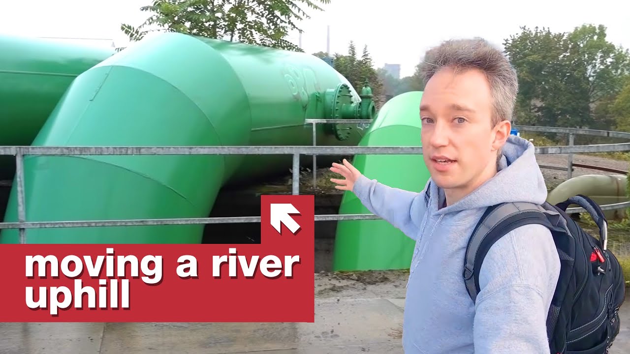
At a major pumping station, an engineer explains the stark mechanics of this altered basin. Because the ground collapsed relative to regional riverbeds, natural flow ceased entirely. Instead, the station must physically hoist the entire flow of the River Boye 18 meters upward so it can discharge into the elevated River Emscher, which subsequently carries the runoff into the Rhine. Across this single operational district of 83 square kilometers, roughly 60 pumping stations operate around the clock. If these stations fail, nearly 60 percent of the area would be submerged. In dry weather, floodwaters would overtake the basin within four to five days; under heavy storm conditions, inundation would occur in as little as five hours.
```mermaid flowchart TD accTitle: Water Drainage Architecture in the Sunk Ruhr Basin accDescr: Diagram illustrating how rain and river water are pumped up from subsided land into the Rhine. subgraph SubsidedBasin["Subsided Ruhr Valley Basin (Sunk up to 20m)"] Rain["Rainwater Runoff"] --> Boye["River Boye"] PopArea["Populated Settlements"] -.->|"Risk of flooding in 5 hrs"| Boye end
subgraph PumpInfra["Pumping Infrastructure"] Boye --> Station["Main Pumping Station<br/>(Up to 40,000 L/s)"] Station -->|"Pumps lift water 18m up"| Pipes["Underground Pressure Pipes"] end
subgraph DischargeNetwork["Elevated Natural Outflow"] Pipes --> Emscher["River Emscher"] Emscher --> Rhine["Rhine River"] Rhine --> Sea["North Sea"] end ```
- Ground levels dropped unevenly across the Ruhr by as much as 20 meters due to deep-vein mining dating back to 1850. - A single regional sector spans 83 square kilometers and depends on approximately 60 separate pumping stations. - Outlining the direct cause of this structural crisis, the engineer notes: “The problem is that we have coal mining in this area since 1850.” - Warning of the immediate vulnerability of the valley if the pumps lose power, the engineer states: “From my operational area, nearly 60% would be flooded if the whole pump stations wouldn't work.”
[02:39](https://www.youtube.com/watch?v=LseK5gp66u8&t=159s) The Eternal Cost: Running Pumps in Perpetuity
Across the broader Ruhr Valley, roughly 180 pumping stations of varying capacities keep the settled landscape dry. The facility handling the River Boye is the network's largest, equipped to pump up to 40,000 liters of water every single second through massive underground pipes following severe storms. Popular accounts frequently mislabel these facilities as groundwater or aquifer management systems, but the site engineers clarify that this is an error or mistranslation: the network functions specifically as storm drainage to redirect surface rainwater. Because the coal companies extracted the underlying geology and caused the collapse, those mining companies remain legally and financially responsible for funding the continuous operation of these stations.
When industrial coal extraction began around 150 years ago, nobody foresaw the regional subsidence that would follow. Even when land began visibly sinking around 1900, the economic value of anthracite meant extraction continued unabated; operators simply built early pump networks to manage the water. This decision locked the region into an unavoidable perpetual commitment known historically as *Ewigkeitslasten* (perpetual obligations). Because the physical topology cannot naturally revert to its pre-mining elevation, the drainage systems cannot be decommissioned in 100, 1,000, or even 10,000 years without drowning the region's cities.
- Around 180 pumping stations operate throughout the Ruhr Valley drainage network. - Peak throughput at the Boye station reaches 40,000 liters per second during intense storms. - Confirming who shoulders the permanent financial burden of running the stations, the engineer explains: “The coal mining companies are paying for this because they had dug the coal.” - Summarizing the valley's permanent engineering trap, Tom concludes: “If people want to live in the Ruhr Valley, not the Ruhr Swamp or the Ruhr Lake, then the pumps must run.”
## Notable quotes > [02:39](https://www.youtube.com/watch?v=LseK5gp66u8&t=159s) If people want to live in the Ruhr Valley, not the Ruhr Swamp or the Ruhr Lake, then the pumps must run. — Tom Scott
## Mentioned Tom Scott, Emschergenossenschaft, Ruhr Valley, Tetrahedron, River Boye, River Emscher, Rhine River, North Sea, UNESCO World Heritage, Michelle Martin, Bela Lempp, Daniel Fischer
## Video description The Ruhr Valley, in north-west Germany, is an industrial coal-mining area. And because of that kilometre-deep mining, parts of it have sunk, the drainage patterns have changed: and now, if the pumps of Emschergenossenschaft ever stop, quite a few towns and cities will end up flooded.
Filmed safely in September 2020: https://www.tomscott.com/safe/
REFERENCES: https://www.derwesten.de/region/rhein-und-ruhr/wenn-die-pumpen-stillstaenden-id12358775.html https://fxreflects.blogspot.com/2008/12/ruhr-valley-secrets-richard-serras.html -- and of course, my interview with the team from Emschergenossenschaft
Edited by Michelle Martin https://www.youtube.com/@OnTheCrux
Thanks to Bela Lempp and Daniel Fischer for the suggestion.
(Alternate title: "Iffen Pumperschtoppen, Der Deutschehabitaten Unterwasser". Alternate video: https://www.youtube.com/watch?v=6LvY6vQQET8 )
🟥 MORE FROM TOM: https://www.tomscott.com/ (you can find contact details and social links there too) ❓ LATERAL, free weekly podcast: https://lateralcast.com/ https://youtube.com/lateralcast/ 👥 THE TECHNICAL DIFFICULTIES: https://youtube.com/techdif
[Source](https://www.youtube.com/watch?v=LseK5gp66u8)