Barcelona Bans Through-Traffic Across Grid to Curb Pollution
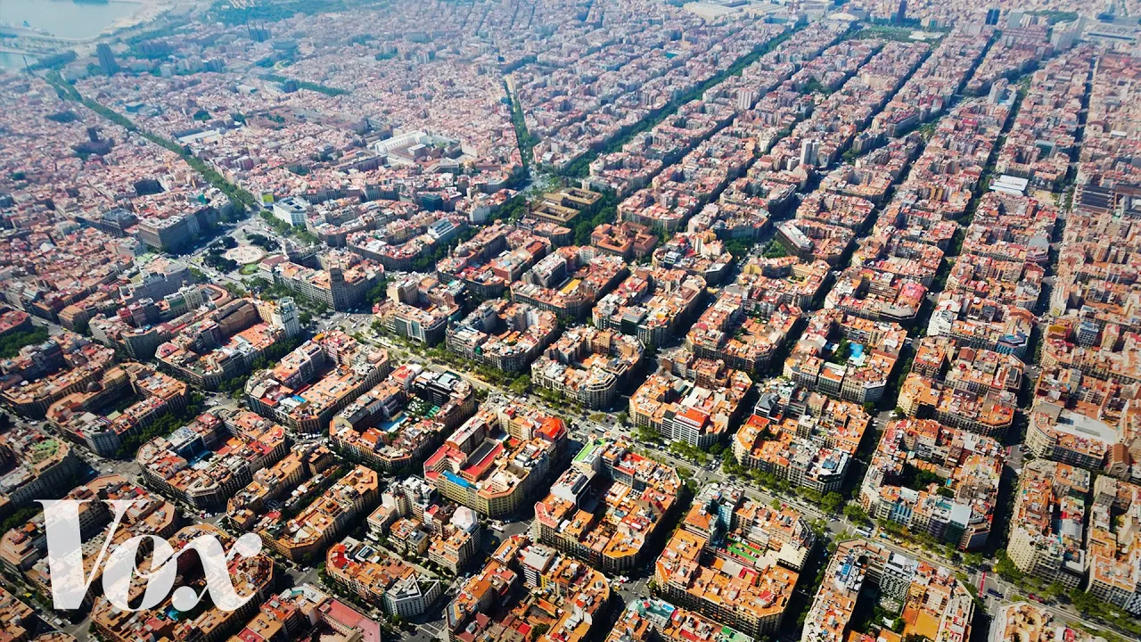
Superblocks: How Barcelona is taking city streets back from cars — Vox

Vox

Barcelona's superblock model demonstrates that reclaiming streets from cars reduces pollution and boosts local commerce, but replicating its success in North America requires dismantling systemic zoning and parking regulations.

AI-assisted summary of Superblocks: How Barcelona is taking city streets back from cars — original source. Check the original for full context.

Source published:

Key ideas

  • Barcelona's Urban Mobility Plan aims to cut vehicular traffic by 21% to combat dangerous air pollution linked to roughly 3,500 premature deaths annually across the metropolitan area. (0:01)
  • The city's superblock ("superilles") strategy carves out three-by-three block grids, diverting transit and freight around the perimeter while capping interior vehicle speeds at 10 km/h. (1:11)
  • Precedent from Vitoria-Gasteiz shows superblocks increased pedestrian space from 45% to 74%, reduced nitrogen oxide by 42%, and boosted local commercial activity rather than hurting it. (2:22)
  • Adopting the model in the United States faces structural obstacles, including single-use zoning, mandatory parking minimums, and a tendency to treat walkable streets as luxury enclaves. (3:15)

Detailed notes

## Background Published by Vox on YouTube on September 27, 2016, this video explores how modern cities have been overwhelmingly constructed around automobiles. It highlights an urban design strategy being tested in Barcelona that reclaims streets for pedestrians and public life.

## TL;DR Confronting hazardous air pollution and vehicular noise, Barcelona initiated an Urban Mobility Plan centered on superblocks (superilles)—nine-block grids that reroute through-traffic to perimeter arterials and cap interior vehicle speeds at 10 km/h. Backed by real-world data from Vitoria-Gasteiz, the concept demonstrates that converting street grids to pedestrian-first zones slashes harmful emissions and noise while revitalizing local commerce. The video traces this initiative back to Ildefons Cerdà's nineteenth-century master plan for the Eixample district, contrasting Barcelona's systemic rollout with the United States, where parking minimums, street-width standards, and single-use zoning relegate walkable environments to isolated, high-cost enclaves. In doing so, it argues that modern cities must structurally outgrow the unsustainable model of universal car ownership.

## Atmosphere & style The presentation is analytical, persuasive, and intellectually brisk, propelled by Vox's trademark explanatory narration paired with clear cartographic animations and street-level footage. It begins with a sobering examination of car-dominated urban realities before shifting into an optimistic, solutions-oriented showcase of pedestrian-first design. The overall feel is that of an eye-opening urban design masterclass, methodically dismantling everyday assumptions about how streets must function.

## Bulletin - [00:01](https://www.youtube.com/watch?v=ZORzsubQA_M&t=1s) Barcelona's Urban Mobility Plan aims to cut vehicular traffic by 21% to combat dangerous air pollution linked to roughly 3,500 premature deaths annually across the metropolitan area. - [01:11](https://www.youtube.com/watch?v=ZORzsubQA_M&t=71s) The city's superblock ("superilles") strategy carves out three-by-three block grids, diverting transit and freight around the perimeter while capping interior vehicle speeds at 10 km/h. - [02:22](https://www.youtube.com/watch?v=ZORzsubQA_M&t=142s) Precedent from Vitoria-Gasteiz shows superblocks increased pedestrian space from 45% to 74%, reduced nitrogen oxide by 42%, and boosted local commercial activity rather than hurting it. - [03:15](https://www.youtube.com/watch?v=ZORzsubQA_M&t=195s) Adopting the model in the United States faces structural obstacles, including single-use zoning, mandatory parking minimums, and a tendency to treat walkable streets as luxury enclaves.

## Key takeaways - [00:01](https://www.youtube.com/watch?v=ZORzsubQA_M&t=1s) Standard American cities allocate nearly all urban public space to cars, leaving pedestrians with marginal sidewalks and crosswalks. - [00:45](https://www.youtube.com/watch?v=ZORzsubQA_M&t=45s) Severe air pollution exceeding EU standards prompted Barcelona to set an aggressive goal of cutting vehicular traffic by 21%. - [01:11](https://www.youtube.com/watch?v=ZORzsubQA_M&t=71s) Superblocks join nine conventional city blocks into a single pedestrian-first zone that blocks through traffic across its interior. - [01:35](https://www.youtube.com/watch?v=ZORzsubQA_M&t=95s) Vehicular access inside superblocks is restricted to local trips capped at 10 km/h, with curbside parking relocated to underground garages. - [02:05](https://www.youtube.com/watch?v=ZORzsubQA_M&t=125s) Barcelona planned initial superblock pilot programs across five neighborhoods, with 120 intersections targeted for long-term transformation. - [02:22](https://www.youtube.com/watch?v=ZORzsubQA_M&t=142s) The Basque city of Vitoria-Gasteiz proved superblocks can lower noise levels by 5.5 dBA and slash particulate pollution by 38%. - [02:52](https://www.youtube.com/watch?v=ZORzsubQA_M&t=172s) Contrary to common retailer fears, pedestrianizing urban streets consistently stimulates local retail and economic activity. - [03:15](https://www.youtube.com/watch?v=ZORzsubQA_M&t=195s) Barcelona's Eixample district grid was engineered in 1859 by Ildefons Cerdà to guarantee equal public health, sunlight, and ventilation across all neighborhoods. - [03:55](https://www.youtube.com/watch?v=ZORzsubQA_M&t=235s) Unlike European implementations, American car-calming initiatives are frequently isolated within wealthy commercial districts rather than applied universally. - [04:20](https://www.youtube.com/watch?v=ZORzsubQA_M&t=260s) U.S. zoning codes, wide street requirements, and mandatory parking minimums enforce vehicle dependency and block organic mixed-use walkability. - [04:50](https://www.youtube.com/watch?v=ZORzsubQA_M&t=290s) Barcelona treats clean air and car-free mobility as a fundamental right across all socioeconomic classes rather than a luxury amenity. - [05:15](https://www.youtube.com/watch?v=ZORzsubQA_M&t=315s) Growing urban centers cannot sustainably scale under the assumption that every resident can own and drive a personal automobile.

## Detailed walkthrough ### [00:01](https://www.youtube.com/watch?v=ZORzsubQA_M&t=1s) Reclaiming City Streets from the Automobile

In almost any standard American city, stripping away the infrastructure carved out for motor vehicles leaves shockingly little behind. Pedestrians are left with narrow concrete ribbons along the fringes and crosswalks strung between them, while personal vehicles swallow nearly all public space. City dwellers have become thoroughly conditioned to squeeze onto cramped sidewalks, pause at crosswalk signals, and watch cyclists hazard their lives in precarious strips of asphalt. As the video observes regarding this car-centric baseline: “Americans are used to cars the way that fish are used to water.” For the vast majority of people, vehicular dominance is so completely embedded in everyday life that the possibility of designing an urban environment any other way has never even crossed their minds.

Faced with a mounting public health crisis, Barcelona began actively seeking an alternative. By 2014, the Catalan capital alongside its 35 outlying municipalities was repeatedly breaching the European Union’s statutory air quality standards. Scientific studies linked local air pollution to approximately 3,500 premature deaths every year, compounded by debilitating citywide noise pollution generated by relentless traffic. Rather than accepting this status quo, the municipality crafted an aggressive Urban Mobility Plan with the explicit target of cutting overall vehicular traffic by 21 percent.

- Air pollution in Barcelona and its 35 surrounding municipalities contributed to an estimated 3,500 premature deaths annually. - The regional government consistently failed to meet European Union air quality benchmarks. - Barcelona's Urban Mobility Plan set a concrete target to reduce urban traffic volume by 21%.

---

[01:11](https://www.youtube.com/watch?v=ZORzsubQA_M&t=71s) The Anatomy of a Superblock

The centerpiece of Barcelona’s strategy relies on an urban planning mechanism known in Catalan as *superilles*, or "superblocks." While urban designers have historically used the term "superblock" to describe gargantuan megablocks that sever all pedestrian flow, Barcelona’s model does the exact opposite. Planners carve out a nine-square-block grid (a three-by-three block perimeter) and prohibit through traffic from cutting across its interior. Heavy freight haulers, municipal buses, and private drivers journeying across town are rerouted exclusively around the outer ring.

```mermaid flowchart TD accTitle: Superblock Traffic Routing System accDescr: Flowchart illustrating how through-traffic is routed along the perimeter while interior streets prioritize pedestrians and low-speed access.

subgraph Perimeter ["Perimeter Arterials"] A["Through Traffic & Transit<br/>(Buses, Freight, Commuters)"] end

subgraph Interior ["Interior Street Grid (3x3 Blocks)"] B["Local Access Only<br/>(Speed Limit: 10 km/h / 6 mph)"] C["Underground Parking Garages"] D["Reclaimed Public Realm<br/>(Markets, Games, Pedestrians)"] end

A -->|"Bypasses Interior"| Perimeter Interior -.->|"Access Only"| B B --> C B --> D ```

Within the interior nine-block zone, streets are transformed. The speed limit is capped at a strict 10 kilometers per hour (roughly 6 miles per hour), surface-level curbside parking is eliminated and relocated to subterranean parking garages, and asphalt once choked with traffic is reclaimed for open-air markets, recreation, and community gatherings. Explaining the experiential transformation, the speaker notes: “Within this nine square block perimeter you're gonna have kind of a pleasant streetscape where people can walk around and mingle and do things without this kind of constant fear of cars around.” While initially slated for trial runs in five distinct neighborhoods, municipal planners identified 120 key intersections across the broader metropolitan area prime for conversion.

- Superblocks join nine conventional city blocks into an interconnected three-by-three precinct. - Through-traffic and public transit are diverted entirely to outer boundary streets. - Internal vehicular speeds are restricted to 10 km/h (just over 6 mph). - Surface-level parking spaces are moved underground to free up public rights-of-way. - Barcelona selected 5 pilot neighborhoods and mapped out 120 intersections suited for potential conversion.

---

[02:22](https://www.youtube.com/watch?v=ZORzsubQA_M&t=142s) Real-World Evidence: The Vitoria-Gasteiz Model

To anticipate the real-world performance of widespread superblocks, planners look northwest of Barcelona to the Basque city of Vitoria-Gasteiz, which began pioneering superblock interventions in 2008. The empirical results in its central superblock provide clear validation for the model:

| Metric | Before Superblock Implementation | After Superblock Implementation | Impact | |:--- |:--- |:--- |:--- | | **Pedestrian Surface Space** | 45% of total area | 74% of total area | +29 percentage points | | **Ambient Noise Level** | 66.5 dBA | 61.0 dBA | 5.5 dBA reduction | | **Nitrogen Oxide ($\text{NO}_x$)** | Baseline urban level | Post-implementation level | 42% decrease | | **Particle Pollution ($\text{PM}$)** | Baseline urban level | Post-implementation level | 38% decrease |

Alongside marked environmental improvements, local commerce flourished rather than suffering. Defying long-held assumptions among merchants that removing vehicular access hurts retail revenue, commercial turnover climbed. As the speaker highlights regarding merchant trends: “What you consistently see when people change their streetscapes to prioritize human beings over cars is you don't see any decline in economic activity, you see the opposite.” Slower foot and bicycle traffic naturally invites people to linger, browse storefronts, and patronize neighborhood establishments, establishing a self-reinforcing social and economic hub.

---

[03:15](https://www.youtube.com/watch?v=ZORzsubQA_M&t=195s) Urban Design and the Challenge for American Cities

Applying the superblock template outside of Spain brings into focus Barcelona’s unique structural heritage. Much of the city was constructed before the advent of the personal automobile, organized along a disciplined layout. The Eixample district—the ground zero for the modern superblock initiative—was mapped out in 1859 by urban planning pioneer Ildefons Cerdà. Cerdà effectively coined the term and field of "urbanization," devising an egalitarian grid system engineered to provide uniform access to sunlight, ventilation, schools, and hospitals across every sector.

Even though Cerdà's regular street grid provides a natural canvas, superblock advocates stress that cities do not need identical historical layouts for the concept to succeed. When American municipalities attempt pedestrian-first or car-calmed experiments, however, they run into systemic institutional barriers:

- Interventions in the United States tend to be confined to affluent, high-revenue commercial corridors rather than being rolled out universally. - Conventional U.S. single-use zoning mandates the rigid separation of housing and retail, preventing the organic mixed-use neighborhoods essential for true walkability. - Mandatory parking minimums artificially subsidize vehicle dependency by forcing developers to construct asphalt parking lots. - Excessive street-width minimums result in wide roadways that remain inherently hostile to foot traffic.

These regulatory policies turn walkable urban districts into rare, isolated luxury enclaves across North America. In contrast, Barcelona’s project avoids cordoning off a single affluent shopping district or showpiece plaza. By designing superblocks as a contiguous network spanning both working-class and wealthy neighborhoods, Barcelona frames vehicular freedom and clean, safe air as a fundamental civil right. Addressing this imperative, the speaker reflects: “Maybe — this might be overly optimistic — but I think it has sunk in in the U. S. that the model whereby every city resident comes with a car — and drives a car everywhere – is just inherently limited.” Ultimately, sustaining healthy and expanding cities requires engineering urban spaces where high-density populations can work, travel, and thrive entirely free of automobile dependence.

## Notable quotes > [00:01](https://www.youtube.com/watch?v=ZORzsubQA_M&t=1s) Americans are used to cars the way that fish are used to water.

> [02:22](https://www.youtube.com/watch?v=ZORzsubQA_M&t=142s) What you consistently see when people change their streetscapes to prioritize human beings over cars is you don't see any decline in economic activity, you see the opposite.

## Mentioned Barcelona, European Union, Ildefons Cerdà, Eixample, Vitoria-Gasteiz, Vox

## Video description Modern cities are designed for cars. But the city of Barcelona is testing out an urban design trick that can give cities back to pedestrians.

Help us make more ambitious videos by joining the Vox Video Lab. It gets you exclusive perks, like livestream Q&As with all the Vox creators, a badge that levels up over time, and video extras bringing you closer to our work! Learn more at http://bit.ly/video-lab

Read more: http://www.vox.com/2016/8/4/12342806/barcelona-superblocks

Thumbnail image from http://shutterstock.com

Subscribe to our channel! http://goo.gl/0bsAjO

Vox.com is a news website that helps you cut through the noise and understand what's really driving the events in the headlines. Check out http://www.vox.com to get up to speed on everything from Kurdistan to the Kim Kardashian app.

Check out our full video catalog: http://goo.gl/IZONyE Follow Vox on Twitter: http://goo.gl/XFrZ5H Or on Facebook: http://goo.gl/U2g06o

[Source](https://www.youtube.com/watch?v=ZORzsubQA_M)

中文简报

巴塞罗那禁止街区过境交通以遏制污染 巴塞罗那的“超级街区”模式表明,从汽车手中夺回街道不仅能减少污染,还能促进本地商业发展,但要在北美复制这一成功经验,需要破除体制性的分区和停车法规。 面对严重的空气污染和交通噪音,巴塞罗那启动了以“超级街区”(superilles)为核心的《城市出行规划》。该方案由九个街区组成网格,将过境交通分流至外围干道,并将内部车辆限速控制在每小时10公里。在维多利亚-加斯泰斯真实数据的支持下,这一理念证明将街区路网改造为行人优先区可大幅削减有害排放与噪音,同时重振本地商业。视频追溯了该举措的历史渊源——伊尔德方斯·塞尔达19世纪为扩展区(Eixample)制定的总体规划,并将巴塞罗那的系统性推进与美国进行了对比;在美国,最低停车配额、街道宽度标准和单一功能分区使得适宜步行的环境沦为孤立且高成本的少数区域。由此,视频指出现代城市必须从结构上摒弃普遍拥有汽车这一不可持续的模式。 巴塞罗那的《城市出行规划》旨在减少21%的机动车交通,以应对大都市区每年导致约3500人过早死亡的危险空气污染问题。 (0:01) 该市的超级街区(“superilles”)策略划分出三乘三的街区网格,将过境交通和货运分流至外围,同时将内部车速限制在每小时10公里以内。 (1:11) 维多利亚-加斯泰斯的先例显示,超级街区使行人空间从45%增加到74%,氮氧化物减少了42%,并且促进了当地商业活动,而非带来负面冲击。 (2:22) 在美国采纳该模式面临体制性障碍,包括单一功能分区、强制性最低停车配额,以及将步行街区视为高档专属区域的倾向。 (3:15)

Reading summary

To combat severe air pollution and reclaim public space dominated by automobiles, Barcelona developed its "superblock" model to restrict through-traffic and prioritize pedestrian life across broad residential grids. Public Health Crises Prompt Barcelona's Mobility Pivot (0:01) In standard automobile-centric cities, personal motor vehicles absorb the overwhelming majority of public space, leaving pedestrians confined to narrow sidewalks and crosswalks. By 2014, Barcelona and its 35 surrounding municipalities were consistently violating European Union air quality benchmarks. Scientific research linked local air pollution to roughly 3,500 premature deaths each year, a problem further compounded by pervasive traffic noise. In response, municipal authorities established an Urban Mobility Plan aimed at reducing total vehicular traffic by 21 percent. The Three-by-Three Superblock Mechanism (1:11) The core of Barcelona's urban strategy is the superblock (*superilla*), which clusters a nine-square-block grid (a three-by-three perimeter) to exclude cut-through traffic. Heavy freight, city buses, and cross-town private vehicles are restricted entirely to outer arterial roads. Inside the interior streets, vehicle speeds are capped at 10 kilometers per hour (about 6 miles per hour), and curbside parking is relocated to subterranean garages. This repurposes surface asphalt for community recreation, open-air markets, and pedestrian walking. Planners launched pilots in five neighborhoods and mapped 120 key intersections across the metropolitan area for prospective transformation. Empirical Precedents and Economic Outcomes in Vitoria-Gasteiz (2:22) Barcelona's planning drew precedent from Vitoria-Gasteiz, a Basque city that adopted superblocks in 2008. In its central superblock, pedestrian surface space grew from 45% to 74% of the total area, ambient noise dropped by 5.5 dBA, nitrogen oxide levels fell by 42%, and particulate pollution declined by 38%. Additionally, local business turnover increased rather than contracted, countering merchant worries that curbside car restrictions harm retail. As the program observes, prioritizing pedestrian flow allows people to linger and frequent shops, generating economic and social vitality. Structural and Regulatory Barriers in American Cities (3:15) While Barcelona benefits from the egalitarian, pre-automobile grid laid out by Ildefons Cerdà in the 1859 Eixample district, advocates argue identical historic layouts are not mandatory for superblocks to succeed. In the United States, pedestrian-friendly interventions are frequently hindered by systemic planning frameworks: single-use zoning that separates housing from commercial centers, mandatory parking minimums that subsidize car dependency, and excessive street-width regulations. Consequently, walkable districts in North America often remain isolated enclaves in affluent corridors rather than the networked public utility implemented across Barcelona. The program emphasizes that treating car access as an entitlement for every urban resident imposes structural limitations on urban growth and public health. Sustaining dense cities ultimately requires reimagining street networks so that clean air and public spaces function as universal municipal rights rather than localized amenities.

精炼阅读摘要

Vox探讨了巴塞罗那推行的“超级街区”(Superblocks/Superilles)模式,该举措旨在打破私家车对城市空间的垄断,通过重构街区交通流线以应对空气污染与公共健康危机,并为全球汽车依赖型城市提供了不同于传统规划的替代方案。 汽车主导危机与巴塞罗那减流目标 (0:01) 在典型汽车导向的城市中,绝大部分公共空间被机动车道和停车位占据,行人和骑行者往往只能在狭窄的边缘空间活动。巴塞罗那及其周边的35个市镇长期面临严峻的公共卫生危机,空气质量反复超出欧盟法定标准。科学研究显示,当地空气污染每年直接导致约3500人过早死亡,伴随而来的严重交通噪音也严重损害市民健康。为摆脱这一现状,巴塞罗那市政府制定了激进的城市出行计划(Urban Mobility Plan),设定了将整体机动车交通量削减21%的明确量化目标。 超级街区重构内部空间与交通分流 (1:11) 超级街区的核心设计是将九个传统街区组合成一个“三乘三”的网格单元。城市规划者彻底重置了交通流线:过境机动车、重型货运及公交干线被严格限制在超级街区的外围环道行驶,禁止直接穿行街区内部。街区内部道路仅允许本地车辆以不超过10公里/小时(约6英里/小时)的速度出入,地面路侧停车位全部迁至地下车库。原先拥堵的沥青路面被改造为步行区、户外露天市场和社区游憩空间。巴塞罗那最初在5个街区启动试点,并在整个大都会区锁定了120个适于改造的关键路口。 维多利亚案例验证环保与商业效益 (2:22) 巴斯克地区的维多利亚-加斯泰斯(Vitoria-Gasteiz)自2008年起实践超级街区模式,其实证数据为巴塞罗那提供了直接佐证。在改造后的核心街区,行人可用地面空间占比从45%大幅提升至74%;环境噪音水平下降5.5分贝(从66.5分贝降至61.0分贝);氮氧化物(NOx)排放下降42%,颗粒物污染(PM)减少38%。此外,该模型打破了“限制车辆进入会损害零售业”的传统商户偏见,较慢的人行与自行车动线反而吸引了更多人流驻足,实际商业营业额不降反升,形成了充满活力的社区经济圈。 历史肌理优势与美国制度性障碍 (3:15) 巴塞罗那推行超级街区得益于其独特的历史基础。拓展区(Eixample)由现代城市规划先驱伊尔德方斯·塞尔达(Ildefons Cerdà)于1859年设计,其规则的网格布局天然具备良好的通风、采光和空间通用性。与之形成鲜明对比的是,美国城市在推行类似步行化改造时面临严苛的制度瓶颈:单功能分区法规强制隔离居住与商业功能,最低停车配额要求迫使开发商建造大面积沥青停车场,过宽的车道设计规范加剧了对行人的排斥,导致步行街区往往沦为少数高收入阶层享有的孤立商业孤岛。巴塞罗那则将超级街区作为跨越工薪与富裕社区的连贯网络,将安全空间与清洁空气视作普惠的公民权利。 该节目指出,让每位居民都依赖并随时随地驾驶私家车的城市发展模式具有不可持续的内在局限;如何在维持高密度人口增长的同时,通过城市空间重塑摆脱对汽车的绝对依赖,是保障现代都市长期健康运转的核心挑战。

Detailed notes — zh

## Background 该视频由新闻机构 Vox 于 2016 年 9 月 27 日发布在 YouTube 平台上。页面简介指出,现代城市普遍为汽车而设计,而西班牙巴塞罗那正在试验一种创新的城市设计手法,旨在将城市街道重新归还给行人。 ## TL;DR 面对严峻的空气污染与过早死亡危机,巴塞罗那制定了《城市出行规划》,核心举措是推行由“3×3”街区构成的“超级街区”(Superblocks)。该方案将过境交通与重型车辆限制在外围主干道,内部街道则严格限速 10 km/h 并将停车位转入地下,从而转化为适宜集会、市集与漫步的步行空间。西班牙城市维多利亚-加斯泰斯的先行经验表明,超级街区不仅显著降低了噪音和污染,还带动了商业活力的提升。反观美国城市,因僵化的用地分区和促车法规,步行环境往往沦为富人专属的奢侈品;而巴塞罗那的探索则致力于实现空间正义,将无车干扰的宜居街区打造成全体居民普惠共享的基本权利。 ## Atmosphere & style 全片洋溢着 Vox 标志性的严谨新闻调查质感与清晰明快的信息设计美学。讲述者以直击痛点的生动比喻切入,配合受访学者的透彻点评与直观的街区拓扑图示,将复杂的城市规划逻辑拆解得深入浅出。叙事基调既冷静审视了汽车霸权对城市健康的制度性侵害,又对巴塞罗那的大胆重构展现出由衷的期待与乐观,在理性质询与空间人文主义的关怀中激发出观众对未来城市形态的深刻反思。 ## Bulletin - [00:01](https://www.youtube.com/watch?v=ZORzsubQA_M&t=1s) 巴塞罗那制定《城市出行规划》力争削减21%的机动车通行量,以应对每年导致多达3500人过早死亡的严峻空气污染问题。 - [01:11](https://www.youtube.com/watch?v=ZORzsubQA_M&t=71s) 巴塞罗那提出“超级街区”(Superblocks)模式,将3×3的九宫格街区组合成封闭单元,将穿行车辆阻断在外围主干道,内部严格限速10 km/h并腾出大量公共活动空间。 - [02:22](https://www.youtube.com/watch?v=ZORzsubQA_M&t=142s) 西班牙维多利亚-加斯泰斯的实践证明,超级街区使行人空间占比提升至74%,二氧化氮排放下降42%,且并未损害商业,反而通过步行客流带动了区域经济增长。 - [03:15](https://www.youtube.com/watch?v=ZORzsubQA_M&t=195s) 美国城市推行步行街区面临土地分区隔离与最低配建停车位等制度壁垒,而巴塞罗那将无车空间作为普惠性权利推向全市,为破解汽车依赖提供了新的制度范式。 ## Key takeaways - [00:01](https://www.youtube.com/watch?v=ZORzsubQA_M&t=1s) 现代城市空间被汽车深度主导,行人和骑行者被边缘化至狭窄夹缝中,公众已对这种环境习以为常。 - [00:01](https://www.youtube.com/watch?v=ZORzsubQA_M&t=1s) 巴塞罗那及周边35个市镇持续未能达标欧盟空气质量,空气污染每年造成多达3500人过早死亡,倒逼城市推行减车改革。 - [00:01](https://www.youtube.com/watch?v=ZORzsubQA_M&t=1s) 巴塞罗那出台《城市出行规划》,设立了将全市机动车交通总量削减21%的减排目标。 - [01:11](https://www.youtube.com/watch?v=ZORzsubQA_M&t=71s) 超级街区将9个方形街区组合为一个大单元,过境交通、公交车与货车被强制导流至外围主干道通行。 - [01:11](https://www.youtube.com/watch?v=ZORzsubQA_M&t=71s) 超级街区内部将限速压低至10公里/小时,地面停车位转入地下,释放出街道用于市集、体育与社区交往。 - [02:22](https://www.youtube.com/watch?v=ZORzsubQA_M&t=142s) 维多利亚-加斯泰斯自2008年起的实践验证了超级街区的可行性,行人空间从45%大幅提升至74%。 - [02:22](https://www.youtube.com/watch?v=ZORzsubQA_M&t=142s) 维多利亚-加斯泰斯核心区噪音从66.5分贝降至61分贝,二氧化氮与颗粒物排放分别减少42%和38%。 - [02:22](https://www.youtube.com/watch?v=ZORzsubQA_M&t=142s) 剥夺机动车路权并未导致商业衰退,相反,步行环境的提升促进了客流停驻与消费,形成了良性商业生态。 - [03:15](https://www.youtube.com/watch?v=ZORzsubQA_M&t=195s) 巴塞罗那扩展区的网格化结构由伊尔德丰斯·塞尔达于1859年奠定,但规划师强调超级街区逻辑可适用于非网格形态城市。 - [03:15](https://www.youtube.com/watch?v=ZORzsubQA_M&t=195s) 美国城市的减车尝试往往受限于僵化的区划隔离(Zoning),居住区与商业区被割裂,无法形成混合型步行社区。 - [03:15](https://www.youtube.com/watch?v=ZORzsubQA_M&t=195s) “最低配建停车位标准”与“最低街道宽度标准”等促车法规,将美国可步行街区推向了昂贵而稀缺的“奢侈品”境地。 - [03:15](https://www.youtube.com/watch?v=ZORzsubQA_M&t=195s) 巴塞罗那模式的关键在于其空间正义理念,它将“免受汽车侵扰的空间”确立为全城居民共享的普遍权利,而非富人区特权。 - [03:15](https://www.youtube.com/watch?v=ZORzsubQA_M&t=195s) “人人配车并驾车出行”的传统城市发展模型存在根本局限,制约了城市规模的进一步成长与居民健康。 ## Detailed walkthrough ### [00:01](https://www.youtube.com/watch?v=ZORzsubQA_M&t=1s) 汽车主导的城市困境与巴塞罗那的破局思考 在典型的美国城市街头,如果将专门留给汽车的空间全部剥离,剩下的行人空间其实少得可怜,仅剩路旁狭窄的人行道和偶尔穿插的过街设施。汽车已牢牢主导了现代城市:行人在窄道上步履维艰,在路口苦等红绿灯;骑行者只能在极窄的夹缝中艰难穿行。正如讲述者打的一个生动比喻:“Americans are used to cars the way that fish are used to water.”(美国人习惯汽车的方式,就像鱼习惯水一样。)这种现象在美国如此普遍,以至于大多数人从未想过城市生活其实可以有另一种可能。 为了打破这种局面,将城市空间重新还给行人和骑行者,巴塞罗那探索出了一条引人注目的路径。2014年,巴塞罗那面临极其严峻的空气污染挑战,该市及其周边的35个市镇持续未能达到欧盟的空气质量标准。严酷的研究数据显示,当地空气污染每年导致多达3500人过早死亡;此外,机动车通行还带来了巨大的噪音污染。为了挽救城市环境,巴塞罗那制定了一项雄心勃勃的《城市出行规划》(Urban Mobility Plan),目标是将机动车交通量削减21%。 ### [01:11](https://www.youtube.com/watch?v=ZORzsubQA_M&t=71s) “超级街区”(Superblocks)的核心设计机制 整个出行规划中最具创意的核心举措,被称为加泰罗尼亚语的“superilles”,即“超级街区”(Superblocks)。这一城市设计理念旨在最大限度地减少市中心的汽车存在。虽然“superblock”一词在历史上曾指代过完全不设机动车通道的超大体量建筑群,但巴塞罗那的做法截然不同。 巴塞罗那的方案采用“3×3”网格,即把9个方形城市街区组合为一个大单元,彻底阻断其内部的过境穿行交通: ```mermaid flowchart TD accTitle: Superblock Traffic Flow Concept accDescr: Diagram showing how Barcelona superblocks divert through-traffic to the perimeter while keeping the interior for low-speed local access and pedestrians. subgraph Perimeter ["外围主干道 (Perimeter)"] A["过境交通 / 公交车 / 重型货车"] -->|"环绕通行"| B["外围主干道网络"] end subgraph Interior ["超级街区内部 (Interior)"] C["限速 10 km/h (约 6 mph)"] D["路面停车位转入地下"] E["街道空间转化为市集、运动与活动广场"] end B -.->|"仅限居民与基础服务低速驶入"| Interior ``` 公交车、大型货车以及任何仅想从城市一侧前往另一侧的穿行车辆,都被强制引导至超级街区外围通行。而在街区内部,车速上限被严格限制在每小时10公里(约合6英里/小时),路面临时停车位全部转移至地下。通过这些改造,街道不再是危险的沥青车道,而成为居民逛市集、开展户外运动和邻里集会的宜人场所。正如受访者所评价的:“Within this nine square block perimeter you're gonna have kind of a pleasant streetscape where people can walk around and mingle and do things without this kind of constant fear of cars around.”(在这个九街区的范围内,你将拥有宜人的街景,人们可以在其中走动交流、开展活动,而不必时刻对身边的汽车提心吊胆。)巴塞罗那率先在5个街区进行实地试点,并锁定了全区约120处适合推广改造的潜在交叉路口。 ### [02:22](https://www.youtube.com/watch?v=ZORzsubQA_M&t=142s) 维多利亚-加斯泰斯的成功先例与经济红利 超级街区并非停留在图纸上的乌托邦构想。位于巴塞罗那西北部的西班牙城市维多利亚-加斯泰斯(Vitoria-Gasteiz)早在2008年就开始实践超级街区理念,其取得的数据为这一模式提供了强有力的现实支撑: - **行人空间占比**:在市中心的核心超级街区内,行人专用空间从原有地面总面积的 45% 暴增至 74%。 - **噪音降幅**:得益于车流量的大幅缩减,区域环境噪音从 66.5 分贝降至 61 分贝。 - **空气质量改善**:区域内二氧化氮(氮氧化物)排放量锐减 42%,颗粒物污染减少 38%。 令人意外的是,剥夺机动车路权不仅没有损害商业,反而让当地经济更加繁荣。受访者明确指出:“What you consistently see when people change their streetscapes to prioritize human beings over cars is you don't see any decline in economic activity, you see the opposite.”(当人们改变街景、将人置于汽车之上时,你一贯看到的绝非经济活力的衰退,而是恰恰相反的景象。)当街道环境变得友好舒适,更多的人选择步行或慢速骑行,停下脚步光顾街边店铺的频率随之增加,社会交往活动的聚集促使商业生态形成了良性循环。 ### [03:15](https://www.youtube.com/watch?v=ZORzsubQA_M&t=195s) 美国城市的制度痛点与空间正义启示 这种模式能否移植到美国城市?巴塞罗那推行超级街区具备得天独厚的先天优势:城市的大部分区域成型于汽车普及之前,并拥有规整的网格结构。例如,超级街区规划所依托的扩展区(Eixample),是由伊尔德丰斯·塞尔达(Ildefons Cerdà)于1859年规划设计的。塞尔达当年不仅创造了“城市化”(urbanization)这一概念与学科体系,更通过均质网格布局实现了学校、医院等城市公共资源的公平分配。不过,超级街区的设计师们坚称,推行该方案并非必须依赖严格的网格路网,其设计逻辑适用于任何城市形态。 反观美国城市,尽管也有部分减少汽车的探索,却始终陷入制度性困境: - **财富门槛与空间割裂**:减车改造往往只局限在极少数商铺密集、原本就富裕的高端社区,无法惠及普罗大众。 - **僵化的区划隔离**:当地土地利用分区(Zoning)通常要求居住区与商业区严格分离,扼杀了兼具居住与商业的理想步行混合街区。 - **制度性促车法规**:严格的“最低配建停车位标准”(Parking Minimums)迫使城市建造大量停车场,而“最低街道宽度标准”则造就了极度宽阔、对步行极度不友好的道路。 - **步行街区沦为奢侈品**:在这些法规制约下,美国的高步行指数街区变成了昂贵而孤立的“奢侈品”。 巴塞罗那方案最根本的突破在于它超越了局部改造的思维——它并不是挑出某一个豪华社区或特定的城市广场改造成步行示范区,而是把超级街区方案推向整座城市,将“远离汽车干扰的空间”确立为每位居民不论身处哪个地段都能享有的基本权利。 探讨最后谈及了城市发展理念的转向。受访者总结道:“Maybe — this might be overly optimistic — but I think it has sunk in in the U.S. that the model whereby every city resident comes with a car — and drives a car everywhere – is just inherently limited. It limits the growth of your city, it limits the health of your city and the growth of your city.”(也许这听起来有些过于乐观,但我认为美国人已经开始意识到:那种让每个市民都配备一辆车并开车去往任何地方的模式,本身就存在局限。它限制了城市的成长,也损害了城市的健康。)未来无论采取何种途径,城市都必须找到一种让大量人口紧密聚居、却无需人人都依赖汽车的生活模式,让居民在没有汽车绑架的环境下,依然能够自如地通勤、工作、玩耍,并享受美好的城市生活。 ## Notable quotes > [02:22](https://www.youtube.com/watch?v=ZORzsubQA_M&t=142s) What you consistently see when people change their streetscapes to prioritize human beings over cars is you don't see any decline in economic activity, you see the opposite. — 受访者 > [00:01](https://www.youtube.com/watch?v=ZORzsubQA_M&t=1s) Americans are used to cars the way that fish are used to water. — 讲述者 ## Mentioned Vox, 巴塞罗那, 超级街区, 维多利亚-加斯泰斯, 伊尔德丰斯·塞尔达, 扩展区 (Eixample), 《城市出行规划》 (Urban Mobility Plan), 欧盟 ## Video description Modern cities are designed for cars. But the city of Barcelona is testing out an urban design trick that can give cities back to pedestrians. Help us make more ambitious videos by joining the Vox Video Lab. It gets you exclusive perks, like livestream Q&As with all the Vox creators, a badge that levels up over time, and video extras bringing you closer to our work! Learn more at http://bit.ly/video-lab Read more: http://www.vox.com/2016/8/4/12342806/barcelona-superblocks Thumbnail image from http://shutterstock.com Subscribe to our channel! http://goo.gl/0bsAjO Vox.com is a news website that helps you cut through the noise and understand what's really driving the events in the headlines. Check out http://www.vox.com to get up to speed on everything from Kurdistan to the Kim Kardashian app. Check out our full video catalog: http://goo.gl/IZONyE Follow Vox on Twitter: http://goo.gl/XFrZ5H Or on Facebook: http://goo.gl/U2g06o [Source](https://www.youtube.com/watch?v=ZORzsubQA_M)

Source quotes

[2:22] 受访者: What you consistently see when people change their streetscapes to prioritize human beings over cars is you don't see any decline in economic activity, you see the opposite. [0:01] 讲述者: Americans are used to cars the way that fish are used to water.

Source quotes

[0:01] Americans are used to cars the way that fish are used to water. [2:22] What you consistently see when people change their streetscapes to prioritize human beings over cars is you don't see any decline in economic activity, you see the opposite.

Original transcript

[0:01] If you imagine a typical American city street, and you take away the space that’s dedicated [0:06] to cars, you aren’t left with very much. [0:09] There are some narrow walkways on the side, and some bridges in between them, but not [0:12] much else. [0:13] Cars dominate cities. [0:16] Spend some time walking around most cities and you’ll find yourself pushed to narrow [0:18] sidewalks, waiting for crosswalk lights. [0:20] You’ll find cyclists navigating really narrow strips of space. [0:23] Americans are used to cars the way that fish are used to water. [0:28] That’s so ubiquitous in the U.S. that I think for most people, it just never occurred [0:32] to them that it could be otherwise. [0:35] But what if there were a way to change that? [0:36] To give space back to pedestrians and bicyclists, and to make cities more friendly to life outside [0:42] of a car? [0:43] It turns out Barcelona might have a solution. [0:48] In 2014, the city was faced with serious air pollution problems. [0:51] Barcelona and its 35 surrounding municipalities consistently failed to meet the EU’s air [0:55] quality targets. [0:57] Studies were showing that air pollution in the region causes 3,500 premature deaths every [1:02] year. [1:03] Traffic in the city also causes severe noise pollution. [1:05] So the city developed an extensive Urban Mobility Plan with the hope of reducing traffic by [1:10] 21 percent. [1:11] The coolest part of the plan [1:12] were these things: [1:15] They call them "superilles". [1:17] Superilles? [1:18] “Si, superilles.” [1:19] That translates to “superblocks”. [1:21] It’s this urban design concept intended to minimize the presence of cars in city centers. [1:26] The word “superblock” has been used before to describe huge city blocks without any passageways [1:30] for cars. [1:31] But that’s not what’s happening here. [1:33] So here’s how Barcelona’s plan works. [1:35] You take nine square city blocks and close off the inside to through traffic. [1:39] So buses, big freight trucks — or any vehicles that are trying to get from one part of town [1:44] to the next — have to drive around the perimeter. [1:47] Inside the superblock, the speed limit is kept to 10 kilometers per hour — that translates [1:51] to just over 6 miles per hour — and curbside parking is replaced by underground parking. [1:55] That means you wind up with street space for markets, outdoor games, and events. [2:00] Within this nine square block perimeter you're gonna have kind of a pleasant streetscape [2:05] where people can walk around and mingle and do things without this kind of constant fear [2:11] of cars around. [2:13] The concept is going to be tested out in five neighborhoods, but the city has identified [2:17] 120 possible intersections throughout the region where it could be implemented. [2:22] So how do we know what the results of this kind of plan would look like? [2:24] Well, northwest of Barcelona is a city called Vitoria-Gasteiz, which has implemented superblock [2:29] designs since 2008. [2:30] In the main superblock at the city center, pedestrian space increased from 45 percent [2:35] of the total surface area to 74 percent. [2:37] With so much less traffic, noise levels dropped from 66.5 dBA to 61 dBA. [2:43] Most impressive of all, there was a 42% reduction in nitrogen oxide emissions and a 38% reduction [2:48] in particle pollution in the area. [2:51] On top of that, business is up. [2:52] What you consistently see when people change their streetscapes to prioritize human beings [2:58] over cars is you don't see any decline in economic activity, you see the opposite. [3:03] You get more people walking and cycling around more slowly, stopping more often patronizing [3:09] businesses more, and that … center of social activity will tend to build on itself. [3:15] So here’s the question: could something like this work in an American city? [3:20] Barcelona has some unique advantages getting started on this plan, in that a lot of it [3:26] was built before cars, and a lot of it was built on a simple grid. [3:32] The district of Eixample — where the superblock plan is based — was designed in 1859 [3:38] in this repetitive grid structure by this guy, Ildefons Cerdá. [3:41] He basically invented the word for (and the study of) “urbanization” when he laid out this [3:46] grid plan for Barcelona that evenly distributed resources like schools and hospitals. [3:51] But superblock designers insist that cities don’t need a simple grid structure [3:54] to implement this kind of plan. [3:56] It can work anywhere. [3:58] Now, cities in the US have have attempted some car-minimizing projects like this. [4:01] The problem is, they’re usually done in wealthier areas with lots of existing businesses. [4:07] Zoning policies often require separation of residential and commercial areas — but an [4:11] ideal walkable area would be a mix of the two. [4:14] On top of that, zoning minimums on parking availability encourage the presence of cars [4:18] and parking lots, and minimums on street width make for wide, unwalkable streets. [4:24] Because of that, walkable districts are basically isolated luxury items in the US. [4:29] What makes the Barcelona plan different is that they aren’t setting aside one fancy [4:32] neighborhood or town square to make pedestrian-friendly [4:35] — instead, by proposing superblocks throughout [4:38] the entire city, they’ve declared car-free spaces a right for everybody, no matter what [4:42] part of town they're in. [4:44] Maybe — this might be overly optimistic — but I think it has sunk in in the U. S. that the model whereby [4:52] every city resident comes with a car — and drives a car everywhere – is just inherently limited. [4:57] It limits the growth of your city, it limits the health of your city and the growth of your city. [5:01] So one way or another we have to find ways of having a lot of people live close to one another without all of [5:09] them having cars. [5:11] You know, being able to get around and work and play in live and have enjoyable lives without cars.