London Tube Adopted Harry Beck Circuit Diagram After Initial Rejection
Map Men
Harry Beck's decision to discard geographic scale for an electrical circuit diagram succeeded because transit passengers prioritize network topology over physical distance.
AI-assisted summary of The Tube Map nearly looked very different — original source. Check the original for full context.
Source published:
Key ideas
- London's early underground network was fragmented among hostile private rail operators who deliberately suppressed competitors on maps and refused interline passenger transfers. (0:00)
- American magnate Charles Tyson Yerkes consolidated London's disparate subterranean rail lines into the UERL by late 1905, establishing unified ticketing before his death. (1:44)
- Frank Stingemore and Frank Pick began simplifying transit mapping in the 1920s by stripping away surface streets and distorting geographical scale for suburban branches. (4:02)
- In 1931, laid-off draftsman Harry Beck designed the modern diagrammatic Tube map using electrical circuit principles, which was initially rejected by Pick before a trial run proved massively successful in 1933. (6:02)
Detailed notes
## Background This video was published on YouTube by the educational-comedy channel Map Men (created by Jay Foreman and Paul Kendler) on September 26, 2022. The video description promotes their book 'This Way Up - When Maps Go Wrong', credits their production team and guest cast, and humorously notes that the spaghetti used during filming was donated to a food bank.
## TL;DR The episode explores the chaotic history and cartographic evolution behind the iconic London Underground map. In the 19th century, competing private rail operators published disjointed, biased maps that actively confused passengers until American financier Charles Tyson Yerkes consolidated the lines under the UERL in the early 1900s. Early attempts to map the entire network, such as the cluttered 1908 'spaghetti' map and Frank Stingemore's scaled-down 1924 diagram, struggled to balance geographic accuracy with suburban expansion. The breakthrough came when redundant electrical draftsman Harry Beck reconceptualized the system as a geometric circuit diagram restricted to horizontal, vertical, and 45-degree angles, creating the beloved 1933 design that revolutionized global transit cartography.
## Atmosphere & style The presentation is brisk, satirical, and irreverent, balancing deep transit history with snappy sketch comedy, fast-paced editing, and self-deprecating banter. Jay Foreman and Paul Kendler deliver historical breakdowns through dry British wit, theatrical character reenactments, and playful jabs at transport enthusiasts and historical figures alike. The pacing moves energetically from historical chaos to cartographic triumph, concluding with a characteristically surreal promotional sketch.
## Bulletin - [00:00](https://www.youtube.com/watch?v=cTLCfl01zuE&t=0s) London's early underground network was fragmented among hostile private rail operators who deliberately suppressed competitors on maps and refused interline passenger transfers. - [01:44](https://www.youtube.com/watch?v=cTLCfl01zuE&t=104s) American magnate Charles Tyson Yerkes consolidated London's disparate subterranean rail lines into the UERL by late 1905, establishing unified ticketing before his death. - [04:02](https://www.youtube.com/watch?v=cTLCfl01zuE&t=242s) Frank Stingemore and Frank Pick began simplifying transit mapping in the 1920s by stripping away surface streets and distorting geographical scale for suburban branches. - [06:02](https://www.youtube.com/watch?v=cTLCfl01zuE&t=362s) In 1931, laid-off draftsman Harry Beck designed the modern diagrammatic Tube map using electrical circuit principles, which was initially rejected by Pick before a trial run proved massively successful in 1933.
## Key takeaways - [00:00](https://www.youtube.com/watch?v=cTLCfl01zuE&t=0s) Early private rail operators in London competed ruthlessly, creating biased maps that hid rival lines and requiring passengers to walk between surface street ticket booths to transfer. - [01:44](https://www.youtube.com/watch?v=cTLCfl01zuE&t=104s) Charles Tyson Yerkes founded the Underground Electric Railways Company of London (UERL) in 1902 and completed major line acquisitions by 1905, creating an integrated system. - [03:00](https://www.youtube.com/watch?v=cTLCfl01zuE&t=180s) The 1908 UERL map was the first to display all underground lines together with equal line weights and distinct colors, but it became an illegible 'plate of spaghetti' due to excessive surface detail. - [04:02](https://www.youtube.com/watch?v=cTLCfl01zuE&t=242s) Under Frank Pick, the UERL unified its corporate identity by instituting the roundel logo and Edward Johnston's standardized geometric typeface. - [04:02](https://www.youtube.com/watch?v=cTLCfl01zuE&t=242s) Frank Stingemore's 1924 pocket map removed landmarks and selectively compressed suburban lines, demonstrating that geographic fidelity was unnecessary for passenger navigation. - [06:02](https://www.youtube.com/watch?v=cTLCfl01zuE&t=362s) Harry Beck, drawing on his engineering background with signaling schematics, abandoned true geography entirely to treat the Underground as an electrical circuit diagram. - [06:02](https://www.youtube.com/watch?v=cTLCfl01zuE&t=362s) Beck restricted the network map to vertical, horizontal, and 45-degree diagonal vectors while evening out central station spacing and compressing outer terminals. - [06:02](https://www.youtube.com/watch?v=cTLCfl01zuE&t=362s) Frank Pick initially rejected Beck's design in 1931 as too abstract and geographically misleading for the general public. - [06:02](https://www.youtube.com/watch?v=cTLCfl01zuE&t=362s) A cautious 1933 public trial met with immediate passenger acclaim, causing London Transport to adopt Beck's schematic design as the permanent standard.
## Detailed walkthrough ### [00:00](https://www.youtube.com/watch?v=cTLCfl01zuE&t=0s) The Icon of London and the Chaos of Private Railways
The London Underground map ranks alongside Big Ben, the Tower of London, the London Eye, and M&M's World as one of the ultimate cultural symbols of London. Instantly recognized, parodied, and loved worldwide, it sees new iterations published every few months. This regular refresh cycle has fostered an obsessive community of transit cartography enthusiasts who boast vast collections and can identify the minutest graphical differences between prints—prompting the hosts to fondly deride them: “Eurgh. Look at them. Massive bunch of nerds.” Yet this design was far from an inevitability; it almost took a drastically different shape, which in turn could have radically altered the London it depicts.
```mermaid flowchart TD accTitle: Evolution of London Underground Mapping accDescr: Diagram tracing the progression from fragmented private rail lines to Harry Beck's diagrammatic network map.
subgraph EarlyEra["Fragmented Origins (19th c. – 1905)"] A["Private Railway Companies"] -->|"competing services"| B["Biased Individual Maps"] C["Charles Tyson Yerkes"] -->|"consolidation (1902–1905)"| D["UERL Integrated Network"] end
subgraph DesignEvolution["Cartographic Evolution (1908–1933)"] D --> E["1908 Joint Map<br/>(Cluttered 'Spaghetti')"] E --> F["Frank Pick Branding<br/>+ Stingemore Map (1924)"] F --> G["Harry Beck's Circuit Diagram (1931)"] G --> H["1933 Public Trial & Adoption"] end ```
The historical roots of London’s underground transit date to the mid-19th century, when independent, privately run railway lines began opening beneath the city. At the time, passengers had no unified guide. Each private operator published its own map, rendering its own routes in bold, assertive strokes while downplaying rivals in faint, nearly invisible lines. Rival operators were in ruthless competition, leading to deliberate inconvenience for passengers. On the central circular route, the Metropolitan Railway operated clockwise while the similarly named Metropolitan District Railway ran anti-clockwise. A traveler buying a ticket from the wrong booth was forced to take the long way around just to travel a single stop. Interchange between services was equally hostile: transferring between lines at Bank station required riding a lift to street level, walking across the open road, buying an entirely separate ticket, and riding an elevator back down underground.
- Private rail operators routinely suppressed rivals' presence by drawing competing lines as narrow, faint lines. - Competing lines refused interline transfers, requiring redundant street-level ticketing between platforms.
---
[01:44](https://www.youtube.com/watch?v=cTLCfl01zuE&t=104s) Enter Charles Tyson Yerkes and the Birth of UERL
For London's subterranean rail lines to reach their potential, the patchwork needed to be unified under a coordinated system with single-ticket through-journeys. Achieving this required an immense fortune. In 1902, that ambition arrived in the person of Charles Tyson Yerkes, a wealthy American railway magnate with a colossal bank account, an equally colossal moustache, and a wife named Guttridge. Yerkes spearheaded the very American concept of a single consolidated network covering the entire city, forming the Underground Electric Railways Company of London (UERL, or colloquially, "ooerrl").
Yerkes embarked on an aggressive spending spree, acquiring existing lines alongside four unfinished railway projects: the Charing Cross, Euston and Hampstead Railway; the Metropolitan District Railway; the Great Northern, Brompton and Piccadilly Railway; and the Baker Street and Waterloo Railway. His takeover spree concluded in November 1905. Just one month later, in December 1905, Yerkes died. Through this timely exit, he neatly escaped paying the massive debts accumulated during his acquisitions, leaving behind a consolidated, integrated railway system featuring standardized station architecture and through-ticketing.
- In 1902, Charles Tyson Yerkes spearheaded the establishment of the Underground Electric Railways Company of London (UERL). - By November 1905, Yerkes had acquired multiple critical railways, creating an integrated system right before his death in December 1905.
---
[03:00](https://www.youtube.com/watch?v=cTLCfl01zuE&t=180s) The 1908 Map and the Search for Readability
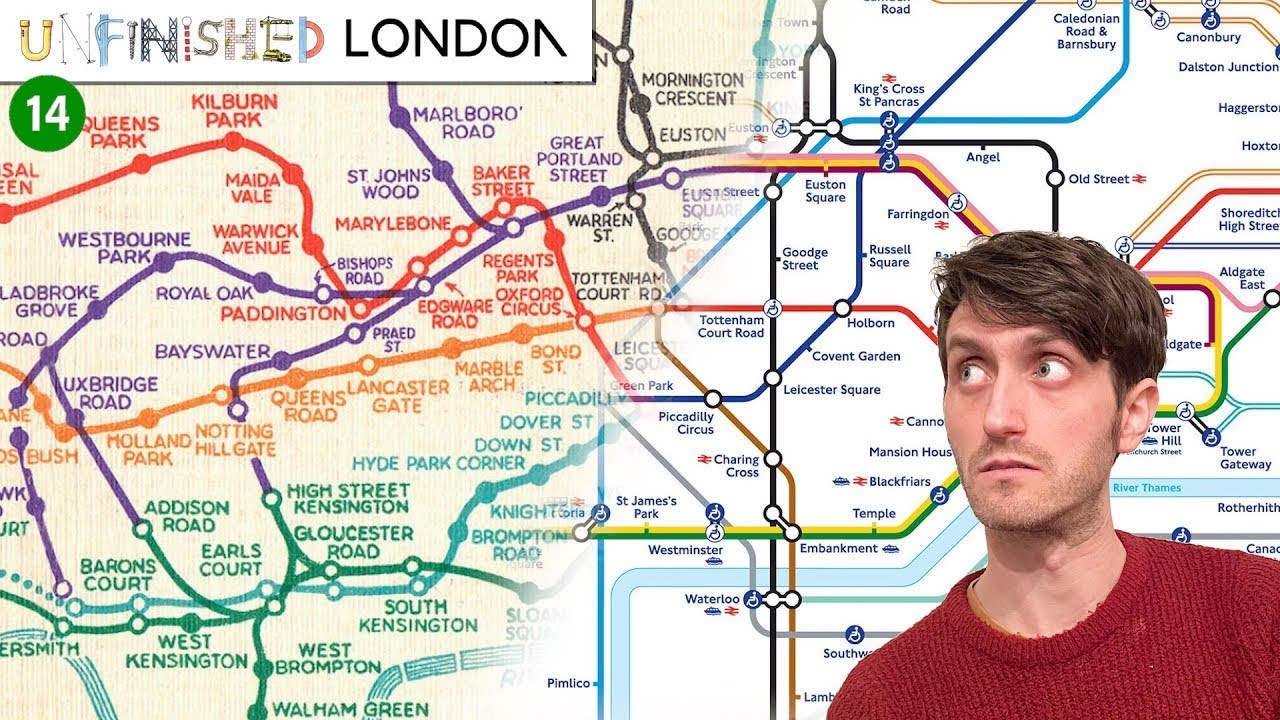
A unified network demanded a unified guide, and in 1908 the UERL published the first joint map depicting every underground line across London, even including those outside UERL ownership. This map introduced core conventions that endure today, such as giving every line equal visual weight and using distinct colors for each route—though the original palette featured surprises, like rendering the Piccadilly line in bright yellow.
Despite these breakthroughs, the 1908 edition suffered from overwhelming clutter. By trying to combine rail routes with surface roads, landmarks, and commercial venues like the Army & Navy Auxiliary Stores, the resulting diagram looked like an illegible "plate of spaghetti." Across the early 20th century, various companies attempted alternative visual schemes to capture the growing system. These ranged in utility, highlighted by MacDonald Gill’s 1914 "Wonderground Map"—described as being “Simultaneously incredibly detailed and incredibly completely useless.”
- The 1908 UERL map established the precedent of uniform line thickness and distinct color-coding across operators. - Excessive geographic detail—such as surface landmarks and commercial shops—made early comprehensive maps messy and difficult to read.
---
[04:02](https://www.youtube.com/watch?v=cTLCfl01zuE&t=242s) Frank Pick and Frank Stingemore's Distorted Scale
By the early 1920s, the Tube was sprawling out into distant suburbs, making geographical mapping even more impractical. To tackle this, the UERL appointed Frank Pick as its head of publicity. Pick was single-mindedly dedicated to building a coherent, recognizable corporate identity for the network. He instituted standard system-wide signage: introducing the iconic roundel (a red circle pierced by a blue horizontal bar), standardizing the Johnston typeface with its geometric circular "O"s and diamond tittle dots, and commissioning artistic publicity posters.
Pick insisted on visual uniformity for maps across all stations, platforms, and brochures. In search of a functional design, Pick commissioned Frank Stingemore in 1924. Stingemore stripped away the surface clutter entirely, retaining only a beige background with the River Thames as a sole geographic anchor. Crucially, Stingemore cheated real-world scale: he compressed suburban terminal branches—such as those on what would become the Northern line—into straight, unscaled corridors to keep the central network legible. The hosts observe that despite this geographical distortion:
> “For passengers trying to get from station A to station B this map still served its purpose perfectly well.”
Unless someone was actually operating the train—and arguably not even then—exact spatial curvature and physical track lengths were irrelevant to navigating the network.
- Frank Pick standardized the Tube's visual brand, establishing the roundel logo and uniform Johnston typography. - Frank Stingemore's 1924 map removed landmarks and roads, utilizing scale distortion to fit sprawling suburban branches onto a pocket-sized sheet.
---
[06:02](https://www.youtube.com/watch?v=cTLCfl01zuE&t=362s) Harry Beck's Radical Circuit Diagram
Stingemore proved that geographic scale could be stretched, but another employee took the concept to its logical extreme. Harry Beck (formally Henry Charles Beck), an engineering draftsman working at the UERL drawing electrical signaling schematics, lost his job during redundancies in 1931. In his spare time, Beck channeled his technical background into a passion project: conceptualizing the London Underground as an electrical circuit diagram. Drawing inspiration from strip maps used inside carriage compartments, Beck abandoned geography completely:
> “While Stingemore's approach was to be a little bit naughty with scale, Beck's approach was that scale could absolutely go [BEEP] itself.”
Beck restricted the track paths exclusively to horizontal, vertical, and 45-degree diagonal lines. Working through pencil drafts, he replaced physical track bends with straightened vectors, evening out the spacing between crowded central stations while compressing the distant outer suburbs. He prioritized symmetry, uniform spacing, and parallelism above all else. Though not a map in the strict geographical sense, this "Journey Planner" diagram was far easier to read than any prior effort, creating an impression of an orderly, tightly integrated system.
Believing he had solved transit mapping, Beck returned to the UERL (now reorganizing as London Transport) later in 1931 to present his sketch to Frank Pick. Pick hated it. He rejected the submission on the grounds that it was geographically inaccurate and assumed the general public would fail to grasp the abstraction. The diagram did introduce distortions: closely adjacent stations in central London appeared widely separated, potentially tricking tourists into taking the train for trips that were faster on foot, such as walking between Queensway (then Queen's Road) and Bayswater in less than twenty seconds.
Persistent lobbying by Beck eventually convinced Pick to relent. Pick agreed to a small, cautious public trial in exchange for Beck leaving him alone. In early 1933, London Transport issued a limited print run to a few stations, featuring a modest cover note stating: *"A new design for an old map. We should welcome your comments."* Passenger reception was immediate and overwhelmingly enthusiastic. The public embraced the diagrammatic layout, and by 1933, Harry Beck’s layout officially supplanted Stingemore's map across all London Underground publicity, setting the template for transit cartography worldwide—just before professional troubles began to mount for Beck.
- Beck was a redundant signaling draftsman who treated transit routes like an electrical circuit diagram. - All routes were restricted to three basic vectors: horizontal, vertical, and 45-degree diagonals. - Central stations were spaced out evenly while outer suburban stops were compressed inward. - Frank Pick originally dismissed the sketch as an unreadable, inaccurate novelty before relenting to a limited trial in 1933.
[09:14](https://www.youtube.com/watch?v=cTLCfl01zuE&t=554s) Unfinished London Teaser and Surfshark VPN Sponsorship
Following the conclusion of the episode, viewers are told to stay right where they are to await the next installment of *Unfinished London*. Jay Foreman then appears on camera to thank everyone for watching and immediately offers an apology for taking a little longer than usual to release the video. However, he insists he has a thoroughly valid excuse for the delay: “Just a few weeks ago the most amazing thing in the world happened to me: I downloaded Surfshark VPN.” He explains that Surfshark VPN is an application and browser extension designed to encrypt internet data while granting access to the web through a network of more than 3,200 servers spread across over 95 countries worldwide.
Jay explains that activating Surfshark effectively transforms the user into an internet user browsing from a completely different country, unlocking access to foreign streaming libraries, regional discounts, and content otherwise unavailable locally. He confesses that this is the real reason for his late upload schedule, having spent the preceding weeks staying up all night binge-watching television programs that cannot typically be viewed on the British internet. To illustrate the flexibility of the service, he rattles off cross-border combinations, pointing out that Surfshark allows British viewers to watch American Netflix, German viewers to watch French Amazon Prime, Canadian viewers to stream Mexican Disney+, and virtually any other conceivable pairing.
Beyond entertainment, Jay highlights the critical security advantages of the software, noting how reassuring it is to keep one's personal data private and secure. Turning the service on conceals the user's IP address, guarding against advertisers, online trackers, and hackers. Furthermore, a single Surfshark account can protect an unlimited number of devices, ensuring that an entire household's growing collection of gadgets remains covered simultaneously. Jay pitches the promotional offer by directing viewers to the link in the video description using the discount code "jayforeman" to receive 83% off Surfshark along with three additional months for free, hyping it up with the claim: “It'll be the best thing that ever happens to you.”
The pitch culminates in a surreal domestic sketch where Jay excitedly yells out, “Honey! The baby just said his first words.” When asked off-camera what those words were, Jay matter-of-factly reports that the infant stated Surfshark offers a 30-day money-back guarantee. When his partner asks, “Does that effectively make it a free trial?”, Jay confirms, “Yes it does,” before urging viewers to make the most important decision of their lives by downloading the VPN immediately. The segment closes with Jay baby-talking lovingly down at the screen: “Aww, who's a useful and affordable little VPN? Surfshark is! Yes you are! Yes you are!”
- **Network reach:** More than 3,200 servers located across over 95 countries. - **Device policy:** Protects an unlimited number of devices simultaneously on a single account. - **Promotional offer:** Use code `jayforeman` via the link in the description to receive 83% off plus three extra months free. - **Guarantee:** 30-day money-back guarantee, effectively functioning as a risk-free trial.
## Notable quotes > [06:02](https://www.youtube.com/watch?v=cTLCfl01zuE&t=362s) While Stingemore's approach was to be a little bit naughty with scale, Beck's approach was that scale could absolutely go [BEEP] itself. — Jay Foreman and Paul Kendler
## Mentioned London Underground, Harry Beck, Frank Pick, Frank Stingemore, Charles Tyson Yerkes, Underground Electric Railways Company of London (UERL), London Transport, Metropolitan Railway, Metropolitan District Railway, MacDonald Gill, Wonderground Map, Surfshark VPN, Jay Foreman, Paul Kendler, Unfinished London, This Way Up - When Maps Go Wrong
## Video description 📕 Buy the MAP MEN BOOK 'This Way Up - When Maps Go Wrong' https://lnk.to/mapmen
SEE NEW EPISODES EARLY, AND BEHIND-THE-SCENES EXTRAS... http://www.patreon.com/mapmen
WRITTEN AND CREATED BY Jay Foreman and Paul Kendler
EDITED BY Jay Foreman
DIRECTOR Jade Nagi
DIRECTOR OF PHOTOGRAPHY / ADDITIONAL ANIMATION Paul Kendler
RUNNERS Ángel Martínez Lana Farhat
STUDIO RUNNERS Chris Law Patrizio Serao
BOOKING CLERK(S) Tim Dunn
CHARLES TYSON YERKES John Henry Falle
GUTTRIDGE YERKES Mandy Dassa
DINNER/MONOPOLY Jon Gracey Simon Kendler
FRANK PICK Geoff Marshall https://www.youtube.com/@geofftech2
HARRY BECK Jago Hazzard https://youtube.com/@JagoHazzard
THANKS TO Mark Ovendon Michael Sercan Daventry The Salisbury Cherie Selale http://www.Greenlanes.london
MASSIVE NERDS Achyut Chaudhary, Alex Cole, Anthony Norris-Watson, Arian Parmar, Benjamin Patel, Blogging Tex and Wil, Finn Gahagan, Geoff's Marshall’s Mum, George Arrigoni, George Lwman, Harry Morgan, "ISBSP”, James Chadwick, K Dar, roadsignreport1, Luca Filippi, Matthew Finn, Mez Abad, Ruth Carlson, Ryan Oakley, Steve Lovelace, TheBritFromOz, Timo Ko, Tom P Moore, Tyrese Monford. (Sorry I couldn’t include you all!)
VFX Chris Walker https://www.artstation.com/zangrethordigital
Kard (music from Wacky Wheels) by Mark Klem
Royalty free Music by Giorgio Di Campo for @FreeSound Music http://freesoundmusic.eu https://www.facebook.com/freemusicfor... https://youtube.com/freesoundmusic original video: https://youtu.be/D-_GPpo6pxU
We donated the amount of spaghetti used in this video to a food bank.
[Source](https://www.youtube.com/watch?v=cTLCfl01zuE)