Handcart of 99 Phones Tricks Google Maps, Reroutes Real Traffic
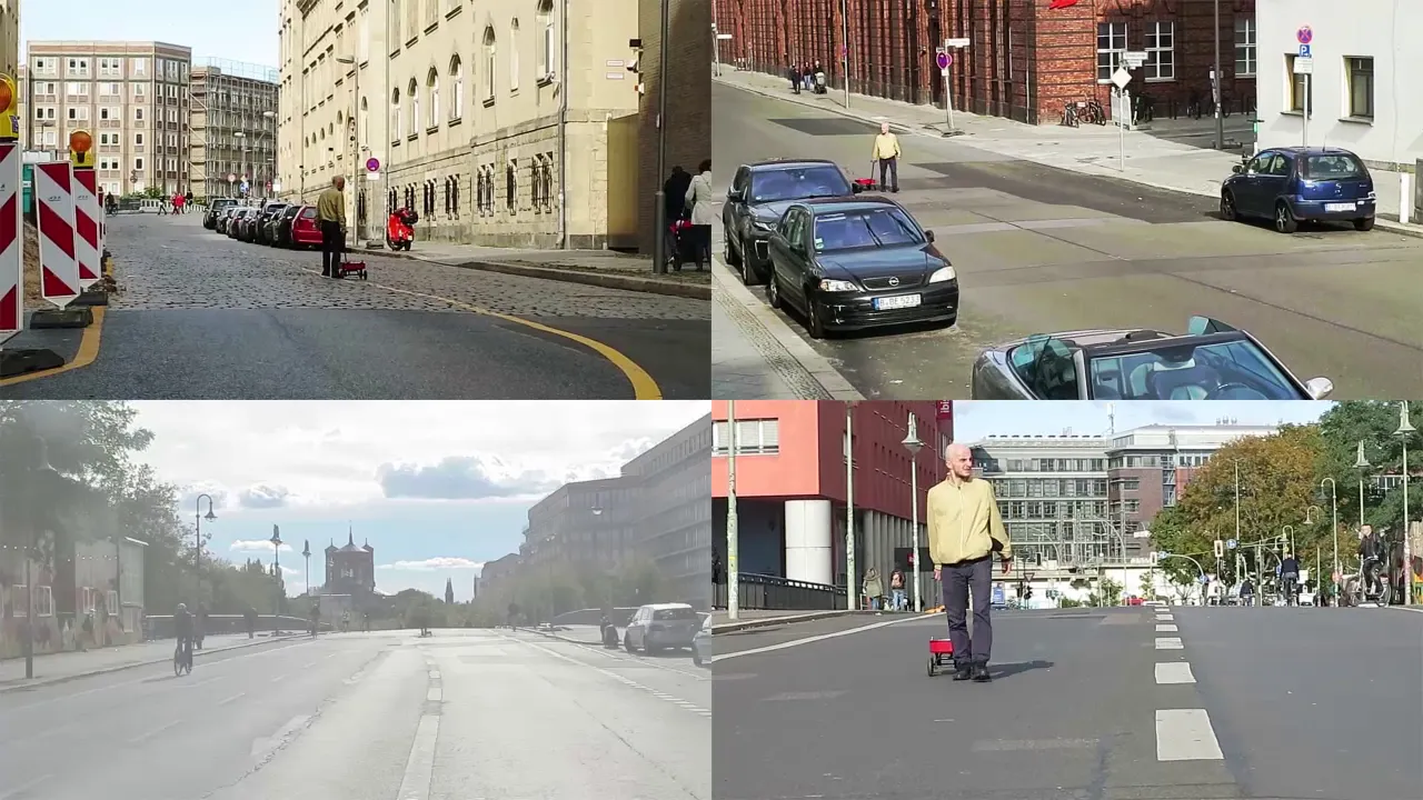
Simon Weckert
Concentrated location data from clustered mobile devices generates virtual congestion on mapping platforms, prompting navigation algorithms to divert real-world vehicles away from physically clear streets.
AI-assisted summary of Google Maps Hacks by Simon Weckert — original source. Check the original for full context.
Source published:
Key ideas
- Artist Simon Weckert utilized 99 second-hand smartphones transported in a handcart to trick Google Maps into generating virtual traffic jams. (0:00)
- The concentration of devices moving slowly caused physically empty streets labeled green on Google Maps to turn red, indicating severe vehicular congestion. (0:00)
- The simulated digital traffic jam directly impacted physical traffic patterns by causing navigation systems to reroute real cars onto alternative roads. (0:00)
Detailed notes
## Background Published by Simon Weckert on YouTube on February 1, 2020, this video documents an intervention where 99 smartphones are hauled in a handcart. According to the description, the concentrated devices generate a virtual traffic jam on Google Maps, turning green roads red and actively rerouting physical cars away from the clear street.
## TL;DR The short project demonstrates how digital mapping algorithms can be manipulated to reshape physical urban movements. By wheeling a handcart packed with 99 smartphones down city streets, the concentrated location data fools Google Maps into registering the slow cart as a severe vehicular backup. This turns physically open streets red on the digital map, prompting navigation platforms to redirect real drivers onto alternate routes to bypass the non-existent congestion.
## Atmosphere & style The presentation carries a calm, minimalist, and conceptual tone, functioning more like a quiet art performance than a high-energy tech stunt. Bookended only by brief, understated remarks—'So, let's go' and 'Thank you. Thank you'—the piece feels observational and subtly subversive. It leaves viewers with a quiet sense of irony as the low-tech act of pulling a wagon effortlessly disrupts complex digital infrastructure.
## Bulletin - [00:00](https://www.youtube.com/watch?v=k5eL_al_m7Q&t=0s) Artist Simon Weckert utilized 99 second-hand smartphones transported in a handcart to trick Google Maps into generating virtual traffic jams. - [00:00](https://www.youtube.com/watch?v=k5eL_al_m7Q&t=0s) The concentration of devices moving slowly caused physically empty streets labeled green on Google Maps to turn red, indicating severe vehicular congestion. - [00:00](https://www.youtube.com/watch?v=k5eL_al_m7Q&t=0s) The simulated digital traffic jam directly impacted physical traffic patterns by causing navigation systems to reroute real cars onto alternative roads.
## Key takeaways - [00:00](https://www.youtube.com/watch?v=k5eL_al_m7Q&t=0s) Simon Weckert demonstrates how digital mapping services can be manipulated using low-tech physical interventions. - [00:00](https://www.youtube.com/watch?v=k5eL_al_m7Q&t=0s) A total of 99 smartphones were loaded into a single handcart and pulled through city streets. - [00:00](https://www.youtube.com/watch?v=k5eL_al_m7Q&t=0s) The simultaneous streaming of location data from 99 closely clustered devices mimicked slow-moving vehicular traffic. - [00:00](https://www.youtube.com/watch?v=k5eL_al_m7Q&t=0s) Google Maps interpreted the high density of slow-moving phones as an acute traffic jam. - [00:00](https://www.youtube.com/watch?v=k5eL_al_m7Q&t=0s) Clear road segments designated green on the interface were algorithmically altered to red. - [00:00](https://www.youtube.com/watch?v=k5eL_al_m7Q&t=0s) The digital intervention produced immediate consequences in the physical environment by rerouting actual vehicles. - [00:00](https://www.youtube.com/watch?v=k5eL_al_m7Q&t=0s) Navigation apps relying on Google Maps traffic data diverted drivers onto detour routes to bypass the phantom obstruction. - [00:00](https://www.youtube.com/watch?v=k5eL_al_m7Q&t=0s) The project exposes the friction and vulnerabilities between digital algorithmic infrastructure and real-world urban space.
## Detailed walkthrough ### [00:00](https://www.youtube.com/watch?v=k5eL_al_m7Q&t=0s) Generating a Virtual Traffic Jam
The demonstration begins with an prompt to set the intervention into motion: “So, let's go.” The project investigates the friction between digital mapping platforms and physical urban space by transporting 99 smartphones inside a handcart through city streets. As the cart moves along, the high density of devices reporting location data simultaneously causes Google Maps to register the localized cluster as slow-moving vehicular congestion.
Through this intervention, a road segment that is physically clear and designated as green on the interface turns red to signal a severe traffic jam. This virtual congestion reverberates directly back into the physical environment: navigation systems relying on real-time data interpret the red line as an obstacle and steer actual drivers onto alternate routes to avoid the phantom jam. The brief demonstration concludes simply with the words, “Thank you. Thank you.”
```mermaid flowchart LR accTitle: Virtual Traffic Jam Mechanism accDescr: Process showing how 99 smartphones in a cart alter Google Maps traffic data and real-world navigation. A["99 Smartphones in Handcart"] --> B["Google Maps Ingests Clustered Location Data"] B --> C["Street Shifts from Green to Red"] C --> D["Vehicular Traffic Rerouted to Other Roads"] ```
- A total of 99 smartphones are loaded into a single handcart to simulate a cluster of slow-moving road users. - The concentrated data payload turns green road segments red on Google Maps, triggering algorithmic alerts of heavy traffic. - Navigation services respond by redirecting physical cars onto alternative roadways to avoid the non-existent congestion.
## Mentioned Google Maps, Simon Weckert
## Video description 99 smartphones are transported in a handcart to generate virtual traffic jam in Google Maps.Through this activity, it is possible to turn a green street red which has an impact in the physical world by navigating cars on another route to avoid being stuck in traffic. #googlemapshacks
http://simonweckert.com/googlemapshacks.html
[Source](https://www.youtube.com/watch?v=k5eL_al_m7Q)