California Water Rights Promise Five Times More Supply Than Nature Yields
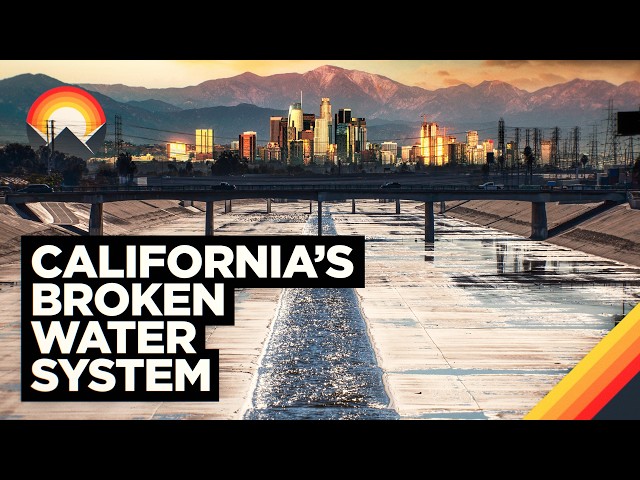
Wendover Productions
The state's permanent water crisis persists because rigid historical laws allow corporate agricultural monopolies to privately capture public water supplies at the expense of booming urban populations.
AI-assisted summary of California's Water Problem — original source. Check the original for full context.
Source published:
Detailed notes
## Background Published on YouTube on March 10, 2026, by Wendover Productions, this video explores the critical nature of California's water infrastructure and systemic management issues. The video description encourages viewers to sign up for the streaming platform Nebula at a 50% discount to watch original series like Day Pass, while also providing social media links and production credits for the writing, editing, animation, and sound teams.
## TL;DR California faces a deep structural water crisis driven by a geographical disconnect where half of its population lives on just 10% of the land in the semi-arid south, far from natural water sources. To survive, cities like Los Angeles and San Diego rely on a massive, highly engineered network of aqueducts and pumping stations to import water across vast distances. However, this engineering feat is undermined by an archaic 'prior appropriation' legal framework that has over-allocated five times more water rights than nature actually provides. This system heavily favors senior water rights holders in industrial agriculture, allowing private conglomerates like The Wonderful Company to monopolize public water resources while urban centers face an increasingly dry and uncertain future.
## Atmosphere & style The presentation is analytical, eye-opening, and deeply grounded in investigative storytelling, shifting smoothly from awe at America's monumental engineering triumphs to sharp skepticism regarding legal and corporate maneuvering. It carries an objective yet increasingly urgent tone as it unravels the hidden 'paper water' gap and the quiet privatization of public resources. Watching it feels like a sobering journey behind the scenes of everyday geography, blending macro-level map explanations with a stark, investigative look at corporate control over a vital resource.
## Key takeaways - [00:00](https://www.youtube.com/watch?v=GeYvNkaLAqA&t=0s) California faces a geographic water crisis because half of its total population lives in four southern counties that occupy just 10% of the state's land area. - [00:39](https://www.youtube.com/watch?v=GeYvNkaLAqA&t=39s) The rapid growth of the Southern California mega-region was fueled by economic factors like global trade and aerospace, alongside an heavily marketed narrative of an ideal, stable climate. - [02:09](https://www.youtube.com/watch?v=GeYvNkaLAqA&t=129s) Southern California cities operate with a severe local precipitation deficit, receiving a fraction of the rainfall seen in cities like New York or London. - [02:29](https://www.youtube.com/watch?v=GeYvNkaLAqA&t=149s) Local mountain precipitation is largely lost to the ocean due to concrete flood protection networks, forcing cities to rely entirely on engineered import systems. - [03:28](https://www.youtube.com/watch?v=GeYvNkaLAqA&t=208s) The century-old Los Angeles Aqueduct relies on a precise, gravity-fed design but carries a legacy of rural conflict after completely drying out Owens Lake. - [04:25](https://www.youtube.com/watch?v=GeYvNkaLAqA&t=265s) The Colorado River Aqueduct functions as an uphill river, using a series of massive mountain pumping stations to lift water across the desert landscape. - [05:52](https://www.youtube.com/watch?v=GeYvNkaLAqA&t=352s) The 444-mile California Aqueduct, part of the State Water Project, is the state's longest single waterway and channels northern snowmelt all the way south. - [06:56](https://www.youtube.com/watch?v=GeYvNkaLAqA&t=416s) Los Angeles and San Diego are deeply dependent on engineered water, drawing roughly 88% and 80% of their respective supplies from these import networks. - [07:30](https://www.youtube.com/watch?v=GeYvNkaLAqA&t=450s) The American West utilizes the 'prior appropriation' legal framework, establishing a strict 'first-come, first-served' chronological hierarchy for water rights. - [08:34](https://www.youtube.com/watch?v=GeYvNkaLAqA&t=514s) Under prior appropriation, junior water rights holders—which frequently include younger, growing urban areas—are the first to be cut off during shortages. - [09:50](https://www.youtube.com/watch?v=GeYvNkaLAqA&t=590s) A 2014 UC Davis study revealed a massive structural deficit, showing California has legally allocated five times more water rights than its environment naturally produces. - [11:14](https://www.youtube.com/watch?v=GeYvNkaLAqA&t=674s) The Central Valley possesses an ideal climate for agriculture, producing 99% of US almonds and 40% of national fruits and nuts on just 1% of the country's farmland. - [11:46](https://www.youtube.com/watch?v=GeYvNkaLAqA&t=706s) Industrial corporate agriculture, exemplified by conglomerates like The Wonderful Company, dominates the Central Valley rather than independent family farms. - [12:32](https://www.youtube.com/watch?v=GeYvNkaLAqA&t=752s) In communities like Lost Hills, the extensive footprint of corporate facilities and infrastructure resembles a modern iteration of a historical company town. - [13:46](https://www.youtube.com/watch?v=GeYvNkaLAqA&t=826s) The Resnick family privately owns 57% of the 1.5 million acre-foot Kern County Water Bank, granting them more water than all households in Los Angeles combined. - [14:29](https://www.youtube.com/watch?v=GeYvNkaLAqA&t=869s) The 1994 Monterey Amendments transferred control of the state's underground water bank to private entities and permanently abolished the State Water Project's urban preference rule. - [15:00](https://www.youtube.com/watch?v=GeYvNkaLAqA&t=900s) Privatizing the water bank turned a public trust commodity into a private profit generator, allowing agribusinesses to sell water back to urban areas during droughts. - [16:24](https://www.youtube.com/watch?v=GeYvNkaLAqA&t=984s) A severe economic mismatch exists statewide, as agriculture consumes 80% of California's water while contributing only 2.5% to the state's total economy. - [16:40](https://www.youtube.com/watch?v=GeYvNkaLAqA&t=1000s) A legal 'use-it-or-lose-it' mindset, coupled with worsening climate pressures like shrinking snowpacks, is forcing California toward a major structural reckoning.
## Detailed walkthrough ### [00:00](https://www.youtube.com/watch?v=GeYvNkaLAqA&t=0s) The Great California Disconnect and the Southern Boom
California is globally recognized as an absolute powerhouse by almost any metric, yet it harbors an inherent and potentially fatal flaw rooted in its geography. This major disconnect is symbolized by the state's longest waterway and its two modest, human-made terminal reservoirs, which mark the conclusion of California's most complex water system. The core of the problem is simple: the vast majority of its people live exactly where the water isn't. Just four of California’s 58 counties—home to the mega-region of Los Angeles and San Diego—contain roughly 19 million people. This means half of the state's total population is packed into a mere 10% of its land area.
Over the past century, this relatively young southern mega-region rapidly caught up to the historically dominant power center of San Francisco. A variety of historical factors supercharged this boom, including national rail connections, global trade established through the ports of Los Angeles and Long Beach, oil bubbling to the surface, and a massive aerospace boom triggered by World War II. Yet, beneath all these economic drivers lay a fundamental baseline reality: Southern California boomed because it was an unbeatable place to live. Boosters on the *Los Angeles Times* editorial board, postcard artists, railroads eager to sell property, Midwesterners coaxing their families to move, and sanatoriums marketing their services to sick urbanites all sold the exact same narrative: endless sunshine, pleasant temperatures, and a hospitable climate.
Locals still swear by this image today, and the daily temperatures back it up. In Los Angeles, the average mean temperature of the coldest month differs from the hottest month by a mere 16° Fahrenheit (9° Celsius). This lack of dramatic seasonal variation, regulated by the nearby Pacific Ocean, means it is rarely too hot and never quite cold. The city frequently boasts its average of 263 sunny days a year as a major selling point. However, this promotional boosterism tends to turn these alluring characteristics into "cartoonish oversimplifications." The critical downside to a persistent lack of cloud cover is, inevitably, a severe lack of water.
- **Population Concentration:** 4 counties house ~19 million people (50% of the state's population in 10% of its area). - **Temperature Stability:** Only a 16°F (9°C) difference between LA's hottest and coldest months. - **Sunshine Metric:** Los Angeles averages 263 sunny days per year.
---
[02:09](https://www.youtube.com/watch?v=GeYvNkaLAqA&t=129s) The Precipitation Deficit and the Age of Engineering
While neither Los Angeles nor San Diego are classified as true deserts, their semi-arid Mediterranean climates place them remarkably close. San Diego proper receives a meager 10 inches of rain per year, while Los Angeles fares only slightly better at 12 to 15 inches. To put this into perspective, New York City receives between 42 and 49 inches of annual precipitation, and London gets 23 to 25 inches. Because these Southern California cities sit in the shadow of nearby mountain ranges, their regional water supply is slightly aided by heavier mountain precipitation—receiving about 30 inches annually in the Cuyamaca and Laguna mountains, and 33 to 50 inches in the San Gabriel mountains.
Unfortunately, this mountain water does little to quench the urban thirst. Much of it is either absorbed directly into park soil or violently flushed through steep, rocky terrain before entering a "dizzying and dirty array of concrete structures." In the name of flood protection, these engineering networks rapidly whisk increasingly tainted water straight into the Pacific Ocean. This leaves the massive urban and suburban populations high and dry regarding local water access. However, these cities had timing on their side; they came of age during the absolute peak of America's belief that it could simply engineer its way out of any problem presented by nature. Today, the San Diego and Los Angeles metro areas survive by relying on three massive water infrastructure networks that represent the historical furthest reach of American ingenuity.
- **Annual Precipitation Comparisons:** * San Diego: ~10 inches * Los Angeles: 12–15 inches * London: 23–25 inches * New York City: 42–49 inches - **Mountain Precipitation:** Cuyamaca and Laguna mountains get ~30 inches; San Gabriel mountains get 33–50 inches.
---
[03:28](https://www.youtube.com/watch?v=GeYvNkaLAqA&t=208s) The Los Angeles Aqueduct and the Owens Valley Legacy
The oldest of these infrastructure networks is the Los Angeles Aqueduct, an entirely gravity-fed system that is more than a century old and remains central to LA’s modern water mix. The development of this project was "shady from the start," built upon quiet, misleading negotiation tactics and an overstated need for further water resources spearheaded by the city's chief engineer. Once fully operational, the aqueduct famously caused one of California's largest bodies of water, Owens Lake, to dry up entirely. This environmental destruction ruined the local way of life and dried out nearby farmland, driving the valley's locals to repeatedly attempt to sabotage the project.
Spanning 230 miles (370 kilometers) and requiring more than 160 tunnels, the aqueduct relied on incredibly precise grading throughout its entire run to maintain its strict gravity-fed flow. At the time of its construction, it was considered a feat of engineering as complex as the Panama Canal. While it fundamentally dried out the Owens Valley long ago, it remains a central historical story that deeply informs the modern divide and distrust between urban and rural California. Despite the bitter legacy, the gravity-fed system keeps moving water to this day, though it has since been eclipsed by newer, even more impressive projects.
- **Aqueduct Length:** 230 miles (370 kilometers). - **Engineering Scale:** Features over 160 tunnels designed to maintain a strict gravity-fed flow. - **Historical Impact:** Completely dried up Owens Lake, establishing a lasting urban-rural divide.
---
[04:25](https://www.youtube.com/watch?v=GeYvNkaLAqA&t=265s) The Colorado River Aqueduct: Pumping Rivers Uphill
Newer and vastly more complex is the Colorado River Aqueduct. Designed in the late 1920s by a collection of growing municipalities that united to form the Metropolitan Water District of Southern California, the aqueduct was constructed during the 1930s as a massive Great Depression-era public works project. The system starts right at the state's border, pulling its water directly from Lake Havasu. However, the exact geographical features that make Lake Havasu a great spot to dam the Colorado River for a ninth time—namely, the steep canyon terrain—also make it incredibly difficult to get water out of the area.
To bypass this terrain, engineers designed the Whitsett Intake Pumping Plant, which uses nine separate pumps to push the incoming aqueduct water directly uphill to the Gene Wash Reservoir about a mile away. This lift is only the beginning of a grueling journey across a mountainous desert landscape. From the reservoir, another set of pumps lifts the water another 300 feet (90 meters) to a subsequent reservoir. This mechanical pattern repeats across the desert: another pump station is required to clear the Iron Mountains, followed by two more pumping stations to push the water over the Eagle Mountains before the aqueduct finally hits its highest point.
From an aerial perspective, this infrastructure looks more or less like a standard river, but its side profile reveals a radically different story. It is a literal human river running uphill before finally reaching its peak and flowing down by gravity into the thirsty metropolitan hubs of Los Angeles and San Diego. Capable of hydrating a medium-sized city all by itself, this uphill river was officially recognized in 1952 as one of the seven engineering marvels of the United States, standing alongside iconic landmarks like the Panama Canal, the Hoover Dam, and the Empire State Building.
- **Construction Era:** Designed in the late 1920s; built as a public works project in the 1930s. - **Elevation Lift Example:** One specific lift pushes water 300 feet (90 meters) uphill. - **Key Infrastructure:** Powered by the Whitsett Intake Pumping Plant and a sequence of mountain pump stations (Iron and Eagle mountains). - **Accolade:** Named one of the seven engineering marvels of the US in 1952.
---
[05:52](https://www.youtube.com/watch?v=GeYvNkaLAqA&t=352s) The State Water Project and the Northern Lifeline
The most recent of the big three networks is the State Water Project, constructed in the 1960s. An eight-hour, 500-mile (800-kilometer) drive up Interstate 5 from Los Angeles leads to Lake Oroville, a massive northern reservoir. Lake Oroville frequently makes national headlines; its record-low water marks signal periods of extreme mega-drought, such as in 2021, while dramatic spillway failures dominate the news during exceptionally wet years, like 2017. The primary job of this reservoir is to regulate the flow of the Sacramento River by providing supplemental, high-Sierra snowmelt, effectively taming and mechanizing what was once a wild waterway.
After navigating the natural path of the Sacramento River, the water moves into the Clifton Court Forebay. From there, it flows down to a major pumping station that forcefully pushes the water into the California Aqueduct. At this juncture, the water that initially began as pristine Sierra snow embarks on a massive 444-mile journey. This path is replete with distinct forks, additional pumping stations, and regional reservoirs that systematically disperse the water to central valley farmers, smaller urban centers, and eventually all the way down to Southern California. Transporting water across the entire length of one of America's largest states, the California Aqueduct stands alone as the longest single waterway in the entire state.
Through these massive engineering feats, Southern California—backed by the expertise and funding of local, state, and federal government bodies—has effectively engineered away its greatest geographic constraint. They are far from natural, lined heavily with concrete, channeled through mountain tunnels, and forced upward through massive pipes, but these waterways are highly reliable and deeply relied upon. Today, Los Angeles receives about 88% of its water from these three aqueducts, while San Diego counts on the Colorado River and California Aqueduct for roughly 80% of its supply. From a purely technical perspective, these systems possess the sheer capacity to satisfy present demands and even match ongoing population growth.
- **Aqueduct Length:** The California Aqueduct spans 444 miles, making it the state's longest single waterway. - **Recent Climate Milestones:** Lake Oroville experienced a severe mega-drought low in 2021 and a major spillway failure in 2017. - **Urban Reliance Metrics:** * Los Angeles: Receives ~88% of its water from the three aqueducts. * San Diego: Relies on import networks for ~80% of its water.
---
[07:30](https://www.youtube.com/watch?v=GeYvNkaLAqA&t=450s) Prior Appropriation and the Water Accounting Deficit
Despite this unparalleled plumbing network, Southern California, and the state as a whole, remains trapped in a perpetual water crunch. The underlying issue does not stem from a failure of engineering, but rather from a fundamental flaw in accounting. In the American West, where rain is scarce, farmers, towns, and super-cities must rely on pulling water from winter snowmelt that trickles down into localized rivers and creeks. Historically, the early miners, homesteaders, ranchers, and territorial judicial systems realized that for Western expansion to succeed, they needed strict rules to govern a public resource that was incredibly hard to come by and geographically constrained to haphazard channels.
Ultimately, these early settlers settled on a first-come, first-served legal framework known as "prior appropriation." The system operates under a rigid chronological hierarchy. For instance, if a collection of individuals claimed water rights from a river and built a physical ditch to divert that water back in 1901, they have counted on that water for their crops ever since. If no one else holds an earlier claim, their water rights are considered the most senior. Because they do not require all the water in the river, a second group of farmers might arrive three years later, in 1904, and build an upstream ditch to siphon off water. This is perfectly legal upriver of the senior rights holder, provided that their new diversion does not negatively impact the senior holder's historical supply downriver.
In theory, this process continues up and down the river until every single drop is legally accounted for. Crucially, this system dictates exactly who gets cut off first should the river experience a drought or a "down year." In a shortage, the most recent claims—the most junior water rights—are cut off completely. If a drought gets so extreme that only enough water remains to satisfy one of the two claims, the historical 1901 claim completely predates the 1904 claim, meaning the senior group's ditch receives its full allotment while the junior users get nothing. In reality, massive agricultural entities like the Imperial Irrigation District and the Palo Verde Irrigation District hold some of the most senior rights on the entire Colorado River. As a result, the countless users located upriver from them must legally ensure water reaches these senior districts, or negotiate costly deals to offset the cuts.
- **Legal Doctrine:** Prior appropriation operates on a strict "first-come, first-served" chronological basis. - **Seniority Impact:** Junior water rights holders are completely cut off first during dry years to protect senior holders.
---
[09:50](https://www.youtube.com/watch?v=GeYvNkaLAqA&t=590s) The Structural Deficit and the Paper Water Gap
The existence of the prior appropriation system introduces two massive problems for modern California. First, seniority is the absolute rule of the land, which automatically penalizes big urban areas because major cities naturally sprouted up much later than historical homesteads, ranches, and farms. Second, nature is inherently messy and difficult to measure. Accurately accounting for water is complicated by shifting soil absorption rates, underground groundwater pooling, and high evaporation rates. The only absolute certainty in recent years is that the state is receiving slightly less and less water each year.
To quantify the exact gap between legal water rights allocated by the state and the amount of water nature actually produces, a landmark 2014 study was conducted at UC Davis. Requiring extensive archival research to dig through centuries of old property rights, the researchers discovered a stunning discrepancy: the state of California has legally allocated about 370 million acre-feet of water a year. However, a good precipitation year in reality only produces about 70 million acre-feet. This means California has allocated legal rights to an incredible five times more water than its environment can actually produce, creating a massive, permanent structural deficit.
Because of prior appropriation, whoever holds the junior rights loses first, and because these junior holders are often growing urban municipalities trying to keep pace with population growth, the places where the actual people live are the most vulnerable to being cut off. In day-to-day practice, cities have yet to be officially cut, and even during the absolute worst historical droughts, California has managed to avoid running completely dry. However, the margins are getting finer every year, and the closer these calls become, the more intense scrutiny is directed toward the other side of California's water equation: its massive agrarian heartland.
- **The UC Davis Study (2014):** Revealed that California has allocated 370 million acre-feet of water rights, while a good weather year yields only 70 million acre-feet. - **The Allocation Gap:** The state has legally promised 5x more water than nature naturally provides.
---
[11:14](https://www.youtube.com/watch?v=GeYvNkaLAqA&t=674s) Industrial Agriculture and the Corporate Towns of the Central Valley
California is far more than just its two dominant coastal urban hubs; it is also a massive agrarian heartland. Virtually all leafy green vegetables produced in the United States during the winter months are grown in the Imperial Valley. Meanwhile, the state’s massive Central Valley—which the California Aqueduct physically bisects—produces an astonishing 99% of the nation's almonds and 40% of its total fruits and nuts, all utilizing just 1% of the country's total agricultural land. Just as Southern California is viewed as an ideal place for humans to live, the Central Valley is the perfect place to grow high-value crops, boasting 300 sunny days a year, top-tier soil quality, and extreme temperature variations between day and night that naturally boost the sugar content of the fruit. Yet, it faces the same familiar limitation: water.
While it is easy to romanticize the plight of the independent farmer who took risks, arrived first, and built a family livelihood around historical water rights, the reality on the ground looks vastly different. By and large, this region is dominated by massive industrial corporate agriculture. This corporate dominance is clear when looking at the most notable brands operating out of the Central Valley: POM Pomegranates, Wonderful Almonds and Pistachios, and Halos Clementines. While these are all highly recognizable independent brands to the average American consumer, they are actually all owned by a single corporate behemoth: The Wonderful Company. This massive conglomerate also owns Fiji Water, Justin Wines, Teleflora, and Wonderful Citrus.
This is a far cry from mom-and-pop farming. Although the controlling Resnick family are major players in international philanthropy, persistent questions linger regarding the authenticity of their charitable efforts, as well as the exact means through which they managed to accumulate such a staggering amount of water for private commercial use. The core of The Wonderful Company's empire centers in Kern County. They run the bulk of their distribution operations out of the city of Shafter, while their philanthropic efforts take center stage in the nearby unincorporated community of Lost Hills.
In Lost Hills, where roughly half of the 95% Hispanic population draws its direct paycheck from The Wonderful Company, some residents view the family's actions as pure generosity. Others, however, view it as a modern remnant of the historical "company town" labor structure that has long since gone by the wayside across the rest of America. A visual scan of the town quickly explains why: moving north from the Almond Village Apartments (built on land donated by the corporation), a visitor encounters the Wonderful Preschool neighboring the Wonderful College Prep Academy. North of that stands the Wonderful Bridge crossing the highway, which directly connects the town to the Wonderful Park and a soccer field, all heavily adorned with the corporate Wonderful logo.
- **Central Valley Agricultural Output:** Produces 99% of US almonds and 40% of national fruits and nuts on only 1% of US agricultural land. - **Corporate Monopolization:** The Wonderful Company controls POM Pomegranates, Wonderful Almonds/Pistachios, Halos Clementines, Fiji Water, and Justin Wines. - **Lost Hills Demographics:** An unincorporated community with a 95% Hispanic population, highly dependent on a single corporate employer.
---
[13:46](https://www.youtube.com/watch?v=GeYvNkaLAqA&t=826s) The Kern County Water Bank and the Monterey Amendments
Whether these corporate town initiatives are viewed as altruistic or as a method of labor control, what matters most to California's broader water landscape is what lies directly beneath the ground of Kern County. The element that truly makes the Wonderful corporate empire possible is the Kern County Water Bank. This is a partially natural underground aquifer structure capable of holding roughly 1.5 million acre-feet—or 500 billion gallons—of water. To put that volume into perspective, that is the exact maximum amount of water the Colorado River Aqueduct could pump in an entire year at peak capacity, or the total amount of water legally promised to the entire nation of Mexico annually from the Colorado River.
Of this massive underground storage capacity, the Resnick family privately owns an astonishing 57%. This unprecedented private storage, paired with their highly senior surface water rights along the state's rivers, grants The Wonderful Company direct access to more water than what every single household in the city of Los Angeles uses in a year combined. The historical process through which a private entity gained ownership of such a massive share of a public state resource is, "at best, a bit opaque."
The Resnicks successfully acquired this massive share of the water bank via the 1994 Monterey Amendments. These amendments were the direct result of quiet, closed-door negotiations between the California Department of Water Resources and a small collection of private entities operating along the State Water Project, whose junior water rights were facing constant threats from persistent regional droughts. The two parties ultimately struck a deal: total ownership over the state's yet-to-be-completed underground water bank was officially transferred from public state hands into the hands of these private entities. In exchange, the private entities agreed to retire the junior water rights that were causing a strain on the state's infrastructure project. Crucially, this quiet deal also struck out the State Water Project's long-standing "urban preference rule," a mandate which had historically dictated that water must be delivered first to urban populations during a shortage.
- **Water Bank Storage Capacity:** Holds 1.5 million acre-feet (500 billion gallons) of water. - **Private Ownership Share:** The Resnick family owns 57% of the Kern County Water Bank, giving them more annual water than all LA households combined. - **The 1994 Monterey Amendments:** A quiet policy shift that transferred a public water bank to private entities and permanently abolished the historical "urban preference rule" for water delivery.
[15:00](https://www.youtube.com/watch?v=GeYvNkaLAqA&t=900s) The Resnick Water Empire and the Privatization of Public Trust
The quiet nature of the deal that removed urban preference has led some critics to label the transfer of the Kern Water Bank as an underhanded rip-off to California residents for the sake of a single institution. While the optics of the situation are undeniably bad, others argue it was a fairer deal when looking at the broader context. What remains less subjective, however, is that the water bank helped the Resnick agricultural empire expand to its massive current scale. It grants them the flexibility and confidence to plant high-revenue cash crops that happen to be extremely water-intensive, without having to consider urban Californian needs at all. This arrangement essentially took what was a state-owned water bank—storing a commodity existing in the public trust—and turned it into a profit generator for a billionaire family when they sell that water back to urban areas in need.
While the Resnicks alone are not the sole cause of California's constant water strain, they serve as the best example of how the current system inadvertently benefits well-resourced agribusinesses. They possess the power to lobby and sway policymakers, invest heavily in long-game projects at the Kern Water Bank to strengthen their holdings, and use their massive scale to consume an ever-growing portion of the water supply. In doing so, they turn California's prime inherent attributes, like its first-class soils and ideal temperatures, toward growing crops that demand massive amounts of water, entirely ignoring how many other people could make use of that same resource.
- The transfer of the state-owned water bank removed urban preference, allowing it to become a private profit generator. - The Resnick family uses the water bank's flexibility to secure and grow high-revenue, water-intensive cash crops. - Large agribusinesses use their scale, lobbying power, and heavy investments to disproportionately capture the state's water supply.
[16:24](https://www.youtube.com/watch?v=GeYvNkaLAqA&t=984s) California's Broad Water Dilemma and Future Reckoning
The problem transcends billionaire almond farmers entirely, pointing to a fundamental structural mismatch across the state. Statewide, agriculture accounts for a staggering 80% of all water use, regardless of how wealthy the individual farmer is. In stark contrast, agriculture only accounts for 2.5% of California's economy. This is a clear case where heritage is running directly into efficiency. Beyond the tension of agriculture versus urban use, the broader issue stems from a combination of sloppy math, a systemic belief that all water can and ought to be put to work, and a "use-it-or-lose-it" mentality that ensures water remains a perpetual top issue in California.
This crisis may feel less pronounced during the increasingly rare periods of comparative abundance. However, if a multi-decade wet period were to persist, the state, cities, and farmers would eventually identify it as the new norm, putting the water to use as if those conditions would last every year. In reality, the future looks much drier: fires are getting worse, summers are becoming drier, wet periods are growing shorter, and the snowpack is more scant. This leaves California ripe for a major reckoning, forcing the ultimate questions: "Does the water serve best the people or the plants?" and "Does this new future rely on new rules or the rules that got the state to this position in the first place?"
- Agriculture consumes 80% of California's water but only contributes 2.5% to the state's economy. - Structural issues include sloppy math, the belief that all water must be put to work, and a "use-it-or-lose-it" legal framework. - Climate pressures include worsening fires, drier summers, shorter wet periods, and a dwindling snowpack.
[17:35](https://www.youtube.com/watch?v=GeYvNkaLAqA&t=1055s) Nebula Original Programming and Creator Crossover Appeal
While California's water future is uncertain, what is completely figured out is what viewers should watch next. *Day Pass*, hosted by Jason from *Not Just Bikes*, is a Nebula Original streaming series born from the collective streaming platform created by Wendover and a host of other creators. The show unleashes Jason to do what he knows and loves best—public transit and travel—by exploring global cities entirely through the lens of public transit. Backed by a bigger budget than what is usually possible on YouTube, it represents a concept that a lot of people put a lot of thought into, blending travel and transit into a compelling format. For fans of Wendover, the crossover appeal is natural; rather than relying on maps and explanations from above, Jason is on the ground experiencing and critiquing it all firsthand.
Beyond *Day Pass*, the Nebula catalog continues to grow deeper every month with diverse content from the same team and fellow creators. Wendover's team features projects like *Abolish Everything*, a live comedy debate premise recorded in New York, and *Scav*, a docu-series tracing the drama and outrageous unfoldings of the country's largest annual scavenger hunt at the University of Chicago. Additionally, Joseph from *RealLifeLore* is producing his *Mad King* series, while Joe Scott’s *Oldest and Newest Places on Earth* acts as an awfully compelling full-length documentary that blends fascinating geology with extreme travel.
- *Day Pass* is a Nebula Original travel-and-transit show hosted by Jason of *Not Just Bikes*. - *Abolish Everything* is a live comedy debate series recorded in New York. - *Scav* is a docu-series covering the University of Chicago's massive annual scavenger hunt. - Featured creator content includes *Mad King* by RealLifeLore and *Oldest and Newest Places on Earth* by Joe Scott.
[19:07](https://www.youtube.com/watch?v=GeYvNkaLAqA&t=1147s) Nebula Subscription Discount and Creator Support
To keep this independent creator cycle going, Nebula is running a special promotional deal for the audience. By using the dedicated link, `nebula.tv/wendover`, viewers can get a full 50% off a Nebula subscription. This promotion brings the total cost down to just $30 for an entire year. At a time when mainstream commercial streaming services only seem to get more expensive, this offer stands out as a "screaming deal." Viewers are encouraged to give the platform a shot, with a closing note of thanks for supporting the Wendover channel and all the other creators building out Nebula with awesome content.
- A 50% discount is available via the link `nebula.tv/wendover`. - The promotional pricing reduces the subscription cost to $30 for an entire year.
## Notable quotes > [00:00](https://www.youtube.com/watch?v=GeYvNkaLAqA&t=0s) cartoonish oversimplifications
> [02:09](https://www.youtube.com/watch?v=GeYvNkaLAqA&t=129s) dizzying and dirty array of concrete structures
> [03:28](https://www.youtube.com/watch?v=GeYvNkaLAqA&t=208s) shady from the start
> [07:30](https://www.youtube.com/watch?v=GeYvNkaLAqA&t=450s) prior appropriation
> [07:30](https://www.youtube.com/watch?v=GeYvNkaLAqA&t=450s) down year
> [11:14](https://www.youtube.com/watch?v=GeYvNkaLAqA&t=674s) company town
> [13:46](https://www.youtube.com/watch?v=GeYvNkaLAqA&t=826s) at best, a bit opaque
> [13:46](https://www.youtube.com/watch?v=GeYvNkaLAqA&t=826s) urban preference rule
> [16:24](https://www.youtube.com/watch?v=GeYvNkaLAqA&t=984s) use-it-or-lose-it
> [16:24](https://www.youtube.com/watch?v=GeYvNkaLAqA&t=984s) Does the water serve best the people or the plants?
> [19:07](https://www.youtube.com/watch?v=GeYvNkaLAqA&t=1147s) screaming deal
## Mentioned California, Los Angeles, San Diego, San Francisco, Long Beach, Pacific Ocean, New York City, London, Cuyamaca mountains, Laguna mountains, San Gabriel mountains, Los Angeles Aqueduct, Owens Lake, Panama Canal, Owens Valley, Colorado River Aqueduct, Metropolitan Water District of Southern California, Lake Havasu, Colorado River, Whitsett Intake Pumping Plant, Gene Wash Reservoir, Iron Mountains, Eagle Mountains, Hoover Dam, Empire State Building, State Water Project, Interstate 5, Lake Oroville, Sacramento River, Clifton Court Forebay, California Aqueduct, Imperial Irrigation District, Palo Verde Irrigation District, UC Davis, Imperial Valley, Central Valley, POM Pomegranates, Wonderful Almonds and Pistachios, Halos Clementines, The Wonderful Company, Fiji Water, Justin Wines, Teleflora, Wonderful Citrus, Resnick family, Kern County, Shafter, Lost Hills, Almond Village Apartments, Wonderful Preschool, Wonderful College Prep Academy, Wonderful Park, Kern County Water Bank, Mexico, Monterey Amendments, California Department of Water Resources, Day Pass, Jason, Not Just Bikes, Nebula, Wendover Productions, Abolish Everything, New York, Scav, University of Chicago, Joseph, RealLifeLore, Mad King, Joe Scott, Oldest and Newest Places on Earth
[Source](https://www.youtube.com/watch?v=GeYvNkaLAqA)