California High-Speed Rail Splurges $6 Billion to Avoid Billionaire Ranch
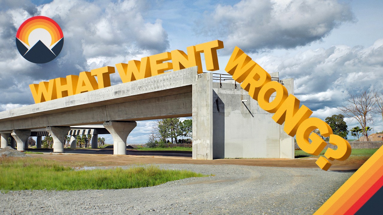
What Went Wrong With California High Speed Rail — Wendover Productions

Wendover Productions

The project's ballooning budget and missed deadlines stem from early planning choices that prioritized political compromises and ambitious design over practical geographic routing.

AI-assisted summary of What Went Wrong With California High Speed Rail — original source. Check the original for full context.

Source published:

Detailed notes

## Background This video was published on YouTube by the channel Wendover Productions on May 20, 2026. The page description encourages viewers to subscribe to Nebula for 50% off an annual subscription, highlights other transit-related series like Day Pass, and provides social media links along with production credits for writing, animation, sound, and design.

## TL;DR The video breaks down the bureaucratic, political, and engineering failures of the California High-Speed Rail project, which is six years delayed and seven times over its original budget. It details highly controversial routing decisions, such as picking the Palmdale detour over the direct Tejon Pass route due to alleged corporate and political friction, and looping through the eastern Central Valley to secure urban swing votes. Geological challenges like shallow water tables, resistance from freight railroads, and navigating the mountain barriers of Los Angeles and San Francisco ultimately turned the project's ambitious goals into a logistical nightmare. Today, funding has dried up, leaving active construction restricted exclusively to the Central Valley segment.

## Atmosphere & style The presentation feels deeply analytical, investigative, and sobering, stripping away the initial 2008 voter optimism to reveal a stark structural crisis. The narrator delivers the breakdown with a measured, expert-focused tone that shifts from exposing alleged backroom political deals to unravelling complex geometric and environmental dilemmas. It evokes a strong sense of architectural frustration and irony, leaving the viewer feeling as though they are watching an absolute farce born from planning-room deception rather than simple on-site mismanagement.

## Key takeaways - [00:00](https://www.youtube.com/watch?v=2NK0wBBZZ24&t=0s) The California Intercity High-Speed Rail Commission was formed in 1993, culminating in the voter approval of Prop 1A in 2008, which promised a system by 2020 with a $33–$42 billion budget. - [00:00](https://www.youtube.com/watch?v=2NK0wBBZZ24&t=0s) Three decades after the initial commission, the project is six years delayed, seven times over budget, and has not yet laid a single foot of track. - [00:58](https://www.youtube.com/watch?v=2NK0wBBZZ24&t=58s) High-speed rail requires long, gentle curves and geographically continuous land, making historical rail alignments obsolete and engineering exceptionally difficult. - [00:58](https://www.youtube.com/watch?v=2NK0wBBZZ24&t=58s) Exiting the Los Angeles basin required navigating seismically active mountain ranges, creating one of the costliest and most complex engineering puzzles globally. - [02:11](https://www.youtube.com/watch?v=2NK0wBBZZ24&t=131s) Planners bypassed the direct Tejon Pass route for the Palmdale alignment, a controversial detour allegedly driven by a political tit-for-tat deal between local officials. - [04:18](https://www.youtube.com/watch?v=2NK0wBBZZ24&t=258s) The Palmdale detour offered strategic advantages, including room for regional housing growth and a future desert track connection to the privately built Brightline West network. - [06:31](https://www.youtube.com/watch?v=2NK0wBBZZ24&t=391s) Official cost estimates for the Tejon Pass route were artificially inflated by $6 billion to account for complex tunneling designed to avoid a legal war with the powerful corporate-owned Tejon Ranch. - [09:21](https://www.youtube.com/watch?v=2NK0wBBZZ24&t=561s) Planners rejected a cheaper, faster western corridor down Interstate 5 because the Central Valley's major cities and vital swing voters were located on the east side. - [09:21](https://www.youtube.com/watch?v=2NK0wBBZZ24&t=561s) France's national rail operator, SNCF, offered to partner on the project but explicitly conditioned their involvement on using the direct western I-5 route. - [12:21](https://www.youtube.com/watch?v=2NK0wBBZZ24&t=741s) Negotiating rights-of-way proved difficult as Union Pacific completely refused track access, while environmental and historical preservation laws forced costly detours around sites like Colonel Allensworth State Historic Park. - [14:41](https://www.youtube.com/watch?v=2NK0wBBZZ24&t=881s) A major geological oversight regarding a shallow water table forced planners to flip-flop on a Central Valley routing decision, wasting two and a half years and sparking 13 years of litigation. - [14:41](https://www.youtube.com/watch?v=2NK0wBBZZ24&t=881s) The Authority chose the mountainous Pacheco Pass over Altamont Pass to avoid splitting train services or losing high frequencies between San Francisco, San Jose, and Silicon Valley. - [16:44](https://www.youtube.com/watch?v=2NK0wBBZZ24&t=1004s) The project repeatedly prioritized ambition over practicality, aiming for extreme speeds and direct downtown access without having the necessary funding secured. - [16:44](https://www.youtube.com/watch?v=2NK0wBBZZ24&t=1004s) Active construction is trapped exclusively in the Central Valley—the easiest section to build but the one serving the fewest people—while public perception attributes the delays to state corruption rather than structural planning failures.

## Detailed walkthrough ### [00:00](https://www.youtube.com/watch?v=2NK0wBBZZ24&t=0s) The Promise of Prop 1A and the Reality of Reality

In 1993, the California legislature officially set the wheels in motion to connect the state's major urban hubs by forming the California Intercity High-Speed Rail Commission. By 2008, after fifteen years of exhaustive studies, a concrete plan was presented to voters on the very same ballot where they chose between Barack Obama and John McCain. The proposition promised a true high-speed rail system connecting Los Angeles to San Francisco in a blistering 2 hours and 40 minutes, with an estimated price tag of $33 to $42 billion and an initial operations date of 2020. The electorate enthusiastically approved Prop 1A with 52.6% support.

Flash forward three decades from that initial 1993 commission, and the reality looks radically different. The massive infrastructure project is now six years past its original completion deadline, staggering under a budget that has ballooned to seven times the initial estimate, entirely devoid of an official completion date, and remarkably, has yet to see a single foot of track actually laid down. Turning the voter-approved dream into physical infrastructure proved to be an engineering and bureaucratic nightmare.

- **1993:** California Intercity High-Speed Rail Commission formed. - **2008:** Prop 1A passes with 52.6% voter approval. - **Original Targets:** 2-hour-and-40-minute travel time, $33–$42 billion budget, 2020 opening. - **Current Status:** 7x over budget, 6 years delayed, 0 feet of track laid.

---

[00:58](https://www.youtube.com/watch?v=2NK0wBBZZ24&t=58s) The Geometric Trap and the Mountain Fortress of Los Angeles

The fundamental engineering challenge of high-speed rail is that it demands a perfectly continuous block of geographically and geometrically compatible land. While standard railroads can utilize historical track alignments that are over a century old, high-speed trains cannot cope with their tight geometry; they require incredibly long, gentle curves to maintain maximum velocity. After years of intense debate, environmental analysis, and legal proceedings, planners mapped out the broad strokes of the route, choosing specific cities and mountain passes. However, as soon as construction began, those early planning decisions immediately came back to haunt them.

The most daunting puzzle was figuring out how to exit the sprawling urban basin of Los Angeles, a city famously characterized by the ability to drive from "warm weather surfing to high altitude skiing in just an hour or two, traffic permitting." Because LA is hemmed in on all sides by massive mountain ranges, breaking out of the basin required conquering seismically active terrain. Planners knew from the outset that building high-speed lines through these mountains would inevitably rank as one of the costliest and most complicated engineering feats ever attempted globally.

---

[02:11](https://www.youtube.com/watch?v=2NK0wBBZZ24&t=131s) The Great Route Debate: Tejon Pass vs. Palmdale Detour

Preliminary studies narrowed the exit strategies down to two fierce competitors: Tejon Pass and the Palmdale alignment. At first glance, Tejon Pass was the logical, common-sense favorite. It followed the existing Interstate 5 corridor, meaning construction crews would have immediate road access, a built-in power infrastructure backbone for electric trains, and a pre-existing environmental footprint to ease the regulatory review process. Most importantly, Tejon was the direct route. Achieving the legally mandated 2-hour-and-40-minute trip time—written explicitly into California law following Prop 1A—meant that missing the target would literally violate state law. Any deviation from Tejon would force planners to desperately claw back minutes elsewhere.

It came as a massive shock when the California High-Speed Rail Authority voted instead for the Palmdale alignment. This deeply controversial detour penalizes the train's journey by adding anywhere from 3 to 12 minutes to the trip time, driving up expenses elsewhere to compensate. Detractors frequently point to this decision as "example number one" of pure political corruption. According to insider reports, LA County Board of Supervisors member Michael Antonovich desperately wanted the train to route through his district in Palmdale to spur job growth and turn the area into a viable commuter town for LA. To get it, a alleged tit-for-tat deal was struck with Rail Authority board member Jerry Epstein. Epstein, a real estate developer with major holdings in Marina del Rey, allegedly traded his influence over the 9-member board to back the Palmdale route in exchange for Antonovich's crucial vote to renew his lucrative county land lease.

- **Tejon Pass Route:** Follows I-5, direct path, pre-existing power/road infrastructure, faster travel times. - **Palmdale Alignment:** A massive detour adding 3 to 12 minutes of travel penalty. - **The Alleged Deal:** Supervisor Michael Antonovich (Palmdale backing) paired with Board Member Jerry Epstein (seeking Marina del Rey lease renewal).

---

[04:18](https://www.youtube.com/watch?v=2NK0wBBZZ24&t=258s) The Hidden Logic of the Desert Detour and the Brightline Connection

While the backroom political drama holds plenty of truth, defining the Palmdale decision solely as corruption oversimplifies a complex choice with real strategic advantages. The Antelope Valley offered something the heavily densified LA Basin couldn't: room to sprawl. In a region suffocated by a severe housing crisis, turning Palmdale into a low-cost commuter hub could provide genuine downward pressure on regional housing prices. Furthermore, the decision showed remarkable foresight regarding a parallel project—Brightline West, a privately operated high-speed rail line currently building a route from Las Vegas to Los Angeles.

Brightline West started construction much later but is moving far faster because it intentionally avoided the "hard part" of tunneling through dense urban environments. Instead, its line terminates on the outer fringes of LA in Rancho Cucamonga, roughly 40 miles (65 km) from downtown. By routing California HSR through Palmdale, a simple, low-cost 50-mile (80-km) track could be laid across the flat, open desert to link the two networks. This elegant interconnection would allow a Bay Area train to run directly to Las Vegas in under 4 hours, while giving Brightline West trains a direct track straight into LA Union Station. To keep this ambitious future alive, both agencies have formally coordinated to ensure perfectly compatible signaling systems, track geometry, and engineering standards.

- **Rancho Cucamonga:** Brightline West terminal, located 40 miles / 65 km outside downtown LA. - **Desert Link:** A proposed 50-mile / 80-km flat desert connection between Palmdale and Brightline. - **System Interoperability:** Shared standards for track geometry, signaling, and equipment.

---

[06:31](https://www.youtube.com/watch?v=2NK0wBBZZ24&t=391s) The Corporate Wall of Tejon Ranch and the $6 Billion Inflation

Despite the regional perks, the High-Speed Rail Authority publicly maintained that raw cost was the true deciding factor. Their official analyses claimed that the direct Tejon Pass route required such intense tunneling and earthworks that its price tag wasn't meaningfully cheaper than the longer Palmdale alternative. However, critics fiercely argue that this study was profoundly flawed because it purposely avoided cutting through Tejon Ranch. This massive tract of private land is no longer a simple homestead; it is a powerful commercial empire traded on the New York Stock Exchange with a $500 million market cap, raking in tens of millions annually via real estate and agriculture.

The corporate leaders of Tejon Ranch violently opposed an active high-speed rail line running through their highest-value land alongside Interstate 5, where they planned a massive master-planned housing development. Because the high-speed train would never stop in such a small community, the noise and visual pollution would utterly destroy their property values. Compounding the issue, Tejon Ranch had cleverly placed hundreds of thousands of acres into conservation status through a pact with environmental groups to secure their development permits. Utilizing eminent domain would have triggered an endless, brutal legal war against a wealthy corporation and a coalition of powerful environmental non-profits. To bypass this headache, state planners assumed the Tejon route would require massive, convoluted bypass tunnels, artificially inflating independent cost estimates by an astounding $6 billion and skewing the final decision.

- **Tejon Ranch Profile:** NYSE-traded commercial enterprise, $500 million market cap. - **The Friction:** Rail alignment threatened a lucrative master-planned community near I-5. - **The Cost Penalty:** Avoiding the ranch's surface land via forced tunneling added an estimated $6 billion to the Tejon proposal.

---

[09:21](https://www.youtube.com/watch?v=2NK0wBBZZ24&t=561s) Entering the Central Valley: Swing Votes and Freight Rails

After finally charting a path out of the mountainous LA Basin, the project advanced into the flat agricultural fields of the Central Valley. This was undeniably the geographically simplest segment of the line, yet it brought its own unique political and logistical obstacles. Planners faced another binary choice: follow the straight, highly direct Interstate 5 corridor on the west side, or loop eastward toward the valley's cities. The I-5 option was deeply attractive—featuring an existing right-of-way where the train could effortlessly slide into the median or run alongside the highway with minimal land acquisition or bridge building. This exact strategy is what allows Brightline West to build down the I-15 median at a lightning-fast pace. The I-5 route was 5.6% cheaper and sliced 11 to 20 minutes off travel times, so much so that France's national rail operator, SNCF, offered to partner with the state to build the system on the strict condition that California chose this direct western path.

Yet again, the costlier option won out due to human geography. Virtually all of the Central Valley's major population centers sit on the east side, while the western I-5 corridor is a barren stretch of small farming hamlets. Forcing city residents to drive far out west to catch a train would kill ridership and ruin the railway's long-term economics. More critically, it would destroy the political coalition needed to pass the project. While left-leaning voters in San Francisco and Los Angeles easily supported massive public transit spending, rural Central Valley residents were the vital swing votes. To win over urban valley strongholds like Bakersfield, Fresno, and Merced, the train had to come directly to them, forcing a longer, more complex eastern alignment.

- **SNCF Interest:** France's national rail operator offered partnership explicitly conditioned on using the direct I-5 alignment. - **Financial Delta:** Feasibility studies pinned the I-5 route as 5.6% cheaper. - **The Political Geography:** The west side is rural fields; the east side holds the major cities (Bakersfield, Fresno, Merced). - **Target Speed:** 220 mph operational speeds required to meet the legal 2-hour-and-40-minute mandate.

---

[12:21](https://www.youtube.com/watch?v=2NK0wBBZZ24&t=741s) Historic Parks, Hostile Railroads, and the Hanford Bypass Saga

Even on the flat plains of the eastern Central Valley, infrastructure obstacles quickly multiplied. The existing state highway was useless because its curves were graded for 65 mph, whereas the high-speed rail required sweeping, gentle curves to maintain its legally mandated 220 mph cruise speed. Hugging the highway closely would mean demolishing massive amounts of built-up urban infrastructure. Planners turned to the existing freight rail corridors, but Union Pacific flatly refused to cooperate, fearing the high-speed viaducts would permanently block the future expansion of their already capacity-constrained, highly lucrative freight lines. Fortunately, BNSF took a more cooperative, transactional approach, permitting construction parallel to their tracks in exchange for proper financial compensation.

Even with the BNSF shortcut, historical and local friction points emerged. The alignment ran headfirst into Colonel Allensworth State Historic Park, a sacred site on the National Register of Historic Places preserving the only town in California entirely founded and governed by African Americans. Because federal law strictly prohibits federally funded projects from seizing historic land, the Authority had to design a costly deviation around the park, triggering a painstaking parcel-by-parcel private land acquisition process that could trap uncooperative landowners in court for 3 to 7 years. Meanwhile, the town of Hanford flatly rejected a high-speed line cutting through its center. To maintain speed and appease the town, the Authority attempted to design a bypass, sparking a massive regulatory saga with the US Army Corps of Engineers and the EPA over local wetlands. Forced to study a western alternative to their preferred eastern viaduct route, planners and local residents eventually shifted their favor toward a western trench design that buried the high-speed tracks neatly beneath existing roads and freight lines.

- **Union Pacific:** Completely refused access to protect its long-term freight track capacity. - **BNSF:** Agreed to parallel construction in exchange for financial compensation. - **Colonel Allensworth State Historic Park:** Protected by federal funding laws; forced a manual, parcel-by-parcel detour. - **Hanford Bypass:** Shifted from an eastern viaduct to a western trench under environmental regulatory pressure.

[14:41](https://www.youtube.com/watch?v=2NK0wBBZZ24&t=881s) The Water Table Flip-Flop and the Battle for San Francisco

Further geological studies revealed a significant oversight in the Western routing plan: the area's water table was uniquely shallow, sitting at just 10 to 15 feet rather than the standard 30 to 40 feet. The immense amount of pumping and water management infrastructure required to overcome this obstacle meant the route would ultimately be far more expensive than the original eastern plan. Consequently, planners performed an about-face and reverted to their original layout. This planning flip-flop cost the project two and a half years and severely soured community relations, sparking a grueling 13-year lawsuit involving a local landowner, the County Board of Supervisors, and the railroad.

With delays compounding at every turn due to small decisions, the project faced its most contentious routing choice yet: how to enter San Francisco. Much like Los Angeles, the Bay Area is walled off by mountains, forcing another high-cost, high-complexity engineering solution. Initial exploratory studies boiled the options down to two primary candidates: Altamont Pass and Pacheco Pass. The northeastern route through Altamont Pass possessed massive advantages, as it would track along an existing rail and Interstate corridor—making use of pre-existing right of ways and power infrastructure—while directly hitting growing population hubs like Merced and Modesto.

However, the Altamont Pass route harbored a fatal flaw in the eyes of the High-Speed Rail Authority. Its northeastern approach meant that trains could not seamlessly serve San Francisco, Silicon Valley, and San Jose altogether. The authority would either have to physically split the trains into two separate directions after the pass, drastically increasing trip times, or run entirely separate services for San Francisco and San Jose, which would slice service frequencies in half and cripple the network's competitiveness. This fundamental dilemma ultimately pushed the authority toward Pacheco Pass, which offered the added benefits of bypassing a highly expensive new crossing over the Bay itself and routing through less developed land. Predictably, this choice ignited fierce backlash from local NIMBYs and environmental groups, triggering years of relentless legal battles.

- **Water Table Depth:** 10 to 15 feet along the western option, compared to the expected 30 to 40 feet. - **Planning Delay:** 2.5 years lost due to the routing flip-flop. - **Lawsuit Duration:** 13 years of litigation between a local landowner, the County Board of Supervisors, and the railroad. - **Primary Bay Area Options:** Altamont Pass (northeastern route) vs. Pacheco Pass.

[16:44](https://www.youtube.com/watch?v=2NK0wBBZZ24&t=1004s) Ambition Over Practicality: The Reality of California's High-Speed Rail

From its inception to the present day, the California High-Speed Rail project has consistently chosen "ambition over practicality." The project layout spared no luxury: aiming for some of the fastest operational speeds in the world, trying to hit virtually every population center along the corridor, and insisting on carving paths through dense downtown cores rather than bypassing them. In striving to build the absolute gold standard of international high-speed rail, the project may have ultimately "flown too close to the sun."

The initial proposal pitched to voters back in 2008 is now laid bare as an "absolute fantasy." It promised cost efficiencies on par with European rail systems and an even faster construction timeline, completely ignoring the state's total lack of experience in building high-speed rail, not to mention the logistical nightmare of cutting through seismically active mountains and crowded urban centers. Making matters worse, the plan was pushed through with only a tiny fraction of its necessary funding actually secured. Today, with cost estimates ballooning up to seven times the original projections, funding has completely dried up. As a result, active construction is entirely confined to the Central Valley segment—the absolute easiest phase to build, yet the one that serves the fewest people.

While the progress made in the Central Valley is meaningful, it represents only a small sliver of a complete San Francisco-to-Los Angeles line. Planners may have initially believed that fabricating a fantastical budget was a pragmatic necessity to win voter approval for a worthwhile long-term system, but that deception has backfired, making the current state of the project look like an "absolute farce." While instances of on-site construction mismanagement exist, the structural crisis stems from a massive mismatch between expectations and reality. To the lightly informed public, the sluggish progress looks like a textbook example of state-level corruption and incompetence, when the true failure occurred back in the planning room. This toxic public perception has made securing new funding incredibly difficult, especially with a federal government that has turned outright hostile to the project.

- **Voter Approval Year:** 2008. - **Cost Escalation:** Current estimates are up to 7 times higher than the original projections. - **Active Construction Zone:** Limited exclusively to the Central Valley segment. - **Core Dilemma:** The ongoing debate of "perfect versus good enough" in modern rail development, where compromise is usually what gets trains running.

[19:23](https://www.youtube.com/watch?v=2NK0wBBZZ24&t=1163s) Exploring Transit Boundaries on Nebula

While high-speed rail has demonstrated a transformative impact across Europe and Asia, regional accessibility can manifest in other innovative formats. The narrator poses a fascinating hypothetical—"what if public transit was free?"—to introduce a new series by Jason from *Not Just Bikes* titled *Day Pass*, exclusively streaming on Nebula. In the series, Jason ventures to Luxembourg, the only country on Earth to offer completely free public transportation, testing out every mode of transit available to see if the radical experiment is truly worth it. The narrator also highlights other episodes from the season, including journeys to Nantes, France (the historical birthplace of public transit), and Copenhagen, Denmark, celebrated as one of the world's premier cycling cities.

Nebula offers a robust catalog of original programming tailored specifically for transit enthusiasts. This includes *Express*, a series where creator Liv pushes train travel to its absolute limits, voyaging from Europe to Asia and from the Arctic down to Africa. Subscribers also enjoy early access to the hit travel game show *Jet Lag: The Game*, along with exclusive access to its new outtake channel, *Lost and Found*, and the companion *Layover* podcast. Beyond providing a library of ad-free and sponsorship-free content from hundreds of thoughtful digital creators, a Nebula subscription directly supports independent channels like *Wendover Productions* by offering a stable, predictable revenue stream isolated from the unpredictable volatility of YouTube views and fluctuating ad rates. The service is priced lower than mainstream streaming platforms at standard rates, but viewers who sign up via a dedicated URL receive a significant discount.

- **Featured Nebula Series:** *Day Pass* (Not Just Bikes), *Express*, and *Jet Lag: The Game*. - **Day Pass Destinations:** Luxembourg (completely free transit), Nantes (birthplace of public transit), and Copenhagen (biking capital). - **Exclusive Jet Lag Perks:** Episodes released one week early, *Lost and Found* outtake channel, and *The Layover* podcast. - **Standard Subscription Pricing:** $6 a month or $60 a year. - **Promotional Offer:** 50% off via `nebula.tv/wendover`, reducing the cost to $30 a year (equivalent to $2.50 a month).

## Notable quotes > [00:00](https://www.youtube.com/watch?v=2NK0wBBZZ24&t=0s) The Promise of Prop 1A and the Reality of Reality

> [00:58](https://www.youtube.com/watch?v=2NK0wBBZZ24&t=58s) warm weather surfing to high altitude skiing in just an hour or two, traffic permitting.

> [02:11](https://www.youtube.com/watch?v=2NK0wBBZZ24&t=131s) example number one

> [04:18](https://www.youtube.com/watch?v=2NK0wBBZZ24&t=258s) hard part

> [16:44](https://www.youtube.com/watch?v=2NK0wBBZZ24&t=1004s) ambition over practicality

> [16:44](https://www.youtube.com/watch?v=2NK0wBBZZ24&t=1004s) flown too close to the sun.

> [16:44](https://www.youtube.com/watch?v=2NK0wBBZZ24&t=1004s) absolute fantasy

> [16:44](https://www.youtube.com/watch?v=2NK0wBBZZ24&t=1004s) absolute farce

> [16:44](https://www.youtube.com/watch?v=2NK0wBBZZ24&t=1004s) perfect versus good enough

> [19:23](https://www.youtube.com/watch?v=2NK0wBBZZ24&t=1163s) what if public transit was free?

## Mentioned California Intercity High-Speed Rail Commission, Barack Obama, John McCain, Prop 1A, Los Angeles, San Francisco, Tejon Pass, Palmdale, Interstate 5, California High-Speed Rail Authority, Michael Antonovich, Jerry Epstein, Marina del Rey, Antelope Valley, Brightline West, Las Vegas, Rancho Cucamonga, LA Union Station, Tejon Ranch, New York Stock Exchange, SNCF, Bakersfield, Fresno, Merced, Union Pacific, BNSF, Colonel Allensworth State Historic Park, Hanford, US Army Corps of Engineers, EPA, Silicon Valley, San Jose, Altamont Pass, Pacheco Pass, Nebula, Jason, Not Just Bikes, Day Pass, Luxembourg, Nantes, Copenhagen, Express, Liv, Jet Lag: The Game, Lost and Found, The Layover, Wendover Productions

[Source](https://www.youtube.com/watch?v=2NK0wBBZZ24)

中文简报

为绕开富豪牧场 加州高铁多耗资60亿美元 该项目预算激增、屡屡延期,根源在于早期的规划选择——当时政治妥协与宏大设计被置于实际的地理选线之上。 该视频剖析了加州高铁(California High-Speed Rail)项目在官僚、政治与工程层面的失败;该项目目前已延误六年,且预算达到最初的七倍。视频详述了多项极具争议的路线决策,例如据称因企业与政治分歧而放弃笔直的Tejon Pass路线并选择绕道Palmdale,以及为争取城市摇摆票而迂回穿过Central Valley东部。浅地下水位等地址挑战、货运铁路公司的抵制,加上穿越洛杉矶与旧金山山峦屏障的施工难度,最终让该项目的雄伟目标沦为一场后勤噩梦。如今资金已经枯竭,实际施工仅局限于Central Valley路段。 加州城际高铁委员会成立于1993年,并在2008年推动选民通过了1A法案(Prop 1A),该法案承诺在2020年前以330亿至420亿美元的预算建成该系统。 (0:00) 在最初的委员会成立三十年后,该项目已延误六年,超支达到最初的七倍,且至今尚未铺设哪怕一英尺的轨道。 (0:00) 高铁需要漫长且平缓的弯道以及地理上连续的地块,这导致原有的历史铁路走向无法沿用,工程难度极高。 (0:58) 驶出洛杉矶盆地需要穿越地震活跃的山脉,构成了全球成本最高、最为复杂的工程难题之一。 (0:58) 规划人员绕开了直通的Tejon Pass路线,转而选择Palmdale走线,据称这一极具争议的绕道是由地方官员之间的政治利益交换所促成。 (2:11)

Reading summary

Wendover Productions argues that California's high-speed rail project stalled because planners repeatedly prioritized political compromises and unyielding engineering ambition over practical delivery. The resulting divergence from initial promises produced severe budget inflation and delays, leaving the unfinished network politically vulnerable and financially strained. Unrealistic Mandates and the Proposition 1A Gap (0:00) California voters approved Proposition 1A in 2008 with 52.6% support, endorsing a plan to link Los Angeles and San Francisco in 2 hours and 40 minutes for an estimated $33 to $42 billion by 2020. Over three decades after the initial 1993 study commission, the project has exceeded its original timeline by six years, lacks an official completion date, and faces cost estimates that have inflated to seven times initial figures without a single foot of track laid. The source describes the original voter proposal as an ungrounded fantasy that assumed European-style cost efficiencies and rapid construction despite the state having no high-speed rail experience. Furthermore, the Authority advanced the project with only a small fraction of the necessary financing secured. With funding largely exhausted, active building remains confined strictly to the Central Valley segment—geographically the easiest stretch to construct, but the one serving the fewest riders. Exiting Los Angeles: Political Deals and Corporate Resistance (2:11) Escaping the mountainous Los Angeles Basin required high-speed trains to navigate seismically active terrain with gentle curves capable of sustaining high speeds. The direct choice was Tejon Pass along Interstate 5, which offered pre-existing power infrastructure and the shortest path to satisfy the legally mandated 2-hour-and-40-minute trip time. However, corporate opposition from Tejon Ranch—a publicly traded real estate and agricultural firm valued at $500 million—stalled this corridor. To shield a planned master-planned community and avoid litigation over conservation easements, state planners estimated convoluted bypass tunnels that artificially added $6 billion to the route's projected cost. The Authority ultimately selected a detour through Palmdale, adding a 3- to 12-minute travel penalty. While detractors cited an alleged political quid pro quo between LA County Supervisor Michael Antonovich and Rail Authority board member Jerry Epstein involving a Marina del Rey land lease, the alignment offered strategic benefits. It provided transit-oriented housing relief in the Antelope Valley and enabled a potential 50-mile desert connection to Brightline West's planned terminal in Rancho Cucamonga, 40 miles outside downtown Los Angeles. Central Valley Route Choices and Local Obstacles (9:21) Entering the flat Central Valley, planners weighed a direct western route along Interstate 5 against an eastern route serving regional urban centers. Feasibility studies showed the direct I-5 path was 5.6% cheaper and 11 to 20 minutes faster, prompting France's national rail operator, SNCF, to offer a partnership conditional on its selection. Planners nevertheless chose the eastern route through Bakersfield, Fresno, and Merced, arguing that bypassing these population centers would suppress ridership and forfeit the Central Valley swing voters essential for ballot approval. The eastern alignment introduced severe logistical friction. Existing highways possessed curves too sharp for 220 mph operational speeds, Union Pacific refused access to its freight corridor to protect future freight capacity, and BNSF agreed to parallel access only in exchange for financial compensation. Federal laws protecting Colonel Allensworth State Historic Park forced parcel-by-parcel land condemnations lasting 3 to 7 years. Additionally, bypass debates around Hanford triggered federal environmental reviews and encountered a shallow 10- to 15-foot water table, prompting a 2.5-year routing flip-flop and a 13-year lawsuit. The Bay Area Approach and Technical Perfectionism (14:41) Entering the Bay Area presented another mountain barrier, narrowing to Altamont Pass and Pacheco Pass. Altamont Pass offered established highway and rail corridors directly serving Modesto and Merced, but its northeastern trajectory could not simultaneously reach San Francisco and San Jose without splitting trains or halving service frequencies. Consequently, the Authority chose Pacheco Pass to preserve single-seat service and avoid an expensive Bay crossing, despite triggering protracted environmental and community legal challenges. The project’s overarching struggle stemmed from choosing maximalist ambition over incremental practicality. By pursuing 220 mph operating speeds, carving directly into congested downtown cores, and attempting to link every regional constituency simultaneously, the project exhausted its political and financial capital. What the public often interprets as overt corruption is fundamentally the consequence of early structural miscalculations and unrealistic promises made in the planning room. The source concludes that California High-Speed Rail's fundamental failure lies in the planning room rather than on-site construction alone. By marketing an idealized, gold-standard rail system on an unfeasible budget to win initial approval, the Authority created a public perception of waste that now hinders its ability to secure the critical federal and state funding needed to finish the line.

精炼阅读摘要

Wendover Productions指出,加利福尼亚州高速铁路项目因在选线规划中不断向地方政治博弈、私人商业阻力与全覆盖野心妥协,导致工程技术难度剧增并陷入严重的诉讼与工期延误;这种将“完美方案”置于务实可行性之上的根本失误,最终使预算膨胀至最初估计的七倍,并面临资金链断裂的严峻僵局。 南段选线的政治妥协与商业博弈 (2:11) 在翻越洛杉矶盆地周边活跃地震带山区的规划中,沿5号州际公路穿越特洪山口(Tejon Pass)原本是最直接且具备现成路网与电力走廊的方案,能满足州法律规定的2小时40分钟单程运行指标。然而加州高铁管理局最终选择了绕道棕榈谷(Palmdale)的迂回路线,增加了3至12分钟耗时。批评者指出该决定涉嫌政治利益交换,即洛杉矶县政委员Michael Antonovich试图通过高铁带动棕榈谷成为通勤城镇,并涉嫌与高铁董事会成员Jerry Epstein达成交易,以后者在滨海之王(Marina del Rey)的县属土地租约续签换取支持。不过该路线也具备战略价值:羚羊谷平原能为洛杉矶住房危机提供低成本扩张空间,且未来仅需铺设50英里平坦沙漠轨道,即可与终点设在Rancho Cucamonga的私营Brightline West高铁连通,实现直通拉斯维加斯的跨网络运营。 商业层面的阻力同样对南段选线产生了深远影响。特洪山口走廊直接穿过在纽交所上市、市值约5亿美元的Tejon Ranch商业地产与农业帝国。由于担忧高铁噪音与视觉污染破坏其沿5号公路开发大型规划社区的商业价值,该企业强烈反对线路过境,并借助此前设立的数十万英亩环保地役权构建法律防线。加州高铁管理局为规避昂贵的征地诉讼,假定特洪山口方案必须修建极其复杂的旁通隧道,导致独立评估成本虚增约60亿美元,最终使这一直达路线在方案比选中遭到否决。 中央山谷的选票考量与监管阻碍 (9:21) 进入平坦的中央山谷后,项目在沿5号州际公路直行的西线与绕向主要城市的东线之间再次权衡。西线造价低5.6%,行程可缩短11至20分钟,甚至吸引了法国国家铁路运营商SNCF以采用该路线为前提提出合作。然而,中央山谷的主要人口中心如贝克斯菲尔德(Bakersfield)、弗雷斯诺(Fresno)和默塞德(Merced)均坐落于东侧。为了换取该区域关键摆动选民在2008年第1A号提案中的政治支持,规划部门放弃了经济高效的西线方案,转向深入人口集聚区的东线走向。 在东线施工期间,工程遭遇了复杂的路权限制与环保法律壁垒。列车为维持每小时220英里的巡航速度无法沿用弯道过急的州级公路,而联合太平洋铁路(Union Pacific)为保留自身货运扩容空间拒绝共享走廊,仅BNSF在获得补偿后同意并行修建。此外,受联邦资金保护法律约束,线路必须绕开非裔历史文化遗址Colonel Allensworth State Historic Park,导致耗时数年的逐地块土地征收诉讼;在汉福德(Hanford)地区,为避免穿越城镇中心并满足湿地监管,规划人员曾耗时转向西侧下沉式深埋方案,但因地表水位仅为10至15英尺而面临高额抽水成本,最终被迫推翻方案重回东线,这一反复导致工程延误两年半并引发长达13年的诉讼。 兼顾服务目标的湾区通道抉择 (14:41) 在接入旧金山湾区的设计中,规划争议集中在阿尔塔蒙特山口(Altamont Pass)与帕切科山口(Pacheco Pass)两项方案。阿尔塔蒙特方案可沿现有铁路和公路走廊修建,并覆盖默塞德和莫德斯托等增长型城镇,但存在重大运营缺陷:从东北方向切入湾区无法同时兼顾旧金山与圣何塞(San Jose)及硅谷。若选择在此分线,会大幅增加耗时;若分别运营两条独立线路,则会导致发车频率折半,削弱高频服务的吸引力。 为确保单一通道能够同时贯通旧金山与圣何塞核心区,并避开跨越旧金山湾的高昂建造成本,高铁管理局最终选定了穿越未开发区域较多的帕切科山口。然而,这一选择随即引发了沿线社区邻避效应(NIMBY)与环境保护组织的强烈反弹,接踵而至的长年诉讼进一步加剧了北部走廊的规划停滞。 脱离实际的技术野心与资金困境 (16:44) 节目认为,加州高铁的核心危机在于始终“雄心压倒务实”。设计方案要求达到极高的220英里运行速度,执意穿越密集的城市中心,并试图覆盖沿线每一个主要人口中心。2008年选民通过的第1A号提案承诺以330亿至420亿美元在2020年实现旧金山至洛杉矶2小时40分钟通达,这一构想在加州缺乏高铁建设经验且未充分评估复杂山地地质风险的情况下,被证实严重脱离现实。 目前,项目预估成本已膨胀至初始预期的七倍,工期延误超过六年,尚未铺设任何一英尺实际铁轨,且全线竣工日期缺位。由于缺乏充足的后续资金支持,工程目前仅局限在技术难度最低但客运需求最弱的中央山谷路段。公众与政界逐渐将早期的规划失误误解为施工阶段的腐败与低效,这种负面舆论与联邦层面的敌对态度,使得项目筹措后续关键建设资金变得极其困难。 Wendover Productions总结认为,加州高铁的困局揭示了现代大型基建项目中“追求完美”对“务实落地”造成的损害;由于当前资金枯竭且联邦态度消极,该项目如何打破局限于中央山谷的烂尾风险、重新平衡技术指标与现实可行性,仍是尚未解决的根本难题。

Detailed notes — zh

## Background 本视频由知名知识科普频道 Wendover Productions 于 2026 年 5 月 20 日发布在 YouTube 平台。视频简介主要推介了创作者主导的流媒体平台 Nebula 及其原创交通纪录片《Day Pass》,并附带了年费订阅折扣链接与幕后制作团队名单。 ## TL;DR 视频深度剖析了加州高速铁路项目从 2008 年获批至今预算暴增七倍、工期延宕数年且至今未能通车的系统性根源。内容详尽拆解了洛杉矶出城选线、中央山谷农田穿行以及翻越山口进入旧金山等关键定线中的政治寻租疑云、商业地产博弈、环保地质阻碍与多轮漫长诉讼。作者指出,加州高铁陷入僵局的本质并非单纯的管理不善,而是早期为了赢得选票而许下脱离现实的造价与工期承诺,并在微观规划中偏执于“不妥协的黄金标准”的完美主义。最终导致资金链几乎枯竭,仅能在地势最平坦但人口最稀少的中央山谷推进局部工程,让这项本具划时代意义的基建瑰宝深陷政治信誉与舆论信任危机。 ## Atmosphere & style 全片充盈着理性克制、条分理析且兼具批判力度的调查分析质感,配合流畅精致的地图动画与走廊动线复盘,带来高信息密度的观影体验。叙事语调在揭示技术地理硬伤的严谨客观与讽刺政治妥协的辛辣冷静之间自如游走,整体情绪流露出对宏伟工程蓝图沦为半拉子政治工程的深深惋惜,以及对现代西方基建在“极致完美”与“务实妥协”之间难以自拔的现实反思。 ## Bulletin - [00:00](https://www.youtube.com/watch?v=2NK0wBBZZ24&t=0s) 加州高铁(CAHSR)自2008年第1A号提案通过至今已延宕逾6年,预估成本膨胀至原初330亿至420亿美元预算的7倍,且全线目前尚未铺设任何实质运营铁轨。 - [01:41](https://www.youtube.com/watch?v=2NK0wBBZZ24&t=101s) 出洛杉矶路线因特洪牧场商业与环保阻力放弃直线的特洪隘口方案,绕道棕榈谷导致单程耗时增加3至12分钟,对法律强制要求的“2小时40分钟”全线运行指标造成极大提速成本补偿压力。 - [08:53](https://www.youtube.com/watch?v=2NK0wBBZZ24&t=533s) 中央山谷选线为了换取摇摆选民支持与客流,舍弃了成本更低且直线的5号州际公路走廊,改走途经贝克斯菲尔德、弗雷斯诺等城镇的东线,引发长达十数年的征地诉讼与严重工期延误。 - [17:40](https://www.youtube.com/watch?v=2NK0wBBZZ24&t=1060s) 由于后续资金链近乎枯竭,目前实际建设仅局限于施工难度最低但沿线人口最稀少的中央山谷段,导致公众与联邦政府对其治理能力产生严重的信任赤字。 ## Key takeaways - [00:00](https://www.youtube.com/watch?v=2NK0wBBZZ24&t=0s) 加州高铁于2008年通过1A号提案,承诺以330亿至420亿美元在2020年前后建成旧金山至洛杉矶2小时40分钟通达的高铁,但严苛的地理曲线要求与现实碰撞导致工程迅速失控。 - [01:41](https://www.youtube.com/watch?v=2NK0wBBZZ24&t=101s) 特洪隘口(Tejon Pass)本为出洛杉矶最短且基础设施最完善的通道,但官方最终选择了向东迂回至羚羊谷的棕榈谷(Palmdale)走向。 - [03:01](https://www.youtube.com/watch?v=2NK0wBBZZ24&t=181s) 棕榈谷改道除引发洛杉矶县政委员与开发商的利益输送指控外,客观上也具备承接平价住宅扩张及与私营光亮线西部(Brightline West)接轨直通拉斯维加斯的战略价值。 - [06:31](https://www.youtube.com/watch?v=2NK0wBBZZ24&t=391s) 加州高铁局为回避与特洪牧场商业财团及环保组织的法律恶战,在评估中人为假设需开挖特长隧道,虚增60亿美元预算以证明特洪隘口与棕榈谷造价相当。 - [08:53](https://www.youtube.com/watch?v=2NK0wBBZZ24&t=533s) 法国国铁(SNCF)曾建议沿5号州际公路(I-5)中隔离带修建中央山谷段以降低5.6%成本并提速11至20分钟,但因无法覆盖东部人口中心及摇摆选民而被否决。 - [11:43](https://www.youtube.com/watch?v=2NK0wBBZZ24&t=703s) 借道货运铁路路权时遭遇联合太平洋铁路的拒绝,随后虽与BNSF达成协议,却因阿伦斯沃思历史公园受联邦法律保护而被迫绕行,陷入挨家挨户征地的泥潭。 - [13:43](https://www.youtube.com/watch?v=2NK0wBBZZ24&t=823s) 汉福德(Hanford)绕城方案因地下水位过浅导致地堑排水成本过高,选线在东西线之间反复摇摆耗费两年半,引爆长达13年的马拉松式土地诉讼。 - [15:18](https://www.youtube.com/watch?v=2NK0wBBZZ24&t=918s) 进军旧金山湾区时放弃了可直接服务莫德斯托的阿尔塔蒙特山口,选择帕切科山口(Pacheco Pass)以避免两地列车解编并减少跨海工程,却激化了湾区邻避效应抗议。 - [15:18](https://www.youtube.com/watch?v=2NK0wBBZZ24&t=918s) 加州高铁过度追求穿城直达、极致时速与全线串联所有城镇的“黄金标准”,在缺乏经验与资金的情况下画地为牢,导致整体工程被不切实际的完美主义反噬。 - [17:40](https://www.youtube.com/watch?v=2NK0wBBZZ24&t=1060s) 项目当前仅有最容易施工但服务人口最少的中央山谷段在推进,早期为获批而编造的脱离现实预算直接造成目前资金链枯竭与被贴上“无能腐败”的舆论反噬。 - [18:44](https://www.youtube.com/watch?v=2NK0wBBZZ24&t=1124s) 加州高铁折射出基础设施建设中“完美”与“足够好”的哲学博弈,唯有务实妥协与逐步推进才能让列车真正跑上轨道,否则易沦为半途而废的半拉子工程。 ## Detailed walkthrough ### [00:00](https://www.youtube.com/watch?v=2NK0wBBZZ24&t=0s) 雄心勃勃的蓝图与严苛的工程现实 早在 1993 年,加州立法机构便投票成立了加州城际高速铁路委员会,正式拉开了连接该州各大核心都市圈的高铁工程序幕。然而时光飞逝三十载,在跨过最初规划通车年份整整六年后,这个项目不仅预算超支高达七倍、失去了明确的竣工日期,甚至连“一英尺的铁轨都尚未铺设”。转折点发生在 2008 年,经过长达十五年的前期调研与论证,加州终于向选民递交了一份详尽的高铁蓝图。那一年,就在选民们在奥巴马与麦凯恩之间抉择美国总统的同一张选票上,他们也写下了自己对全美第一条真正意义上的高铁的期许:从洛杉矶到旧金山仅需 2 小时 40 分钟,总预算 330 亿至 420 亿美元,预计 2020 年投入初步运营。最终,加利福尼亚选民以 52.6% 的支持率通过了第 1A 号提案(Prop 1A)。 但通过法案只是纸上谈兵,真正的施工建设很快就撞上了物理与地理的坚硬现实。高速铁路与普通铁路截然不同,它极度依赖一段在地理和几何空间上都高度连续且平缓的土地。现有的传统铁路大多沿着拥有数十年乃至上百年历史的老路线运行,其转弯半径对于高速列车而言过于急促;高铁列车若想维持设计时速,必须拥有极其漫长而平缓的曲线。因此,在 1A 提案通过前后的数年里,规划人员通过连篇累牍的辩论、环境评估、法律审查以及工程调研,艰难地在沿途各座山脉、区域与城市之间权衡取舍。然而,随着工程的实质推进,这些初期决策所埋下的隐患开始无情地反噬规划者。 - **1993 年**:加州城际高速铁路委员会正式成立。 - **2008 年 1A 提案**:以 52.6% 的得票率获批,设定洛杉矶至旧金山全程运行时间为 2 小时 40 分钟,预估造价 330 亿至 420 亿美元,原定 2020 年初期通车。 - **当前现状**:较原计划延宕 6 年以上,预算超支达最初估计的 7 倍,全线尚无实质运营轨道。 --- ### [01:41](https://www.youtube.com/watch?v=2NK0wBBZZ24&t=101s) 翻越群山出洛杉矶:特洪隘口与棕榈谷的路线博弈 规划团队面临的最艰难挑战之一,是如何让列车驶出洛杉矶盆地。洛杉矶四周被巍峨的山脉所包围——当地人常戏称在交通顺畅的情况下,一个人可以在一两个小时内完成从温暖海滩冲浪到高山雪场滑雪的切换。在这些地震活动频发的崇山峻岭中穿凿高铁通道,注定将是不仅限于该项目、甚至在“全球整个高铁修建史上耗资最昂贵、工程最复杂的地段之一”,因此出城路线的选择容不得半点差池。 在前期可行性研究中,方案逐渐聚焦于两个核心竞争者:特洪隘口(Tejon Pass)路线与棕榈谷(Palmdale)迂回路线。乍看之下,特洪隘口几乎是无可争议的明智之选。这里有早已开通的 5 号州际公路(I-5)穿越群山,意味着现成的施工进出通道与电力网络一应俱全,且原有的公路开发已经产生了既有环境影响,能够大幅简化环境审查流程。最重要的是,特洪隘口在地理上是一条径直向北的直线通道。加州 1A 提案通过后,"2 小时 40 分钟" 的运行时间已经被白纸黑字写入加州法律,若未能达标便构成违法,任何偏离直线距离的绕行都会迫使规划者在其他路段绞尽脑汁挤出宝贵的几分钟。 然而,加州高铁管理局(CHSRA)最终的表决结果却大跌眼镜——他们选择了向东绕道羚羊谷的棕榈谷方案。根据测算,这次绕道将使单程行驶时间增加 3 至 12 分钟。这对于必须严守法定运行时间的高铁来说是一个沉重的代价,意味着必须在后续线路的设计中耗费巨资来弥补这段时间损失。 ```mermaid flowchart TD accTitle: 洛杉矶出城路线对比 accDescr: 特洪隘口方案与棕榈谷方案在距离、时间、现有基础设施及工程挑战上的对比 subgraph Tejon["特洪隘口方案 (Tejon Pass)"] T1["沿 5 号州际公路 (I-5) 走廊"] T2["线路笔直,距离最短"] T3["确保达成法定的 2 小时 40 分钟目标"] T4["既有电力、道路基础设施与成熟环境审查"] end subgraph Palmdale["棕榈谷绕行方案 (Palmdale Alignment)"] P1["向东迂回至羚羊谷 (Antelope Valley)"] P2["单程耗时增加 3 至 12 分钟"] P3["导致其他路段需额外巨资提速补偿时间"] P4["引发政治寻租质疑与重大路线争议"] end ``` --- ### [03:01](https://www.youtube.com/watch?v=2NK0wBBZZ24&t=181s) 政治寻租指控与棕榈谷的隐藏战略价值 这项令人费解的决定在民间和业内引发了巨大震动,外界最先浮想联翩的解释是赤裸裸的政治利益输送。在早期规划阶段,洛杉矶县政委员会委员迈克尔·安东诺维奇(Michael Antonovich)所代表的选区正好涵盖棕榈谷,他极力主张高铁经过该地,坚信高铁能为当地带来施工就业,并在未来将棕榈谷变为洛杉矶市区可行的卫星通勤城镇,提振本地经济。与此同时,高铁管理局董事会中有一位名叫杰里·爱泼斯坦(Jerry Epstein)的委员,其本职是大型房地产开发商,在马里纳德尔雷(Marina del Rey)持有大量向洛杉矶县政府长期租赁的土地物业。当时爱泼斯坦正急需县政委员会支持以续签其高价值租约,于是坊间盛传两人达成了一场“投桃报李”的政治交易:安东诺维奇支持爱泼斯坦的商业租约续期,换取爱泼斯坦在九人高铁局董事会中推动并通过棕榈谷走向。爱泼斯坦的影响力被认为最终主导了表决,反对者自此将该事件视为加州高铁沦为政治腐败牺牲品的典型案例。 但这桩政治丑闻虽然在现实中极可能有据可循,将其归结为决定棕榈谷走向的唯一原因却抹杀了复杂的现实考量。事实上,棕榈谷方案本身具备不可忽视的战略优势: 首先,安东诺维奇所看重的经济发展前景并非空穴来风。洛杉矶盆地内部几乎所有新增住房都必须依赖高成本的土地重划与高密度改建,而羚羊谷拥有极其广阔的平原地带可供摊大饼式横向扩张,这恰恰是美国主流住房建设的真实途径。棕榈谷有望转型为低成本宜居通勤镇,为整个大洛杉矶地区紧绷的高房价提供实质性的下行泄压阀。 其次,选择棕榈谷展现了与私营高铁网接轨的远见。在加州高铁规划的同时,由私营资本主导、连接拉斯维加斯至洛杉矶的高铁项目(现称“光亮线西部”,Brightline West)也提上日程。光亮线西部开工虽晚但预计完工远早于加州高铁,原因在于他们刻意避开了进入密集城区的硬骨头工程,其线路并未深入洛杉矶核心区,而是终到距洛杉矶市中心约 40 英里(65 公里)外的郊区库卡蒙格牧场站(Rancho Cucamonga)。如果加州高铁途经棕榈谷,未来只需在平坦开阔的沙漠上修建一段长约 50 英里(80 公里)、造价相对低廉的连接线,就能将两大高铁网络串联起来。 - **网络联动效应**:一旦实现互联,加州高铁列车可从旧金山湾区一路直通拉斯维加斯,全程有望压缩在 4 小时以内,对民航形成强劲竞争力。 - **直通核心枢纽**:光亮线西部的列车亦可借由加州高铁轨道直插洛杉矶市中心的联合车站(LA Union Station),大幅提升其客流吸引力。 - **技术互通准备**:双方已在信号系统、轨道几何线形及建设技术标准上达成兼容共识,为未来的全网互通预留了现实接口。 --- ### [06:31](https://www.youtube.com/watch?v=2NK0wBBZZ24&t=391s) 成本迷局:特洪牧场的商业阻力与虚高的六十亿隧道 抛开宏观战略与政治传言,加州高铁管理局官方给出的终极理由是项目成本。高铁局在详尽分析后声称,特洪隘口方案需要穿越极其严苛的地形,涉及极其庞大的隧道群与土石方开挖工程,其总造价即便距离更短也完全不比棕榈谷方案便宜。 然而,许多独立分析人士对高铁局这一论调的客观性提出了极其尖锐的批评。特洪隘口之所以在纸面上显得造价高昂,是因为规划研究刻意避开了穿过特洪牧场(Tejon Ranch)最经济合理的自然走廊。特洪牧场名义上是一座牧场,实则是一家在纽约证券交易所公开上市、市值达数亿美元的庞大商业实体,依靠在这片全加州最大的私人连片土地上进行房地产综合开发与农业运作,每年攫取数千万美元的营业收入。 由于 5 号州际公路带来了极佳的区位交通优势,特洪牧场所属的这片隘口土地是其商业版图中最值钱的核心资产。该公司长期筹划在此打造超级住宅社区,一条呼啸而过的高铁不仅不可能在人口稀少的小社区设站,其带来的严重噪音污染与视觉阻隔更会直接摧毁周边地块的豪宅溢价。雪上加霜的是,特洪牧场此前为了让房地产规划顺利过审,曾与环保组织联盟达成妥协,将其麾下数十万英亩的土地划归法定生态保护区。 面对这一局面,加州高铁虽然依法享有土地征用权(eminent domain),可以强行征收私有土地,但这意味着铁管局必须同时对抗资金雄厚、政商人脉通天的特洪牧场财团,以及背景深厚的庞大环保非营利组织联盟,卷入漫长而惨烈的法庭诉讼泥潭。为了规避这场政治与法律恶战,加州高铁局在编制路线比选研究时,采取了掩耳盗铃的做法:人为假设特洪隘口方案必须通过开凿极其漫长的特长山岳隧道群彻底绕开这片规划住宅区。独立工程分析指出,这一刻意增加的绕行深埋隧道将特洪隘口的预算凭空推高了整整 60 亿美元,硬生生在纸面上制造出“特洪隘口与棕榈谷造价相差无几”的数据表象,从而为选择棕榈谷铺平了官方说辞。 ### [08:53](https://www.youtube.com/watch?v=2NK0wBBZZ24&t=533s) 特洪农场争议与中央山谷的定线抉择 关于加州高铁离开洛杉矶盆地时的选线争议至今仍未平息。许多批评者认为,州政府本应认真考虑穿越特洪农场(Tejon Ranch)私有土地的最优路径;若真如此评估,凭借更低的预期建造成本与更短的运行时间,该方案极有可能会胜出。批评声音尖锐地指出,最终舍弃直线路段而绕道帕姆代尔(Palmdale)的决策显得荒谬绝伦,而这种荒谬本身恰恰构成了最确凿的证据,坐实了背后存在政治利益交换与裙带关系的嫌疑。 离开洛杉矶盆地后,高铁线路迎来了全线看似最平坦的区域——中央山谷(Central Valley)的农业平原。这里虽然是全线地势最简单的一段,但实际的工程与规划决策绝非易事。当时主要摆在规划者面前的有两个走向选项: 其一是沿着5号州际公路(I-5)走廊延伸。正如特洪山口一样,5号州际公路拥有现成的公有通行权(Right-of-Way),吸引力巨大。铁路可以直接建在高速公路的中央隔离带或两侧,极少需要征收私人土地,也几乎不需要新建大量桥梁。这种思路正是亮线列车西线(Brightline West)在拉斯维加斯至南加州走廊所采用的模式——利用15号州际公路(I-15)中央隔离带施工,从而换取极快的工程进度与更低廉的成本。 ```mermaid flowchart TD accTitle: 中央山谷两大选线方案对比 accDescr: 对比I-5州际公路方案与东线方案在成本、时间、政治支持与工程复杂度等维度的利弊 subgraph I5["I-5 高速公路走廊方案(西侧)"] I1["利用高速公路中隔离带/路缘"] I2["成本低 5.6%,时间快 11-20 分钟"] I3["偏离主要人口中心,面临政治阻力"] end subgraph East["东侧城镇走廊方案(最终选择)"] E1["串联贝克斯菲尔德、弗雷斯诺、默塞德"] E2["争取摇摆选民支持与客流量"] E3["征地官司多、地质复杂、工期严重延误"] end I1 --> I2 I2 -.弃用.-> East E1 --> E2 E2 --> E3 ``` - **法国国铁(SNCF)的青睐**:5号公路走廊在地理上最为笔直,行程时间可缩短11至20分钟,加州高铁管理局可行性研究估算其成本能节省5.6%。法国国家铁路运营商 SNCF 当时曾积极寻求与加州合作建网,但明确开出先决条件:必须采用5号公路走廊。 - **东西分布矛盾**:中央山谷几乎所有的核心人口集聚区全部坐落在东侧,而5号公路沿线绝大多数是零散的农业小镇与农田。若走西侧5号路,东侧主要城镇居民必须开车很久才能换乘高铁,不仅削弱了相对于民航的竞争力,还会拉低客流与票务收入。 - **政治摇摆票的制约**:旧金山与洛杉矶的选民倾向自由派且受益最直接,原本就是公共交通大额支出的铁票仓;中央山谷的选民则是关键的摇摆选票,农村地区基本投反对票,唯有将线路修进贝克斯菲尔德(Bakersfield)、弗雷斯诺(Fresno)和默塞德(Merced)等东部城市中心并承诺创造就业,才能换取当地选票,这最终倒逼项目转向了更长、更贵也更复杂的东线方案。 --- ### [11:43](https://www.youtube.com/watch?v=2NK0wBBZZ24&t=703s) 借道货运走廊的挫折与阿伦斯沃思历史公园绕行 即便东部中央山谷的建筑密度远低于旧金山或洛杉矶,施工障碍依然层出不穷。沿途虽然有一条州道,但其弯道半径是按时速65英里设计的;而加州高铁为了达成法律强制要求的旧金山至洛杉矶“2小时40分钟”运行指标,必须维持220英里的目标时速,急转弯根本无法达标。虽然列车可以在过弯时离开高速公路红线,但多年来周边累积的开发建设意味着大量拆迁,成本与阻力难以承受。 于是规划者转向了既有的货运铁路通道。联合太平洋铁路(Union Pacific)与伯灵顿北方圣太菲铁路(BNSF)在当地均拥有货运主线及富余路权: - **铁路巨头的截然态度**:高铁局首先接洽了联合太平洋铁路,但遭到对方断然拒绝。联合太平洋担心高铁的高架桥等永久设施会挤占自身原本就极度紧张的主干线,阻碍未来的货运扩能。随后高铁局接洽了态度相对务实的 BNSF,双方达成协议,在支付合理补偿的前提下允许高铁平行于 BNSF 路权修建。 - **阿伦斯沃思上校州立历史公园(Colonel Allensworth State Historic Park)危机**:即便拿到通行通道,地理障碍依然不断。线路途经该历史公园——这是加州历史上唯一由非裔美国人建立并自治的城镇遗址,被列入国家史迹名录(National Register of Historic Places)。 - **联邦法规红线与漫长征地**:联邦法律明文严禁任何接受联邦资助的项目侵占国家史迹名录内的保护用地。加州高铁被迫绕道绕开公园,重新陷入按地块挨家挨户征收私人土地的泥潭。在未能与私人地主达成协议的区段,征地进入法律诉讼程序,一拖就是3到7年。 --- ### [13:43](https://www.youtube.com/watch?v=2NK0wBBZZ24&t=823s) 汉福德支线之争:地下水位引发的13年诉讼泥潭 在中央山谷的汉福德(Hanford)镇,工程遭遇了典型的规划“翻饼”与诉讼僵局。汉福德镇本身不希望高铁横穿市区;同时因为 BNSF 穿镇而过的曲线几何指标过紧,会迫使高铁大幅减速,高铁局也放弃了穿城方案,转而决定修建绕城旁路。 这项改道随即演变为一场耗时数年的漫长拉锯战。由于附近遍布受保护的湿地,工程必须取得美国陆军工兵部队(US Army Corps of Engineers)与美国国家环境保护局(EPA)的审批许可。 ```mermaid flowchart LR accTitle: 汉福德绕城选线反复推倒流程 accDescr: 汉福德绕城选线经历东线高架、西线地堑、发现地下水过浅再退回东线的曲折过程 subgraph Phase1["最初构想"] A["规划东线方案"] --> B["设计采用长距离高架桥"] end subgraph Phase2["监管与民意转向"] C["联邦监管强制要求评估西线"] --> D["西线地堑埋轨方案更受社区欢迎"] end subgraph Phase3["地质现实与诉讼"] E["勘测发现地下水位仅 10-15 英尺"] --> F["排水成本暴增,被迫倒退回东线"] F --> G["耗时 2.5 年,引爆长达 13 年法律诉讼"] end Phase1 --> Phase2 Phase2 --> Phase3 ``` 起初高铁局属意城市东侧的高架桥走向,但联邦监管部门强制要求对西侧走向进行可行性对比评估。在研究过程中,规划团队和当地居民的态度逐渐倒向了西线,认为其对社区的干扰更小。高铁局当时的设想是放弃昂贵的高架桥,将西线铁轨深埋在地堑(trench)壕沟中,上方搭建跨线桥供既有公路与货运列车通行。 然而,更深一步的地质勘测击碎了这一设想:该区域的地下水位出奇地浅,仅在地表以下10至15英尺处(通常区域深度为30至40英尺)。如果开挖深槽,所需的抽水设备与水资源长效管理设施造价将极为高昂,反而远超最初的东线方案。加州高铁局最终只得推翻西线方案,调头重选东线。这一来一回的反复整整浪费了两年半的规划时间,彻底激化了与当地社区的矛盾,最终引发了一名当地土地所有者、县监事会与高铁局之间长达13年的马拉松式诉讼。正如项目沿线随处可见的情景一样,微小的选线摇摆最终演变成了漫长的工程阻滞。 --- ### [15:18](https://www.youtube.com/watch?v=2NK0wBBZZ24&t=918s) 帕切科与阿尔塔蒙特之选:进军旧金山与“完美主义”反噬 全线最后一个重大走向抉择,同时也是争议最激烈的焦点之一,就是如何翻山进入旧金山湾区。旧金山与洛杉矶一样,周围群山环抱,这注定进城路段必须穿越复杂昂贵的高山地形。经过初步勘测,主要有两条翻山廊道进入候选:阿尔塔蒙特山口(Altamont Pass)与帕切科山口(Pacheco Pass)。 - **阿尔塔蒙特山口方案的优缺点**:这条东北部通道沿途能直接串联默塞德和莫德斯托(Modesto)等快速增长的人口中心,带来可观的增量客流;还能沿用现有的铁路、州际公路及现成电力走廊。但高铁局认为其致命缺陷在于:东北侧进湾区的角度导致一列车无法同时兼顾旧金山与硅谷/圣何塞。届时列车要么在出山口后拆分成两截分别开往两地(极度增加旅行时间),要么开行各自独立的点对点班次(这会直接将两座城市的发车频次砍半,大幅削弱公交化运营的竞争力)。 - **帕切科山口方案的最终拍板与代价**:高铁局最终选定了靠南的帕切科山口。该方案的一大优势是无需斥巨资新建跨越旧金山湾的铁路跨海桥梁,且穿越的土地开发密度较低。然而,这一选择引爆了强烈的“邻避效应”(NIMBY)和环保团体的激烈抗议,导致一系列诉讼持续经年。 纵观加州高铁从创立初期到如今的全过程,无论宏观蓝图还是微观设计,项目几乎始终在“野心”与“务实”之间偏执地选择前者: - 追求全球最高等级的营运时速; - 执意串联沿途几乎每一个城镇人口中心; - 选择直接穿过市中心核心区,而非绕城设站; - 试图打造毫无妥协的“最高行业黄金标准”。 正是这种一味追求完美的执念,让加州高铁“飞得太高而灼伤了翅膀”。2008年呈现在加州选民面前的蓝图完全是一场彻头彻尾的幻想:在完全缺乏高铁建设经验、全线贯穿地震带和密集城区的恶劣条件下,项目竟然预设了与欧洲相当的成本以及超越欧洲的极速建造工期。更为严峻的是,在仅落实了微不足道的一小部分初始资金的情况下,项目就贸然启动,如今其预估总成本已经膨胀了数倍之巨。 ### [17:40](https://www.youtube.com/watch?v=2NK0wBBZZ24&t=1060s) 现实与预期的巨大脱节:中谷段困局与政治信誉危机 随着建造成本比起初预估飙升数倍,加州高铁的后续资金链已近乎枯竭。这种窘境直接导致目前的实际施工仅局限于中央山谷(Central Valley)路段——这也是整条线路中最容易铺设、却服务沿线人口最少的一段。尽管该区段的工程本身意义重大且已取得扎实进展,但与贯通旧金山至洛杉矶的完整全线相比,目前所完成的不过是沧海一粟。究其根源,项目规划者在早期或许暗自认定,编造脱离现实的“梦幻预算”是赢得选民投票批准的务实手段,毕竟该系统在长远看来物有所值;然而到了今天,这一弄巧成拙的政治算计反倒让整个工程沦为一场彻头彻尾的闹剧("an absolute farce")。 虽然深入审视施工细节确实能发现零星的管理不善,但工程面临的最核心症结其实是“公众预期与工程现实之间的巨大鸿沟”。在缺乏深度背景认知的广大公众眼中,该项目自获批以来的坎坷推进,已被牢牢贴上了州政府治理中“腐败与无能”("corruption and incompetence in state governance")的标签,即便真正的致命伤其实出在早期的规划阶段。这种根深蒂固的负面舆论让后续筹资雪上加霜,联邦政府甚至已对该项目表现出毫不掩饰的抵触与敌意。 ```mermaid flowchart TD accTitle: 加州高铁项目的恶性循环困局 accDescr: 展示了从不切实际的预算规划到资金枯竭的因果逻辑链条 subgraph Planning ["早期规划阶段"] A["为获选民批准<br/>虚构极低预算"] --> B["预期与现实严重脱节"] end subgraph PublicReaction ["舆论与政治反噬"] B --> C["成本飙升与工期延误"] C --> D["公众形成'腐败与无能'刻板印象"] D --> E["联邦政府抵触态度"] end subgraph ConstructionCrisis ["施工与资金困境"] E --> F["资金链面临枯竭"] F --> G["仅能推进最易修建的<br/>中央山谷段"] end ``` - **选址反差**:目前唯一在建的中央山谷段不仅施工难度最低,而且恰恰是整个规划中辐射人口最少的区域。 - **治理危机**:公众将工期延误归咎于执行期的管理混乱与体制腐败,却忽视了最初将项目推上绝路的正是早期政治妥协下的虚假预估。 - **联邦态度**:随着预算失控带来的信任赤字,来自联邦政府的资金支持渠道已面临直接阻力。 --- ### [18:44](https://www.youtube.com/watch?v=2NK0wBBZZ24&t=1124s) 完美主义与务实妥协的博弈:高铁未来的不确定性 如果能完整建成,加州高铁无疑将成为全世界最宏伟、最具颠覆性且具有时代变革意义的铁路工程之一,甚至足以成为“美国铁路基础设施皇冠上的明珠”("the crown jewel of American rail infrastructure")。然而,这一雄伟蓝图的未来此刻正命悬一线。这生动折射出现代铁路开发中永恒的哲学争论:“完美”(perfect)还是“足够好”(good enough)。在铁路出行的黄金时代早已远去的21世纪,基础设施建设面临着极度严苛的经济挑战,唯有务实与妥协才是促成列车真正跑上轨道的推手。追求极致的完美在极少数成功时刻固然光芒万丈,但在现实中,它往往以半途而废的遗憾收场。 亚洲与欧洲的成功经验早已证明,高铁能够在整片区域内释放颠覆性的红利,从根本上改善千百万居民的生活品质。不过,提升公共交通的可达性其实存在多元路径,且同样能够达成相近的社会效益——例如,如果公共交通能够彻底免费,世界又会变成怎样? - **时代挑战**:现代高铁建设的经济学模型极为复杂,单靠追求无瑕的设计方案往往难以落地,往往是向现实妥协的务实方案才能让系统最终通车。 - **潜在价值**:全线贯通后的加州高铁具备重塑区域经济地理的顶级潜力,但过高的沉没成本与僵持的推进节奏使其随时可能沦为半拉子工程。 --- ### [19:38](https://www.youtube.com/watch?v=2NK0wBBZZ24&t=1178s) 赞助推荐:Nebula平台与优质交通出行内容 针对公共交通的创新形式,频道主推介了流媒体平台 Nebula 上的原创内容。频道“Not Just Bikes”的创作者 Jason 在其全新纪录片系列《Day Pass》中走访了卢森堡——世界上唯一实现全境公共交通完全免费的国家。Jason 在片中体验了该国的每一种公共交通工具,深度探讨这种模式的实际体验及其社会经济回报。该系列第一季还探访了公共交通发源地法国南特(Nantes),以及全球著名的自行车之城丹麦哥本哈根(Copenhagen)。 除了城市微观视角,Nebula 上还汇聚了众多面向交通爱好者的硬核节目。例如创作者 Liv 主持的《Express》,记录了她搭乘列车跨越超乎寻常的长途旅程,轨迹横跨欧洲至亚洲、甚至从北极圈一路延展至非洲。知名旅行竞技节目《Jet Lag: The Game》不仅能在该平台上提前一周观看正片,观众还可以收看全新未剪辑花絮频道《Lost and Found》以及每集复盘播客《The Layover》。Nebula 汇聚了数百位富有深度的独立数字创作者,为用户提供完全免受广告与商业赞助打扰的纯粹视听体验,同时也为创作者提供了摆脱 YouTube 播放量与广告费波动的稳定收入来源。 - **《Day Pass》精选剧集**:包括卢森堡(全球唯一公交全免费国家)、法国南特(现代公共交通诞生地)与丹麦哥本哈根(世界级自行车友好城市)。 - **交通主题系列**:《Express》(超长途跨洲跨极地列车旅行)与《Jet Lag: The Game》(提前一周抢先看,附带《Lost and Found》花絮与《The Layover》独家复盘播客)。 - **平台订阅价格**:标准订阅费为每月 6 美元或每年 60 美元;使用专用促销链接(nebula.tv/wendover)可享年费五折优惠,折后仅需每年 30 美元(约合每月 2.50 美元)。 ## Notable quotes > [00:00](https://www.youtube.com/watch?v=2NK0wBBZZ24&t=0s) 一英尺的铁轨都尚未铺设 — Sam Denby > [01:41](https://www.youtube.com/watch?v=2NK0wBBZZ24&t=101s) 全球整个高铁修建史上耗资最昂贵、工程最复杂的地段之一 — Sam Denby > [01:41](https://www.youtube.com/watch?v=2NK0wBBZZ24&t=101s) 2小时40分钟 > [06:31](https://www.youtube.com/watch?v=2NK0wBBZZ24&t=391s) 特洪隘口与棕榈谷造价相差无几 > [15:18](https://www.youtube.com/watch?v=2NK0wBBZZ24&t=918s) 飞得太高而灼伤了翅膀 — Sam Denby > [15:18](https://www.youtube.com/watch?v=2NK0wBBZZ24&t=918s) 最高行业黄金标准 > [17:40](https://www.youtube.com/watch?v=2NK0wBBZZ24&t=1060s) an absolute farce — Sam Denby > [17:40](https://www.youtube.com/watch?v=2NK0wBBZZ24&t=1060s) corruption and incompetence in state governance — Sam Denby > [18:44](https://www.youtube.com/watch?v=2NK0wBBZZ24&t=1124s) the crown jewel of American rail infrastructure — Sam Denby > [18:44](https://www.youtube.com/watch?v=2NK0wBBZZ24&t=1124s) perfect — Sam Denby > [18:44](https://www.youtube.com/watch?v=2NK0wBBZZ24&t=1124s) good enough — Sam Denby ## Mentioned 加州城际高速铁路委员会, 加州高铁管理局 (CHSRA), 第1A号提案 (Prop 1A), 巴拉克·奥巴马 (Barack Obama), 约翰·麦凯恩 (John McCain), 迈克尔·安东诺维奇 (Michael Antonovich), 杰里·爱泼斯坦 (Jerry Epstein), 光亮线西部 (Brightline West), 特洪牧场 (Tejon Ranch), 法国国家铁路公司 (SNCF), 联合太平洋铁路 (Union Pacific), 伯灵顿北方圣太菲铁路 (BNSF), 阿伦斯沃思上校州立历史公园 (Colonel Allensworth State Historic Park), 美国陆军工兵部队 (US Army Corps of Engineers), 美国国家环境保护局 (EPA), Nebula, Not Just Bikes, Jason, 《Day Pass》, Liv, 《Express》, 《Jet Lag: The Game》, 《The Layover》, 《Lost and Found》, Sam Denby ## Video description Get Nebula using my link for 50% off an annual subscription: https://go.nebula.tv/wendover Watch Day Pass: https://nebula.tv/daypass?ref=wendover Youtube: http://www.YouTube.com/WendoverProductions Instagram: http://Instagram.com/sam.from.wendover Twitter: http://www.Twitter.com/WendoverPro Sponsorship Enquiries: wendover@standard.tv Other emails: sam@wendover.productions Reddit: http://Reddit.com/r/WendoverProductions Writing by Sam Denby Animation by Sara Stoltman, Gabriel Ferreras, Austin Glass, and Kate Ermolenkko Sound by Manni Simon and Dony Bullen Thumbnail by Simon Buckmaster [Source](https://www.youtube.com/watch?v=2NK0wBBZZ24)

Source quotes

[0:00] Sam Denby: 一英尺的铁轨都尚未铺设 [1:41] Sam Denby: 全球整个高铁修建史上耗资最昂贵、工程最复杂的地段之一 [1:41] 2小时40分钟 [6:31] 特洪隘口与棕榈谷造价相差无几 [15:18] Sam Denby: 飞得太高而灼伤了翅膀 [15:18] 最高行业黄金标准 [17:40] Sam Denby: an absolute farce [17:40] Sam Denby: corruption and incompetence in state governance [18:44] Sam Denby: the crown jewel of American rail infrastructure [18:44] Sam Denby: perfect [18:44] Sam Denby: good enough

Source quotes

[0:00] The Promise of Prop 1A and the Reality of Reality [0:58] warm weather surfing to high altitude skiing in just an hour or two, traffic permitting. [2:11] example number one [4:18] hard part [16:44] ambition over practicality [16:44] flown too close to the sun. [16:44] absolute fantasy [16:44] absolute farce [16:44] perfect versus good enough [19:23] what if public transit was free?

Original transcript

[0:00] In 1993, California's legislature voted [0:02] to form the California Intercity [0:04] High-Speed Rail Commission, formally [0:06] starting the process to build a [0:07] high-speed railway to connect the [0:09] state's major cities. Today, three [0:12] decades on and six years past the first [0:14] planned completion date, the project is [0:16] seven times over budget, now devoid of a [0:18] planned completion date, and lacking a [0:20] single foot of laid track. But back in [0:23] 2008, after a decade and a half of [0:25] study, California presented a detailed [0:28] plan for the railroad to its voters. On [0:30] the very same where Californians made [0:32] their choice between Obama and McCain, [0:34] they also marked their opinion on [0:35] whether the state should build America's [0:37] first true high-speed rail system. LA to [0:40] San Francisco, 2 hours and 40 minutes, [0:42] 33 to 42 billion dollars, initial [0:45] operations by 2020. The voters' answer, [0:48] of course, was yes. With 52.6% support, [0:52] Prop 1A passed. But then they actually [0:54] had to go and build the thing, and this [0:56] [music] proved challenging. [0:58] The difficulty of building high-speed [0:59] rail is that it needs a continuous block [1:02] of geographically and geometrically [1:04] compatible land. Other railroads [1:06] typically run on tracks that follow [1:07] routes that have had trains for dozens, [1:09] even over a hundred years, but the [1:11] geometry of these tracks is too tight. [1:14] High-speed trains need long, gentle [1:16] curves to maintain their high speeds. [1:19] So, much of the work leading up to Prop [1:20] 1A was determining where, in broad [1:22] strokes, it make the most sense to build [1:25] these tracks. Through years of debate, [1:27] environmental analysis, legal [1:29] proceedings, and study, they'd weighed [1:31] the tradeoffs and made selections of [1:32] which mountain passes, regions, and [1:34] cities the railroad should hit. But as [1:36] construction started, the planners [1:39] started to pay for their decisions. One [1:41] of their most difficult was how to leave [1:43] Los Angeles. You see, the sprawling [1:45] urban area is surrounded on all sides by [1:48] massive mountains. After all, it's the [1:50] city where one can drive from warm [1:52] weather surfing to high altitude skiing [1:54] in just an hour or two, traffic [1:55] permitting. The stakes of getting the [1:57] selection right were high as building [1:59] high-speed rail lines through these [2:01] seismically active mountains would [2:02] inevitably be one of the costliest and [2:04] most complicated sections of [2:05] engineering, not just of this project, [2:07] but of any high-speed rail project ever [2:09] attempted worldwide. [2:11] After preliminary study, there were [2:13] really two serious contenders: Tejon [2:15] Pass and the Palmdale alignment. At [2:18] first glance, Tejon Pass was the most [2:19] obvious. It's where Interstate 5 crosses [2:22] the mountains, meaning there's already [2:23] road infrastructure to allow for [2:25] construction access. There was already [2:26] power infrastructure to provide the [2:28] backbone of what's needed for electric [2:29] trains, [music] and there was already [2:30] environmental impact, easing the [2:32] environmental review process. Tejon was [2:34] also just quite simply the more direct [2:37] route. The system had to meet its wildly [2:40] ambitious voter-approved 2-hour and [2:42] 40-minute trip time. It was literally [2:44] written into California law following [2:46] Prop 1A, meaning missing that target is [2:48] a violation of California law. Taking [2:51] anything but the Tejon Pass route would [2:53] force planners to find those minutes [2:55] elsewhere. [2:56] That made it surprising when the [2:58] California High-Speed Rail Authority [2:59] voted for the alternative, the Palmdale [3:01] alignment. This was and still is a [3:04] massively controversial choice. [3:06] Depending on who you ask, this detour [3:08] will add between 3 and 12 minutes to the [3:11] trip time, a massive penalty that will [3:13] drive up spending elsewhere to [3:14] compensate. On first glance, this [3:17] decision makes little sense, but some [3:19] theories have been put forward. Chief [3:21] among them, simple political cronyism. [3:24] In the early days of planning, there was [3:25] an LA County Board of Supervisors member [3:27] named Michael Antonovich who represented [3:29] the district that included Palmdale. He [3:32] believes a routing through Palmdale [3:33] would buoy the region both through job [3:35] opportunities during construction and [3:37] economic development once the train made [3:38] it a viable commuter town to LA. [3:41] Meanwhile, the Rail Authority's board [3:42] included a member named Jerry Epstein [3:45] who otherwise was a real estate [3:46] developer with major holdings in Marina [3:48] del Rey, which operated under a [3:50] long-term lease from the county. He was [3:52] looking for votes from the Board of [3:53] Supervisors to renew this lease, so he [3:55] allegedly struck a tit-for-tat deal. [3:58] Support from Antonovich for his lease [3:59] renewal in exchange for his support for [4:01] Antonovich's Palmdale alignment [4:03] ambitions. While the board encompassed [4:05] nine members, Epstein's influence was [4:07] reportedly enough to persuade the rest [4:09] to follow their lead. Detractors of the [4:11] project use this as example number one [4:13] of how corruption has brought California [4:15] HSR to its current state. But while this [4:18] story almost certainly has has some [4:20] truth to it, its frequent [4:21] characterization as a the deciding [4:23] factor for the Palmdale alignment is a [4:25] massive oversimplification of the [4:27] decision. You see, the Palmdale [4:29] alignment has some legitimate [4:31] advantages. To start, the economic [4:33] development opportunities that made it [4:34] so attractive for Antonovich were real [4:37] and could be a positive for the entire [4:38] housing crunched region. Unlike almost [4:41] everywhere in the LA Basin, where [4:42] additional housing stock primarily comes [4:44] through densifying, the Antelope Valley [4:46] has room to sprawl, the primary way [4:49] housing real istically gets built [4:50] [music] in the US. It could become an [4:53] attractive low-cost commuter town, which [4:55] would provide downward pressure on [4:56] housing prices for the entire [music] [4:58] region. Picking Palmdale also [5:00] represented some real foresight. Just as [5:02] California's HSR project was in its [5:04] planning phases, so too was what is now [5:07] known as a Brightline West, a privately [5:09] operated high-speed line now in [5:11] construction from Vegas to LA. It [5:14] started construction long after [5:15] California HSR and is expected to finish [5:17] far sooner, thanks in part to its [5:19] decision to not attempt [music] the hard [5:21] part, construction through urban areas. [5:24] They cover most of the journey, but stop [5:26] short of going to any major population [5:28] center in LA, rather terminating on its [5:30] outskirts at Rancho Cucamonga station, [5:32] about 40 miles or 65 km from downtown [5:35] LA. The thinking was that this would be [5:37] good enough to be competitive with [5:38] flying, since travelers could drive or [5:40] take local trains to get to this [5:42] station. But if California HSR were to [5:44] build through Palmdale, the two lines [5:46] could be connected by building a [5:47] relatively simple and low-cost 50-mi [5:49] [music] 80-km line across the flat open [5:53] desert. This would improve both [5:55] projects. California HSR trains from the [5:57] Bay Area could now run to Las Vegas, and [5:59] a likely sub-4-hour run time would still [6:01] be reasonably competitive versus air [6:03] travel. Brightline West, meanwhile, [6:06] would now have a route deeper into LA. [6:08] They could use California HSR's tracks [6:10] as a means to service LA Union Station, [6:13] likely making it a more competitive [6:14] service as well. While this [6:16] interconnection is not formally in [6:18] motion as a project, it's also far from [6:20] a pipe dream. In fact, California HSR [6:22] and Brightline West made sure that [6:24] they'd use compatible signaling systems, [6:26] track geometry, and standards to keep [6:28] the door open for this [music] ambitious [6:29] future. [6:31] At the end of the day, though, according [6:32] to the Rail Authority at least, cost was [6:34] the biggest factor. Once they looked in [6:36] detail at what it would actually take to [6:38] build each of these options, they [6:40] determined that Tejon Pass required [6:42] quite a lot of tunneling and earthworks, [6:44] leading to a price tag that was not [6:46] meaningfully cheaper than the Palmdale [6:47] alternative, despite [music] the far [6:49] shorter distance. Again, at least [6:51] according to their analysis. So, even [6:54] with a slightly longer trip time via [6:56] Palmdale, the Authority decided that the [6:58] development, connection, [music] and [6:59] cost-saving opportunities made Palmdale, [7:02] on balance, a better route. But plenty [7:04] disagree. Plenty call their [7:06] decision-making process [7:07] >> [music] [7:07] >> deeply flawed. You see, the alignment [7:10] study through Tejon Pass did not include [7:12] it taking the most efficient path [7:14] through this Tejon Ranch. Despite its [7:17] name, this massive tract of private [7:19] land, one of the largest in the state, [7:21] is hardly a ranch anymore. Rather, it's [7:24] a massive commercial enterprise traded [7:25] on the New York Stock Exchange with a [7:27] market cap of half a billion dollars, [7:30] generating tens of millions of dollars [7:32] of annual revenues by exploiting its [7:33] land for real estate development and [7:35] agriculture. The company is strongly [7:37] opposed to Tejon Pass alignment, as this [7:39] area is theoretically its highest value [7:42] land thanks to the connectivity [7:44] Interstate 5 provides. The company has [7:46] long had plans for a massive [music] [7:48] housing development in the area and a [7:49] high-speed rail line running through it [7:51] would only negatively affect the [7:52] theoretical value of this project. After [7:55] all, there never realistically be a stop [7:57] to serve such a small population center [7:59] and the noise pollution and visual [8:00] impact would likely [music] turn buyers [8:02] away. Compounding the difficulty, in [8:05] order to get approval for this [8:06] development, Tejon Ranch struck a deal [8:08] with a coalition of environmental groups [8:10] to put hundreds of thousands of acres of [8:12] its land into conservation status. [8:14] >> [music] [8:14] >> So, while California HSR does have [8:16] eminent domain authority, meaning it [8:18] could just take private land regardless [8:20] of owners' wishes, doing so would [8:23] inevitably set off a lengthy legal [8:24] battle both with this well-funded and [8:26] politically connected private company [8:28] and a coalition of powerful [8:30] environmental nonprofits. The state [8:32] didn't want to deal with that, so in its [8:34] alignment studies it always assumed that [8:36] a Tejon Pass alignment would include a [8:38] long stretch of tunnels to route around [8:40] the proposed development, even if it did [8:42] still pass through the ranch's land. [8:44] Independent analysis has suggested that [8:46] this inflated cost by as much as $6 [8:48] billion [8:49] pushing the estimated price up to [8:51] roughly on par with Palmdale. Critics [8:53] suggest that the state should have [8:55] seriously considered an alignment that [8:56] did [music] take the most efficient [8:58] route through Tejon Ranch's land and in [8:59] doing so, there's every chance they'd [9:01] have selected that option given the [9:03] likely lower costs and faster trip [9:05] times. To this day, there remains a [9:07] vigorous debate over this decision and [9:10] many suggest that how nonsensical it [9:12] looks is, in fact, the most damning [9:14] evidence that the real reason behind [9:16] Palmdale's selection was, in fact, the [9:18] alleged political cronyism. [9:21] But after exiting the LA Basin, next the [9:23] project is to cross the flat [9:25] agricultural lands of the Central [9:27] Valley. This is by far the simplest [9:30] section of the line, but that doesn't [9:31] mean it's simple. There were really two [9:34] primary alignment options. One was, once [9:37] again, the I-5 corridor. Just as with [9:40] Tejon Pass, the fact that there was an [9:41] existing right of way was attractive. [9:44] The railroad could primarily route in [9:45] the median or alongside the highway. Few [9:48] bridges would have to be built and [9:49] little private land would have to be [9:50] acquired. In fact, this is the exact [9:53] strategy that Brightline West is using [9:55] for its Vegas service. It's building in [9:57] the I-15 median, enabling its [9:59] theoretical lightning-fast construction [10:01] timeline and lower cost. [10:03] >> [music] [10:03] >> I-5 is also the most direct alignment [10:05] for California HSR geographically, [10:08] allowing for 11 to 20-minute faster trip [10:10] times, once again, depending who you [10:12] ask, and was estimated as 5.6% lower in [10:15] cost by the High-Speed Rail Authority's [10:17] feasibility studies. The alignment was [10:19] so attractive, in fact, that France's [10:21] national rail operator, SNCF, was [10:23] briefly looking at partnering with the [10:25] state to build its system under the [10:26] condition that they chose this [10:28] alignment. But just as with Tejon versus [10:31] Palmdale, the more costly option had its [10:33] advantages. Particularly, essentially [10:36] every major population center in the [10:38] Central Valley is on its east side. The [10:41] corridor along I-5 is mostly bounded by [10:43] small agricultural communities and their [10:45] fields, meaning those in cities along [10:47] the east side of the Central Valley [10:48] would need to drive to pick up the [10:50] train, making their travel times longer [10:52] and the train less competitive versus [10:53] planes. [music] This would then push [10:55] down ridership, pushing down revenue, [10:57] and making the theoretical economics of [10:59] the railway more challenging. But more [11:01] importantly, in the eyes of [music] the [11:03] early planners, it would make the [11:04] politics more challenging. You see, the [11:07] constituencies in San Francisco and LA [11:09] were the easiest [music] to win over. [11:11] They had a lot to gain from the service, [11:12] and their left-leaning politics were [11:14] generally more compatible with big [11:16] public spending for public [music] [11:17] transport. Central Valley residents, [11:19] meanwhile, were the swing votes. The [11:22] rural areas were always going to vote [11:23] majority now. The project might be able [11:25] to sway some with the promise of jobs [11:27] during [music] construction, but the [11:28] easiest votes to pick up were those in [11:30] the urban areas to the east, like [11:32] Bakersfield, Fresno, and Merced. So, to [11:34] gain their support, the project had to [11:36] provide service to them, pushing it [11:38] towards a longer, costlier, and more [11:40] complex eastern alignment. Even if low [11:43] in density compared to LA or San [11:45] Francisco, there are still plenty of [11:47] obstacles in the eastern Central Valley. [11:49] While there is a state highway through [11:51] the area, it didn't make as much sense [11:52] to follow it. Its curve radiuses were [11:54] designed for 65 mph speeds, [music] [11:57] while the train needed gentler turns to [11:59] keep its target 220 mph speed, which [12:01] was, once again, necessary to meet the [12:04] legally mandated 2 hour [music] and 40 [12:06] minutes timing. [12:07] While the railroad could theoretically [12:08] leave the highway's right of way during [12:10] turns, the amount of building and [12:12] infrastructure that had built up around [12:14] the highway through time made this [12:15] option more costly and complicated than [12:17] the alternatives. Too much would have to [12:19] get knocked down. [12:21] Also available were existing freight [12:23] railroads. Union Pacific and BNSF run [12:26] through the area, and they had enough [12:27] room alongside their existing tracks [12:29] [music] to fit more. The High-Speed Rail [12:31] Authority started with Union Pacific, [12:33] but they outright refused. They likely [12:35] viewed high-speed rails as a potential [12:36] obstacle to future development of their [12:38] capacity constrained, highly valuable [12:40] track. It's very possible they'll want [12:42] to build a more capacity through the [12:43] area in the future, and it'd be a lot [12:45] more difficult if there were all sorts [12:46] of high-speed rail viaducts and other [12:48] structures getting in the way. So, the [12:50] High-Speed Rail Authority went to BNSF, [12:52] which took a more cooperative approach. [12:54] For proper compensation, they were [12:56] willing to allow construction parallel [12:58] to their right of way. But, while this [13:00] acted as a massive shortcut, there were [13:02] still obstacles. For example, this, [13:06] Colonel Allensworth State Historic [13:07] [music] Park. This preserves the only [13:10] town in California that was founded and [13:12] run by African Americans, and it sits on [13:14] the National Register of Historic [13:15] Places. Federal law prohibits projects [13:18] with any federal funding, which the [13:20] railroad would be, from taking land from [13:22] sites in such status, so the high-speed [13:24] railroad had to deviate around it. That [13:27] meant, in this area, they did have to go [13:29] through the time-consuming process of [13:31] acquiring private land parcel by parcel. [13:33] If individual owners and the railroad [13:35] could come to an agreement, this was a [13:36] relatively straightforward process, but [13:38] if not, they'd enter a legal process [13:40] that would span 3 to 7 [music] years. [13:43] In other sections, the complication was [13:45] less so the obstacle, but more so the [13:47] solution. The town of Hanford, for [13:49] example, did not want the high-speed [13:51] rail running through it, even though the [13:53] freight railroad already did, and the [13:54] Rail Authority wasn't interested in [13:56] routing that way anyway, since the tight [13:58] geometry of BNSF's right of way would [14:00] force slower speeds. So, rather they [14:02] built a bypass around the town, but this [14:04] [music] turned into a whole saga. [14:07] Due to wetlands in the area, they'd have [14:09] to go through the US Army Corps of [14:10] Engineers and the EPA to get a permit. [14:13] The railroad initially preferred an [14:14] alignment east of the city, but to [14:16] properly evaluate, the federal [14:17] regulators forced us to do a feasibility [14:19] study on a western alignment. As the [14:22] study went on, the planners actually [14:23] started to favor the western alignment, [14:26] and locals started advocating for it, [14:27] too, preferring its lower impact on the [14:29] local area. The railroad was thinking [14:31] that rather than building a viaduct, as [14:33] they planned in the [music] east, they [14:35] could bury the tracks in a trench and [14:37] route roads, freight rails, and other [14:39] existing elements above it. But [14:41] eventually, after yet further study, it [14:43] became clear that the water table in the [14:45] area was uniquely shallow, [music] [14:47] 10 to 15 ft, rather than the usual 30 to [14:50] 40. With all the pumping and water [14:52] management infrastructure they'd need to [14:54] make this work, it was looking more [14:56] costly than their original eastern plan, [14:58] [music] so they went back to that. This [15:00] whole flip-flop cost them about 2 and [15:02] 1/2 years in planning, but also soured [15:04] relations with the community, [15:06] contributing to the initiation of a [15:07] 13-year lawsuit between a local [15:09] landowner, the County Board of [15:11] Supervisors, and the railroad. At every [15:13] step, small decisions led to long [15:16] delays. [15:18] But the last major routing decision [15:19] along the railroad span turned into one [15:21] of the most contentious of them all, how [15:24] to get into San Francisco. [15:26] >> [music] [15:26] >> Like LA, the Bay Area surrounded by [15:28] mountains on all sides, inevitably [15:30] forcing another complicated high-cost [15:32] section. After initial exploratory [15:34] study, two primary options were [15:36] identified, Altamont Pass and Pacheco [15:39] Pass. This northeastern route had a lot [15:41] of advantages. It would pass through the [15:43] growing population centers of Merced and [15:45] Modesto, adding potential riders to the [15:47] system. It would also follow the [15:49] existing rail and Interstate corridor, [15:51] once again making things easier through [15:53] using an existing right of way and [15:54] existing [music] power infrastructure. [15:57] But it had a problem, and in the eyes of [15:58] the High-Speed Rail Authority, a big [16:00] one. [16:01] Its northeastern entry to the Bay Area [16:03] meant San Francisco, [music] Silicon [16:04] Valley, and San Jose could not be served [16:07] by the same trains. Rather, they'd have [16:09] to split the track into two directions [16:11] and either split physical trains in two [16:13] after the pass to go the separate [16:15] directions, adding to trip times, or run [16:17] separate services for San Francisco than [16:19] San Jose, reducing service frequencies [16:21] for both cities and therefore limiting [16:23] the competitiveness of the network. This [16:25] pushed the authority towards Pacheco [16:27] Pass, and then other benefits stacked on [16:29] top of that, like the avoidance of [16:30] having to build an expensive new [16:32] crossing of the Bay itself, and the [16:34] routing through a less developed area. [16:36] The decision, however, was massively [16:38] controversial with NIMBYs and [16:39] environmental groups, setting off a [16:41] string of lawsuits which lasted for [16:43] years. [16:44] >> [music] [16:45] >> From top to bottom, from its earliest [16:47] days through today, in large ways and [16:49] small, the California High-Speed Rail [16:51] project has consistently chosen [music] [16:53] ambition over practicality. It chose to [16:56] run at some of the fastest speeds of any [16:58] rail line worldwide. It chose to service [17:00] essentially any population center along [17:02] its route. [music] It chose to build [17:03] through downtowns rather than around [17:05] them. It chose to build the absolute [17:08] gold standard of high-speed rail [17:10] services, but in doing so, might have [17:12] flown too close to the sun. [17:15] The The presented to the voters in 2008 [17:17] was just an absolute fantasy. It assumed [17:21] costs on par with and a construction [17:23] timeline faster than European high-speed [17:25] systems, despite a complete lack of [17:27] experience in such construction and a [17:29] route [music] through seismically active [17:31] mountains and dense urban areas. It was [17:34] also presented despite a mere fraction [17:36] of funding actually secured, and now [17:38] with costs estimated as much as seven [17:40] times higher, funding has dried up. [17:43] That's why right now construction is [17:44] only in progress on the Central Valley [17:46] segment, the easiest segment to build [17:49] serving the least amount of people. [17:51] While this project is meaningful, [17:53] significant progress has been made, it's [17:55] still a small fraction of what's needed [17:58] for a full San [music] Francisco to LA [17:59] run. [18:00] Deep down, planners might have believed [18:03] that the fantastical budgeting was a [18:04] pragmatic necessity to get voter [18:06] approval for an ultimately worthwhile [18:08] system, but that decision now makes the [18:10] project look like an absolute farce. [18:13] While a closer look certainly finds [18:15] cases of mismanagement during [18:16] construction here and there, the larger [18:19] problem is a massive mismatch between [18:21] expectations and reality. Despite that, [18:24] the perception from a lightly informed [18:26] wider audience is that the way this [18:28] project has progressed since approval is [18:30] emblematic of corruption and [18:31] incompetence in state governance, even [18:33] though it was the planning phases where [18:36] things really went wrong. That [18:37] perception is making funding harder to [18:39] come by. The federal government is now [18:41] outright hostile to the project. [18:44] If built fully, the California [18:46] high-speed rail system will be one of [18:47] the most impressive, most transformative [18:49] rail projects ever constructed in the [18:51] entire world. [music] [18:53] It will be the crown jewel of American [18:55] rail infrastructure. But its future is [18:58] now in serious jeopardy. This is always [19:01] a debate in rail development, perfect [19:04] versus good enough. Pragmatism is often [19:07] what gets trains running in the 21st [19:09] century. It's not the heyday of rail [19:11] travel anymore. The economics are [19:13] challenging [19:14] >> [music] [19:14] >> and compromise is what gets it done. [19:16] Meanwhile, when perfect happens, it's [19:19] perfect, but it often [music] [19:21] doesn't. [19:23] As we've seen particularly in Asia and [19:25] Europe, high-speed rail can have a [19:27] transformative effect that improves the [19:29] lives of people across a whole region, [19:31] but transit accessibility can take [19:33] different forms that have similar [19:34] effects. Like, what if public transit [19:37] was free? [19:38] >> [music] [19:38] >> That's what Jason from Not Just Bikes [19:40] explores in his new series Day Pass [19:42] where he travels to Luxembourg, the only [19:44] country with completely free public [19:45] transportation. He rides every form of [19:48] public transit in the country as he [19:49] explores what that's like and if it's [19:51] worth it. I'd also recommend the other [19:53] episodes in the first season where he [19:54] goes to Nantes, the birthplace of public [19:56] transit, and Copenhagen, one of the best [19:58] cities in the world for biking. And this [20:00] is just one of plenty of Nebula original [20:02] series for transit lovers. There's also [20:04] Express where Live rides [20:06] trains way further than is sensible from [20:08] Europe to Asia and the Arctic to Africa. [20:10] And of course, Jetlag where in addition [20:12] to getting every episode one week early, [20:14] you also have access to the new outtake [20:16] channel Lost and Found and the Nebula [20:18] exclusive Layover podcast recapping each [20:20] episode. And beyond [music] these, [20:22] there's an ever-growing catalog of [20:23] Nebula original and exclusive content [20:25] from hundreds of your favorite [20:27] thoughtful digital creators, all ad and [20:29] sponsorship free. And not that this is [20:31] the single reason you should subscribe, [20:33] but it's worth knowing that a [20:34] subscription to Nebula helps support [20:36] Wendover and all the other independent [20:38] creators on the platform, providing us a [20:39] stable revenue source that isn't subject [20:41] to the ebbs and flows of YouTube views [20:43] and ad rates. But what really seals the [20:45] deal in my opinion is that the price is [20:48] abundantly reasonable, far lower than [20:50] basically any other streaming site at [20:52] just $6 a month or $60 a year. [20:54] >> [music] [20:55] >> But if you use my link [20:56] nebula.tv/wendover, [20:58] you'll get 50% off, meaning the cost [21:01] comes down to just $30 a year, breaking [21:03] down to a mere $2.50 [21:06] a month. So, head over there to sign up [21:08] today, and if you do, thanks in advance [21:10] for your support.