Skydio Targets Zero-Pilot Fleets With Asymmetric F10 and MegaDock
Stanford Online
Autonomous aerial robotics can scale into 24/7 public infrastructure only if edge perception and automated docking drive the human-to-vehicle pilot ratio toward zero.
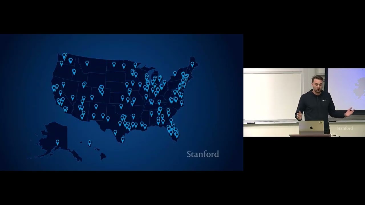
Skydio has evolved from consumer cameras into critical enterprise infrastructure, deploying over 60,000 drones across 4,000 customers with over 28 million Americans living within two miles of an active first responder dock. (6:35)
To solve line-of-sight occlusions in urban canyons, Skydio employs a two-stage reinforcement learning policy that anticipates target motion and proactively cuts corners around buildings to sustain tracking. (24:30)
The asymmetric F10 Lightrunner pairs with the robotic MegaDock to achieve 100 mph dash speeds and 60 minutes of endurance while eliminating parasitic landing gear weight through robotic arm recapture. (40:01)
Safety-critical perception and flight control execute locally on an NVIDIA Jetson Orin NX, while multi-billion-parameter open-vocabulary vision-language models run in the cloud over redundant 5G and radio links. (33:51)
Detailed notes
## Background
This seminar was published by Stanford Online on YouTube on October 30, 2026, as part of the Stanford Robotics Seminar ENGR319 series. Presented by Juraj Kabzan, VP of Autonomy at Skydio, the lecture explores how Skydio's full-stack autonomy powers distributed flying robots, detailing cloud and edge computing architectures, public safety and critical infrastructure deployments, and the newly unveiled F10 Lightrunner fixed-wing aircraft.
## TL;DR
Juraj Kabzan presents Skydio's technological evolution from consumer drones to fully autonomous enterprise fleet robotics operating 24/7. Demonstrating live remote multi-drone orchestration via a web browser, he explains the dual edge-and-cloud autonomy stack that handles real-time obstacle avoidance, visual-inertial odometry, and predictive tracking in urban environments. The seminar highlights Drone as First Responder (DFR) field deployments across major US police departments, the engineering behind the asymmetric F10 Lightrunner and robotic MegaDock, and the company's research roadmap toward vision-language foundation models that allow natural-language fleet control.
## Atmosphere & style
The presentation blends the measured rigor of an academic engineering seminar with the technical confidence of an industry keynote. Kabzan speaks in a direct, pragmatic, and approachable manner, grounding complex algorithmic concepts—like reinforcement learning occlusion policies and GNSS multipath filtering—in high-stakes operational realities like emergency response and utility inspections. The pacing moves smoothly from live remote browser demonstrations to architecture diagrams and audience Q&A, creating an engaging, forward-looking showcase of mature commercial robotics operating at scale.
## Bulletin
- [06:35](https://www.youtube.com/watch?v=Y3Y8pSOYOBo&t=395s) Skydio has evolved from consumer cameras into critical enterprise infrastructure, deploying over 60,000 drones across 4,000 customers with over 28 million Americans living within two miles of an active first responder dock.
- [24:30](https://www.youtube.com/watch?v=Y3Y8pSOYOBo&t=1470s) To solve line-of-sight occlusions in urban canyons, Skydio employs a two-stage reinforcement learning policy that anticipates target motion and proactively cuts corners around buildings to sustain tracking.
- [40:01](https://www.youtube.com/watch?v=Y3Y8pSOYOBo&t=2401s) The asymmetric F10 Lightrunner pairs with the robotic MegaDock to achieve 100 mph dash speeds and 60 minutes of endurance while eliminating parasitic landing gear weight through robotic arm recapture.
- [33:51](https://www.youtube.com/watch?v=Y3Y8pSOYOBo&t=2031s) Safety-critical perception and flight control execute locally on an NVIDIA Jetson Orin NX, while multi-billion-parameter open-vocabulary vision-language models run in the cloud over redundant 5G and radio links.
## Key takeaways
- [00:13](https://www.youtube.com/watch?v=Y3Y8pSOYOBo&t=13s) The Remote Flight Deck allows operators to manage distributed multi-drone operations nationwide from a single web browser interface.
- [03:44](https://www.youtube.com/watch?v=Y3Y8pSOYOBo&t=224s) Automated mid-air deconfliction halts trailing drones dynamically to eliminate collision risks during multi-aircraft returns to rooftop docks.
- [12:00](https://www.youtube.com/watch?v=Y3Y8pSOYOBo&t=720s) Drone as First Responder (DFR) operations achieve a 52% first-on-scene rate in cities like Denver and Las Vegas, aiding de-escalation and situational awareness.
- [15:00](https://www.youtube.com/watch?v=Y3Y8pSOYOBo&t=900s) Autonomous aerial robotics match the algorithmic complexity of Level 4 autonomous passenger cars while operating within severe size, weight, and power (SWaP) constraints.
- [18:26](https://www.youtube.com/watch?v=Y3Y8pSOYOBo&t=1106s) Fleet orchestration aims to drive the pilot-to-drone ratio toward zero, shifting humans from manual pilots to high-level system supervisors.
- [20:22](https://www.youtube.com/watch?v=Y3Y8pSOYOBo&t=1222s) Drones perform onboard dense bundle adjustment and 3D surface reconstruction to dynamically detect geometry discrepancies and correct outdated base maps.
- [23:45](https://www.youtube.com/watch?v=Y3Y8pSOYOBo&t=1425s) Visual occlusion rejection filters out compromised GNSS multipath signals by projecting satellite ephemeris lines of sight directly into calibrated navigation cameras.
- [24:30](https://www.youtube.com/watch?v=Y3Y8pSOYOBo&t=1470s) Autonomous target tracking leverages reinforcement learning trained in simulation to proactively maneuver around urban obstacles before visual line of sight is broken.
- [33:51](https://www.youtube.com/watch?v=Y3Y8pSOYOBo&t=2031s) Edge-cloud hybrid architectures partition workloads by hosting high-frequency safety controls on an onboard Jetson Orin NX and heavy open-vocabulary models in the cloud.
- [40:01](https://www.youtube.com/watch?v=Y3Y8pSOYOBo&t=2401s) The F10 Lightrunner's asymmetric design positions the camera gimbal at the wingtip to provide an unobstructed viewing corridor throughout banked loiter turns.
- [43:00](https://www.youtube.com/watch?v=Y3Y8pSOYOBo&t=2580s) MegaDock's robotic manipulation arm performs launch and mid-air recapture using checkerboard fiducials, eliminating the weight penalty of onboard landing gear.
- [54:44](https://www.youtube.com/watch?v=Y3Y8pSOYOBo&t=3284s) Direct digital surface model (DSM) simulation-to-real transfer minimizes domain gaps, though fine vegetation and adverse weather remain persistent edge-case challenges.
- [56:27](https://www.youtube.com/watch?v=Y3Y8pSOYOBo&t=3387s) Active obstacle avoidance is temporarily disabled during rainfall because falling raindrops create transient noise voxels that trigger false evasive maneuvers.
- [58:51](https://www.youtube.com/watch?v=Y3Y8pSOYOBo&t=3531s) Contested defense variants operate reliably in jammed GPS-denied environments by relying entirely on high-altitude visual-inertial odometry.
- [01:08:07](https://www.youtube.com/watch?v=Y3Y8pSOYOBo&t=4087s) Connect Fusion+ dynamically aggregates bandwidth across diverse tactical radios and redundant commercial 5G carriers to prevent stream dropouts.
## Detailed walkthrough
### [00:13](https://www.youtube.com/watch?v=Y3Y8pSOYOBo&t=13s) Live Demonstration: Remote Flight Deck and Multi-Drone Fleet Operation
Juraj Kabzan introduces the presentation by opening straight into a live demonstration rather than starting with presentation slides. He opens the **Remote Flight Deck**, Skydio's web browser interface used by operators to monitor and teleoperate drones and docking stations deployed across an organization. Kabzan points out that the interactive map displays active docking stations, aircraft locations, and flight constraints: red shaded sectors highlight altitude restrictions and strictly enforced no-fly zones, driven in this instance by nearby commercial airspace around San Francisco International Airport (SFO).
```mermaid
flowchart TD
accTitle: Remote Flight Deck Multi-Drone Operations
accDescr: High-level overview of remote command and control from web browser to multiple active Skydio drones and docking stations.
subgraph UI["Browser: Remote Flight Deck"]
A["Single Operator Touchpad / Web UI"]
end
A -->|"Teleoperation & Click-to-Fly"| D1
A -->|"Multi-Drone Handoff"| D2
A -->|"Remote Control via Cloud"| D3
D1 & D2 --> Autonomy
Autonomy -->|"Auto-Pause Collision Prevention"| M1
Autonomy -->|"Obstacle Avoidance"| M2
```
To demonstrate remote command, Kabzan clicks on **Dock 33**, mounted on the rooftop of Skydio's headquarters in San Mateo, California, and enters the virtual cockpit. Emphasizing that this is a completely live stream and not prerecorded video, he commands the drone to take off directly from his laptop touchpad. Once airborne, he switches to a pointer-lock control mode, panning the drone's cameras to inspect the headquarters roof and parking lot. He spots a vehicle driving below, tags it using a tracking capability called "shadow," and leaves the drone locked autonomously onto the vehicle. While that first drone tracks the car hands-free, Kabzan switches to a second drone at headquarters, **Dock 44**, and launches it. Using a simple "click-to-fly" point on the map interface, he commands the second drone to travel to a designated GPS coordinate autonomously, requiring no active piloting input while en route.
- **Airspace Constraints**: Visible geo-fencing overlays prevent flights inside low-altitude ceilings and restricted rings near major airports.
- **Pointer-Lock Piloting**: Operators can control yaw and camera orientation directly through a standard laptop touchpad or mouse.
- **Autonomous Shadow Tracking**: The vision system locks onto ground assets (such as moving passenger vehicles) and keeps them centered in the camera feed without manual stick inputs.
---
[03:44](https://www.youtube.com/watch?v=Y3Y8pSOYOBo&t=224s) Fleet Operations Across States, Geo-Fencing, and Airspace Deconfliction
Pushing the fleet management demonstration further, Kabzan connects to a third aircraft, **Drone 88**, located at Skydio's high-altitude testing grounds in Colorado. Before engaging the third drone, he disengages tracking on the first drone in San Mateo because the moving car is heading toward a perimeter geofence; Skydio's software explicitly bounds flights within configured operational volumes to prevent airspace excursions. From the exact same laptop browser session at Stanford, he commands the Colorado drone to climb and maneuver seamlessly across the mountain testing facility, showcasing instant cross-country fleet control.
When the missions wrap up, Kabzan commands all active drones back to their respective landing docks simultaneously with a single command. As both San Mateo drones converge toward the headquarters rooftop docks, the system's onboard intelligence handles close-quarters coordination. One returning drone halts mid-air automatically while the other completes its descent. Kabzan notes that this capability prevents mid-air collisions without requiring human supervision:
> “Even though there are multiple drones flying at the same time in the same environment, we automatically pause the drone that is sort of close to it such that they never come to a collision.”
Once the landing sequence finishes, the Remote Flight Deck generates a structured post-flight mission report documenting telemetry, route execution, and operational data. Expressing total confidence in the safety pipeline, Kabzan emphasizes:
> “I had full faith in our underlying autonomy system that even though if I went into a building, our onboard collision avoidance would prevent me to collide with anything.”
- **Airspace Deconfliction**: If multiple return-to-dock trajectories cross within proximity margins, the autonomy system pauses trailing aircraft until landing pads and approach corridors clear.
- **Automated Geofencing**: Hard boundary limits override vehicle-following routines, aborting active tracks before an aircraft can breach safe geographic perimeters.
- **Post-Flight Auditing**: The platform logs an automated mission debrief capturing flight duration, coverage paths, and actionable data collection records.
---
[06:35](https://www.youtube.com/watch?v=Y3Y8pSOYOBo&t=395s) Company Background and Full-Stack Vertical Integration
Kabzan transitions back to his presentation slides and asks the audience how many have heard of Skydio, recognizing that many students remember the company's roots in consumer sports photography with the launch of the **Skydio R1** and **Skydio 2**. Those early platforms relied on off-the-shelf mobile processors and camera sensors to follow athletes autonomously through forests and complex environments. Over the past decade, that core vision-based obstacle avoidance architecture has evolved into enterprise-grade aerial robotics.
```mermaid
flowchart LR
accTitle: Skydio Vertically Integrated Stack
accDescr: Representation of Skydio's full-stack approach spanning hardware, vehicle software, autonomy, and cloud.
HW["Custom Hardware<br>• Docks & Airframes<br>• US Manufacturing"] --> SW["Embedded Software<br>• Flight Dynamics<br>• Motor Controls"]
SW --> AUTO["Autonomy Engine<br>• 360° Vision Pipeline<br>• Edge AI Inference"]
AUTO --> CLOUD["Cloud Platform<br>• Remote Flight Deck<br>• Fleet Orchestration"]
```
Today, Skydio operates with approximately **1,000 employees**, including an autonomy development group of 50 to 60 roboticists, and has shipped more than **60,000 drones** to over **4,000 enterprise and public safety customers**. Kabzan emphasizes that Skydio's primary competitive advantage is complete vertical integration: the company designs the dock mechanisms, molds the airframes, manufactures the hardware inside the United States, writes the low-level embedded motor control software, develops the edge vision AI, and builds the cloud fleet orchestration layer. He explains why owning the entire architecture matters:
> “The fact that we built all of it allows us to really optimize the whole stack and get the most of the last juice of the last percentage of performance out of these systems.”
To illustrate what this looks like in practice, Kabzan displays an operational deployment from Las Vegas. The Las Vegas Metropolitan Police Department deploys clusters of automated docking stations—referred to by Skydio as **"hives"**—across urban rooftops. Operators stationed inside the centralized Real Time Crime Center (**Arctic**) teleoperate and orchestrate drones across the entire city, dispatching them as robotic first responders to 911 calls within seconds.
- **Founded**: 2014, spinning out early autonomy research into commercial products.
- **Scale**: Over 60,000 aircraft deployed to 4,000+ public safety, defense, and industrial infrastructure clients.
- **Workforce**: Approximately 1,000 total personnel, with 50–60 engineers dedicated exclusively to the core autonomy team.
- **Domestic Manufacturing**: All aircraft and automated docking hardware are built and manufactured within the United States.
- **Urban Hive Architecture**: Clustered docks enable distributed metropolitan coverage managed remotely from centralized command centers.
[09:17](https://www.youtube.com/watch?v=Y3Y8pSOYOBo&t=557s) Real-World DFR Deployments: De-escalation and Rescue Operations
Juraj Kabzan shares real-world case studies demonstrating how automated Drone as a First Responder (DFR) systems alter the outcomes of high-stakes emergency calls. In one incident with the Bernalillo County Sheriff's Office, deputies were dispatched to a reported shooting. When the drone arrived on scene ahead of ground units and captured video from an aerial perspective, officers realized that the individuals firing the weapon were actually young children who had stolen a firearm from their parents. Knowing this immediately shifted how responding officers approached the scene, allowing them to de-escalate the encounter, disarm the kids safely, and avoid lethal force. As Kabzan highlights: “They said themselves that if they didn't know this very critical piece of information, however small it may look like, the entire incident might have might have turned in much worse much worse direction.”
In Oklahoma City, the police department received an emergency report that a pedestrian had been struck by a train. Because train tracks stretch across miles of rugged terrain where patrol cruisers cannot quickly navigate, searching on foot or by car is agonizingly slow. OKC PD dispatched a drone directly along the tracks, spotted the injured person within minutes, and directed paramedics straight to the exact GPS coordinates, saving the person’s life. Kabzan notes that in medical emergencies, receiving actionable situational awareness minutes sooner often makes the difference between survival and death.
A local incident in San Francisco illustrated continuous suspect tracking. When a stolen vehicle call came in, the department dispatched a drone and maintained an uninterrupted visual line of sight across a relay of multiple drones. The aerial camera caught the suspect pulling over to pry off a license plate from another vehicle, driving forward, and swapping the stolen plate onto the car. Humorously, the suspect held the plate right up toward the drone’s camera, giving police an unambiguous shot of the new number. The drone kept filming as the suspect tinted the windows until officers determined the safest intersection to deploy spike strips, disabling the vehicle and taking the occupants into custody without any high-speed pursuit, property damage, or injuries. Reflecting on these field incidents, Kabzan emphasizes: “It's really incredible how the right right information at the right time can change the outcome.”
```mermaid
flowchart TD
accTitle: Drone as a First Responder Operational Workflow
accDescr: Workflow showing how a 911 call triggers an automated dock launch, providing aerial reconnaissance and informing ground responders.
subgraph Launch ["Alert & Autonomous Dispatch"]
A["911 Emergency Call"] --> B["Docked Drone Deployment"]
B --> C["High-Speed Autonomous Transit"]
end
subgraph Intel ["Aerial Intelligence"]
C --> D["Arrives on Scene Ahead of Units"]
D --> E["Live Video & Telemetry Relay"]
end
subgraph Response ["Field Action"]
E --> F["Coordinating Officers Assess Threat"]
F --> G["De-escalation, Medical Aid, or Safe Interdiction"]
end
```
[12:00](https://www.youtube.com/watch?v=Y3Y8pSOYOBo&t=720s) Drone as a First Responder (DFR) Impact and Infrastructure Inspection
Beyond individual anecdotes, aggregate metrics demonstrate that aerial robotics are systematically transforming municipal public safety. San Francisco reported a 30% decline in overall crime following the implementation of its DFR programs. In New York City, police used drones to intervene in over 200 subway surfing incidents, preventing fatal falls and electrocutions. Across agencies such as the Denver Police Department and Las Vegas Metro Police, telemetry reveals that a drone arrives on scene first 52% of the time on calls where it is dispatched. When airborne sensors beat patrol cars to a 911 scene, the coordinating officers assess threats, detect hidden dangers, or stand down unnecessary units before officers even pull up to the curb.
The domestic footprint of these systems has expanded rapidly. Kabzan notes that over 28 million Americans currently live within two miles of an active Skydio first responder docking station. These weatherproof docks house the aircraft continuously, enabling automated takeoff and landing whenever a dispatch call is logged, with zero manual on-site piloting required.
DFR is merely the first vertical where remote docking stations have scaled; utility and critical infrastructure monitoring is following the same blueprint. Kabzan displays footage from a dock permanently installed directly adjacent to an electric substation. Utility operators run inspections entirely through a browser interface—taking off proactively for routine health checks or reactively in response to grid alarms. In one inspection, the drone detected visible thermal burn damage on a power distribution pole. Identifying localized component wear before a failure cascade enables utility teams to repair hardware before lines trip and knock out electrical power across whole neighborhoods.
- **Crime reduction:** San Francisco police recorded a 30% drop in overall crime after deploying dock-based drone systems.
- **Youth intervention:** Over 200 dangerous subway surfing incidents were halted by NYPD aerial operations.
- **First on scene:** Drones arrive before ground patrol cars on 52% of dispatched 911 calls in cities like Denver and Las Vegas.
- **Population coverage:** More than 28 million Americans reside within a 2-mile operational radius of a Skydio first responder dock.
[15:00](https://www.youtube.com/watch?v=Y3Y8pSOYOBo&t=900s) From Toys to Critical Infrastructure: Autonomous Flight at Scale
Kabzan draws a direct technical parallel between advanced flying robots and the autonomous driving industry where he spent his earlier career. Having worked on Level 4 autonomous passenger cars, he stresses that the algorithmic and engineering complexity required for an autonomous drone is comparable to that of self-driving automobiles: “I can really say that the complexity of autonomous cars is is and these drones is is really similar.” A small, multi-kilogram airframe must pack compute hardware, perception sensors, robust long-range communications, and full fail-safe autonomy to fly safely at high speeds above densely populated city streets while managing aerospace aerodynamics and variable weather.
This engineering maturity marks an industry-wide transition away from consumer photography gadgets toward critical civil infrastructure. Emphasizing the operational rigor now expected of these fleets, Kabzan explains: “What we are seeing at H transition in is that it's not anymore these systems are toys. If these systems became an infrastructure, meaning that these systems must be always available 24/7, 365 days a year, and they need to be always functioning when a pilot needs them, they need to work, and they need to fly there.” Moving past the early 2000s era of manual RC quadcopters carrying hobbyist cameras, automated docks paired with the Skydio X10 airframe allow operators to launch missions across the country with a single button press.
While Skydio’s annual flight volume has surged past 1 million flights per year across police departments alone, Kabzan points out that the industry is still in the earliest innings of its growth curve. In public safety, 1 million annual flights represents only a fraction of total 911 call volume. In energy utilities, Skydio docks monitor approximately 610 distribution poles, set against an overall US inventory of 180 million poles that require continuous monitoring. Similarly, within national defense and the US Army’s Short Range Reconnaissance (SRR) contract, Skydio has delivered around 3,000 X10D systems; yet, as Kabzan puts into perspective, that entire volume corresponds to roughly a single week of small drone consumption in the war in Ukraine, underscoring the massive scale the robotics sector must still achieve.
[18:26](https://www.youtube.com/watch?v=Y3Y8pSOYOBo&t=1106s) Scaling Drone First Responder Operations: From 1:1 to Fleet Orchestration
Looking at the problem on a global scale, the deployment of autonomous drones for emergency response is only just beginning, with immense potential and impact ahead. To illustrate the scaling challenge of responding to hundreds of 911 calls, a simulation of Clark County using a dataset of roughly 500,000 emergency calls demonstrates the operational bottleneck. When deploying dock infrastructure strategically, agencies initially place docks in densely populated areas with the highest call volume—starting with 15 docks and 15 operators. However, scaling that deployment to cover the entire county demands 160 docks. Under a traditional one-to-one pairing model, that would require 160 dedicated human pilots. Finding, hiring, and training high-quality pilots to be proficient in their duties is notoriously difficult and represents the primary barrier to scale.
To break this bottleneck, Skydio introduced multi-vehicle supervision, enabling a single pilot to operate at least four drones simultaneously. Even with a one-to-four ratio, covering Clark County still requires approximately 40 to 42 human operators. The ultimate engineering goal is to drive the ratio of operators as close to zero as possible. Under this paradigm, human pilots shift from tactical manual control to high-level orchestrators who oversee entire fleets via abstract mission commands, leaving the drones to coordinate, plan, and execute tasks collaboratively. As Juraj Kabzan stated:
> “Our goal is really to go to as close to zero as possible, meaning that pilots are going to become this sort of high-level orchestrators that they can operate their own fleets just through high-level commands and task them with high-level executive missions that these drones can sort of together perform and solve.”
- **Clark County Simulation:** Evaluated against an empirical dataset of roughly 500,000 emergency 911 calls.
- **Infrastructure Scaling:** Initial high-density coverage starts at 15 docks; full regional coverage scales to 160 docks.
- **Operator Ratios:** Traditional 1:1 operation requires 160 pilots; multi-vehicle supervision (1:4) reduces the requirement to 42 operators, with the long-term target approaching fully autonomous orchestration.
---
[20:22](https://www.youtube.com/watch?v=Y3Y8pSOYOBo&t=1222s) Autonomous Urban Transit and Dynamic Map Reconstruction
Achieving operator autonomy requires breaking complex operational challenges into smaller, incremental engineering milestones, effectively giving human operators superpowers. The first step was enabling reliable point-to-point transit across dense urban environments such as San Francisco. Operators simply click a target destination across the city, and the drone autonomously routes and flies the path without requiring continuous human attention. Under the hood, this navigation system leverages a composite mapping stack that fuses digital surface models (DSM), digital terrain models (DTM), and structured infrastructure data, such as power line vectors, into a unified map representation used for onboard graph-based path planning.
subgraph Updating["Map Maintenance"]
DenseBA --> Compare{"Compare Reconstructed Geometry vs Prior Map"}
Compare -->|"Discrepancies Detected"| DynamicObs["Identify Cranes & New Construction"]
DynamicObs --> UpdateMap["Update Prior Map Representations"]
UpdateMap --> MapRep
end
```
Every map-reliant robotic system faces an inherent limitation: real-world environments evolve faster than static cartography can be updated. Unmapped construction cranes or newly erected structural frameworks in metropolitan centers like Miami or San Francisco pose severe collision hazards. To solve this, Skydio processes imagery captured by the drone’s top and bottom navigation cameras during routine customer flights. The fleet performs dense bundle adjustment and 3D surface reconstruction on the fly, comparing the newly reconstructed geometry against the base map. When discrepancies arise—such as unmapped foundation work or high-rise cranes—the system flags the delta and automatically updates the global mapping representation to maintain long-term reliability. During an audience exchange regarding digital twins, Kabzan clarified that while the system ingests 3D spatial representations from satellite data and other sources, it focuses strictly on functional 3D occupancy geometry rather than photorealistic visual fidelity:
> “Maps are never up to date. You know, that's that's that's a fundamental problem that we have to we have to overcome as well.”
---
[23:45](https://www.youtube.com/watch?v=Y3Y8pSOYOBo&t=1425s) Overcoming GPS Multipath in Urban Canyons via Visual Occlusion Rejection
Operating within dense urban canyons introduces severe positioning degradation. Handheld devices and standard GPS receivers consistently fail in downtown corridors due to physical satellite occlusion and multipath signal reflections bouncing off skyscrapers. These reflections corrupt pseudorange calculations, producing erratic localization jumps that are intolerable for autonomous low-altitude urban flight.
To achieve robust global localization, the aircraft tightly couples raw GNSS receiver data with its onboard vision system. Because the autonomy stack knows the ephemeris and precise line-of-sight vector to each satellite across the sky, it projects those satellite vectors directly into the drone's calibrated camera frames. If an image indicates that a building or physical obstacle obstructs the direct line of sight to a particular satellite, the estimator identifies that signal as an occluded or multipath measurement and systematically rejects it from the sensor fusion filter. This vision-aided satellite culling yields a resilient global pose estimate that remains reliable even inside narrow urban street corridors. As Juraj Kabzan explained:
> “Because we have access to all sensor measurements on the drone as well as the camera information, we can fuse both of them together and smartly see where the satellites are actually in the sky and then reject them which we know in the image space are occluded.”
---
[24:30](https://www.youtube.com/watch?v=Y3Y8pSOYOBo&t=1470s) Next-Generation Tracking ("Shadow") and Occlusion Handling with Reinforcement Learning
In Drone First Responder (DFR) operations, finding and following subjects of interest—whether a fleeing vehicle or a suspect on foot—is an essential requirement. Skydio’s tracking capability, designated "Shadow," is designed to lock onto targets in both daylight and thermal nighttime conditions, maintaining continuous visual tracking without operator intervention. A baseline perception model detects and tracks the subject in 2D image coordinates, which are then ray-cast against local 3D terrain and map data to derive continuous 3D world coordinates.
However, real-world deployments revealed a major operational edge case: ground vehicles routinely travel faster than drones, causing the aircraft to fall behind. When a pursued vehicle turns down an urban block and passes behind a high-rise, the drone loses line of sight, blinding the tracker and causing missions to fail. To overcome line-of-sight occlusion, Skydio developed an end-to-end deep learning and reinforcement learning (RL) policy deployed on Skydio Ascent.
```mermaid
flowchart LR
accTitle: Two-Stage Shadow RL Architecture
accDescr: Pre-training an encoder for visibility maps followed by RL action policy training.
subgraph Stage1["Stage 1: Representation Learning"]
MapData["3D Map & Subject Geometry"] --> Encoder["Pre-trained Deep Encoder"]
Encoder --> VisLoss["Visibility Map Prediction"]
end
The model architecture splits into two primary stages:
1. **Pre-trained Spatial Encoder:** A large neural network ingests curated 3D city maps and subject kinematics to predict visibility maps—identifying spatial regions where the drone must position itself to maintain an unobstructed view of the target.
2. **Compact Policy Network:** The high-dimensional spatial representation is compressed into a low-dimensional latent embedding. This compact embedding feeds into an action policy trained via reinforcement learning at scale in simulation.
By training the policy across simulated cities, beginning with San Francisco and expanding across nationwide urban maps, the system learns predictive pursuit maneuvers. Instead of passively following a car's historical trajectory, the policy anticipates occlusions, proactively climbs or cuts corners around buildings, and regains visual tracking immediately as the subject reappears. As Juraj Kabzan noted:
> “Once the car goes behind a building, you have no idea where the subject of your interest is, you lose line of sight, and you don't know what's going to happen next.”
[27:16](https://www.youtube.com/watch?v=Y3Y8pSOYOBo&t=1636s) Predictive Subject Tracking and Fallback Handling
Juraj Kabzan presents real-world flight footage illustrating the sophisticated emergent behaviors produced by Skydio's reinforcement learning tracking policies. In a deployment test conducted on the streets of San Francisco, a tracked target vehicle slowed to a halt and prepared to make a right turn. Rather than passively lagging behind, the trained policy recognized the deceleration cue, accelerated the drone forward, and positioned the aircraft directly above the vehicle. By anticipating the maneuver before it fully unfolded, the drone placed itself in the optimal vantage point to maintain uninterrupted visual line of sight regardless of which direction the car broke toward next.
```mermaid
flowchart TD
accTitle: Tracking and Occlusion Handling Workflow
accDescr: Sequence diagram showing autonomous predictive tracking transitioning to human takeover if a subject is completely lost.
subgraph Tracking ["Autonomous Tracking Policy"]
A["Detect Subject Deceleration / Turn Cues"] --> B["Accelerate Drone Overhead"]
B --> C["Swing Around Occlusions Early"]
end
subgraph Fallback ["Lost Visual Contact"]
C -->|"Occlusion / Lost Subject"| D["System Flags Target Loss"]
D --> E["Remote Human Pilot Takes Over"]
end
```
When an audience member asks about the system's safety fallback when line of sight is entirely obstructed by tall buildings, Kabzan clarifies the boundary between current autonomy and human oversight. As Kabzan explains, “In our case what would happen, we would lose the subject because we don't know what happens, and in that case the human has to take over.” If an obstruction completely breaks track, the autonomy software flags the drop and prompts an operator to intervene.
Kabzan then highlights another demonstration recorded at Skydio Ascend, the company's annual conference held in Las Vegas. In that test, a vehicle navigated tight turns around a multi-story parking structure. The policy anticipated the vehicle's right turn around the corner of the garage, proactively swinging the drone wide around the building facade well ahead of time to preserve an unbroken line of sight.
[28:51](https://www.youtube.com/watch?v=Y3Y8pSOYOBo&t=1731s) Autonomous Critical Infrastructure Inspection and Asset Localization
Shifting focus from Drone as First Responder (DFR) operations to enterprise asset inspection, Kabzan explains how Skydio automates the capture of utility and critical infrastructure. The workflow begins inside the software platform, where operators import a catalog of physical assets and select the specific equipment requiring inspection. The software automatically calculates a customized “shot sheet”—a precomputed series of inspection poses, camera angles, and vantage points tailored to achieve optimal photographic coverage of critical structural components. Drones equipped with an RTK (Real-Time Kinematic) GPS module execute these flight paths autonomously, capturing centimeter-accurate imagery that is uploaded for human analysis and automated anomaly detection.
```mermaid
flowchart LR
accTitle: Autonomous Infrastructure Inspection Pipeline
accDescr: Step-by-step workflow for localizing utility assets and planning automated inspection shot sheets.
subgraph Localization ["Asset Localization"]
A["Rough Asset Priors"] --> B["Coarse Mapping Flight"]
B --> C["Dense 3D Reconstruction"]
C --> D["Point Cloud Asset Matching"]
end
subgraph Inspection ["Execution"]
D --> E["Extract 3D Geometry & Extents"]
E --> F["Generate Optimized Shot Sheets"]
F --> G["Autonomous RTK Capture"]
end
```
A major operational hurdle in scaling this technology across utilities is the poor spatial accuracy of client asset registries. While a few well-resourced utility operators possess millimeter-grade LiDAR point clouds covering their entire electrical transmission grid, most enterprise customers only have rough, inaccurate prior coordinates.
To overcome this discrepancy, Skydio deploys a multi-stage localization and mapping pipeline:
- **Coarse Reconnaissance:** The drone conducts an initial automated mapping flight over the approximate asset coordinates provided by the customer's database.
- **Vision-Based Detection & 3D Reconstruction:** Onboard cameras detect the infrastructure targets in video frames and reconstruct the full scene into a dense 3D point cloud.
- **Geometric Association:** The system identifies which points belong to physical assets, associates reconstructed structures with the customer's noisy prior guesses, and isolates exact structural boundaries such as the top elevation points.
- **Automated Shot Planning:** Using the verified 3D geometry, the planner synthesizes precise camera waypoints and triggers autonomous inspection missions without requiring manual piloting.
[32:05](https://www.youtube.com/watch?v=Y3Y8pSOYOBo&t=1925s) Autonomous Security, Geofencing, and Alert Management
Kabzan turns to Skydio's newest operational vertical: autonomous perimeter security and facility protection. In these deployments, permanent docking stations are distributed across university campuses, corporate headquarters, and utility facilities. The docked drones operate 24/7 on continuous autonomous patrol routes without direct human steering. Facility managers interact with the system via a web dashboard, drawing virtual detection geofences over sensitive ground zones where unauthorized presence is prohibited.
Because Skydio aircraft run onboard vision models trained to detect people and vehicles, the system continuously compares physical target locations against the geofenced polygons. If an intruder enters a restricted zone, an alert triggers immediately in the remote control center. This enables a centralized operations model where a single remote pilot can oversee fleets of autonomous drones deployed across disparate geographic sites throughout the country.
Kabzan emphasizes that operational feasibility hinges entirely on maintaining an extremely low false-positive rate. As Kabzan points out, “Every model that we have to train for this application needs to be highly accurate, because if you imagine that you have tens or hundreds perhaps drones across the entire country or across your deployment, if you were to getting alerts all the time, you would never be able to keep up with it.” High precision ensures operators only intervene when genuine security breaches occur.
[33:51](https://www.youtube.com/watch?v=Y3Y8pSOYOBo&t=2031s) Open-Vocabulary Models and Edge-to-Cloud Video Streaming
While standard person- and car-detection models address typical perimeter threats, enterprise customers frequently require alerts for specialized operational hazards or site-specific objects, such as misplaced wooden pallets or open industrial warehouse doors. To meet this need, Skydio is transitioning toward open-vocabulary detection architectures that allow operators to type arbitrary natural-language text prompts directly into the web console.
```mermaid
flowchart LR
accTitle: Hybrid Edge and Cloud Vision Architecture
accDescr: Drone video capture streaming over redundant wireless links to cloud foundation models and remote dashboards.
subgraph Drone ["Skydio X10 Edge"]
A["Onboard Cameras"] --> B["NVIDIA Jetson Orin NX"]
B --> C["Real-Time Video Encoding"]
end
subgraph Transport ["Fused Data Links"]
C --> D["Skydio Link Point-to-Point Radio"]
C --> E["Redundant 5G Cellular SIMs"]
end
subgraph Cloud ["Cloud Infrastructure"]
D & E --> F["Video Ingestion Engine"]
F --> G["Open-Vocabulary Foundation Models"]
G --> H["Operator Alerts & Web Dashboard"]
end
```
Deploying open-vocabulary foundation models introduces a substantial compute bottleneck. While the Skydio X10 carries an onboard NVIDIA Jetson Orin NX processor, it operates within strict embedded size, weight, and power (SWaP) limits that cannot host multi-hundred-million or multi-billion parameter foundation models. Skydio solves this by distributing the autonomy stack across edge and cloud:
- **Edge Responsibilities:** The onboard Jetson Orin NX handles safety-critical flight controls, real-time obstacle avoidance, visual odometry, and immediate edge perception.
- **Cloud Responsibilities:** Heavyweight vision-language foundation models run in the cloud, processing real-time video streams routed from the drone fleet to identify arbitrary user-queried objects.
- **Redundant Network Bonding:** Because continuous cloud-based inference relies entirely on uninterrupted video feeds, Skydio integrates bonded communication channels. Each aircraft simultaneously fuses long-range point-to-point radio (Skydio Link via the base station) with multiple redundant 5G cellular SIM cards, ensuring seamless connectivity back to the cloud.
[36:12](https://www.youtube.com/watch?v=Y3Y8pSOYOBo&t=2172s) Expanding the Fleet: Skydio R10 for Tight Environments
Skydio relies on Skydio Connect Fusion to maintain low-latency, high-resolution video streams continuously, which serves as a fundamental building block for training massive models and deploying them reliably in the cloud. However, customer needs and operational environments vary significantly across public safety and industrial sectors. Addressing operations in confined spaces, Skydio launched the Skydio R10, a compact drone engineered with integrated propeller guards specifically designed to navigate tight spots where conventional airframes cannot go.
```mermaid
flowchart LR
accTitle: Skydio Connect Fusion edge-to-cloud pipeline
accDescr: Onboard video feeds stream via Skydio Connect Fusion to the cloud to drive large models and situational awareness.
subgraph Onboard["Aircraft Sensing"]
CAM["Fisheye Nav Cams"]
AVOID["Obstacle Avoidance"]
end
subgraph Cloud["Cloud Infrastructure"]
CF["Skydio Connect Fusion\n(Low-latency / High-res)"]
MODELS["Large-Scale AI Models"]
end
CAM --> AVOID
AVOID --> CF
CF --> MODELS
```
The R10 serves specialized tactical and industrial workflows, including SWAT operations and utility inspections inside narrow underground tunnels and building interiors. Despite its miniature footprint, it retains forward-facing obstacle avoidance driven by two onboard fisheye navigation cameras. This enables an operator to pilot the aircraft at full speed straight through small tunnels or indoors without the risk of colliding with walls or structural obstacles.
- The R10 uses a dedicated prop guard enclosure to permit contact with obstacles while maintaining flight.
- Two fisheye navigation cameras power the forward-facing perception pipeline to maintain collision prevention in GPS-denied, enclosed spaces.
---
[37:25](https://www.youtube.com/watch?v=Y3Y8pSOYOBo&t=2245s) The Core Trade-Off of Drone as First Responder (DFR)
In Drone as First Responder (DFR) operations, flight speed and endurance are the defining operational requirements. Operators constantly demand two conflicting performance traits: “Hey, I want to fly faster. And once I fly there, once I get there, I want to be there as long as possible.” While standard multirotors struggle to provide both range and hover time, fixed-wing airplanes excel aerodynamically, achieving much higher cruise speeds and extended time on station due to the lift generated by their wings.
```mermaid
flowchart TD
accTitle: Fixed-wing operational challenges in urban DFR
accDescr: The limitations of traditional fixed-wing aircraft versus operational requirements in dense urban environments.
subgraph Conventional["Traditional Fixed-Wing"]
CREW["Large Ground Crew Required"]
MULTI["Multiple Operators per Aircraft"]
OCCLUSION["Center Fuselage Gimbal\n(Wing blocks target in turns)"]
end
subgraph DFR_Needs["DFR Urban Requirements"]
SPEED["High-Speed Transit"]
LOITER["Extended Loiter Time"]
SOLO["Single Remote Operator"]
SIGHT["360° Continuous Line of Sight"]
end
Conventional -.->|"Fails to meet"| DFR_Needs
```
However, existing fixed-wing platforms fail to meet the constraints of dense urban environments. Traditional tactical fixed-wing drones require massive ground crews for launch and recovery, and frequently require multiple human pilots to manage a single sortie. Furthermore, existing airframes mount the sensor payload directly along the center of the fuselage. When such an aircraft enters a banked loiter circle around a target of interest, the inboard wing invariably dips down and occludes the camera's line of sight. For high-frequency surveillance tasks like following a fleeing suspect or tracking a vehicle, losing visual contact even for a split second often leads to losing the target entirely.
---
[40:01](https://www.youtube.com/watch?v=Y3Y8pSOYOBo&t=2401s) Autonomous Docking and the Asymmetric F10 Lightrunner
To eliminate ground crews while securing long-range fixed-wing efficiency, Skydio developed an autonomous system based around the MegaDock and a novel tailsitter aircraft—the F10 Lightrunner. The MegaDock houses multiple aircraft inside a sheltered container shelf equipped with a high-precision robotic manipulation arm. To launch, the arm retrieves an airframe from its charging slot and releases it vertically; on return, the vehicle maneuvers into a hover above the dock, where the robotic arm reaches up, catches it, and returns it to its shelf. By delegating all mechanical launch-and-recovery complexity to the ground station, the flying vehicle avoids the deadweight penalty of onboard landing gear or vertical lift-rotor systems during cruise.
```mermaid
flowchart LR
accTitle: MegaDock automated cycle
accDescr: The cycle of an aircraft launched, cruising, hovering, and being recaptured by the MegaDock robotic arm.
subgraph MegaDock["MegaDock System"]
SHELF["Charging Shelf"]
ARM["Robotic Arm"]
end
subgraph Flight["Flight Profile"]
VTO["Vertical Launch (Tailsitter)"]
TRANS["Transition to Forward Wing Flight"]
HOVER["Vertical Recovery Hover"]
end
SHELF --> ARM
ARM --> VTO
VTO --> TRANS
TRANS --> HOVER
HOVER --> ARM
ARM --> SHELF
```
The airframe itself breaks conventional aerodynamic symmetry to eliminate sensor occlusion during loitering maneuvers:
Juraj Kabzan highlights the vehicle's geometry, noting that “it's nicely asymmetric, right? It's not really as a unique is not really the same as as the conventional vehicles that are perfectly symmetric.” The payload gimbal sits out on the extreme tip of the left wing, and the main fuselage body is counterbalanced far to the right side. When the drone circles a ground target in a left-hand bank, the camera maintains an unobstructed line of sight into the center of the turn without any portion of the wing blocking the view. The propulsion and control configuration includes two motors, two aerodynamic flaps/control surfaces, and two forward-facing navigation cameras for onboard obstacle detection.
- **MegaDock**: A self-contained weatherproof enclosure with a robotic arm that automates multi-vehicle storage, charging, launch, and physical recapture.
- **Tailsitter VTOL**: Ascends vertically directly out of the dock before transitioning into wing-borne forward flight for maximum aerodynamic range.
- **Asymmetric mass distribution**: Left-wingtip gimbal mount balanced by an offset right-side fuselage, guaranteeing an occlusion-free viewing corridor during left-hand turns.
- **Sensing suite**: Forward stereo navigation cameras for autonomy and obstacle clearance, paired with belly-facing visual-inertial odometry cameras.
---
[43:00](https://www.youtube.com/watch?v=Y3Y8pSOYOBo&t=2580s) Look-At Autonomy and Fleet-Scale Data Loops
Operating the aircraft requires zero piloting skill over flight surfaces, pitch angles, or transition speeds. Skydio implemented an optimization-based flight planning system where the user interface reduces entirely to a “look-at” point on a map: the operator clicks the target, and the planner automatically calculates the optimal trajectories to reach the scene and stay in forward flight. Juraj Kabzan emphasizes how completely this abstracts away the vehicle dynamics: “The all what you have to do is look at a look at a like you have to just say that I want to look at that point and that that higher level planner just figures out exactly what is the most optimal trajectory that I have to take while sort of of course making sure that this always flies the most efficient most efficient region for this vehicle is always forward flight so you never want to de-transition.” The planner also enforces behavioral priors that keep the vehicle orbiting to the left, guaranteeing the wingtip gimbal never points through the airframe.
```mermaid
flowchart TD
accTitle: Data feedback and autonomy lifecycle
accDescr: High-level planner down to low-level VIO, dock tracking, and the continuous fleet deployment loop.
subgraph UI["Operator Interface"]
CLICK["User Sets 'Look-At' Target Point"]
end
subgraph Autonomy["Autonomy & Perception Stack"]
PLANNER["Optimization-Based Trajectory Planner\n(Constrained to Left-Hand Loiter)"]
VIO["Visual-Inertial Odometry (VIO)\n(Nav Cams on Airframe Belly)"]
LAND["Fiducial Dock Alignment\n(Checkerboard Pose Tracking)"]
end
subgraph Loop["Continuous Improvement Engine"]
DEPLOY["Real-World Deployment"]
DATA["Fleet Telemetry & Edge Data Collection"]
RETRAIN["Model Retraining & Validation"]
end
CLICK --> PLANNER
PLANNER --> VIO
VIO --> LAND
LAND --> DEPLOY
DEPLOY --> DATA
DATA --> RETRAIN
RETRAIN --> DEPLOY
```
Underneath this mission autonomy lies the visual-inertial odometry (VIO) stack proven on the Skydio X10. Downward-facing belly navigation cameras continuously calculate high-rate ego-motion estimates without relying solely on satellite positioning. When approaching the MegaDock for retrieval, the perception pipeline identifies visual checkerboard fiducials mounted directly on the dock structure. By resolving the relative 6-DoF transformation between the docking arm and the descending aircraft, the dock's robotic manipulator tracks the aircraft in real time and safely traps it out of hover. Reflecting on how Skydio scales these disparate architectures across micro-drones, multirotors, and fixed-wing tailsitters, Kabzan points to rapid iterative deployment: “I think this loop, like how quickly you can actually deploy stuff to the real world, get the data back, and you know, retrain your models and evaluate them, and how quickly you can turn this this.”
[45:11](https://www.youtube.com/watch?v=Y3Y8pSOYOBo&t=2711s) Skydio's Massive Flight Dataset and the Future of Natural Language Autonomy
At Skydio, the core development crank revolves around continuous data feedback. Skydio holds what is currently the largest dataset of flying robots in existence, working closely with partner customers who opt in to share their operational flight logs. All customer data is aggregated and systematically de-identified before being fed into massive training pipelines. This high-scale model training cycle directly powers the company's autonomous capabilities across varied environments.
Looking ahead, the goal is straightforward: deploying more flying robots into the real world. Beyond expanding fleet sizes, the primary research frontier is eliminating intermediate-level piloting interfaces so users can interact with drones purely through conversational language. Juraj Kabzan envisions a paradigm shift where “the drone becomes your body and you spoke to it just with natural language.” This approach aims to free users from managing flight trajectories, allowing drones to execute end-to-end missions based purely on high-level operator intent.
```mermaid
flowchart LR
accTitle: Data Engine to Natural Language Flywheel
accDescr: Diagram illustrating how fleet data fuels autonomy models, driving natural language interfaces.
subgraph DataEngine["Fleet Data Engine"]
A["Customer Operations & Opt-In Data"] --> B["Aggregation & De-Identification"]
B --> C["Large-Scale Model Training"]
end
subgraph FutureAutonomy["Next-Gen Autonomy"]
C --> D["Advanced Onboard Autonomy"]
D --> E["High-Level Intent via Natural Language"]
E --> F["Autonomous End-to-End Missions"]
end
```
- Skydio controls the largest operational dataset of flying robots in the industry.
- Customer telemetry and sensory data are aggregated and de-identified before training autonomy models at scale.
- The next step in autonomy research aims to remove intermediate drone-tasking interfaces in favor of direct natural language instruction.
- Skydio designs and manufactures the full robotics stack end-to-end—encompassing mechanical hardware, low-level embedded software, high-level perception, planning autonomy, and cloud fleet infrastructure.
---
[47:25](https://www.youtube.com/watch?v=Y3Y8pSOYOBo&t=2845s) Drone as First Responder (DFR) Workflows and Public Transparency
During the Q&A session, an audience member asked how 911 dispatch calls translate into drone flights and who operates the aircraft. 911 dispatchers do not fly the drones. Instead, incoming 911 emergency calls are routed through integration platforms such as Axon, which transcribe voice calls in real time and generate map markers within the Skydio platform. The software evaluates the call against pre-configured agency policies and automatically primes a docked drone for flight. An officer pilot then reviews the situation and initiates the autonomous launch with a single click. These pilots are sworn police department personnel rather than Skydio employees, operating under local agency protocols.
Addressing community trust and fleet oversight, Kabzan emphasizes that transparency is vital for public-safety robotics. Skydio developed and unveiled a dedicated Transparency Dashboard at their Ascend event. This platform allows police departments to publish audit logs of every completed flight path. Kabzan highlighted the role of open reporting: “one of the very critical feature that we have that we have invested a lot into and we have also you know announced in in in during Ascend is a transparency dashboard. That means that every single PD actually publishes every single flight they do on this dashboard, so you or anyone who is interested how these drones are being used, they can actually go and look at every time they fly.”
- 911 audio streams are transcribed by third-party systems like Axon to generate dispatch markers within Skydio's mission interface.
- Drones auto-prime inside their docks based on agency dispatch logic; certified police department pilots review the incident and click to execute autonomous takeoff.
- Pilots operating DFR missions are agency personnel, not Skydio employees, trained under municipal operating guidelines.
- The public Transparency Dashboard exposes flight paths, mission logs, and deployment frequencies to open scrutiny.
---
[51:08](https://www.youtube.com/watch?v=Y3Y8pSOYOBo&t=3068s) Airspace Coordination, Low-Light Flight, and Onboard Edge Computing
An attendee inquired about airspace conflicts with commercial delivery systems like Amazon Prime Air or Zipline. Skydio does not participate in package delivery, focusing instead on public safety, enterprise inspections, and defense. Skydio coordinates directly with delivery operators to share live telemetry and mission vectors. Because Skydio DFR flights respond to active 911 emergencies, they receive airspace priority, prompting autonomous delivery drones to dynamically yield or route around the emergency operational envelope.
When asked about indoor navigation without GPS or in unlit spaces, Kabzan clarified that Skydio avoids bulky LiDAR attachments. Instead, the Skydio X10 and smaller indoor platforms leverage optical sensors combined with modular illumination accessories called NightSense. These add-ons feature top and bottom infrared emitters paired with infrared cameras, or high-output visible-light arrays, enabling visual obstacle avoidance and localization even in total darkness.
Addressing vehicle-to-vehicle swarming and onboard edge processing, Kabzan explained that Skydio drones communicate strictly with cloud infrastructure rather than maintaining vehicle-to-vehicle mesh links. Mission coordination happens in the cloud, while all safety-critical, high-frequency autonomy loops remain strictly on the edge. High-frequency perception tasks—such as 360-degree obstacle avoidance, visual subject tracking, and sky masking for GNSS satellite visibility—execute locally on the drone’s compute hardware to guarantee crash-prevention fail-safes even when cellular or radio links drop.
```mermaid
flowchart TD
accTitle: Compute Stack Architecture (Edge vs Cloud)
accDescr: Division of operational workloads between the drone edge processor and the centralized cloud.
- Skydio coordinates real-time telemetry with drone delivery providers (such as Amazon and Zipline); 911 emergency response flights hold route priority over commercial deliveries.
- Night navigation and obstacle avoidance rely on NightSense modules (top/bottom infrared LEDs and infrared cameras) or visible floodlights rather than LiDAR.
- DFR aircraft avoid direct vehicle-to-vehicle radio links, relying instead on cloud architecture for tasking and coordination.
- Critical safety and autonomy functions (obstacle avoidance, visual subject tracking, sky-mask GNSS processing) run locally on the aircraft’s onboard computer to ensure zero interruptions during wireless signal drops.
[54:44](https://www.youtube.com/watch?v=Y3Y8pSOYOBo&t=3284s) Onboard Autonomy, Cloud Reasoning, and the Simulation-to-Real Gap
Juraj Kabzan finishes explaining the partition between edge and cloud computing: all critical safety behaviors, fail-safes, and emergency handling run locally on the aircraft so it can safely navigate even when connectivity drops out completely. Meanwhile, high-level reasoning—such as open-vocabulary detection and semantic planning—is offloaded to run in the cloud.
An audience member asks about the simulation infrastructure used for training policies: whether it relies on the previously discussed occupancy maps, and what sim-to-real gap the team experienced when deploying those models to real-world hardware. Kabzan explains that the simulation relies on a digital surface model (DSM) rather than dense 3D voxel grids:
```mermaid
flowchart LR
accTitle: Sim-to-Real Policy Training Pipeline
accDescr: Pipeline showing digital surface models used in simulation and transferred to the real aircraft using an identical representation.
subgraph SIM["Simulation Environment"]
A["Digital Surface Model\n(Height per Pixel)"] --> B["Vehicle Dynamics\nEngine"]
B --> C["Policy Training\nin Sim"]
end
subgraph REAL["Real World Flight"]
C --> D["Deploy Onboard"]
D --> E["Identical Maps\nLow Domain Shift"]
E --> F["Edge Execution"]
end
```
Because the exact same digital surface maps are used onboard during deployment, Kabzan notes the representation gap is minimal. While bridging the underlying vehicle dynamics model required substantial engineering, he emphasizes: “So, if you train a policy in your simulator, you have very high chance that it's going to work also also in real world.”
The primary operational challenge remaining is occlusion handling:
- Reconstructed maps capture static structures like buildings reliably.
- Vegetation and trees—particularly when observed from long standoff distances—are harder to model accurately and cause unexpected occlusions.
- Skydio is addressing this by migrating toward end-to-end learning models that directly reason over visual occlusion.
---
[56:27](https://www.youtube.com/watch?v=Y3Y8pSOYOBo&t=3387s) Flight Envelopes, Adverse Weather, and Rain Obstacle Avoidance
An attendee asks about operational limits in harsh weather, citing severe scenarios like heavy rain or thick wildfire smoke in the Los Angeles area. Kabzan points out that, like any certified aviation system, the drones must obey aerodynamic physical limits. The docking stations feature integrated weather and thermal monitoring stations to assess environmental suitability before a flight. When extreme conditions (such as severe thunderstorms or winds exceeding propulsion authority) are detected, the system advises the operator against flying, though human pilots retain the authority to override the warning.
Precipitation presents a specific sensor challenge rather than an airframe limit. While the aircraft are physically waterproof and capable of flying through rain, Skydio disables active obstacle avoidance in rainy conditions. Falling raindrops generate transient noise that the perception system reconstructs as spurious voxels in the local map, which would otherwise trigger erratic evasive maneuvers. High ambient wind remains the single most critical environmental restriction dictating flight safety.
---
[57:52](https://www.youtube.com/watch?v=Y3Y8pSOYOBo&t=3472s) F10 Lightrunner Flight Performance and Speed Envelope
When asked about the flight speed and endurance profile of the new aircraft, Kabzan details the performance benchmarks of the F10 Lightrunner:
- **Maximum Dash Speed:** Capable of reaching approximately 100 mph (demonstrated during a sprint test at Skydio's Ascent conference).
- **Flight Endurance:** Roughly 60 minutes of flight time, vastly exceeding conventional multirotor endurance.
- **Low-Speed Boundary:** At lower speeds (around 20 mph), the aircraft reaches a threshold where it must de-transition from forward fixed-wing flight back to vertical hover.
- **Flight Control Architecture:** A unified Model Predictive Control (MPC) framework governs the entire aerodynamic transition envelope. If an operator or mission commands a velocity below stall speed, the MPC autonomously commands tilt and motor adjustments to resume hover mode.
---
[58:51](https://www.youtube.com/watch?v=Y3Y8pSOYOBo&t=3531s) Defense Hardware Variants (X10D) and GPS-Denied Navigation
Addressing an inquiry regarding military and defense operations, Kabzan outlines the architecture of the Skydio X10D defense variant. Unlike commercial enterprise units, the X10D excludes standard commercial 5G modules and uses dedicated tactical radios designed for contested environments.
Electronic warfare and jamming represent another major operational obstacle. In GPS-denied or actively jammed zones, the drone relies on visual-inertial odometry (VIO) optimized to run reliably even at high operating altitudes. While visual odometry accumulates drift over long distances compared to absolute GNSS positioning, Kabzan explains that the localization estimate remains sufficiently accurate to execute missions and guide the drone back to its approximate launch coordinates.
---
[01:00:00](https://www.youtube.com/watch?v=Y3Y8pSOYOBo&t=3600s) Autonomous Surveillance and Suspicious Activity Detection
A questioner asks about security applications where customers want drones to autonomously identify and lock onto suspicious behavior without requiring manual selection, while acknowledging the challenge of resolving human activity from high operating altitudes. Kabzan confirms that autonomous tracking of suspicious activity is an area of active development.
To overcome altitude and resolution constraints, Skydio leverages full vertical integration over the sensor payload:
1. Wide-area perception detects potential moving entities within the scene.
2. The system automatically pans and punches in with an optical zoom crop to inspect the target at high resolution.
3. A short multi-second video snippet is captured and evaluated to verify whether the target is a human subject or a false positive.
4. The camera rapidly cycles between zooming in to scrutinize targets and zooming out to maintain wide situational awareness.
---
[01:01:45](https://www.youtube.com/watch?v=Y3Y8pSOYOBo&t=3705s) Regulatory Compliance, BVLOS Operations, and Tracking Agility
Asked about air traffic regulations and operating permits, Kabzan outlines Skydio’s collaboration with the Federal Aviation Administration (FAA). Skydio's internal regulatory team works directly with customers to secure Beyond Visual Line of Sight (BVLOS) waivers and multi-drone authorizations, enabling a single remote operator to manage several aircraft at once under FAA Part 107. Geofencing, local altitude ceilings, and airspace constraints are enforced strictly by the onboard software, preventing pilots from accidentally breaching regulatory airspace limits.
Regarding tracking agility and maximum speeds during pursuit missions:
- Skydio drones maintain an active obstacle avoidance speed limit of up to 20 m/s (approximately 45 mph).
- The underlying tracking and avoidance policy uses a unified motion model across target types rather than maintaining distinct behavioral controllers for tracking pedestrians versus automobiles.
- For flexible mission requirements, the modular Skydio X10 airframe allows pilots to switch sensor payloads or descend in altitude to capture closer detail when needed.
[01:03:50](https://www.youtube.com/watch?v=Y3Y8pSOYOBo&t=3830s) Payload Attachments and Behavioral Security Deterrence
Juraj Kabzan outlines the specialized hardware attachments designed to expand the operational capabilities of Skydio's flying robots in public safety and security deployments. Beyond standard vision sensors, operators can equip aircraft with physical modular payloads such as powerful spotlights and directional speaker systems. These allow remote pilots to illuminate ground areas by turning the lights on or off from a browser interface, lower altitude, and speak directly to individuals on the ground in real time.
The physical presence of the drone coupled with these attachments acts as an immediate psychological and physical deterrent. In commercial security monitoring, Kabzan notes that intruders often react to the autonomous drone's arrival without requiring on-site human intervention:
> “So, if someone is an area that they shouldn't be in, if they see a drone, they generally like leave by themselves.”
- **Spotlight attachment:** Features high-intensity illumination that provides high ground visibility for nighttime missions and deterrence.
- **Loudspeaker attachment:** Enables real-time two-way voice communication and acoustic warnings from remote pilots.
- **Autonomous security deterrence:** Flight descent combined with intense illumination provides an active presence that prompts unauthorized persons to vacate monitored property.
---
[01:04:53](https://www.youtube.com/watch?v=Y3Y8pSOYOBo&t=3893s) Mobile Docking Stations and Local Radio Deployments
Addressing questions on infrastructure flexibility, Kabzan discusses how Skydio's docking systems can transition from permanent fixed installations to mobile edge bases. Operators can mount docking stations onto mobile platforms, such as trailers or utility vehicles, allowing rapid deployment into remote or off-grid locations where traditional cellular access or physical docking stations are nonexistent.
Once on-site, the mobile system utilizes dedicated external radio gear and local directional antennas rather than depending entirely on commercial telecommunications. The operator initiates a dedicated calibration flight to map out local spatial boundaries and reference coordinates. While relying on local antenna arrays restricts operational range relative to nationwide 5G cellular infrastructure, it establishes an autonomous base in remote operational zones.
```mermaid
flowchart TD
accTitle: Mobile Dock Deployment Flow
accDescr: Workflow from transporting a mobile dock to establishing localized flight operations.
subgraph Transport ["1. Rapid Mobilization"]
A["Trailer / Vehicle Dock Integration"] --> B["Relocate to Remote Field Site"]
end
subgraph Setup ["2. Site Calibration"]
B --> C["Deploy External Radio & Local Antenna"]
C --> D["Execute Initial Setup Flight for Localization"]
end
subgraph Operation ["3. Localized Autonomous Flight"]
D --> E["Autonomous Mission Execution via Local RF"]
E -.->|"Trade-off"| F["Reduced Range Compared to 5G"]
end
```
---
[01:06:22](https://www.youtube.com/watch?v=Y3Y8pSOYOBo&t=3982s) Vision-Language-Action Models and Cloud-to-Edge Distillation
Evaluating the evolution of AI architectures within the autonomy pipeline, Kabzan assesses the incorporation of Vision-Language-Action (VLA) foundation models. Certain operational tasks—such as processing incoming 911 dispatch calls to trigger automated dock bay openings—can be handled by narrower transcription and dispatch pipelines without requiring a generalized end-to-end VLA model. Nevertheless, Skydio actively develops multimodal foundation models to interpret high-level semantic instructions into robotic trajectories.
Because multimodal foundation backbones involve multi-billion-parameter architectures pre-trained on internet-scale multimodal data, Skydio's immediate deployment architecture focuses on executing these heavy models in the cloud. However, Kabzan highlights the broader computational trend toward efficiency and knowledge distillation, anticipating that condensed, targeted policy networks will progressively move to onboard compute over time. Regarding execution speeds, inference cycles operate at a benchmark of roughly 100 milliseconds to preserve responsive system performance.
> “I think that some form of a larger foundation model with sort of some backbone that is pre-trained on large on internet-wide data is going to be is very interesting for us.”
- **Architecture stages:** Near-term execution uses specialized modular subcomponents alongside cloud-based foundation models; long-term architectures look toward distilled onboard policies.
- **Latency target:** Foundational reasoning loops operate in the ballpark of ~100 ms to support dynamic autonomy.
- **Edge migration:** As parameter pruning and model distillation advance, multi-billion-parameter architectures will be adapted down to power-constrained edge platforms.
---
[01:08:07](https://www.youtube.com/watch?v=Y3Y8pSOYOBo&t=4087s) Connect Fusion+ and Network Redundancy
Reliable video transmission and low-latency remote command execution depend on Skydio’s multi-channel networking architecture, Connect Fusion+. Rather than toggling between disjointed data channels, Connect Fusion+ dynamically aggregates and fuses available signal bandwidth across diverse radio links and multiple commercial cellular carriers simultaneously to maximize data throughput.
Prior to deploying autonomous systems across a municipal or industrial site, Skydio surveys and maps local cellular signal coverage to inform operators where connectivity dropouts might arise. If a specific carrier signal drops or degrades mid-flight, the bonding system automatically rebalances bandwidth across surviving radio links. While comprehensive signal degradation across multiple active modems can occasionally induce transient video dropouts, multi-bearer fusion significantly minimizes mission-critical communication failures.
> “Because we fuse so many of them, it happens less frequently but it it it may happen still.”
Following the discussion on network resilience, Kabzan concludes the session, observing with a smile that the Q&A has run roughly ten minutes over the scheduled seminar window before thanking the audience.
## Notable quotes
> [20:22](https://www.youtube.com/watch?v=Y3Y8pSOYOBo&t=1222s) Maps are never up to date. — Juraj Kabzan
## Mentioned
Amazon Prime Air, Axon, Bernalillo County Sheriff's Office, Connect Fusion+, Denver Police Department, F10 Lightrunner, Federal Aviation Administration (FAA), Juraj Kabzan, Las Vegas Metropolitan Police Department, MegaDock, New York City Police Department, NightSense, NVIDIA Jetson Orin NX, Oklahoma City Police Department, Remote Flight Deck, San Francisco International Airport (SFO), San Francisco Police Department, Skydio, Skydio 2, Skydio Connect Fusion, Skydio Link, Skydio R1, Skydio R10, Skydio X10, Skydio X10D, US Army, Zipline
## Video description
For more information about Stanford’s graduate programs, visit:
https://stanford.io/grad-ed-engr319-1009
October 9, 2026
This seminar covers:
• How Skydio’s autonomy stack enables flying robots to navigate complex environments, track subjects, and execute missions from high-level operator commands
• The full autonomy stack powering Skydio’s flying robots, spanning both cloud and edge computing
• The F10 Lightrunner, Skydio’s recently unveiled aircraft with a distinctive asymmetric design
• How the F10 extends autonomy to long-range fixed-wing flight, including robotic takeoff and landing from MegaDock
• How these capabilities let a single operator orchestrate multiple drones remotely through a web browser
• How this brings autonomous robotics to public safety and critical infrastructure applications
Follow along with the seminar schedule: https://stanfordasl.github.io/robotics_seminar/archive/
Juraj Kabzan is the VP of Autonomy at Skydio, where he leads robotics software development for advanced flying robots.
Skydio推出非对称F10与MegaDock,发力零飞手无人机机队
只有借助边缘感知与自动化机巢将人机飞手比例降趋近于零,自主空中机器人才能扩展为全天候公共基础设施。
Juraj Kabzan介绍了Skydio从消费级无人机迈向全天候运行的全自主企业级机队机器人的技术演进。通过网页浏览器现场演示远程多无人机协同编排,他讲解了在城市环境中处理实时避障、视觉惯性里程计和预测性追踪的边缘与云端双重自主架构。本次研讨会重点介绍了无人机作为第一响应者(DFR)在美国主要警察部门的实地部署、非对称F10 Lightrunner及机械臂MegaDock背后的工程设计,以及该公司旨在实现自然语言机队控制的视觉语言基础模型研发路线图。
Skydio已从消费级摄像设备演变为关键企业基础设施,向4,000家客户部署了超过60,000架无人机,超过2800万美国人生活在现役第一响应者机巢方圆两英里范围内。 (6:35)
为解决城市峡谷中的视线遮挡问题,Skydio采用两阶段强化学习策略来预判目标运动,并主动绕过建筑物转角以维持持续追踪。 (24:30)
非对称F10 Lightrunner与机械臂MegaDock相结合,实现了100英里/小时的冲刺速度和60分钟的续航时间,同时通过机械臂抓取回收消除了起落架带来的额外寄生重量。 (40:01)
安全攸关的感知与飞行控制在本地的NVIDIA Jetson Orin NX上执行,而数十亿参数的开放词表视觉语言模型则通过冗余的5G及无线电链路在云端运行。 (33:51)
Reading summary
Juraj Kabzan argues that aerial robotics are evolving from consumer gadgets into 24/7 critical civil infrastructure, driven by complete vertical hardware integration, automated docking, and an autonomy architecture designed to shift human pilots from manual control to high-level fleet orchestration.
Scaling Public Safety and Fleet Orchestration (18:26)
Drone as a First Responder (DFR) operations have demonstrated concrete tactical value across municipal agencies, with telemetry showing drones arrive on scene first 52% of the time. Incidents cited include the Bernalillo County Sheriff's Office safely de-escalating an armed encounter after aerial feeds revealed children firing a stolen weapon, and Oklahoma City police rapidly locating an injured pedestrian along rugged railroad tracks. Kabzan notes that over 28 million Americans now reside within two miles of a Skydio docking station.
However, scaling municipal operations is constrained by staffing bottlenecks under traditional 1:1 pilot-to-drone ratios. A simulation of Clark County's 500,000 emergency calls indicated that full geographic coverage requires 160 docks, which would necessitate 160 dedicated human pilots. To address this limitation, Skydio introduced multi-vehicle supervision allowing a single pilot to manage four drones concurrently, with an engineering objective to push human supervision ratios near zero by shifting pilots into high-level orchestrators issuing abstract mission tasks.
Partitioned Edge-Cloud Autonomy and Sensing (33:51)
Autonomous flight in complex urban environments requires balancing strict Size, Weight, and Power (SWaP) constraints on the airframe against high computational demands. Skydio partitions its architecture between edge processors and cloud infrastructure. Onboard NVIDIA Jetson Orin NX units execute high-frequency, safety-critical loops—including 360-degree vision-based obstacle avoidance and visual-inertial odometry—ensuring fail-safe execution even if communication links drop. Heavyweight vision-language foundation models run in the cloud, processing live video feeds streamed via Connect Fusion+, a network system that aggregates multiple commercial cellular carriers and local radio channels.
To navigate dense downtown corridors without positioning failures, the platform resolves urban GNSS multipath distortion through camera-aided sensor fusion. Because standard GPS signals bounce off high-rise structures, the autonomy stack projects expected satellite line-of-sight vectors into calibrated camera frames, identifying and systematically culling signals that correspond to visually obstructed satellites before they corrupt global pose estimation.
Aerodynamic Innovation and Predictive Tracking (40:01)
Conventional fixed-wing drones offer superior transit speed and loiter endurance over multirotors but historically suffered from two flaws: requirement of large ground crews for recovery, and camera occlusion caused by the inboard wing dipping into the sensor's line of sight during banked turns. To resolve this trade-off, Skydio developed the F10 Lightrunner, an asymmetric tailsitter reaching dash speeds of roughly 100 mph with 60 minutes of endurance. The airframe mounts its sensor payload on the far left wingtip and uses a trajectory planner constrained to left-hand loitering orbits. Ground support is automated through the MegaDock, which uses a robotic manipulation arm to launch and recapture the vehicle.
For tracking moving subjects on the ground, Skydio deployed "Shadow," a two-stage reinforcement learning policy. Rather than passively following target telemetry, the policy recognizes deceleration cues, accelerates forward, and positions the aircraft overhead prior to street turns to preserve an uninterrupted visual line of sight around tall buildings.
Environmental Boundaries and Operational Transparency (56:27)
Despite automated navigation, physical flight physics and perception boundaries impose strict operational limits. While Skydio airframes are waterproof, active obstacle avoidance must be disabled during rain because falling droplets create transient sensory noise that local voxel mapping algorithms misinterpret as physical obstacles, causing erratic flight maneuvers. In GPS-denied or actively jammed defense environments, platforms like the tactical X10D substitute GNSS with altitude-optimized visual odometry, which inevitably accumulates positional drift over distance but remains sufficiently accurate to guide aircraft back to their launch points.
Regulatory compliance and societal integration represent additional operational hurdles. Deploying multi-drone operations Beyond Visual Line of Sight (BVLOS) requires tailored FAA Part 107 regulatory waivers. To build public trust, Skydio established a Transparency Dashboard allowing participating public safety agencies to publish audit logs and flight paths for public scrutiny.
While Skydio aims to eliminate manual piloting in favor of natural language mission orchestration, current autonomy remains bounded: human operators must intervene whenever tracking targets are fully obstructed, and adverse weather or sensor limitations enforce operational flight ceilings. Realizing scalable, pilotless operations depends on ongoing work in model distillation to onboard edge compute and expanding regulatory BVLOS frameworks.
[0:13] Uh, thank you for having me. Thank you
[0:16] for allowing Skydio to present. And
[0:18] yeah, I'll I'll tell you more about what
[0:19] we have been up to for the last few
[0:21] months and months and years.
[0:23] And but before I actually go into the
[0:26] you know the presentation stuff and
[0:27] slide, I I do like to start with just
[0:29] like giving you a glimpse of what
[0:30] actually we have built. Um, so this is a
[0:33] something that we call uh
[0:35] um
[0:35] a remote flight deck. So it's our main
[0:37] user interface that you can log into or
[0:39] anyone in the world you can log into and
[0:41] you see sort of all of our all of these
[0:42] systems across your across your
[0:45] organization. In this case, you know, I
[0:47] have here a bunch of docking station,
[0:48] bunch of drones. I will click on on one
[0:51] particularly that is you know dock 33
[0:53] that is in the that is in our in our
[0:56] headquarters down in San Mateo, very
[0:58] close from here. What you can see on the
[0:59] map is sort of areas, you know, where we
[1:01] can and cannot fly. Obviously, you know,
[1:03] the red areas represent a like a um
[1:06] maximum altitude and you cannot fly
[1:07] where you cannot fly, mainly because of
[1:09] the San Francisco San Francisco airport
[1:12] or other ones that perhaps have limited
[1:14] uh limited altitude. But uh without sort
[1:16] of uh talking further, let me just enter
[1:19] enter cockpit in one of these uh one of
[1:22] these docking stations. Uh again, this
[1:24] is completely live. This is not a video.
[1:26] I'm doing everything in in in a live in
[1:27] in live. So let's hope everything works
[1:29] out. But yeah, these are sort of the
[1:31] docking stations that are on the on our
[1:33] on the roof of our headquarters and I'm
[1:35] right now taking off with one of them.
[1:38] And I will do my best piloting them from
[1:41] a touchpad. It's a interesting
[1:43] experience, but I'll I'll I'll do my
[1:44] best.
[1:45] Um hopefully our underlying autonomy
[1:47] system will allow me to actually still
[1:49] do it efficient efficiently. So yeah, I
[1:51] am I am right now in there. As you can
[1:53] see, I'm moving it left and right and I
[1:55] can go uh change to something pointer
[1:57] lock. or I'm doing is moving sort of my
[1:59] my on the mouse pad and I'm
[2:02] I'm sort of controlling the drone flying
[2:04] around. I can see exactly on left side
[2:06] of you know where I'm looking at it on
[2:08] the map.
[2:09] And
[2:10] yeah, I can look around in our in our
[2:12] headquarters see who is in the office
[2:13] and who isn't. So you know, we can
[2:16] we can have the conversation afterwards.
[2:18] But let's say that you know, there is
[2:20] something something interesting
[2:21] happening with this car. So I'm going to
[2:22] just just looking look at it. And you
[2:25] know, I'm going to pick another drone
[2:26] because you know,
[2:27] there's always a scenario when you when
[2:29] you when something critical is happening
[2:31] that you want to keep view on something
[2:33] while start to do something else. So I
[2:35] looked I I enabled something called
[2:36] share feature called shadow while while
[2:39] the drone is sort of locked on that one.
[2:41] On that particular car, I logged in to a
[2:43] different drone number 44 and I can
[2:48] I can take off with another drone.
[2:51] While I will do that I can of course
[2:54] still go back to the original drone and
[2:56] control it in a manual way further, but
[2:57] I'll wait once uh until it sort of takes
[3:00] off. And as you can see here, there are
[3:02] sort of you can I I have I have the map
[3:04] area. These red or or orange orange
[3:07] boxes represent sort of geo fences where
[3:09] I cannot fly, but I can in this case
[3:11] just click on the map and
[3:14] and commandeer the drone and just say
[3:15] fly here. And while it is flying, I
[3:17] technically don't even have to
[3:18] necessarily look. It's going to
[3:19] completely completely do everything
[3:21] autonomously. But I can while it flies
[3:23] here, I can go back to the first drone.
[3:26] Rotate around, see whether we have we we
[3:28] are lucky enough to have a car. I see
[3:30] car here. So let me just look at it
[3:33] and that one is going to start tracking
[3:34] that particular vehicle. I can go while
[3:36] it tracks, I can go back to this one and
[3:39] continue sort of doing
[3:40] doing whatever I need whatever work I
[3:42] need to do with the first drone.
[3:44] And yeah, while while all of this
[3:47] happening, I could if I want to I
[3:49] actually let me try. I'll take another
[3:51] drone. This is going to be number 88
[3:54] that I think is going to be completely
[3:55] on the other side side of the
[3:58] on the other side of the country.
[4:00] I will stop the first one this tracking
[4:02] the vehicle because we don't want to the
[4:04] drone to fly with our geo fences so we
[4:06] always make sure that the the drones can
[4:08] fly only in a certain area and I know
[4:10] that if the car goes further it will it
[4:11] will go out of them so I'll just stop
[4:13] it.
[4:14] But
[4:15] I'll go I'll now move to completely
[4:17] different part of the country.
[4:18] This is
[4:20] this one is in the Colorado so that's
[4:23] our another testing site which we have.
[4:26] That I can again just I I change to this
[4:28] drone and I can fly this drone
[4:30] completely seamlessly.
[4:32] Fly around change the altitude and again
[4:34] do some do some useful useful work with
[4:37] this drone.
[4:38] And now I can go back to again see all
[4:41] these drones at the same time and if I
[4:43] want I can you know if I'm done with
[4:45] some some work that I've been doing I
[4:47] can just send all the drones
[4:49] to return return landing dock and I
[4:52] don't have to pay it I don't have to
[4:53] really control them anymore all of this
[4:55] is happening completely autonomously. As
[4:57] you can imagine in this particular
[4:59] scenario we have two drones that are
[5:00] returning you see the our headquarter
[5:02] our roof on headquarters there is
[5:04] there's bunch of these docking stations
[5:06] already and you might have noticed one
[5:08] of them actually got paused that's
[5:10] something that we call our airspace
[5:11] deconfliction so even though there are
[5:13] multiple drones flying at the same time
[5:15] in the same environment we auto
[5:17] automatically pause the drone that is
[5:19] sort of close to it such that they never
[5:21] they never come to a collision. So it's
[5:22] again completely autonomous you you
[5:24] don't have to you don't have to pay
[5:25] attention to it they deconflict itself
[5:27] once the once the first drone let's say
[5:29] land the second one is going to get
[5:31] unblocked and
[5:33] is going to land afterwards.
[5:34] After sort of I am done with my mission
[5:36] I get a post flight report that I can
[5:38] sort of I can sort of share any insights
[5:40] about the flight what I what useful work
[5:43] I have done later.
[5:44] And
[5:46] that's about it so this this is sort of
[5:48] again what you what we have just seen is
[5:50] like three drones flying two of them in
[5:52] our headquarters Samatel, one in one in
[5:54] a Colorado flying just from here from
[5:57] this laptop in completely autonomously.
[5:59] And I had full faith in our underlying
[6:01] autonomy system that even though if I
[6:03] went in into a building, you know, it
[6:05] would still it would not allow me to our
[6:07] on board collision avoidance would
[6:08] prevent me prevent me to collide with
[6:11] anything.
[6:12] So, that's a really a high-level feature
[6:14] capability what you can do all of what
[6:16] you can do with these drones.
[6:18] And I'll jump back to
[6:21] back to the presentation
[6:23] to tell you more about, you know, what's
[6:24] what what's what what we are seeing
[6:27] where the most use of these drones are
[6:28] on these all systems as well as touching
[6:30] on the other, you know, other other
[6:32] robotic platforms that we have been
[6:33] working on.
[6:35] So, yeah,
[6:36] how many of you have heard of Skydio?
[6:38] I'm curious.
[6:39] Oh, nice. Awesome. That's great. I I
[6:42] suspect many of you have heard of us
[6:43] heard about us mainly from our consumer
[6:45] days. So, this is sort of where we
[6:46] started of course more than 10 years ago
[6:49] with Skydio R1 and Skydio Skydio 2.
[6:51] Those are the first two drones mainly
[6:53] used for uh,
[6:55] so taking pictures, taking very very
[6:57] nice videos of of of people doing
[6:59] doing doing sports. We were able to sort
[7:01] of track very closely while avoiding
[7:04] avoiding obstacles and keeping them
[7:05] still line of sight. So, that's really
[7:07] the foundation that we have been we have
[7:09] been building on on on on for a long
[7:11] time.
[7:12] What we are doing uh, is is taking sort
[7:13] of off the shelf sort of
[7:15] commodity mobile CPUs as well as imaging
[7:17] sensors.
[7:19] Of course, making them custom more more
[7:20] efficient and putting in on four motors
[7:23] and propellers, putting the cutting edge
[7:25] AI technology and building flying
[7:26] robots. And that's really the the the
[7:28] fun part working at Skydio.
[7:30] A little bit of, you know, about the
[7:31] company where we are right now. Founded
[7:33] in 2014, we have more than 60,000 at
[7:35] this point more drones shipped and more
[7:38] at this point more than 4,000 4,000
[7:40] customers. So, it's really a
[7:41] fairly matured. Yes.
[7:44] Right around 1,000.
[7:45] Around 1,000 around 1,000 employees.
[7:47] Yeah.
[7:48] The autonomy team itself is around 50 60
[7:50] people.
[7:52] Um yeah, so the the main thing and I and
[7:55] I think we have seen this across many
[7:56] industries. The very important part and
[7:58] we we see it as well is that at Skydio
[8:00] we build everything from the dock
[8:02] hardware to the drone hardware as well
[8:04] as we do all the manufacturing in US by
[8:06] by us as well as we build all the
[8:08] low-level vehicle software, the autonomy
[8:10] software, and the cloud software. And
[8:12] really the fact that the the capability
[8:14] or
[8:14] the the fact that we built all of it
[8:16] allows us to really optimize the whole
[8:19] stack and and get the most of the last
[8:21] juice of the last percentage of of a
[8:23] performance out of these systems. And
[8:25] that turns out to be incredibly
[8:27] important, especially as you know, the
[8:29] the usage of these system grows and the
[8:31] reliability of the system that is
[8:33] required to actually deliver useful work
[8:35] goes up very very quickly.
[8:37] This is actually a um an example of one
[8:39] of our deployments. This is not
[8:40] AI-generated video uh picture even
[8:42] though it may look like it. This is uh
[8:44] in Las Vegas in Las Vegas. These are
[8:46] sort of the they have deployed bunch of
[8:48] these hives as we call them. Hives is
[8:50] sort of the one deployment in one
[8:52] location of multiple docking stations.
[8:54] And they have many of these across the
[8:56] entire city. And then they have one area
[8:58] that they call Arctic uh real-time crime
[9:01] center that they have the pilots sitting
[9:03] in and they can coordinate and also
[9:05] uh teleoperate all of these all of these
[9:07] drones from that one single location.
[9:09] We are like these are already deployed
[9:11] at scale and we are hearing there is
[9:13] constant influx of success stories
[9:15] across all our portfolios of customers.
[9:17] This is just one example from Bernalillo
[9:19] County Sheriff's Office where they heard
[9:21] uh
[9:22] where they got a call that there's
[9:23] someone uh shooting a gun.
[9:26] Then so they take it took a stand, they
[9:27] deployed it, and when they actually
[9:29] looked from different perspective, they
[9:30] noticed these are actually kids who
[9:31] stole a gun from from their parents.
[9:34] Uh and this is a very very critical
[9:37] information that was then relayed to
[9:38] these police officers that were on the
[9:39] on the site, and they managed to adjust
[9:42] their response according to knowing this
[9:44] information. They said themselves, and
[9:46] once they knew it, then they disarmed
[9:48] disarmed the kids, took the gun, and
[9:50] de-escalated de-escalated the whole
[9:51] situation. They said themselves that if
[9:53] they didn't know this very critical
[9:55] piece of information, however small it
[9:57] may look like, the entire incident might
[9:59] have might have turned in much worse
[10:01] much worse direction. They might have
[10:02] been killed or something something along
[10:03] those lines. But, it's very important to
[10:05] have the right information at the right
[10:07] time, which really can save lives.
[10:10] Similarly, from OKC PD, this was one of
[10:13] the case that that they got a call that
[10:16] that a person was hit by a train. They
[10:18] immediately dispatched a drone, flew to
[10:20] to the location where where they guess
[10:22] where they guess it happened, but as you
[10:24] can imagine, train tracks are very long.
[10:26] So, they took a drone, they flew along
[10:27] the train tracks, and very quickly they
[10:29] were able to actually find that there
[10:31] was indeed a person that who was hit by
[10:33] a train, and they have identified
[10:35] the person where it is, sent paramedics
[10:37] there, and they were actually able to
[10:39] save life of this person. Again, it's
[10:40] very important that you get the right
[10:42] information at the right time as quickly
[10:43] as possible.
[10:45] And lastly, well, perhaps you know, the
[10:46] closest to us down from San Francisco,
[10:49] they got a call of a stolen car. So,
[10:50] again, dispatched one one drone.
[10:52] Throughout this entire event, they
[10:54] dispatched actually multiple drones to
[10:55] cover to to keep an eye on this car for
[10:57] entire period of time. They always had
[10:59] it
[11:00] had it in line of sight. This actually
[11:02] incident that they said that they heard
[11:03] of that is happening, but had never seen
[11:05] or had it on the footage. In this case,
[11:07] the the the
[11:09] the person is stealing another license
[11:10] plate from another car, sitting in
[11:12] there, driving a little bit forward
[11:15] further, and what he what what he does
[11:16] then is actually exchange the plate.
[11:18] Thankfully, he nicely shows it to the
[11:20] drone, so we can very clearly see the
[11:21] new license plate, you know, thank God.
[11:24] Uh, so, then we always we we the drone
[11:27] always kept this person in in the field
[11:29] of view. Now, he's tinting his
[11:32] his
[11:33] uh windows.
[11:34] And, you know, this is very critical
[11:36] part that the police officials always
[11:37] know where where the car is. And once
[11:39] they choose that this is like a safe
[11:41] time, they actually rolled out the
[11:42] spikes uh and and got the car got the
[11:45] car to stop and got the people to
[11:47] custody. And then again, all everything
[11:48] was de-escalated very fairly fairly
[11:50] efficiently without anyone hurting and
[11:53] any any sort of damage. So, that's it's
[11:54] really incredible how the right right
[11:57] information at the right time can change
[11:58] the outcome.
[12:00] And we are seeing statistics across all
[12:01] our customers, you know, for example, in
[12:03] San Francisco, they report 30% drop in
[12:06] overall crime
[12:07] overall crime since they deployed these
[12:09] systems.
[12:10] Uh New York, they have they have
[12:12] intervened in more than 200 subway
[12:14] serving incidents again uh saving lives.
[12:17] And you know, these statistics keep
[12:18] going. Denver Police Department, Las
[12:20] Vegas, they are all all seeing that the
[12:22] thing because the drone can can be
[12:24] deployed so quickly from 911 call and
[12:26] can fly to the destination where
[12:28] actually this 911 call happens, they see
[12:30] that 52% of the time drone is the first
[12:33] thing that arrives to the scene. And as
[12:35] you can imagine in the in the scenarios
[12:37] that it matters the most, if you get a
[12:39] if you get there earlier and you can
[12:40] actually relay what's happening back to
[12:42] the back to the coordinating officer,
[12:45] uh this additional information may
[12:46] adjust very sub- substantially what type
[12:49] of response they will do. And this is
[12:50] like extremely this is this turns out to
[12:52] be extremely important
[12:54] across all all our customers.
[12:56] At this point of time, more than 28
[12:59] million Americans live within 2 miles of
[13:01] a of a of a Skydio first responder. And
[13:04] first uh uh first responder drone is
[13:07] really is is a is a system that we call
[13:09] uh that police officers are using these
[13:11] docking stations to respond to 911
[13:12] calls.
[13:14] Um the you know, on the other side
[13:18] uh
[13:21] Hopefully.
[13:22] Cool.
[13:24] On the other side, you know, I talked a
[13:25] lot a lot about the police deployments,
[13:27] this is just one one one vertical that
[13:29] these systems are used for. This is a a
[13:32] video, hopefully it loads,
[13:34] from a a substation where So, this dog
[13:36] is deployed right next to a substation
[13:38] where people can where where where
[13:41] utility uh
[13:42] companies can operate them remotely,
[13:44] take off and inspect the
[13:46] inspect the the the substations for any
[13:49] possible damage. And they can do it
[13:51] proactively or reactively depending on
[13:52] the situation, but it's very important
[13:54] that they identify if there is any
[13:56] possible any possible uh damage early on
[13:59] such that they can perhaps fix it even
[14:00] before some some damage occurs. In this
[14:03] case,
[14:04] in this case they have uh identified
[14:06] actually a burn like a burned area on a
[14:09] pole. And again, this information is
[14:11] very important because if you can react
[14:12] quickly, you can actually fix it before
[14:14] any sort of further damage happens and
[14:16] perhaps an area loses entirely power.
[14:19] And this
[14:20] um
[14:22] And this information is again uh it's
[14:23] important to get this information as
[14:25] quickly as possible.
[14:26] The
[14:29] Uh
[14:30] that's I think the same one. Perfect.
[14:33] And a part of that, we are of course of
[14:35] course supporting We have We have
[14:36] shipped many many drones to the national
[14:38] security customers
[14:40] uh uh and our allies.
[14:42] Um in terms of the you know, in terms of
[14:44] the growth, we are seeing, you know,
[14:45] especially since we have deployed this
[14:47] X10 Plus docking station, our sales are
[14:50] are are the the market is seeing that
[14:52] the the systems can generate tremendous
[14:54] impact and our sales are so sort of
[14:56] sales are uh reflecting that as well and
[14:58] growing very rapidly.
[15:00] In terms of complexity, me personally, I
[15:02] come from sort of L4 background. I have
[15:03] worked my rest of my career on
[15:05] autonomous cars. And I can really say
[15:07] that the complexity of autonomous cars
[15:09] is is and these drones is is really
[15:11] similar. We have a tremendous amount of
[15:13] technology that is really fit in a very
[15:15] tiny body that flies above cities, you
[15:18] know, above above densely populated
[15:20] areas in a very high speed. So, in terms
[15:23] of the amount of technology that goes
[15:24] into these little things, it it it is
[15:26] tremendous. Everything from, you know,
[15:28] starting with autonomy, just making that
[15:30] thing fly, fly reliably in all of the
[15:32] all of the scenarios, but all going all
[15:34] the way to like making sure you have
[15:36] reliable link to the drones, as well as,
[15:38] you know, these are aerospace that are
[15:39] sort of
[15:40] flying systems at high speed. So, all
[15:42] the aerodynamics need to be considered.
[15:44] There is like there's a lot of
[15:45] technology that is going into very small
[15:48] systems.
[15:49] So, who do we serve? We really serve
[15:52] really
[15:53] the backbone of our civil civilization.
[15:55] And we have we have demonstrated at this
[15:57] point of time that these these flying
[15:59] robots have life-saving impact to all of
[16:01] these all of these industries.
[16:04] What we are seeing at H transition in is
[16:07] that it's not anymore these systems are
[16:09] toys. If these systems became an
[16:11] infrastructure, meaning that these
[16:13] systems must be always available 24/7,
[16:15] 365 days a year, and they need to be
[16:18] always functioning when a pilot needs
[16:20] them, they need to work, and they need
[16:22] to fly there. So, it's really like we we
[16:23] have transitioned from the era in early
[16:25] 2000 when these things were just a toy
[16:28] with sort of some camera on it that you
[16:29] could make a cool shots and a cool
[16:31] videos to something that people rely on
[16:34] for a day daily work and save lives
[16:36] across all our industry across many
[16:38] industries.
[16:39] And the AFR is the first example where
[16:41] flying robots flying robots really
[16:44] scaled and became an infrastructure.
[16:46] This point, they are they are deployed
[16:48] across the entire US.
[16:50] And we are seeing this scale also
[16:52] reflect in our annual as fly rate. So,
[16:54] this is how many flights we are doing
[16:56] per year. And you know, we started in
[16:58] 2021 with sort of small numbers, but we
[17:00] are seeing this huge spike which was
[17:01] mainly driven by, you know, our
[17:03] introduction of X1, which is our main
[17:05] main workhorse. But, you know, truly, if
[17:08] I even if I even further dig down to the
[17:11] Doc Plus X1, that's truly the key
[17:13] enabler that at this point of time these
[17:15] systems are deployed completely
[17:17] autonomous, always ready for anyone that
[17:19] need them in the most critical time, and
[17:21] just and just by as I as I did in the
[17:22] beginning, I can just uh press a button
[17:24] and they take off and and and fly.
[17:28] Uh
[17:29] more than we have DFR flights, so these
[17:31] police officers are flying more than 1
[17:33] million flights per year.
[17:35] But if you think about it in a in a in a
[17:36] in a global or or on a larger scale,
[17:38] this is really a tiny fraction of all
[17:40] 911 calls. And our goal is really that
[17:43] the drone is always going to respond
[17:44] first to 911 call because it can arrive
[17:46] there faster as we have shown by metrics
[17:48] by many of our customers, and as a
[17:50] result sort of can can give this
[17:52] critical information much earlier than
[17:54] than before.
[17:55] We are we are uh the docks are close to
[17:58] 610
[17:59] uh distribution poles right now. But
[18:01] again, if you take it in the even across
[18:03] just across US, there's 180 million
[18:06] distribution poles that we can always
[18:07] keep up to date, inspect, and make sure
[18:10] there is no damage. So really
[18:12] and on on on on the on a SRR side, we
[18:16] have shipped we have delivered more than
[18:17] around 3,000 X Tendees to the
[18:20] uh to the SRR contract, but if you think
[18:22] about it, that's just like 1 week of
[18:24] usage across Ukraine. So if you if you
[18:26] think about it at a at a global global
[18:28] scale, we are just starting. This is
[18:31] just the beginning. Just the beginning
[18:33] and the impact that we are seeing that
[18:34] we can make, the benefit we deliver, and
[18:37] the opportunity is just is just
[18:38] enormous.
[18:40] So but truly like if you are thinking
[18:42] about, you know, responding to 200 10
[18:45] calls, can can this this overall concept
[18:47] that we have right now scale? And really
[18:49] what's what's sort of the outcome of the
[18:51] the autonomous team mission that's
[18:52] Skydio?
[18:53] So if I if I play forward the
[18:54] simulation, this is a Clark County
[18:56] simulation where we have
[18:58] around 500,000 calls in our data set.
[19:01] And if I
[19:02] obviously, if you are thinking about
[19:04] where you want to strategically deploy
[19:06] your docks, you first want to deploy the
[19:08] docks in the most sort of densely
[19:10] populated areas where you are seeing the
[19:11] most 911 calls. So, you start there, you
[19:14] start with 15 dogs, you have 15
[19:16] operators, but as you can sort of
[19:17] continuously scale it up and you want to
[19:19] cover all of them, it becomes 160 dogs
[19:22] requiring 160 humans to fly them if you
[19:24] want to do one-to-one pairing. And
[19:26] obviously, one thing that we are hearing
[19:28] very very
[19:29] very often is that finding, you know,
[19:31] high-quality pilots and and training
[19:34] them to be very proficient in their in
[19:36] in their in their duties is extremely
[19:38] extremely difficult. And that's one of
[19:40] the sort of one of the key thing that we
[19:42] have to overcome to enable this overall
[19:44] scale. We have introduced a capability
[19:46] and I've showed you to earlier that, you
[19:47] know, you can go from one-to-one, so
[19:49] meaning one-to-one pairing that one
[19:51] pilot operates one drone, to something
[19:53] that one pilot can operate at least four
[19:55] drones at the same time.
[19:57] But even then,
[19:58] um
[19:59] even then, that just cuts to 42 42
[20:02] operators. Our goal is really to go to
[20:04] as close to zero as possible, meaning
[20:07] that pilots are going to become this
[20:08] sort of high-level orchestrators that
[20:10] they can operate their own fleets just
[20:12] through high-level commands and and task
[20:14] them with high-level high-level
[20:15] executive executive missions that these
[20:18] drones can sort of together perform and
[20:20] and solve.
[20:22] Um so, we're giving pilots superpowers
[20:24] and we haven't done it
[20:26] we of course don't do it, you know, from
[20:28] zero to 100 immediately. We are all
[20:30] engineers, so we sort of distribute the
[20:32] problems to smaller pieces to solve them
[20:33] incrementally. So, this is one of the
[20:35] features that, you know, where we
[20:36] started
[20:37] uh where we where we gave people
[20:39] superpowers that they can navigate from
[20:41] point A to point B even in some
[20:42] something like dense dense urban
[20:44] environment. This is a San Francisco.
[20:46] So, all of the people have to do is just
[20:48] like all pilots have to do, fly there
[20:50] across the city and the drone does
[20:52] everything completely autonomous and the
[20:54] the the human doesn't have to really
[20:55] think about it. So, that's really one of
[20:57] the areas that you just task the drone
[20:58] to go there and it performs everything
[21:01] autonomously. So, how does it work under
[21:03] the hood? What technology does it really
[21:04] rely on?
[21:05] Uh so, we do rely on maps. We have
[21:08] multiple source of the maps. We use a
[21:10] digital surface map, digital terrain
[21:11] map, as well as more of a structured
[21:13] information where for example our power
[21:14] lines. We combine all that information
[21:17] into one sort of map representation that
[21:19] then we sort of then we load to the
[21:21] drone. And on top of it, you know, once
[21:23] you have the map, once you know roughly
[21:25] where the buildings are, then you can
[21:26] use graph search or you know, some
[21:29] uh, some methods like that to find you
[21:31] know, what's the most efficient most
[21:33] efficient path to travel from point to
[21:35] point A to point B fairly efficiently.
[21:38] But I'm sure like all of you have worked
[21:40] on robotics and and all of you know that
[21:41] anything that relies on a map has to a
[21:44] fundamental problem. Maps are never up
[21:46] to date. You know, that's that's that's
[21:48] a fundamental problem that we have to we
[21:50] have to overcome as well. So in order I
[21:53] am and obviously if if you're flying
[21:55] through a city and you don't have a
[21:56] building in your in your map that that
[21:57] that can cause a lot of problems. So
[21:59] what we do
[22:00] is that as as as customers are flying
[22:02] throughout throughout throughout the
[22:04] cities we we take all the data, we do
[22:07] dense bundle adjustment and dense
[22:08] reconstruction, we reconstruct all of
[22:10] the areas as the as the drone flies
[22:12] thanks to our top and bottom nav
[22:13] cameras, and
[22:15] we can then identify and compare the two
[22:17] maps against each other and see whether
[22:19] there are areas that you know, that we
[22:20] have reconstructed but are not in the
[22:22] map and identify exactly as in this case
[22:25] this giant this large crane and and
[22:27] whole sort of foundations of a building
[22:29] uh, of a building and we can update the
[22:31] map update the map with additional
[22:32] information. And as you can imagine, you
[22:35] know, if you're going in Miami or San
[22:36] Francisco or the biggest cities, there's
[22:37] always construction. So this turns out
[22:39] to be very very critical part to really
[22:41] make it make sure that this this this
[22:43] system can work always as I mentioned
[22:45] and and and and always reliable.
[22:49] Um,
[22:50] yeah, and the the fact we are flying in
[22:53] dense urban environment. And as you as
[22:54] you know, if you go with your phone down
[22:56] in San Francisco, the GPS on the phone
[22:59] it becomes very unreliable. Yeah?
[23:02] >> You guys have the answer for the digital
[23:03] twin of the city you guys have?
[23:06] We generally we generally get various
[23:08] sources of the map. You can think of it
[23:10] the maps can be generated from
[23:11] satellites or or whatever. We can we
[23:13] first start there and then we build on
[23:15] top of it.
[23:19] Uh I mean depending what you mean by
[23:21] full digital because we don't
[23:22] necessarily need in this particular case
[23:24] about how it looks or how pretty it is.
[23:26] We mainly care about there is a building
[23:28] and may may mainly about more like
[23:30] occupancy map of some sort. So that's
[23:32] the main thing that we rely on.
[23:35] I mean it is 3D. It is 3D. So yes.
[23:38] From that perspective.
[23:41] Uh and then if you have any questions of
[23:42] course always ask. Please. Um
[23:45] So yeah. Um global pose estimate. Uh as
[23:48] you know if you go down down San
[23:49] Francisco in the city GPS tends to be
[23:52] very unreliable. The main reason why
[23:54] that actually happens is because the
[23:55] satellites are actually occluding. There
[23:57] is multipath effect that you know the
[23:59] the the that
[24:01] makes the measurements unreliable. But
[24:02] because we have access to the you know
[24:05] the or or all sensor measurements on the
[24:07] drone as well as the camera information,
[24:09] we can fuse both of them together and
[24:11] smartly you know see where the
[24:13] satellites are actually on the in the
[24:14] sky and then reject them which we know
[24:17] in the image space are occluded. And as
[24:19] a result we can actually build a sort of
[24:21] GP GPS pose estimate that is
[24:23] substantially more reliable and accurate
[24:25] in in exactly these scenarios where we
[24:27] care the most about.
[24:30] Um the other one is shadow.
[24:33] Uh as for the DFR, you know, you can
[24:35] imagine that if you fly to a location
[24:37] very often there is like you are looking
[24:38] for something or or someone and then you
[24:41] want to once you find them you want to
[24:42] lock on them and make sure you always
[24:43] keep the kill the keep them in field of
[24:45] view. There's another area of very very
[24:47] active work for us where we want to
[24:49] where we want to get to the state that
[24:50] you actually just lock on a sub lock on
[24:52] a subject uh whether it's a car or a
[24:54] person and uh whether it's during the
[24:56] day or night and you really don't have
[24:58] to care about anything else. That's
[25:00] That's a really fundamental capability
[25:01] that we are investing a lot of a lot of
[25:03] time and an effort to.
[25:04] Um how it works under the hood is that
[25:06] we have, of course, we have a tracking
[25:08] model
[25:09] that is able to identify for us a
[25:11] location of the subject in the in the 2D
[25:14] sort of image space and then project it
[25:16] based on the location of the drone on a
[25:18] map and get a 3D coordinate.
[25:20] Uh the one thing that we have introduced
[25:22] uh well uh
[25:25] Hopefully it's going to go.
[25:26] Yeah, one thing that we have seen one
[25:28] thing we have seen when we deploy this
[25:29] in the real world and then again people
[25:31] start using in real applications is that
[25:33] if you track a car, obviously drone is
[25:35] not as fast as a car, and very often you
[25:37] fall behind. And in that case as in and
[25:40] in that scenarios as as you can see
[25:41] here, you're we are trying to the person
[25:43] is trying to track this car, very often
[25:45] this car goes behind a building. Once
[25:47] the car goes behind a building, you have
[25:49] no idea where the where the car or or
[25:50] subject of your interest is, you lose
[25:53] you lose line of sight, and you don't
[25:54] know what's going to happen next.
[25:57] The way we have solved it uh is that we
[25:59] have trained we have a trained a deep
[26:00] learning model
[26:02] where we where we take actually the you
[26:03] know the same map information that I've
[26:05] told you about that we that we care a
[26:07] lot about that is curated as accurate as
[26:09] possible, and we feed it through uh
[26:12] through a neural network to actually
[26:13] output directly the actions. And that's
[26:15] really our next generation That's our
[26:17] next generation of a shadow that we have
[26:19] introduced
[26:21] on Ascent. The way we the way we train
[26:23] this policy is it has multiple stages.
[26:26] So, first of all, you know, the encoder
[26:27] is of course uh much larger network than
[26:29] the than the action policy itself. So,
[26:31] we pre-train the policy based on, you
[26:33] know, making sure that predicts
[26:34] visibility map because that's actually
[26:36] what you care about. You want to know
[26:37] where the subject where you have to be
[26:39] so that you have visibility of the map
[26:41] in addition to other information. We
[26:43] take the sort of What we do is that we
[26:44] take the larger map and we can encode in
[26:46] an in a in a in a embedding in much
[26:49] smaller dimension such that you
[26:50] afterwards we can take this embedding
[26:53] and
[26:54] train it
[26:55] uh
[26:57] train it in RL fashion at a at a very
[26:59] large scale. So we we use simulation for
[27:02] this
[27:02] where we deployed it in where where
[27:04] where we deployed it in start with San
[27:06] Francisco. We start with San San
[27:08] Francisco. We train the policy there and
[27:09] of course over time we want to make sure
[27:11] that this works across the entire
[27:12] country and all the cities. So we scale
[27:14] it substantially across all the maps
[27:16] that we that we have and
[27:19] and afterwards uh we deploy it on the
[27:21] drone.
[27:22] This is another example that uh there
[27:25] very interesting behaviors that fall out
[27:26] of this policy. This is an example in
[27:28] San Francisco where the car actually uh
[27:30] came to came to a stop and went to the
[27:32] right and we have seen that actually the
[27:34] model learned that before as the car
[27:36] comes to a stop it has to actually speed
[27:38] up and go right on top of it such that
[27:40] it has such that it is positioned in the
[27:42] best possible way
[27:44] uh whatever the whatever the drone
[27:46] whatever the car does next. So it has
[27:48] the best chance actually to keep the
[27:50] visibility. Yes.
[27:51] >> This is very impressive. I'm curious
[27:53] what's the fallback in this.
[27:55] For example like Are you mentioning in
[27:57] the other building
[27:58] >> Yeah.
[28:00] Yeah in our in our case what it what
[28:01] would happen we would lose the we would
[28:03] lose the subject because we don't know
[28:04] what happens and in that case
[28:06] uh the human has to take over. That's
[28:08] the right that's the current situation.
[28:10] Yes. Yes. We would flag it and the human
[28:12] has to has to take over.
[28:14] Uh I will
[28:17] go back to this video
[28:20] where Yeah this was actually in an hour
[28:22] ascent our yearly conference that
[28:23] happened few months ago in in in uh
[28:26] actually month ago in in Vegas where the
[28:28] car actually came came to make turn
[28:30] around the garage and even here you can
[28:32] see it's going to turn right again and
[28:34] the policy is going to actually decide
[28:35] to swing around the building much
[28:37] earlier actually and anticipate the car
[28:39] actually will do that such that it is
[28:41] positioned in the best best location
[28:43] such that it has field of view uh line
[28:45] of sight to that uh to that subject.
[28:49] Um
[28:51] Yeah, so that's I talked a lot about
[28:52] DFR, but now I want to switch gears a
[28:54] little bit to talk about inspecting and
[28:56] inspecting critical infrastructure.
[28:58] So, the way the way the software
[29:00] generally the way that the software
[29:01] generally works is that you can select
[29:03] all the assets that you load all the
[29:04] assets into the software, and then you
[29:06] can select which assets you want to
[29:08] inspect, and the software automatically
[29:10] generates all what are all of the areas
[29:13] or what are the actually shot shots that
[29:15] I have to take of the assets such that I
[29:16] have the best coverage of the things I
[29:18] care about the most that then can be
[29:20] inspected.
[29:21] All what you do is just a select which
[29:22] of them you care about, uh
[29:24] pick what type of shot sheet as we call
[29:26] it, uh
[29:27] uh and and take the and and execute the
[29:29] mission in completely autonomous manner.
[29:31] Then we have on these drones
[29:34] um
[29:35] on accident we have RTK attachment that
[29:37] you can actually just mount on it, which
[29:38] gives you as you all know very reliable
[29:40] pose estimate. So, then we can just go
[29:42] and take all of these shots of these
[29:44] assets that are then loaded into the
[29:46] system and and a human can sort of
[29:48] inspect them to figure out any possible
[29:50] any possible anomalies or anything that
[29:52] needs to that needs to be inspected.
[29:55] Uh
[29:56] what it turns out when deploying these
[29:57] things
[29:58] that
[30:00] uh as you can imagine what you're
[30:01] relying on is the one thing uh which is
[30:03] the
[30:05] location of the assets.
[30:06] And that turns out to be a big problem.
[30:08] Many of the utility customers some of
[30:10] the utilities customers have actually
[30:11] very precise location of these assets
[30:13] because they have spent the time and
[30:15] energy and and money to actually create
[30:17] high precision lidar point clouds of the
[30:19] entire entire grid, but it's not really
[30:22] it's not really the case across all the
[30:24] all the utility customers out there.
[30:27] So, the thing that we have to build is
[30:29] in order to make this work really like
[30:31] how do you get actually the precise
[30:32] location of the assets?
[30:34] So, the the way that these things are
[30:35] actually deployed right now
[30:38] uh
[30:40] uh is that you first do a mapping
[30:41] mission around these assets that needs
[30:43] to be sort of roughly around around the
[30:45] location of the assets. You know
[30:46] generally at the beginning like this is
[30:48] roughly these assets are in those
[30:49] locations. Then you detect them, you
[30:51] sort of the you do you do you detect
[30:53] these assets in the in the in the in the
[30:55] camera field of view and we do the
[30:56] complete 3D reconstruction of the scene.
[30:59] And once we have that, we can easily
[31:00] identify actually the the the the asset
[31:03] and then match them to their original
[31:04] prior guess where they are. Which these
[31:07] guesses are sort of sometimes very
[31:08] close, sometimes further, but because we
[31:10] have them because we already know all of
[31:12] them, we can sort of do the best
[31:13] matching to to their prior guesses. So
[31:15] yeah, we built as I mentioned it's very
[31:17] important that we built sort of the
[31:19] the entire dense point cloud and
[31:22] afterwards and I once we have a dense
[31:24] point cloud and we also have a
[31:25] detections of these assets, it is fairly
[31:27] straightforward to figure out which of
[31:29] the points
[31:30] uh, lay
[31:32] uh, which of the points are on the
[31:34] assets and once you have that you can
[31:36] figure out exactly their 3D geometry,
[31:38] can figure out their the what's what's
[31:40] their what's their top point and
[31:41] afterwards it is fairly straightforward
[31:43] to figure out what are the shot sheets,
[31:44] what are locations of the photos that
[31:46] you have to take so that you cover as
[31:48] much of the assets as possible or the or
[31:50] the areas of the assets um,
[31:51] that that you need.
[31:55] Uh,
[31:57] yeah.
[32:00] Uh, okay, I'll I'll move forward. Um,
[32:03] the
[32:04] so that was inspection and now the last
[32:05] one which is perhaps the newest new the
[32:07] newest for us, which is securing
[32:09] critical infrastructure, securing
[32:11] securing areas. Yeah, this is fairly uh,
[32:14] new area for us.
[32:16] Uh,
[32:18] where the main goal is that you have
[32:20] many of these docking stations spread
[32:22] across your, you know, it could be for
[32:23] example Stanford universities or or or
[32:26] sort of headquarters or or utility
[32:29] customers and you can plan a mission
[32:32] that you want to perform. You want these
[32:33] systems to fly completely autonomously
[32:36] and then all that they do is they fly
[32:37] 24/7 all the time on these areas. And
[32:41] then you can draw on the on the air on
[32:42] the on the ground these sort of
[32:44] detection areas that you care about,
[32:45] meaning I really don't want that there
[32:47] is anyone going to be in this area. And
[32:49] if there is someone, I really want to
[32:51] know about it.
[32:52] We have, as I as I showed you before, we
[32:54] have already sort of the people and car
[32:56] detection system running on or running
[32:57] on board of the drone, and we know where
[33:00] these detections actually happen. So,
[33:02] every time if we detect people or car in
[33:04] these air in these detection areas, we
[33:07] can just send an alert to pilots or or
[33:09] operators that hey, there's someone in
[33:11] these areas, pay attention to it. That
[33:13] means that really means that what what
[33:15] happens is that you can have one pilot
[33:16] have, you know, operating the fleets of
[33:18] the drones across completely different
[33:20] areas occurring the country, have these
[33:22] systems operating in autonomous manner,
[33:24] and all what you do is you pay attention
[33:26] to if an alert happens.
[33:28] As you can imagine, the one very very
[33:30] important thing here is the reliability
[33:31] of these models. Every model that we
[33:33] have to train for this application needs
[33:35] to be highly accurate, because if you
[33:37] imagine that you have, you know, tens or
[33:38] or hundreds perhaps drones across the
[33:40] entire across the entire country or
[33:42] across your deployment, if you were to
[33:44] getting alerts all the time, you would
[33:46] never be able to keep up with it. So,
[33:47] the false positive rate really matters
[33:49] here.
[33:51] Uh but what we have noticed that
[33:53] uh what we have noticed
[33:56] uh that depending on the use case and
[33:59] application uh sometimes just people or
[34:03] cars is is not enough. Sometimes you
[34:05] want something, you know, more unique
[34:07] for your use case. So, really the
[34:08] direction that we are going for going
[34:10] towards next is work on the models that
[34:12] are more going direction of open
[34:14] vocabulary, so you can really type
[34:16] whatever whatever is your very interest.
[34:18] And whereas in this case is sort of
[34:19] wooden wooden pallets. And if you if you
[34:22] see the wooden pallets in the in the in
[34:23] the field of view, you get these alerts,
[34:25] and you notify the pilots to actually,
[34:27] you know, pay attention to and and take
[34:29] over and figure out what's actually
[34:30] happening. In this case, I was looking
[34:32] for wooden pallets and I think later
[34:34] there's also going to be doors. But
[34:36] really the the the direction that we are
[34:37] going towards is to is to build these
[34:39] models in such a way that are as
[34:41] generalizable as possible
[34:43] leveraging the
[34:44] uh the latest foundation models.
[34:48] But you can ask like, "Hey, uh these are
[34:50] big models, right? If you are thinking
[34:51] about open vocabulary or anything text
[34:53] specific, these are, you know, hundreds
[34:55] of millions going toward multiple
[34:57] billions of parameters models. Can you
[34:59] run on the board?" On NX 10, we have we
[35:02] have NVIDIA Orin NX. So, these are
[35:04] fairly small compact computer, fairly
[35:06] power efficient. So, obviously, we
[35:08] cannot run it we can we cannot run it on
[35:10] the on the board. The way we actually
[35:12] solve this is we run all we run always
[35:14] in the cloud. One one very critical
[35:16] piece of piece for us is
[35:18] the most important thing that these
[35:20] systems are are giving to customers is
[35:22] the real-time sort of video that we
[35:24] could actually can look at where the
[35:26] drone is, and then we can we always of
[35:27] course stream
[35:29] stream the footage from the board from
[35:31] the drone through the cloud to the
[35:32] everyone to the everyone's computer.
[35:34] And uh only only way that is actually
[35:37] So, this is very very important
[35:38] fundamental part of our architecture and
[35:41] our our product. So, we are investing a
[35:42] lot of resources and time into it. The
[35:44] way it works under the hood and really
[35:46] what enables it that we have multiple
[35:48] source of connections. We have
[35:49] point-to-point point-to-point link. So,
[35:52] every docking station comes with sort of
[35:53] external radio that, you know, can talk
[35:55] to the drone. So, we have sky we have we
[35:57] have sky dealing as we call it. But at
[35:59] the same time, in many of our
[36:01] deployments, these drones have SIM cards
[36:03] in them and so we have 5G. And you know,
[36:06] we don't have just one, we have
[36:07] multiple. So, we are really fusing all
[36:09] of these sources, all of these
[36:10] connections together into one sort of
[36:12] connect fusion that allows us to have
[36:15] always low latency and high resolution
[36:17] video always available. And that is
[36:19] really fundamental piece that allows us
[36:21] to take these train these very very
[36:23] large models and and deploy them in the
[36:26] cloud.
[36:27] And and always always work.
[36:30] Um
[36:31] obviously, you know, there are various
[36:33] various uh
[36:35] there are various tasks. Every every
[36:37] customer, every every use case may
[36:39] require different type of drone and
[36:40] different type of vehicle.
[36:42] Uh we have uh recently launched
[36:44] something new drone called uh Skydio
[36:47] R10, which is a smaller form factor that
[36:49] has sort of prop guard around it and can
[36:51] actually go in the very tight areas.
[36:53] Uh that is used across uh SWAT
[36:56] deployments or utility inspections. You
[36:58] know, it flies in a very tight tunnels.
[37:00] The very very tight um tunnels or areas.
[37:03] It has still obstacle avoidance. It has
[37:05] two fisheye cameras on board. So, we
[37:07] still provide sort of a front-facing
[37:09] obstacle avoidance capability. So, you
[37:12] can still go, you know, full full speed
[37:14] through a through a through a small
[37:16] tunnel or perhaps even go into the to
[37:18] the inside of a building and not really
[37:20] worry about crashing into anything. And
[37:22] that turns out to be extremely
[37:23] important.
[37:25] Well,
[37:26] >> [clears throat]
[37:27] >> uh very often, you know, as I said, uh
[37:29] when you are thinking about DFR
[37:31] deployments, the one critical factor is
[37:33] like you want to fly as fast as possible
[37:35] from point A to point B, right? So, we
[37:37] always get the question, "Hey, I want to
[37:39] fly faster. And once I fly there, once I
[37:41] get there, I want to be there as long as
[37:42] possible." So, those are the the two
[37:44] critical asks that we are getting we are
[37:46] getting we are getting very often.
[37:48] The way um the way the right way to
[37:50] solve it actually is to look into, you
[37:52] know, what is available out there in in
[37:53] planes.
[37:55] Planes can actually fly very fast. They
[37:56] can actually stall stay in the air much
[37:59] longer because they are much more
[38:00] efficient.
[38:01] But if you think about it, you know, if
[38:02] you look out there, what are really are
[38:05] there really any existing fixed-wing
[38:07] aircraft that are available at this
[38:08] scale and sort of are able to fly in
[38:10] dense urban environments?
[38:12] If you look at it,
[38:13] not really. Um there are, you know, the
[38:15] they are various of these systems that
[38:16] require huge crew on the ground to catch
[38:19] them, deploy them, and make sure that
[38:20] they are always available, always ready
[38:22] to sort of uh to to to fly.
[38:25] And even once they are actually deployed
[38:27] and they fly, even then you may need
[38:29] even multiple pilots for a single drone
[38:31] to be operating them.
[38:33] And that that really doesn't, you know,
[38:35] match nicely with, you know, what what
[38:37] we what we are envisioning that you can
[38:38] have fleet of these small drones that
[38:40] you can operate
[38:42] operate multiple perhaps at the same
[38:43] time.
[38:44] So,
[38:46] if you look at a we looked at we looked
[38:48] quite hard in the industry and tried to,
[38:49] you know, see what what works out there
[38:51] the best. So, this is one of the example
[38:53] of fixed-wing vehicle that that that is
[38:55] perhaps the best in the
[38:57] was the best in the
[38:59] in the in the in the category.
[39:01] Uh and one thing that you can notice it
[39:03] actually has the the the camera mounted
[39:05] in the center of the fuselage. And if
[39:07] you think about it, they often they
[39:09] often think what you what you actually
[39:10] want to do for our use cases is that you
[39:13] want to fly somewhere and look at
[39:14] something. Very, very basic, right?
[39:16] And if you if you if you simulate it,
[39:18] what you can actually see that if you
[39:19] just fly somewhere look at something,
[39:21] every single time you loiter around a
[39:23] point, you will see that actually there
[39:25] is a fit part of the wing that that
[39:27] actually occludes your visibility or
[39:29] your your actually subject that you're
[39:31] looking at. And that means that if you
[39:32] are looking at something that is very,
[39:34] very important, uh
[39:36] you will lose it. You will you will very
[39:38] likely lose it, especially if you are,
[39:39] you know, shadowing or tracking someone.
[39:41] Uh that's fairly high frequency task.
[39:43] So, if you lose them even for split of a
[39:45] second, it's very likely you will lose
[39:47] that subject.
[39:48] So, the way we
[39:51] uh
[39:52] the way we
[39:54] The So, the problems overall that we
[39:55] have to solve is fir- first of all, we
[39:57] want to make sure that we can automa- we
[39:59] can do autonomous fully land and and
[40:01] launch these ve- these aircrafts. You
[40:04] want to make sure that the flying
[40:05] experience is very straightforward. All
[40:07] what you have to do is just a click at a
[40:09] point look at like and and just the the
[40:10] the vehicle looks there.
[40:13] And we also always want to want to make
[40:15] sure that you always
[40:16] um maintain the visibility no matter
[40:18] what.
[40:20] To solve it, uh we have introduced um
[40:23] new new product Skydio X10 that I have
[40:26] also, you know, here for everyone to
[40:28] show perhaps afterwards. It is a fairly
[40:30] unique vehicle.
[40:32] And I'll touch on a little bit later,
[40:33] but the way it actually works that we
[40:35] have this docking station we call
[40:37] Megadock that is a
[40:39] that's actually container and within the
[40:41] container you have sort of a shelf where
[40:43] multiple of these systems are charging
[40:45] and living as well as a robotic arm. And
[40:48] that's a that's a fun part. All of the
[40:50] robotic arm does is actually just catch
[40:51] it like takes the one of these one of
[40:53] these vehicles from the shelf, launches
[40:55] it, and once it once the vehicle comes
[40:57] back, sort of picks it up again and puts
[40:59] it in the shelf. And you can then as a
[41:01] result, you can operate multiple of
[41:02] these vehicles just from a single dock.
[41:05] And
[41:06] because this is sort of a
[41:08] this is a vehicle that, you know, it's a
[41:09] sort of a tailsitter, it can sort of go
[41:12] up from from the docking station and
[41:13] then just transition to forward flying
[41:16] to to to forward flying which is
[41:17] substantially more efficient. And as a
[41:19] result, you have the nice thing of
[41:20] everything. You are able to auto
[41:22] completely autonomously take off and
[41:24] land. You are able to
[41:26] and and uh you you have very efficient
[41:29] systems. All the complexity of actually
[41:32] taking off and landing is on the docking
[41:34] station, so it's on the ground. It never
[41:36] flies. And as a result, we can have we
[41:39] can have completely we can have very
[41:41] efficient very efficient vehicle that
[41:43] just flies.
[41:45] It doesn't need to carry this additional
[41:47] weight all the time.
[41:49] So, that solves the first part, making
[41:51] sure that we can always sort of take off
[41:53] and land without any without any
[41:55] additional people. But the other thing
[41:57] is that I want to put I want to, you
[41:58] know, point everyone's attention to
[42:00] is nicely asymmetric, right? It's not
[42:01] really as a unique is not really the
[42:03] same as as the conventional vehicles
[42:05] that are perfectly symmetric. You We
[42:07] have We mounted the gimbal on the left
[42:08] side. I'll try to show it maybe this
[42:10] way. On on on end of the wing so that if
[42:13] it sort of orbits you always, you know,
[42:14] retain the line of sight to the point
[42:16] that to the point that uh if you look at
[42:19] somewhere over there.
[42:20] And as a result, you know, we had to of
[42:22] course counterbalance the fuselage more
[42:25] on the right side. So, it's it as a
[42:26] result, you know, it's it's perfectly
[42:28] asymmetric. We have two control we have
[42:30] control surfaces we have two flaps and
[42:32] of course two motors.
[42:34] And in addition, we have two nav cams in
[42:35] the front so you can always we can we
[42:37] have also obstacle avoidance.
[42:39] Uh from our similar to our
[42:42] uh extend.
[42:46] And yeah, as I mentioned, you know, the
[42:48] fundamental break fundamental
[42:49] breakthrough here is that the gimbal is
[42:51] in this case mounted on the left side on
[42:53] on left uh left uh
[42:55] on left wing at the end so we have
[42:57] always perfect visibility and we never
[42:58] have blind spot.
[43:00] As a result, you know, the other thing
[43:01] so we have solved now we don't have any
[43:03] occlusions. We can take off and land
[43:05] now. We have to fly the way easily. So,
[43:07] we have developed a
[43:09] a new autonomy or or a new autonomy
[43:11] system for
[43:12] for this vehicle which is sort of
[43:14] relying on optimization optimization
[43:15] based methods. The all what you have to
[43:17] do is
[43:18] look at a look at a like you have to
[43:20] just say that I want to look at that
[43:21] point and that that higher level planner
[43:23] just figures out exactly what is the
[43:24] most optimal trajectory that I have to
[43:26] take while sort of of course making sure
[43:29] that this always flies the most
[43:30] efficient most efficient region for this
[43:32] vehicle is always forward flight so you
[43:34] never want to de-transition. So, you
[43:35] loiter. It's also prior such that you
[43:38] always loiter more to the left side so
[43:40] you never so you never actually, you
[43:42] know, uh are are going to the right side
[43:44] because that then you may lose line of
[43:45] sight.
[43:46] And that's really what what what's the
[43:48] final thing that we had to solve is
[43:49] enable that you can just set a look at
[43:52] point and and that's all what you have
[43:54] to do. You don't have to do
[43:55] you don't have to worry about where the
[43:57] vehicle flies. It does everything
[43:58] completely autonomously.
[44:01] Uh
[44:03] and you know, that that was mainly on
[44:05] the planning front but you know,
[44:06] fundamentally underneath there is, you
[44:08] know, we are building on on on fairly
[44:10] matured stack that, you know, we are
[44:11] using our VIO system from extend. So, we
[44:14] are using still our nav cams that are
[44:16] there on on on the belly to figure out
[44:18] the pose estimate of the vehicle, as
[44:20] well as, you know, when we are when we
[44:21] are going to land to a dock, we still
[44:22] detect the checkerboards that are
[44:24] similarly on our on our docking station
[44:27] to figure out the relative
[44:28] transformation between the dock
[44:30] between the arm and the vehicle and then
[44:32] control the actually control the arm so
[44:34] that you can just traps the vehicle as
[44:36] it's landing.
[44:39] Uh
[44:41] So,
[44:42] you know, if you if you take step back,
[44:43] I do think that we have, you know, we
[44:45] have we have
[44:47] very matured autonomy stack that is able
[44:49] to able to control various vehicles
[44:52] across our all entire portfolio. So,
[44:54] what is the fundamental key enabler that
[44:57] that allows all of this?
[44:58] And I think it's really this loop.
[45:00] >> [snorts]
[45:00] >> The
[45:02] I think this loop, like how quickly you
[45:03] can actually deploy stuff to the real
[45:05] world, get the data back, and you know,
[45:07] retrain your models and evaluate them,
[45:09] and how quickly you can turn this this
[45:11] this
[45:12] um
[45:13] this crank really determines how quickly
[45:14] you can move. At Skydio, you know, I
[45:16] think we have at this point the largest
[45:18] sort of data set of of flying robots out
[45:20] there, and we are of course partnering
[45:22] with some of the some of our customers
[45:24] who are who who choose to give us access
[45:25] to their data that we of course
[45:27] aggregate and de-identify and all do all
[45:29] of those things
[45:30] to build sort of huge data set that we
[45:32] can then train all of these models on at
[45:34] large scale and really build the most
[45:36] capable autonomy stack that is out
[45:37] there.
[45:39] Uh so, what's next? Uh well, more
[45:42] robots, obviously. We really love flying
[45:45] robots, and you can definitely expect
[45:46] that over, you know, the next over over
[45:48] over the next few
[45:50] over the next time, we are going to see
[45:51] more and more robots actually flying out
[45:53] there.
[45:54] And but the other thing is I do think
[45:56] that one next step that for us that
[45:58] really is going to enable and, you know,
[45:59] perhaps everyone in the research is
[46:02] uh that is going to enable this
[46:03] transition from from a drone being sort
[46:05] of something that you have to task in
[46:07] intermediate levels is that if the if
[46:09] the drone becomes your body
[46:10] um and you spoke to it just with natural
[46:12] language. And that's really the
[46:14] direction that we are heading on heading
[46:16] towards is to enable that you can just
[46:17] you can just coordinate these drones at
[46:19] very high level commands and they they
[46:21] perform these task task and entire
[46:23] missions completely autonomously.
[46:26] With that,
[46:27] um
[46:30] uh
[46:33] Yeah, uh with that I think that's
[46:35] everything from my front.
[46:36] Thank you very much for listening.
[46:38] Uh in general, uh we are of course
[46:40] hiring across across our entire
[46:42] portfolio in terms of what company we
[46:44] are. You know, we are as I mentioned at
[46:46] the beginning, we are building the
[46:47] hardware, the fundamentals of like all
[46:49] of our all of our all of our robots. We
[46:51] build the software, the low level
[46:52] software, the high level software as
[46:53] well as the cloud. And you know, this
[46:55] this requires the top talent across all
[46:58] areas to come together so that we can
[46:59] optimize the entire stack end-to-end.
[47:02] So, if if if flying robots are something
[47:04] that excites you, please come talk to
[47:06] talk to myself or Paul down there in the
[47:08] middle. Uh and and
[47:11] we are happy to to chat on. We are
[47:13] hiring across all the fronts. Thank you.
[47:16] >> [applause]
[47:19] >> Cool.
[47:22] Do you have any questions? Happy? Yeah,
[47:24] right there.
[47:25] >> I have two questions.
[47:26] >> Yes.
[47:27] >> The first use case that
[47:30] you talked about early smart use cases
[47:32] was how do you scale operations for
[47:34] light on the ground response?
[47:35] >> Yeah.
[47:36] >> Um
[47:38] you have operators who pick up the
[47:40] calls.
[47:40] >> Yes.
[47:41] >> Are those the same people who control
[47:43] the drones? If they're not, what
[47:45] capabilities
[47:47] does
[47:48] your PD have to build up
[47:50] for them to scale up to the
[47:53] deploying these
[47:55] these drones at a scale of the city?
[47:57] >> Right.
[48:08] Yeah, great great question. So, the
[48:09] question was what the what is generally
[48:11] the workflow for PDs with if they got a
[48:13] 911 call and um
[48:16] whether they are they are the same
[48:17] people that actually controls these
[48:19] drones. So, no, they are they are not
[48:20] the same people. Generally, these calls
[48:21] arrive in the 911 911 centers then they
[48:24] relay to the police officers to actually
[48:26] the pilot the drone. So, those are very
[48:28] those are different people. However,
[48:29] there are there are companies that we
[48:31] are working with such as Axon that sort
[48:33] of has a solutions that sort of
[48:35] transcribes right away these these 911
[48:38] calls into a text that then feeds into
[48:41] our system as a markers. And actually,
[48:43] we also have a we have also a system
[48:45] that automatically priors these drones.
[48:47] So, once the 911 call is transcribed, we
[48:50] get the markers, we look at the what
[48:52] what the what the what's the call what's
[48:53] the call about and
[48:55] we determine whether we should actually
[48:57] based on a policy that every single
[48:58] customer chooses themself whether they
[49:00] want to dispatch to such a call and then
[49:02] a drone is automatically open and
[49:04] actually are sort of prime to sort of
[49:06] just lounge. And all of the people then
[49:07] have to do or pilots is just click
[49:09] lounge and they take off autonomously.
[49:11] So, that sort of there exists already
[49:12] solutions and we have actually a
[49:15] capability that that that that we have
[49:17] announced at a send this year that that
[49:19] allows all of this.
[49:21] Cool.
[49:22] What does it
[49:25] Yes.
[49:31] Yes.
[49:37] Uh
[49:38] yeah, so no, these these these pilots
[49:41] for now for for DFR are not part of
[49:43] Skydio. These are generally officers
[49:45] that the police department or whatever
[49:47] customers of employees themself trains
[49:49] themself. Every every
[49:50] every single PD has their own policies,
[49:52] you know, how when they actually should
[49:54] operate a drone, so they go through the
[49:55] training, but they are they are they are
[49:57] not employed by Skydio.
[49:58] >> The motivation behind the question was
[50:00] how do you see the same as a company
[50:02] from something like what happened in
[50:05] >> Right.
[50:08] Yeah.
[50:10] Yeah, I mean it's every single like I
[50:12] think what's the most important for many
[50:14] of these deployments is that every
[50:16] single you know police departments
[50:17] defines their policy how exactly they
[50:20] use these drones when they use and they
[50:22] also sort of manage it themselves manage
[50:25] it manage it
[50:27] themselves, but one thing that perhaps
[50:29] is the most important is transparency.
[50:31] And one of the very critical feature
[50:32] that we have that we have invested a lot
[50:34] into and we have also you know announced
[50:36] in in in during a cent is a transparency
[50:38] dashboard. That means that every single
[50:40] PD actually publishes every single
[50:42] flight they do on this dashboard, so you
[50:45] or anyone who is interested how these
[50:46] drones are being used, they can actually
[50:48] go and look at every time they fly. And
[50:50] that's really I think the fundamental
[50:52] thing for this technology in general for
[50:53] the for for the program is is
[50:55] transparency and make sure that is very
[50:57] obvious
[50:58] everyone can see and sort of perhaps
[51:00] look at how these systems are being
[51:01] used. And that's really the part that we
[51:04] that that we pay a lot of attention to
[51:06] as well.
[51:07] Of course. Yes.
[51:08] >> Do you have a partnership with the
[51:11] companies with Amazon or other companies
[51:13] for the
[51:15] >> Yeah.
[51:16] Yeah.
[51:17] >> Is it like a in the future what your
[51:19] business model
[51:20] >> Uh so we don't do deliveries. That's not
[51:23] really the business market we are in.
[51:26] The the way that we work with Amazon and
[51:28] with with these other these other
[51:30] companies as as Zipline for example is
[51:32] to make sure that these systems never
[51:33] crash into each other. You know, that's
[51:35] the part that we care a lot a lot about,
[51:37] so we have direct collaboration with
[51:38] them such that there is information
[51:40] sharing and you know, when we fly
[51:42] generally these are from 911 calls, so
[51:43] they have higher priority. So they they
[51:45] can sort of adjust their path in such a
[51:47] way they never collide with with us.
[51:51] Yeah.
[51:52] >> Yeah,
[51:53] I feel like every year I come to like
[51:54] Skydio talk and
[51:56] talk to people and it's great to see
[51:58] your progress.
[52:00] >> Cool.
[52:01] >> My question is
[52:03] if you try to indoor navigation
[52:06] and the iOS main bottleneck
[52:09] you know in the dark it's really kind of
[52:11] features and you lose
[52:13] because indoor GPS
[52:15] would do better and then you know a lot
[52:17] of people started putting lighter on top
[52:18] is that something you consider or not?
[52:20] >> So actually uh our drones actually
[52:24] operate even also in in dark
[52:26] environments and they have also obstacle
[52:28] avoidance. The way we have solved it you
[52:29] can mount and something attachment
[52:31] called night sense. So it's infrared on
[52:33] top and bottom that sort of illuminate
[52:35] illuminates the environment to to
[52:36] certain degree is not as perform as
[52:38] during normal light and we have infrared
[52:40] cameras. So that's a way that generally
[52:42] you can you can solve it today.
[52:43] >> Okay, maybe I was confused because you
[52:45] were talking about the drone indoor and
[52:47] then you had two fish eyes and so that
[52:49] small
[52:50] drone can also have that.
[52:52] >> The the the small indoor drone also have
[52:54] actually light.
[52:55] >> Okay.
[52:55] >> It also has light on it. The small one.
[52:57] The the X10 in generally for X10 you
[52:59] would mount the attachments and the
[53:00] attachments can all be either infrared
[53:02] or also normal light. Normal natural
[53:04] light.
[53:04] >> Got you.
[53:06] >> Yeah.
[53:07] >> Skydio you were talking about how you
[53:09] want to reduce the number of operators
[53:11] at work.
[53:12] >> Yeah.
[53:13] >> Um does that involve any use like
[53:15] coordination swarming technologies by
[53:17] Skydio?
[53:18] >> Are you guys working on that?
[53:19] >> How special
[53:22] >> Yeah, so it's a very
[53:23] >> So I mean these these drones generally
[53:25] like don't they never communicate
[53:27] between each other. Um so for these
[53:29] especially for the public safety use
[53:31] cases they always go through the through
[53:33] the cloud and they communicate always
[53:35] through the cloud. So that's a that's
[53:36] the first thing. We don't right now
[53:38] actively work on multiple drones you
[53:40] know tracking the same the same subject
[53:43] sort of in in that way. It is perhaps
[53:45] something that, you know, when we are
[53:46] going to see use cases we can think
[53:47] about in the future. It's not something
[53:49] that we are actively actively pursuing,
[53:51] but most importantly it always goes
[53:52] through the through the cloud.
[53:54] They never communicate with each other,
[53:55] yeah? Oops, sorry.
[53:57] >> You have what with what models with
[54:00] >> Yeah, definitely.
[54:03] Yeah, definitely. I mean, obviously
[54:06] everything that requires high frequency
[54:08] runs on the drone itself, which is like
[54:10] obstacle avoidance, for example. So,
[54:12] that we generally that we run on the on
[54:14] the vehicle itself. Uh subject tracking
[54:16] we run on the vehicle as well. We I
[54:18] showed that we have sort of a sky mask
[54:20] as well to figure out where actually the
[54:21] satellites are. All of those things are
[54:24] on the vehicle itself. Generally, as you
[54:26] as you said, I think that's a fair fair
[54:28] guiding principle. Everything that
[54:30] requires high frequency commands or like
[54:33] sort of cannot has to work also if you
[54:35] don't have connectivity. They are, you
[54:37] know, even though we have very very good
[54:39] connectivity, we still lose the lose the
[54:41] connection time to time. So, it needs to
[54:43] operate, so you can't crash into
[54:44] building, you know, if if you lose the
[54:45] connectivity. So, that all runs on the
[54:47] vehicle. Uh but everything that is sort
[54:49] of higher level reasoning or like like
[54:52] open vocabulary detection type of
[54:54] things, that can all run in the cloud.
[54:57] Yeah.
[54:57] >> Uh in the previous slide you were
[54:58] talking about training articles on the
[55:01] simulator.
[55:01] >> Yeah.
[55:02] >> So,
[55:03] I wanted to first ask how did you sort
[55:05] of build the simulator? Was it using
[55:06] like the occupancy maps that you were
[55:08] talking about? And did you face any
[55:10] sim-to-real gap when you actually
[55:12] deployed it? And if so, how did you
[55:14] >> Yeah, that's awesome question. Uh so,
[55:17] we do rely on on something called
[55:19] digital surface surface map. So, it's
[55:21] not necessarily like 3D 3D voxels, but
[55:23] it's more like a height of every single
[55:24] pixel.
[55:26] And that is where we train all the
[55:28] policy in simulation. Uh but when we
[55:31] deploy it, we actually run we use the
[55:33] same maps. So, there is technically very
[55:35] little sim-to-real gap from that
[55:37] perspective. Uh there is of course
[55:39] sim-to-real gap, the fundamental
[55:40] underlying the sort of vehicle dynamics
[55:42] model that that we have seen, but I
[55:43] think at this point of time we have
[55:45] closed the gap fairly fairly well. So,
[55:47] if you train a policy in your simulator,
[55:49] you have very high chance that it's
[55:51] going to work also also in real world.
[55:53] The one thing I'll build on top of it,
[55:55] obviously, like the one gap that we are
[55:56] seeing right now, the the biggest gap we
[55:58] are seeing right now is
[56:00] is uh shorter occlusions or like
[56:03] occlusions that perhaps are not in a
[56:04] map. We build the maps, we reconstruct
[56:06] the maps, so buildings are fairly well
[56:08] accounted for, but something like trees,
[56:11] and especially if you are far, you know,
[56:12] far behind, that's actually is much more
[56:14] difficult. So, that's the area where we
[56:16] are seeing right now a biggest biggest
[56:18] gap, the next thing we have to work on,
[56:20] where we are going mainly in the
[56:21] direction of more towards end-to-end and
[56:22] those type of models where that problem
[56:24] is going to be much more prominent.
[56:26] Yeah.
[56:27] >> Question, are there any
[56:29] environmental
[56:30] conditions where you cannot fly the
[56:32] drone? Like, for example, there is a
[56:34] heavy rain,
[56:35] not possible. Fire in Los Angeles area,
[56:39] not possible because of like
[56:41] too much smoke, too much uh
[56:43] >> Yeah.
[56:44] So, uh the drones do have specs as any
[56:47] single sort of aviation aviation um
[56:50] uh
[56:50] hardware.
[56:51] So, if there is like thunderstorm and
[56:54] extreme high winds,
[56:55] we of course there's always a as much
[56:57] trust that these systems can generate.
[56:59] So, if there is very high wind, we
[57:00] cannot actually move forward, then we
[57:02] generally cannot fly. All of the docking
[57:03] station have sort of thermal station, so
[57:05] we know if these if there are harsh
[57:07] environments, then we sort of prompt the
[57:09] user that they shouldn't actually fly.
[57:10] They can always override it, but we say
[57:12] we shouldn't. So, that's one of the one
[57:14] of the examples. The other one, for
[57:16] example, in rain, we can still fly. All
[57:18] of these devices are waterproof, so you
[57:20] can fly in a rain, but uh we for example
[57:23] turn off obstacle avoidance today
[57:24] because what we have seen at the rain,
[57:25] there is a lot of sort of spurious
[57:27] voxels that we have to then uh that that
[57:29] would result in in in movement of the
[57:31] vehicle, so we turn off obstacle
[57:32] avoidance in rain. But other than that,
[57:34] I mean
[57:35] uh you generally fly these beyond visual
[57:37] line of sight, so you don't actually see
[57:39] them, and of course you always uh
[57:42] uh so from that perspective, there is
[57:45] only like there are specs for the
[57:46] vehicle, especially for for I would say
[57:47] wind, the most important.
[57:50] Yeah.
[57:52] >> Yeah, you're extremely useful in the
[57:53] cold. I was wondering how fast and how
[57:56] slow
[57:57] fly.
[57:57] >> Yeah, it's around the the fastest one is
[58:00] around 100 is 100 miles 100 miles per
[58:02] hour.
[58:03] Uh
[58:04] we have uh if you anyone is interested,
[58:06] there is we did a sprint in our Ascent
[58:08] conference on YouTube. You can see
[58:10] actually sprint that we were we reached
[58:11] 100 miles. So it's 100 miles an hour.
[58:13] The flight time
[58:16] I would lie. I don't have the exact
[58:17] number in my head.
[58:19] Uh
[58:20] around 60. I I don't remember the exact
[58:23] number.
[58:24] Uh but it's it's definitely much higher
[58:25] than than
[58:26] uh
[58:27] than than than quadcopter. And how slow
[58:31] uh
[58:32] 20
[58:34] uh I would also lie to the exact number.
[58:35] At some point, you know, of course you
[58:36] have to de-transition.
[58:38] Um so there is of course like the the
[58:39] way it works that there is one one MPC
[58:42] controller under the hood that handles
[58:43] all of the transitions. And if you were
[58:44] to command too slow speed, then it will
[58:46] start de-transitioning and start moving
[58:48] in horizontally.
[58:50] Yeah.
[58:51] >> Can you talk more about how like the
[58:52] problem takes
[58:55] Can you create a salt battery now?
[58:57] >> Yes.
[58:58] Yeah,
[58:59] uh a good question as well. So for
[59:01] defense use cases, we have a we have
[59:03] somewhat different product, which is
[59:05] called Xtend D, and that has different
[59:07] it has a special different radio, most
[59:09] importantly. It has different radio. It
[59:11] doesn't have 5G. It doesn't have course
[59:12] connectivity. So it has So that's the
[59:15] that's the main area that that we are
[59:16] seeing. And the other one is of course
[59:18] also GPS denied. In these areas, they
[59:21] generally jam GPS. But that I I do think
[59:24] that something that is is to actually go
[59:26] that it happen not only in sort of the
[59:28] the military use cases that it can
[59:30] actually happen in normal cities as we
[59:31] are seeing for example now in in other
[59:33] other areas.
[59:35] Um but that's the other one. We have VIO
[59:37] that would that generally works even in
[59:39] very high altitude. So we we can still
[59:41] rely on that and get
[59:43] drifty more drifty pulse estimate
[59:44] obviously as GPS, but it's generally
[59:46] good enough to fly somewhere and return
[59:48] in rough approximate where you are.
[59:52] Good question. Yeah.
[59:53] >> I have a question. Uh when it comes to
[59:57] uh when it comes to the tracking um
[60:00] some
[60:02] um
[60:03] How do you say that? So when it comes to
[60:04] the tracking I'm I'm guessing that uh
[60:06] the user is the one selecting the object
[60:08] to track.
[60:08] >> Yeah.
[60:09] >> Um I know that in security when it comes
[60:12] to drones used for security and uh some
[60:14] of the customers might want the tracking
[60:16] to be made more autonomously and for
[60:18] example locking into uh an object or
[60:21] especially someone whose behavior is
[60:24] kind of suspicious. I know this is kind
[60:26] of
[60:27] um complicated because especially
[60:29] because of the resolution because the
[60:30] drone is flying very high. So I'm My
[60:33] question is is it something you're
[60:35] working on? Is it a project uh going on
[60:37] and
[60:38] >> Yeah.
[60:38] >> What are the challenges that you
[60:39] encounter?
[60:40] >> Yeah, yeah, good question. So um there's
[60:43] So the question was mainly like whether
[60:45] we can detect uh detect movement and
[60:47] suspicious activity of the individuals.
[60:49] I mean that's definitely a very
[60:51] interesting and very common use case
[60:52] that we are hearing that we are also
[60:53] actively actually working on. The part
[60:55] that I think is is very important for us
[60:57] is that and and what what is very
[60:59] important for for everyone is that we
[61:01] can control all parts of the stack. So
[61:02] what we can do is that if we first
[61:04] detect someone that we may be suspicious
[61:06] or not, what we do even today we
[61:08] actually zoom in, we punch in, we high
[61:10] get higher crop or high resolution and
[61:12] we confirm whether that's actually
[61:14] personal or it was just false positive
[61:16] and we so we get we and we get also like
[61:18] a snippet like some some amount of
[61:20] seconds of video and then we can confirm
[61:22] whether that is something that we have
[61:24] thought before. So, generally where we
[61:26] can actually zoom in and zoom out, and
[61:28] you know, if you go fast enough, you can
[61:29] sort of see that the drone sort of zooms
[61:30] in and zooms out to different areas and
[61:32] the things that it feels that is
[61:34] suspicious.
[61:36] Uh yeah, yeah.
[61:38] >> [snorts]
[61:45] >> Yes. Yeah, I mean, that's a great
[61:48] question. So, I mean, we work very
[61:49] closely also with FAA uh make it
[61:52] working, and we have we have a
[61:53] regulatory in terms of generally helps
[61:54] these customers to acquire permissions.
[61:56] All of these customers and up their
[61:58] pilots have sort of beyond visual line
[62:00] of sight permissions, and at this point
[62:01] of time they have even a permission to
[62:03] operate multiple drones simultaneously.
[62:06] And that's generally what we work with
[62:07] these customers to acquire these acquire
[62:10] these uh regulatory allowances. And they
[62:12] still They are, of course, as I showed
[62:14] you in the beginning, uh there are still
[62:16] restrictions that you In some areas you
[62:18] have to fly below certain altitude, and
[62:20] that's generally all enforced by the by
[62:22] the software as well. So, that's
[62:23] generally quite nice thing that we can
[62:25] actually enforce some of these
[62:26] restrictions by the soft underlying
[62:28] software that pilots cannot necessarily
[62:30] override. And and and of course, the pay
[62:32] pilot pilots are also trained and
[62:33] certified to operate the part 107. Yeah.
[62:37] >> How fast are the tracking drones? And
[62:39] like, how much do you prioritize like
[62:40] agility for
[62:42] cars?
[62:44] >> Uh so,
[62:46] uh as an engineer, I don't know in miles
[62:48] an hour. The drone
[62:50] maximal the maximal safe speed for
[62:51] example is 20 m per second.
[62:53] Uh so, 20 m per second is generally the
[62:54] maximal speed a drone can fly, and it
[62:56] has obstacle avoidance. Uh we don't we
[62:59] don't today necessarily change the
[63:01] models for vehicle or cars. It's sort of
[63:04] a unified thing. Uh so, we don't
[63:06] necessarily differ or differentiate that
[63:08] we we do very different very different
[63:11] uh
[63:11] behaviors for one or the other. It's
[63:14] it's the same.
[63:15] About 20 m per second, yeah.
[63:17] >> I'm assuming that this is another thing
[63:18] you're looking for a lot of time.
[63:20] Yeah.
[63:27] Yeah.
[63:39] Uh yeah, good question. Uh
[63:41] so, what we have seen actually people
[63:43] also do to use the you know, they can
[63:44] lower the altitude as well and they they
[63:47] are you know, X10 is a modular device
[63:49] that you can mount different
[63:50] attachments. You can put there like we
[63:52] have a spotlight, so you can actually
[63:53] turn on the light and turn it off. You
[63:55] have also speaker attachment to it, so
[63:56] you can actually talk through it and
[63:58] that's generally the way you can you
[63:59] know, lower you can lower the altitude,
[64:00] turn on the flashlight. These
[64:02] flashlights are fairly strong, so they
[64:03] are very very noticeable and and and
[64:06] customers are using them quite actively
[64:08] and that's generally the way. It
[64:09] actually even for security use cases, we
[64:11] have seen that uh that these drones can
[64:15] be somewhat spooky.
[64:16] So, if someone is an area that they
[64:18] shouldn't be in, uh if they see a drone,
[64:20] they generally like leave by themselves.
[64:23] >> [cough]
[64:23] [clears throat]
[64:24] >> Yeah.
[64:53] Yeah, uh
[64:55] Right.
[64:56] I mean, uh
[65:00] As [snorts] I meant So, all of these
[65:02] docking station So, um there is also way
[65:04] to make these docking station remote
[65:05] like more more a mobile. So, um
[65:08] you can put these docking stations in a
[65:10] in a trailer or whatever and you can
[65:12] just move it anywhere where you want.
[65:13] And they And they also come with
[65:15] external radio. So, that's a way you
[65:17] generally can go anywhere you want. You
[65:18] park it. You sort of create a set up
[65:21] flight, as we call to figure out the
[65:22] locations, and you can rely on your
[65:24] local local antenna, and fly purely
[65:27] based on that. That's always possible.
[65:29] Obviously, the you know, the the
[65:31] distance that you can fly
[65:33] is is is more limited in comparison if
[65:35] you rely on 5G, but that's that's
[65:38] something that you can always do.
[65:49] Yeah.
[65:54] >> [clears throat]
[66:01] >> Yes.
[66:10] Yeah.
[66:22] Uh
[66:23] it's good question.
[66:25] I mean, it it will very much depend on
[66:27] the use case you are trying to solve. I
[66:30] do think we will have, as I mentioned,
[66:31] for example, just like
[66:33] if you transcribe down one call,
[66:36] you just need to we just sort of open
[66:37] the doc. That's, you know, can be one
[66:39] part of the model or like doesn't need
[66:40] to be necessarily VLA.
[66:42] But definitely VLA
[66:44] as a general solution is very
[66:46] interesting for us, and it's definitely
[66:47] an also an area that we are we are
[66:49] actively working on. You know, it will
[66:51] probably take us some time to
[66:53] you know, mature it and getting all the
[66:54] way to the fully functioning functioning
[66:56] solution.
[66:58] Um so, we'll do some intermediate
[66:59] intermediate sort of more tailor-made
[67:01] solutions such that we we enable some
[67:03] parts of the functionality, but I I
[67:05] think that some form of a larger
[67:07] foundation model with sort of some
[67:09] backbone that is pre-trained on large on
[67:11] on internet-wide data is going to be is
[67:14] very interesting for us.
[67:20] Uh where do we store? I mean, we have a
[67:22] fairly large substantial data for this
[67:24] part of time that we could potentially
[67:26] do like that.
[67:31] Uh I think I think I mean, initially,
[67:34] you know, given, you know, these
[67:35] generally are multiple billions of
[67:37] parameters models, I do think that
[67:39] initially we will focus on the on the
[67:41] cloud side and make sure that it it that
[67:43] it works there first, but I do think,
[67:45] you know, as a as a general technology
[67:46] trend, we are all seeing that these
[67:48] models are getting more efficient,
[67:49] faster, and you know, over time you can
[67:51] distill them perhaps to smaller, more
[67:53] targeted targeted problem sets, but I do
[67:55] think over time there is there is
[67:57] definitely a path that these are going
[67:58] to get on the drone. You know, it's not
[68:00] going to be first application that we
[68:01] will it's not going to be the first
[68:02] thing that we will do, but I think over
[68:04] time it's it's definitely going to
[68:05] happen.
[68:07] Um it very much it's it's roughly you
[68:10] can think of it roughly 100
[68:11] milliseconds.
[68:13] Yeah.
[68:21] We do we do combination of all. Like
[68:23] that's the that's the that's I guess the
[68:25] the connect fusion plus that you know,
[68:27] it's very important for us that we take
[68:29] all of the signals and we sort of
[68:30] smartly fuse all of the bandwidth from
[68:33] all of the
[68:34] all of the sort of signals together to
[68:37] get the most information.
[68:40] I mean, if if you drop one of them, you
[68:42] can perhaps rely more on the other ones,
[68:44] you know, we we do we do create
[68:45] generally also maps for for customers
[68:47] that you know, if we are doing any
[68:48] larger deployment, we can sort of map
[68:51] what's the cell coverage in the areas,
[68:53] and then if they they know at least if
[68:55] they fly somewhere, they would lose some
[68:56] they would lose connectivity. Uh so, we
[68:58] do that, but we generally like do just
[69:00] smart smart we just fuse it smart ways
[69:03] in smart ways. And yeah, some case it
[69:05] happens if you know you for example lose
[69:07] two and a half out of three or like
[69:08] there is a drops
[69:10] drop on all three of them. There is a
[69:11] chance you will lose you will see cuts
[69:13] in the video. That's also that also
[69:15] happens. Because we fuse so many of
[69:17] them, it happens less frequently but it
[69:19] it it may happen still.
[69:24] Cool.
[69:25] Yeah, I think we are 10 minutes over.
[69:28] But yeah, cool. Thank you.