Radio Data Narrows MH370 Crash Site as Experts Urge Search Restart
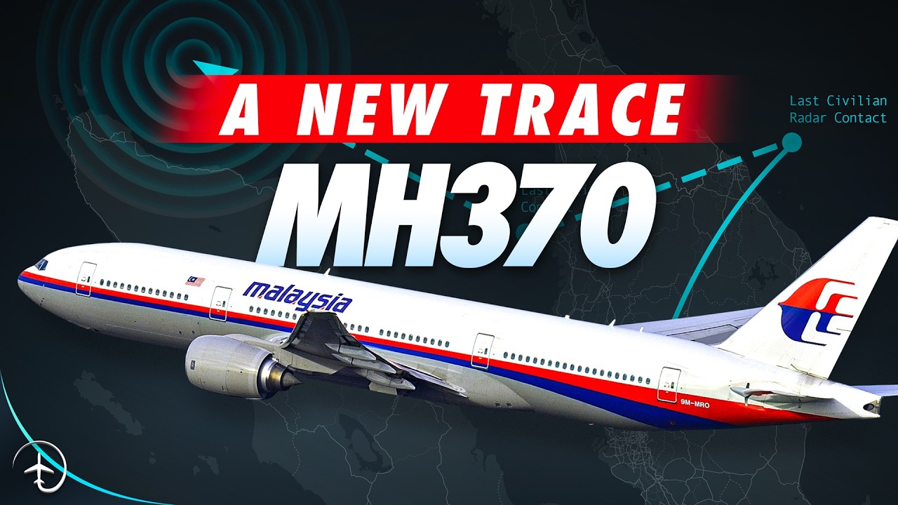
Mentour Pilot
Historical radio-wave scattering and satellite anomalies indicate a pilot manually navigated MH370 past fuel exhaustion into an unsearched sector of the southern Indian Ocean, justifying an immediate resumption of recovery operations.
AI-assisted summary of A NEW Trace! The FULL MH370 Story, so Far.. — original source. Check the original for full context.
Source published:
Key ideas
- Ten years after Malaysia Airlines Flight MH370 vanished with 239 people on board, new research combining Inmarsat satellite data, operational piloting models, and Weak Signal Propagation Reporter (WSPR) radio analysis has yielded two distinct, refined candidate search areas in the southern Indian Ocean. (0:00)
- Satellite oscillator data confirms the Boeing 777's Satellite Data Unit suffered a major electrical power interruption before rebooting at 02:25 UTC, consistent with intentional bus-stripping and cabin depressurization to incapacitate passengers and crew. (40:20)
- Analysis of the flight's initial turn at waypoint IGARI and subsequent navigational track indicates manual, aggressive hand-flying carefully hugging Thai and Indonesian radar boundaries rather than an autopilot system running on a generic heading. (24:07)
- WSPR passive tracking suggests the aircraft flew a deliberate figure-eight pattern around the time of fuel exhaustion, indicating active manual pilot intervention until the final descent rather than an unguided 'ghost flight' spiral dive. (49:08)
Detailed notes
## Background Published on March 16, 2024, by the YouTube channel Mentour Pilot, this 56-minute video examines the disappearance of Malaysia Airlines Flight MH370 ten years after the event. According to the description, the video aims to present what is currently known about how a modern Boeing 777 vanished and to advocate for restarting search efforts using new data and technology.
## TL;DR Host Petter Hörnfeldt provides a detailed operational breakdown of Malaysia Airlines Flight MH370, tracing its departure from Kuala Lumpur, the deliberate deactivation of secondary surveillance systems near waypoint IGARI, and its manual diversion across the Malay Peninsula. Drawing on primary radar data, Inmarsat satellite communications (BTO and BFO calculations), and operational assessments, the analysis explores scenarios involving intentional electrical bus-stripping and cabin depressurization. It highlights recent findings from Weak Signal Propagation Reporter (WSPR) technology alongside independent flight reconstructions by veteran aviators. The video concludes with a direct appeal to authorities to launch a renewed underwater search targeting refined candidate zones in the southern Indian Ocean.
## Atmosphere & style The presentation carries a somber, intensely focused, and analytical tone, driven by Petter Hörnfeldt's measured, professional delivery as an experienced airline captain. Rather than indulging in sensationalism, the narrative maintains a clinical respect for engineering facts, avionics logic, and human physiology. As the technical evidence systematically exposes deliberate cockpit actions, the atmosphere tightens into a chilling realization of the flight's final hours, culminating in an earnest, emotionally grounded plea for closure on behalf of the victims' families.
## Bulletin - [00:00](https://www.youtube.com/watch?v=Y5K9HBiJpuk&t=0s) Ten years after Malaysia Airlines Flight MH370 vanished with 239 people on board, new research combining Inmarsat satellite data, operational piloting models, and Weak Signal Propagation Reporter (WSPR) radio analysis has yielded two distinct, refined candidate search areas in the southern Indian Ocean. - [40:20](https://www.youtube.com/watch?v=Y5K9HBiJpuk&t=2420s) Satellite oscillator data confirms the Boeing 777's Satellite Data Unit suffered a major electrical power interruption before rebooting at 02:25 UTC, consistent with intentional bus-stripping and cabin depressurization to incapacitate passengers and crew. - [24:07](https://www.youtube.com/watch?v=Y5K9HBiJpuk&t=1447s) Analysis of the flight's initial turn at waypoint IGARI and subsequent navigational track indicates manual, aggressive hand-flying carefully hugging Thai and Indonesian radar boundaries rather than an autopilot system running on a generic heading. - [49:08](https://www.youtube.com/watch?v=Y5K9HBiJpuk&t=2948s) WSPR passive tracking suggests the aircraft flew a deliberate figure-eight pattern around the time of fuel exhaustion, indicating active manual pilot intervention until the final descent rather than an unguided 'ghost flight' spiral dive.
## Key takeaways - [02:22](https://www.youtube.com/watch?v=Y5K9HBiJpuk&t=142s) Flight MH370 departed Kuala Lumpur for Beijing with 239 occupants and 7 hours 31 minutes of fuel endurance, crewed by an experienced Captain and a First Officer transitioning onto the Boeing 777. - [19:13](https://www.youtube.com/watch?v=Y5K9HBiJpuk&t=1153s) The Captain made an unusual redundant level report at FL350 seven minutes after reaching cruise, which may indicate checking radio activity after briefly stepping off frequency. - [21:31](https://www.youtube.com/watch?v=Y5K9HBiJpuk&t=1291s) Secondary radar contact ceased abruptly at 01:21 UTC near waypoint IGARI after the transponder was manually switched to 'Altitude Off' without a proper frequency readback to Ho Chi Minh. - [24:07](https://www.youtube.com/watch?v=Y5K9HBiJpuk&t=1447s) Boeing engineering simulations revealed that the sharp, high-speed left turn off airway M765 could only be replicated by disconnecting the autopilot and hand-flying an aggressive steep bank. - [27:26](https://www.youtube.com/watch?v=Y5K9HBiJpuk&t=1646s) Operational pilots hypothesize an intentional electrical bus-stripping and cabin depressurization at FL350, which would exhaust emergency passenger oxygen canisters within 22 minutes while cockpit bottles supplied oxygen for hours. - [33:30](https://www.youtube.com/watch?v=Y5K9HBiJpuk&t=2010s) Breakdowns and delays in ATC coordination between Ho Chi Minh and Kuala Lumpur, coupled with military assumptions of an operational turnback, delayed search and rescue alerts by hours. - [35:21](https://www.youtube.com/watch?v=Y5K9HBiJpuk&t=2121s) Primary radar tracked MH370 navigating northwest along airway N571 in the Malacca Strait using raw VOR radio guidance until radar contact ceased near waypoint MEKAR. - [36:55](https://www.youtube.com/watch?v=Y5K9HBiJpuk&t=2215s) Inmarsat's Burst Timing Offset (BTO) and Burst Frequency Offset (BFO) data provided critical distance arcs and Doppler speed metrics establishing the aircraft's route into the southern Indian Ocean. - [40:20](https://www.youtube.com/watch?v=Y5K9HBiJpuk&t=2420s) Frequency error analysis of the Oven-Controlled Crystal Oscillator proved the Satellite Data Unit experienced a cold restart at 02:25 UTC, after which ACARS was manually prevented from transmitting identifying data. - [46:13](https://www.youtube.com/watch?v=Y5K9HBiJpuk&t=2773s) WSPR historical radio propagation archives have been applied as a distributed passive radar network to reconstruct the flight's trajectory through radar gaps and international borders. - [49:08](https://www.youtube.com/watch?v=Y5K9HBiJpuk&t=2948s) WSPR tracking identifies a deliberate figure-eight holding maneuver between the sixth and seventh handshakes, a behavior inconsistent with the Boeing 777's automatic rudder trim compensations during single-engine drift. - [52:03](https://www.youtube.com/watch?v=Y5K9HBiJpuk&t=3123s) A pilot managing fuel exhaustion could have manually deployed the APU to maintain hydraulic control and flaps for an extended glide of up to 67 nautical miles beyond the 7th Inmarsat arc. - [53:03](https://www.youtube.com/watch?v=Y5K9HBiJpuk&t=3183s) Physical debris recovered across the western Indian Ocean confirms severe structural breakup upon ocean entry, while modern models provide sufficient precision to justify reopening the seabed search.
## Detailed walkthrough ### [00:00](https://www.youtube.com/watch?v=Y5K9HBiJpuk&t=0s) Introduction: A Mystery That Leaves a Trace
The disappearance of Malaysia Airlines Flight MH370 remains one of the deepest puzzles in modern aviation. A Boeing 777, among the largest and most technologically advanced passenger aircraft in service, cannot simply vanish into thin air without leaving any evidence behind. As the host emphasizes:
> "Everything lost leaves a trace."
Flight MH370 vanished with 239 people on board. Over the ensuing decade, the sheer volume of competing theories and unanswered questions made it nearly impossible to address the topic without wandering into pure conjecture—the very reason the host avoided covering it for ten years. However, marked by the ten-year anniversary of the disappearance, an exception is made with a clear objective:
> "This story is created with one goal and one goal only, and that is to persuade the authorities to restart the search for the missing Boeing 777."
Beyond seeking closure for the families—some of whom were contacted prior to the production of this analysis—the renewed push rests on fresh potential evidence. This analysis leverages technology refined and enhanced over recent years that offers new, precise clues regarding the final resting place of the aircraft. The recounting begins from what is solidly documented, leading up to the final routine radio call from the cockpit: *"Good night, Malaysia 370."*
---
[02:22](https://www.youtube.com/watch?v=Y5K9HBiJpuk&t=142s) Pre-Flight Preparations and Dispatch Planning
On the night of March 7, 2014, the flight crew reported for duty at Kuala Lumpur International Airport (KUL) for an overnight passenger service to Beijing Capital International Airport (PEK). On paper, the trip was routine and manageable: - **Planned flight time:** 5 hours and 34 minutes - **Scheduled arrival:** Mid-morning the following day in Beijing - **Captain check-in:** 22:50 local time at the Malaysia Airlines crew room - **First officer check-in:** Approximately 23:15 (25 minutes later)
The sector was scheduled as a training flight. The first officer was finishing his transition type rating from the Airbus A330 to the Boeing 777. His progress had been flawless, and a satisfactory performance on this leg would see him recommended by the captain for his final line check on the subsequent duty. Because the two had never flown together before, the captain arrived early—a standard instructional practice allowing instructors time to review a trainee's training records for areas requiring particular supervision.
Once together, the pilots reviewed the dispatch package: - **En-route weather:** Generally fair, dominated by a subtropical high-pressure system over Thailand. - **Destination weather:** Favorable conditions reported at Beijing. - **En-route turbulence:** A strong jet stream with elevated winds was forecast across roughly two-thirds of the flight path, presenting the only minor operational concern. - **NOTAMs:** None affecting the planned route. - **Fuel load:** With two alternate airports selected for Beijing, the crew ordered 49,100 kg of fuel—an entirely standard figure neither unusually high nor low. - **Endurance:** The fuel provided approximately 7 hours and 31 minutes of endurance, giving roughly two hours of reserve past the planned flight time.
---
[04:47](https://www.youtube.com/watch?v=Y5K9HBiJpuk&t=287s) The Flight Crew Profiles
The flight deck was staffed by two pilots with starkly different levels of experience, creating a naturally steep cockpit authority gradient:
| Detail | Captain | First Officer | |:--- |:--- |:--- | | **Age** | 53 years old | 27 years old | | **Marital Status** | Married, 3 children | Single | | **Total Flying Hours** | ~18,400+ hours | ~2,800+ hours | | **Hours on Boeing 777** | 8,659 hours | 39 hours | | **Career History** | Joined MAS cadet program in 1981; flew Fokker F27, B737-200, A300; Captain on Fokker 50, B737-400, A330; B777 Captain since Sept 22, 1998 | Joined MAS as cadet in 2008; flew B737-400; transitioned to A330 fleet in 2012; moved to B777 in Nov 2013 | | **Current Role** | Type-Rating Instructor (TRI) and Examiner (TRE) | Trainee nearing final line check recommendation |
The captain had served 33 years at the airline with an impeccable record. Outside work, he was an active member of a local political opposition party, assisted with grocery deliveries to the elderly, tinkered with electronics, and ran an active YouTube channel demonstrating domestic appliance repairs and his custom-built home flight simulator. Although the simulator's hard drives had been wiped weeks prior to the disappearance, investigators recovered manually entered waypoints from backup storage files, none of which yielded conclusive findings. He maintained stable personal finances, had no documented medical illnesses, and was viewed as an upstanding member of his community.
The first officer had no major recent life disruptions, held a stable financial situation, and was well-regarded by colleagues. Both pilots were fully rested within legal requirements, holding up-to-date licenses and valid medical certificates.
```mermaid flowchart TD accTitle: Cockpit Crew Experience Hierarchy accDescr: Diagram illustrating the significant disparity in flight experience and cockpit hierarchy between the Captain and First Officer.
subgraph Captain_Profile["Captain (53 yrs old)"] C1["18,400+ Total Hours"] C2["8,659 Hours on B777"] C3["Check Airman / Examiner (TRI / TRE)"] end
subgraph FO_Profile["First Officer (27 yrs old)"] F1["2,800+ Total Hours"] F2["39 Hours on B777"] F3["Transition Trainee from A330"] end
Captain_Profile -->|"Steep Authority Gradient / Instructor Role"| FO_Profile ```
---
[07:49](https://www.youtube.com/watch?v=Y5K9HBiJpuk&t=469s) Boarding and Aircraft Setup: ACARS and SATCOM
After finishing the briefing, the pilots met their ten cabin crew members—a veteran team whose junior member had 13 years of flying experience and senior purser had over 35 years. The aircraft assigned to the flight was a Boeing 777-200ER powered by two Rolls-Royce Trent 892B turbofan engines. The aircraft maintenance log revealed no defects; the only pre-flight maintenance action had been a routine top-up of the cockpit crew oxygen bottle.
The pilots assigned the first officer as Pilot Flying (PF) for the outbound sector. Settling into the right-hand seat, he carried out cockpit initialization: - **23:54:** The aircraft's Aircraft Communications Addressing and Reporting System (ACARS) powered up and established an operational datalink via Satellite Communications (SATCOM). - **23:56:08:** The first officer entered the flight identification and airline parameters into the Flight Management Computer Control Display Unit (FMC CDU), which was immediately logged and relayed groundside via ACARS. - **Antenna Architecture:** The SATCOM link relies on two distinct satellite antenna types (high-gain and low-gain), automatically alternating based on whether the aircraft's internal inertial navigation systems are operational. - **Cargo / NOTOC:** The first officer received an ACARS Notification to Captain (NOTOC). While commonly used for hazardous cargo, this manifest carried no dangerous goods, but rather a special perishable cargo consignment: several tons of fresh mangosteens, monitored due to their propensity to leak moisture and juice during transit.
[10:42](https://www.youtube.com/watch?v=Y5K9HBiJpuk&t=642s) Cargo Details, Passengers, and Departure Clearance
The Notice to Captain (NOTOC) confirmed that the special cargo loaded on board had been thoroughly inspected and was free of any leaks. What the document did not explicitly emphasize, however, was the presence of nearly 2.5 metric tons of lithium-ion batteries. Because these batteries were individually packaged and stored strictly according to safety regulations, they were not categorized as dangerous goods; investigators have consequently ruled them out as a causative factor for the impending disaster. Once the captain completed his external walk-around inspection, the two pilots finalized their preflight preparations and briefing routines in the cockpit.
At 23:25 UTC, the first officer contacted Kuala Lumpur Delivery to request their en-route departure clearance. The controller cleared Malaysia 370 via the PIBOS-1A standard instrument departure off Runway 32R, instructing them to climb initially to 6,000 feet with a transponder code of 2157. The first officer read back the clearance verbatim, and under two minutes later, requested pushback and engine start, which was promptly granted. The Boeing 777 pushed back from the gate, accepted taxi instructions, and slowly rolled out toward Runway 32R through the Malaysian night—the final moment anyone would ever see the airframe with their own eyes.
Aboard the aircraft were 227 passengers representing 14 different nationalities, alongside 12 crew members, bringing the total complement to 239 people. The largest passenger demographic consisted of 153 Chinese nationals, followed by 50 Malaysians and seven Indonesians. Although two passengers traveled under stolen European passports, they were later identified as Iranian nationals seeking asylum who posed no security threat; none of the passengers or operational crew displayed any suspicious profiles before takeoff.
- Special cargo: Approximately 2.5 tons of lithium-ion batteries, individually packaged and stowed, ruling out a cargo fire as the cause. - Total souls on board: 239 (227 passengers and 12 crew members). - Passenger demographics: 153 Chinese, 50 Malaysian, 7 Indonesian, and travelers from 11 other nations. - Departure runway: Runway 32R at Kuala Lumpur International Airport (KLIA). - Assigned initial squawk code: 2157.
---
[13:13](https://www.youtube.com/watch?v=Y5K9HBiJpuk&t=793s) Takeoff and the Initial Direct to IGARI
At 00:40:37 local time on March 8, Kuala Lumpur Tower cleared Malaysia Airlines Flight 370 for takeoff on Runway 32R. With the first officer acting as the pilot flying, radio communications were handled by the captain. Once the engines stabilized, the first officer engaged the Takeoff/Go-Around (TO/GA) switches, sending the widebody accelerating down the runway. At 00:42, the aircraft's SATCOM system logged that the jet was airborne, automatically transmitting routine aircraft identification and technical parameters that confirmed completely normal aircraft performance.
In accordance with standard local operating procedures, the crew immediately transferred to the Kuala Lumpur departure frequency after takeoff. Upon checking in, the departure controller canceled the PIBOS-1A departure routing, clearing the flight direct to waypoint IGARI and to continue climbing to Flight Level 180 (FL180). This direct routing was an ordinary operational convenience routinely granted in the late hours due to sparse traffic. The captain acknowledged the transmission, entered waypoint IGARI into the Flight Management Computer (FMC), and watched as the first officer cross-checked the entry, pressed execute, and dialed FL180 into the Mode Control Panel (MCP). The captain's voice on the air traffic control recordings remained utterly calm, relaxed, and indistinguishable from thousands of routine flights.
Handed over to Lumpur Radar on 132.6 MHz—the sector controller responsible for the flight until the FIR boundary with Vietnam at IGARI—the captain confirmed the frequency transfer smoothly. The controller cleared the aircraft to climb to FL250, followed three minutes later by final clearance to their cruising altitude of Flight Level 350 (FL350).
```mermaid flowchart TD accTitle: MH370 Departure and Initial Climb Sequence accDescr: Sequence of clearances and actions from departure clearance to cruising altitude at FL350.
subgraph Departure["Ground & Departure Operations"] A["Delivery: Cleared PIBOS-1A, Squawk 2157"] --> B["Line up Runway 32R & Takeoff Clearance (00:40:37)"] B --> C["Airborne Logged by SATCOM (00:42)"] end
subgraph EnRouteClimb["Climb Operations"] C --> D["Departure Controller: Cancel SID, Direct IGARI, Climb FL180"] D --> E["Lumpur Radar (132.6 MHz): Climb to FL250"] E --> F["Cleared to Cruise Altitude FL350"] end ```
---
[17:04](https://www.youtube.com/watch?v=Y5K9HBiJpuk&t=1024s) Understanding Primary vs. Secondary Radar
As Flight 370 climbed toward the northeast, it was tracked clearly by civilian air traffic facilities via both primary and secondary radar systems. In modern civil aviation, controllers depend heavily on secondary surveillance radar (SSR). This system relies directly on an active transponder aboard the aircraft, assigned a specific four-digit octal code (using digits 0 through 7). The active transponder replies to ground interrogations by beaming down real-time data packets containing the aircraft's precise identification, altitude, velocity, and even control panel selections. The transponder also broadcasts ADS-B signals picked up by tracking services like FlightRadar24 and enables onboard Traffic Collision Avoidance Systems (TCAS) to coordinate resolution advisories between converging aircraft.
By contrast, primary radar operates on the classic principle of bouncing a raw radio pulse off a target's physical fuselage and measuring the returning echo to calculate its distance and bearing. While primary radar allows controllers and military operators to track non-cooperative objects that do not broadcast data voluntarily, shortwave primary radar signals feature a much more limited operational range. Furthermore, primary radar provides poor, imprecise estimates of an aircraft's altitude and groundspeed—a critical technical limitation that would heavily complicate subsequent analyses of MH370's path.
| Radar Type | Operating Principle | Information Transmitted | Limitations | |:--- |:--- |:--- |:--- | | **Secondary Radar (SSR)** | Two-way interrogation and reply via onboard transponder | Identity, squawk code, pressure altitude, speed, ADS-B telemetry, TCAS coordination | Entirely dependent on an active, functional transponder aboard the target | | **Primary Radar (PSR)** | Reflected pulse waves bouncing off the target's physical skin | Bearing and slant range | Limited range; unreliable or missing altitude and velocity data |
---
[19:13](https://www.youtube.com/watch?v=Y5K9HBiJpuk&t=1153s) The FL350 Level Call and the Seven-Minute Anomaly
At 01:01:14 local time, the captain checked in with Lumpur Radar to report that the flight had leveled off at their cruise altitude of Flight Level 350:
> “Level flight level 350.”
The controller acknowledged the report. While checking in upon reaching cruise altitude was not an operational requirement—acting more as an informal courtesy—the captain’s tone was thoroughly relaxed, featuring a recognizable falling intonation toward the end of his transmission.
However, roughly seven minutes later, the captain keyed the microphone again and repeated the identical report that they were level at Flight Level 350. Official investigative teams noted this double transmission in the final report as an anomaly but dismissed it as having no operational significance.
Experienced airline pilots typically make redundant level reports for one of two distinct reasons. The first is momentary forgetfulness, though the call was non-mandatory to begin with. The second, more telling operational reason occurs when a pilot has been absent from the active ATC frequency—perhaps due to troubleshooting radios, managing cabin issues, or turning down the audio volume:
> “You see if we make that call again and ATC just responds, 'Roger' or something similar, well then we know that they haven't been trying to call us because if they would have, they would now repeat any other messages that they had previously tried to send.”
The seven-minute gap between these identical reports suggests that something occurred inside the cockpit that pulled the captain’s attention completely away from his monitoring duties between 01:01 and 01:08.
[21:31](https://www.youtube.com/watch?v=Y5K9HBiJpuk&t=1291s) Radio Tone and the Last Words over IGARI
A close listening of Captain Zaharie Ahmad Shah’s voice transmissions reveals an important psychological shift. While official accident investigators concluded they could not detect any physiological stress in the cockpit voice recordings, Petter Hörnfeldt notes a striking shift in vocal delivery between the initial and subsequent calls: “In the first, the captain sounds relaxed with a clear dropping intonation towards the end and in the second, he just sounds busy, like he's working on something at the same time that he's making that call.” As a flight instructor, Petter frequently hears that exact cadence during heavy cockpit workloads in both training aircraft and full-flight simulators.
```mermaid flowchart TD accTitle: Sequence of Handover and Disappearance at IGARI accDescr: Chronological events showing radio communications, transponder shutoff, and radar tracking over the FIR boundary.
subgraph Malaysian_Airspace["Malaysian Airspace"] A["01:19:24 KLATCC instructs handoff:<br/>Contact Ho Chi Minh 120.9"] --> B["Last transmission:<br/>'Good night, Malaysian 370'<br/>(No frequency readback)"] B --> C["01:20:43 Aircraft crosses waypoint IGARI"] end
subgraph FIR_Boundary["FIR Handover Gap"] C --> D["+5 seconds after IGARI:<br/>Mode S transponder disabled"] D --> E["+37 seconds later:<br/>Secondary radar return lost entirely"] end
subgraph Evasion_Maneuver["Manual Diversion"] E --> F["Abrupt manual left turn<br/>(Steep bank bypassing Thai ADIZ)"] F --> G["Raw primary radar tracks southwest<br/>toward VPG beacon (Penang)"] end ```
Shortly after that exchange, the Aircraft Communications Addressing and Reporting System (ACARS) transmitted its final routine position report via satellite communications (SATCOM) to the ground station. From that moment forward, the aircraft's SATCOM terminal went completely dark for nearly one hour and 17 minutes.
At 01:19:24 local time, the Kuala Lumpur Area Control Centre (Lumpur Radar) directed MH370 to transfer communications: “Malaysian 370, contact Ho Chi Minh 120.9, good night.” Flight 370 was roughly one minute away from passing waypoint IGARI, remaining within Malaysian airspace but fast approaching the boundary of Vietnamese jurisdiction. The captain delivered the flight's final radio words: “Good night, Malaysian 370.” Crucially, the pilot omitted the standard radio procedure of repeating the assigned frequency (120.9), an error strongly indicative of an operator multitasking under high workload rather than delivering a theatrical sign-off.
[24:07](https://www.youtube.com/watch?v=Y5K9HBiJpuk&t=1447s) Disappearing from Radar and the Sharp Left Turn
Just five seconds after crossing waypoint IGARI, the aircraft’s transponder Mode S capability went dead. The selective deactivation of Mode S while maintaining other transponder functions for a brief window can only be executed deliberately by rotating the transponder selector knob on the center console from the TA/RA (Traffic Advisory/Resolution Advisory) setting to "Altitude Off." Had the transponder suffered a catastrophic power loss or system failure, all broadcast signals would have vanished instantaneously; instead, it took an additional 37 seconds for the secondary surveillance radar return to disappear completely from air traffic control screens.
Immediately following the secondary radar blackout, MH370 abandoned its filed route to Beijing. Raw primary military radar showed that after a momentary veer right toward waypoint BITOD, the twin-engine jet executed a hard left reversal of nearly 180 degrees. Boeing subsequently attempted to reproduce this maneuver in engineering simulators:
- Standard Boeing 777 autopilot logic restricts bank angles to safe passenger thresholds and could not recreate the recorded turn radius and groundspeed timings. - The only simulation runs that matched the primary radar profile required manually disconnecting the autopilot and hand-flying the widebody jet with an aggressive, steep bank angle. - “The only reasonable conclusion that can be drawn from this is that someone had now started interfering with the flight's trajectory on purpose.”
The execution of this diversion exploited air traffic control boundaries. Crossing from the Kuala Lumpur FIR into the Ho Chi Minh FIR meant the Malaysian controller assumed the flight was transferring away, while the Vietnamese controller took no immediate action because the crew had not yet checked in on 120.9. Just north of IGARI lay the airspace border of the Royal Thai Air Force’s Air Defense Identification Zone (ADIZ), marked on high-altitude en-route charts by parallel purple dotted lines. By tightly hugging the border without penetrating the ADIZ, whoever was hand-flying avoided triggering Thai military intercept protocols. Furthermore, the turn slotted the aircraft precisely between the Thai ADIZ and Airway M765, avoiding oncoming international air traffic.
[27:26](https://www.youtube.com/watch?v=Y5K9HBiJpuk&t=1646s) The Southwest Crossing and the Electrical Blackout Theory
After completing the hard U-turn, the 777 tracked southwest across Peninsular Malaysia directly toward the Victor Papa Golf (VPG) VOR navigation beacon situated on Penang Island. Raw radar echoes exhibited subtle track wandering characteristic of manual flying rather than Flight Management Computer (FMC) lateral navigation. The aircraft likely descended slightly to pick up higher true airspeed as it dashed over the mainland. During this transit, a ground cellular tower operated by Celcom on Penang briefly registered a connection attempt from First Officer Fariq Abdul Hamid’s personal mobile phone. Crew standard operating procedures mandate switching mobile devices off prior to departure, indicating a crew member may have powered on a phone in an attempt to transmit distress messages, though no voice call or data transmission cleared the network before contact was lost.
Simultaneously, the aircraft's internal communications network experienced an extraordinary failure. Terrestrial ground stations attempted to uplink a normal ACARS message at 02:03 local time, but received no acknowledgment from the aircraft's SATCOM terminal. A routine cockpit deactivation or internal software crash of ACARS still preserves the underlying satellite data link, which would report that the application layer was unreachable. Because the satellite link failed to complete a handshake, the entire onboard Satellite Data Unit (SDU) had lost electrical power.
```mermaid flowchart TD accTitle: Intentional Depower and Depressurization Scenario accDescr: Flowchart showing how cockpit controls can deliberately isolate power buses and depressurize the aircraft cabin.
subgraph Electrical_Sabotage["Cockpit Electrical Isolation"] direction TB G1["Overhead Panel:<br/>Turn OFF L/R Gen & Backup Gen"] --> APU_Block["APU auto-start initiated by aircraft logic"] APU_Block --> APU_Cancel["Pilot cycles APU switch ON then OFF<br/>(Aborts APU startup)"] APU_Cancel --> RAT_Deploy["Ram Air Turbine (RAT) deploys<br/>automatically / manually"] RAT_Deploy --> RAT_Pwr["RAT powers bare essentials:<br/>PFD, ND, basic Nav<br/>(Autopilot & SATCOM remain DEAD)"] end
subgraph Cabin_Subjugation["Deliberate Depressurization"] direction TB Valves["Pilot manually opens outflow valves"] --> Air_Clean["Packs remain ON<br/>(Cockpit stays heated at FL350)"] Valves --> Pax_Deprec["Cabin altitude climbs to 35,000 ft"] Pax_Deprec --> Pax_Drop["Passenger oxygen masks deploy<br/>(Chemical generators last ~22 min)"] Pax_Drop --> Incap["Passengers and cabin crew succumb to hypoxia"] Air_Clean --> Pilot_Mask["Flight deck oxygen cylinder<br/>(Topped up morning of flight:<br/>Lasts 27 hours for one pilot)"] end ```
Analysis by experienced Boeing 777 operational pilots proposes an explanation:
- A pilot in the cockpit disconnected the primary left and right engine generators as well as the backup electrical generators using the overhead electrical control panel. - To prevent the aircraft's automated systems from compensating via the Auxiliary Power Unit (APU), the pilot had to cycle the APU selector switch to ON and immediately back to OFF to kill the automatic start sequence. - This complete drop of primary alternating current buses dropped the Ram Air Turbine (RAT) into the slipstream to furnish basic flight instruments (Captain's Primary Flight Display and Navigation Display) while leaving non-essential services—including passenger lighting, ACARS, and the SATCOM terminal—entirely dead. - Manual handling remained available because the twin engines continued running, powering all hydraulic lines to the flight control surfaces.
This intentional bus-stripping theory dovetails with the hypothesis of cabin depressurization. To subdue cabin crew and passengers without physical resistance, someone at the controls could manually force the cabin outflow valves fully open while leaving the air conditioning packs running to keep the flight deck warmed. At a cruising altitude of 35,000 feet, cabin decompression prompts the overhead chemical oxygen generators to drop, but these canisters provide passenger oxygen for only 22 minutes. In stark contrast, the cockpit high-pressure crew oxygen bottle, which had been serviced and topped up at Kuala Lumpur that very morning, can supply a single pilot on an emergency mask for 27 hours, leaving whoever remained in the flight deck conscious while the occupants in the cabin succumbed to hypoxia.
[32:16](https://www.youtube.com/watch?v=Y5K9HBiJpuk&t=1936s) Physiological Limits and Manual Control After Depressurization
At cruising altitudes above thirty thousand feet, the time of useful consciousness without supplemental oxygen is brutally short: about one minute at high cruising levels, extending to only a few minutes around thirty thousand feet. Anyone exposed to an unpressurized cabin environment without an oxygen mask would rapidly lose the capacity to make rational decisions before slipping into unconsciousness. If oxygen is not restored, irreversible brain death follows within roughly twenty minutes. Mentour Pilot stresses that investigators still cannot declare as absolute fact what transpired aboard the flight, stating, “But like I said before, we don't know for a fact what happened and we won't know more until the aircraft is found which is why it is so important that we continue the search.”
Hand-flying a massive jetliner under degraded systems while wearing an oxygen mask and relying solely on rudimentary standby navigation instruments is an exhausting, demanding task. This physical strain offers the most plausible explanation for the minor, erratic heading variations observed on primary radar tracks as the Boeing 777 navigated south of Penang and banked right into the Strait of Malacca. Despite occasional brief dropouts in raw radar coverage across civilian and military sensors, the radar returns demonstrated purposeful, managed flight. Mentour Pilot observes, “There were temporary lapses in the radar coverage but all in all, it painted a fairly clear picture of an aircraft flying in a controlled way and not in any way random.”
- **Time of useful consciousness:** Approximately one minute at high cruising altitudes, extending to a few minutes at 30,000 feet. - **Hypoxia progression:** Cognitive degradation leads rapidly to unconsciousness, with death occurring within approximately 20 minutes if supplemental oxygen is withheld. - **Flight characteristics:** Small heading oscillations on radar reflect the physical burden of manual flight under emergency oxygen with limited cockpit instruments.
---
[33:30](https://www.youtube.com/watch?v=Y5K9HBiJpuk&t=2010s) Breakdown in Air Traffic Coordination and Failed Interception
A disastrous combination of misunderstandings between air traffic control centers and Malaysia Airlines headquarters allowed the rogue aircraft to slip through the region unnoticed. Under international procedures, an air traffic controller must raise a query within five minutes if an expected aircraft fails to report at a waypoint. When MH370 vanished from primary secondary radar displays near IGARI, roughly twenty minutes elapsed before the Ho Chi Minh Area Control Center contacted the Malaysian controller in Kuala Lumpur to ask where the jet was. Because this occurred at an airspace boundary in the dead of night, controllers were juggling other traffic and were not monitoring their flight progress strips closely.
```mermaid flowchart TD accTitle: ATC Confusion and MH370 False Tracking Flow accDescr: Diagram illustrating how inaccurate airline tracking data misled air traffic controllers while MH370 escaped unnoticed. subgraph Reality["Actual Aircraft Track"] A["MH370 turns southwest at IGARI"] --> B["Flies around south of Penang"] B --> C["Enters Strait of Malacca"] end subgraph Confusion["ATC & Airline Response"] D["Ho Chi Minh ATC delays query by 20 min"] --> E["Kuala Lumpur ATC contacts MAS Ops"] E --> F["MAS Ops reports plane over Cambodia"] F --> G["Controllers search forward route"] end Confusion -.->|"Faint primary radar echo ignored"| Reality ```
When the Malaysian controller—technically still responsible for the flight—began investigating, he contacted Malaysia Airlines flight operations. Airline dispatchers replied that their tracking screens showed the aircraft proceeding normally over Cambodia. Controllers down the line immediately focused on downstream sectors along the filed flight plan, attempting to raise the flight on radio frequencies. This misdirection blinded them to the solitary primary radar return sneaking southwest. The airline’s operations software was not displaying real-time telemetry; in the absence of incoming data, it was merely plotting projected positions based on the scheduled flight plan. Meanwhile, Malaysian military radar operators saw the sharp left turn off airway M765, but because the aircraft did not infringe on unauthorized airspace, they assumed it was a standard operational air turnback and never scrambled interceptor jets. Mentour Pilot remarks, “It was only later, with the help of radar playbacks that the picture of MH370's true path became clearer.”
- **Handoff delay:** Ho Chi Minh controllers waited approximately 20 minutes before querying Kuala Lumpur, well beyond the standard 5-minute protocol. - **Flawed dispatch tracking:** Malaysia Airlines dispatch erroneously reported MH370 in Cambodian airspace because their flight-following software generated dead-reckoning predictions when actual transponder data ceased. - **Military response:** The Royal Malaysian Air Force tracked the turnback but treated it as an unexceptional domestic maneuver, declining to scramble interceptors.
---
[35:21](https://www.youtube.com/watch?v=Y5K9HBiJpuk&t=2121s) Navigating the Malacca Strait Toward Waypoint MEKAR
After turning northwest into the Malacca Strait, the radar target tracked directly toward waypoint VAMPI. Because the aircraft's SATCOM terminal had not yet re-established contact, the jet was almost certainly operating in an electrically degraded state, possibly sustained only by emergency standby power from the Ram Air Turbine (RAT). Even under such stark conditions, basic navigation remained straightforward. The VPG VOR transmitter on Penang Island remained within reception range, permitting raw radio navigation, and waypoint coordinates could still be displayed on the captain’s navigation display, allowing whoever was at the controls to align the nose with the course.
```mermaid flowchart LR accTitle: Waypoint Navigation along the Strait of Malacca accDescr: Sequence of waypoints and navigational markers followed by MH370 up to the edge of conventional radar coverage. VPG["VPG VOR (Penang)"] -->|"Raw data tracking"| VAMPI["Waypoint VAMPI"] VAMPI -->|"Airway N571"| MEKAR["Waypoint MEKAR"] MEKAR -->|"02:22:12 UTC"| Dark["Radar Horizon / Signal Loss"] ```
The flight crossed VAMPI and continued along airway N571 toward waypoint MEKAR. Just after tracking slightly south of MEKAR, at precisely 02:22:12 UTC, the aircraft faded from civilian and military radar screens entirely. While classified mobile or fixed military radar installations in neighboring countries might have captured returns past this mark, national defense sensitivities have kept any such data hidden. From that moment forward, the physical trail went dark. Mentour Pilot explains the shift in evidence: “So this means that from this point onwards we are now going into the unknown and with that, comes speculation or hypothesis which you all know I try to avoid on this channel so let's instead try to stay with what we do know.”
- **Key waypoints:** Tracked northwest toward VAMPI, then along airway N571 toward MEKAR. - **Navigation capability:** Even with main generators offline, raw VHF omnidirectional range (VOR) data from Penang (VPG) provided reliable lateral guidance. - **Radar disappearance:** All recorded primary radar returns ceased at 02:22:12 UTC just south of MEKAR. - **Data withholding:** Geopolitical and military sensitivities over operational radar capabilities have prevented surrounding nations from releasing potential extended primary radar recordings.
---
[36:55](https://www.youtube.com/watch?v=Y5K9HBiJpuk&t=2215s) Reverse-Engineering Inmarsat Satellites: BTO and BFO
To track a ghost aircraft across open water without radar, an international coalition of accident investigators, satellite engineers, and scientists had to repurpose telecommunications data in ways never intended by its creators. The aircraft’s Aircraft Communications Addressing and Reporting System (ACARS) utilized an Inmarsat geostationary satellite link. Mentour Pilot highlights the novelty of the method: “The signals these satellites were sending were never designed to track aircrafts but since there were signals exchanged with MH370, those signals could be reverse-engineered to provide a crude singular position indicator every time that they appeared.”
Investigators calculated positions using principles borrowed from GPS mechanics. A GPS receiver computes its distance from a satellite by measuring how long a time-stamped radio signal takes to travel across space at the speed of light, placing the receiver on a sphere of a given radius. Similarly, whenever MH370 transmitted an automated electronic signal to the ground station via the Inmarsat satellite, the ground equipment recorded the exact round-trip propagation time. This value, termed Burst Timing Offset (BTO), allowed analysts to calculate the precise distance from the satellite to the aircraft, drawing a circular distance arc along the Earth’s surface for each of the seven hourly handshakes.
```mermaid flowchart TD accTitle: Inmarsat Signal Analysis Architecture accDescr: Breakdown of how BTO and BFO parameters were extracted from satellite handshakes. subgraph Signal["Satellite Transmission"] HS["Inmarsat Handshake Ping"] end subgraph BTO_Branch["Burst Timing Offset (BTO)"] HS --> BTO["Propagation Delay Measured"] BTO --> Arc["Distance Arc from Satellite"] end subgraph BFO_Branch["Burst Frequency Offset (BFO)"] HS --> BFO["Doppler Frequency Shift Measured"] BFO --> Motion["Relative Motion & Vertical Profile"] end ```
Beyond distance arcs, engineers analyzed Burst Frequency Offset (BFO). Just as an ambulance siren shifts to a higher pitch when approaching an observer and drops to a lower frequency when receding—the Doppler effect—radio transmissions experience measurable frequency shifts depending on the transmitter's relative velocity toward or away from the satellite. Because the satellite hovered thousands of miles over the equator, the line-of-sight vector was largely vertical relative to the aircraft's position. Analysts therefore used BFO variations to evaluate whether the aircraft was climbing, cruising level, or descending during each hourly ping.
- **Seven handshakes:** Automated hourly polling signals exchanged between the aircraft's Satellite Data Unit (SDU) and the Inmarsat ground station. - **Burst Timing Offset (BTO):** Measures the round-trip signal travel time at the speed of light, establishing a geometric distance arc on the Earth's surface. - **Burst Frequency Offset (BFO):** Measures the Doppler shift between transmitted and received radio frequencies to evaluate the aircraft's speed, track angle, and vertical climb or descent profile.
---
[40:20](https://www.youtube.com/watch?v=Y5K9HBiJpuk&t=2420s) The 02:25 UTC SATCOM Reboot and the Oscillator Clue
A major technological mystery occurred at 02:25:27 UTC, nearly an hour after the turnback at IGARI, when MH370’s inactive satellite terminal unexpectedly initiated a fresh logon request with the Inmarsat ground station. This event constitutes the famous first handshake. Notably, the Burst Frequency Offset on this initial transmission displayed a significant frequency anomaly, rendering it unreliable for normal Doppler calculations. The root cause lay in the physics of the aircraft’s avionics: the quartz crystals in the SATCOM radio transmitters are housed inside an Oven-Controlled Crystal Oscillator (OCXO) designed to maintain an ultra-stable internal temperature to prevent transmission drift. Following a prolonged electrical outage, the oven requires several minutes to reach operating temperature. The high initial BFO error confirmed that the transmitter had just experienced a cold restart. Mentour Pilot emphasizes the significance: “And this is how we know that the aircraft was likely powered down up until just prior to this point. Science is truly amazing!”
Furthermore, this first logon transmission lacked the customary airline flight number and company identification codes that the aircraft had broadcast throughout the early stages of the flight. If electrical power was manually re-established in the cockpit around 02:25 UTC, an operator seeking to remain undetected would know that the Satellite Data Unit (SDU) would automatically attempt to reconnect and dump ACARS performance logs. To silence the system, the pilot would need to bring up the Multifunction Display (MFD), navigate directly to the communications management page, and manually disable ACARS messaging before the SDU finished establishing its link. This deliberate override wiped the company identification header from the handshake packets, matching the exact anomalies recorded in the Inmarsat data stream.
- **Reboot timestamp:** The SDU initiated an unexpected logon request at 02:25:27 UTC, roughly 60 minutes after the turnback at IGARI. - **Thermal evidence (OCXO):** The uncalibrated BFO value on the 02:25 UTC transmission proves the oscillator oven was still warming up after an extended electrical power interruption. - **Absence of flight ID:** Manual deactivation of communications via the MFD communications manager page before full SDU boot-up stripped the standard airline flight number and company identity from the logon message.
[42:47](https://www.youtube.com/watch?v=Y5K9HBiJpuk&t=2567s) The Seven Inmarsat Handshakes and the Search Area Dilemma
Analyzing the satellite communication records reveals far more about the aircraft’s final hours than simple timing. For instance, investigators can verify that the navigation system remained operational simply by observing which antenna the SATCOM system selected when it began transmitting. In total, the Inmarsat data confirms that the aircraft flew long enough to complete seven satellite handshakes. The first and seventh pings were actually logon requests initiated by the aircraft itself, both most likely triggered by power interruptions. The final logon at 08:19 Malaysian time occurred after approximately 7 hours and 35 minutes of flight—a duration that aligns remarkably well with the endurance calculated from the aircraft's fuel load.
Under normal conditions, the SATCOM system automatically transmits an hourly ping if no other activity takes place. However, two of the recorded handshakes resulted from ground-based satellite calls placed by the Malaysia Airlines Operations Center. Although these calls rang through to the cockpit unanswered, they reset the hourly countdown timer, explaining why the intervals between the seven handshakes were not spaced precisely one hour apart.
```mermaid flowchart TD accTitle: Sequence of MH370 Inmarsat Handshakes accDescr: Flowchart illustrating the timeline and triggers of the seven Inmarsat satellite handshakes recorded from MH370.
subgraph Initial ["Initial Flight & Recovery"] H1["Handshake 1: Logon Request<br/>(Power restoration after blackout)"] end
subgraph Routine ["En Route Pings & Calls"] H2["Handshake 2: Scheduled Hourly Ping"] C1["Unanswered Ground Call<br/>(Resets hourly timer)"] H3["Handshake 3"] C2["Second Unanswered Call<br/>(Resets hourly timer)"] H4["Handshake 4"] H5["Handshake 5"] H6["Handshake 6"] end
subgraph FinalStage ["End of Flight"] H7["Handshake 7: Final Logon Request<br/>(08:19 MYT - Fuel starvation)"] end
H1 --> H2 H2 --> C1 C1 --> H3 H3 --> C2 C2 --> H4 H4 --> H5 H5 --> H6 H6 --> H7 ```
Because all of this data originated from a single geostationary Inmarsat satellite, each handshake defines an arc rather than a discrete geographic fix, creating a massive array of possible flight paths and a daunting search area. Several highly accomplished pilots and investigators, notably Captain Patrick Blelly and Jean-Luc Marchand, have developed plausible reconstructions showing how the Boeing 777 navigated after its last military radar contact. Most analyses conclude that the aircraft turned from its northwesterly track near waypoint NILAM onto a southwesterly heading, skimming past Banda Aceh at the northern tip of Sumatra before turning south into the remote expanse of the southern Indian Ocean. Petter Hornfeldt argues that a passive "ghost flight" scenario does not fit the profile of whoever was in control:
> “It feels a bit unlikely given how active this person was during those initial parts of the maneuver, and I wouldn't be surprised if he continued to be as active until the very end.”
- **Total Recorded Handshakes:** 7 handshakes, beginning with an initial logon after power loss and concluding with a fuel-starvation logon at 08:19 Malaysian time. - **Flight Endurance:** Approximately 7 hours and 35 minutes, matching the known fuel reserves onboard 9M-MRO. - **Missed Inbound Calls:** Two satellite phone calls dialed into the cockpit by airline dispatchers went unanswered but successfully reset the terminal's hourly transmission schedule. - **Key Routing Points:** Waypoint NILAM and the northern tip of Sumatra near Banda Aceh marked the turn toward the southern Indian Ocean.
---
[46:13](https://www.youtube.com/watch?v=Y5K9HBiJpuk&t=2773s) WSPR Technology: A "Poor Man's Primary Radar"
Proving that an active pilot guided the aircraft to the very end requires physical evidence, and a groundbreaking avenue of investigation has emerged from an unlikely source: amateur radio. In 2008, American astrophysicist Joseph Hooton Taylor Jr.—who shared the 1993 Nobel Prize in Physics for his research on binary pulsars—developed the Weak Signal Propagation Reporter protocol, or WSPR (pronounced "whisper"). Designed to study how low-, medium-, and high-frequency radio waves propagate over vast global distances, WSPR software logs low-power transmissions. When these radio waves travel across continents and oceans, they scatter upon encountering physical obstacles, resulting in minute variations in signal strength. Radio amateurs around the world have uploaded these reception reports into a centralized, publicly accessible database that has continuously archived signal data since 2008.
Taylor never intended WSPR to track aircraft, nor did he believe it could be adapted for such a purpose. However, in 2021, avionics systems engineer Richard Godfrey proposed that this massive repository could be paired with modern algorithms to detect concurring anomalies across multiple crossing radio paths, effectively functioning as a distributed "poor man's primary radar." Because global stations log thousands of these transmissions every two minutes, the archive offers dense temporal sampling. Working alongside Dr. Hannes Coetzee and Professor Simon Maskell, Godfrey published a comprehensive study on August 31, 2023, asserting that WSPR data contains verifiable, historical reflections corresponding to the passage of MH370.
> “So, just like with DNA that couldn't be used much during the early years, but has since been refined to incredible accuracy, maybe there actually is something hidden inside of these signals.”
- **Origins of WSPR:** Created in 2008 by Nobel laureate Joseph Hooton Taylor Jr. to explore long-distance radio propagation. - **The Physical Phenomenon:** Radio signals scatter when striking airborne obstacles, causing micro-distortions in signal-to-noise ratio and frequency drift. - **Archival Record:** Historical transmission logs sampled globally every two minutes have been preserved continuously since 2008. - **Research Team:** Avionics engineer Richard Godfrey, Dr. Hannes Coetzee, and Professor Simon Maskell.
---
[49:08](https://www.youtube.com/watch?v=Y5K9HBiJpuk&t=2948s) The WSPR Flight Path and the Mysterious Figure-Eight
The reconstructed trajectory derived from Godfrey’s evolving WSPR algorithms aligns with existing evidence while filling in critical blanks. Initially, the WSPR tracking matches recorded radar returns closely until just prior to waypoint VAMPI, where it shows the aircraft adopting a slightly more westerly course and paralleling the assumed path on a southerly offset. This minor variance could reflect the inherent resolution limits of WSPR analysis, radar inaccuracies at the extreme edge of receiver range, or both. Crucially, the WSPR flight path continues northwest and intersects the arc of the first Inmarsat handshake at precisely 02:28:15 UTC. From there, the data tracks the jet past waypoint SANOB before it executes a left turn toward waypoint URDAM—mirroring the path experts believe was chosen to skirt Indonesian military radar and avoid civil air traffic scrutiny.
```mermaid flowchart LR accTitle: Reconstructed MH370 Routing to the Southern Ocean accDescr: Flowchart showing the route segments indicated by WSPR and radar tracking, avoiding established airways down into the Southern Indian Ocean.
subgraph NorthwestTrack ["Northwest Evasion Track"] VAMPI["Prior to VAMPI<br/>(Westerly turn)"] --> SANOB["SANOB Intercept<br/>(02:28:15 Handshake 1)"] SANOB --> URDAM["URDAM Turn<br/>(Circumventing military radar)"] end
subgraph SouthernTrack ["Jagged Southerly Flight"] URDAM --> Waypoints["Offset Waypoint Vectors<br/>(Avoiding airways & TCAS traffic)"] Waypoints --> Climbs["Speed Drops<br/>(Possible step climbs)"] end
subgraph TerminalArea ["Terminal Phase"] Climbs --> Handshakes["Intersects Inmarsat Arcs 2-6"] Handshakes --> FigEight["Figure-Eight Pattern<br/>(Between Handshakes 6 & 7)"] FigEight --> Flameout["Final Descent & Handshake 7"] end ```
Rather than tracking in a rigid line into the Southern Indian Ocean, the WSPR analysis reveals a series of jagged legs. Each segment aimed directly toward a recognized aviation waypoint without following any published airway. This deliberate routing kept the airliner away from commercial air corridors where an unlit, transponder-silent aircraft could risk an unexpected mid-air collision—especially since TCAS was disabled and the pilot had no traffic display. Periodic speed reductions along the southerly track point to step climbs as fuel burned off. Most importantly, the path intersects all seven Inmarsat handshake arcs.
Between the sixth and seventh handshakes, at the exact time the fuel tanks were running dry, the WSPR data indicates that the aircraft entered a distinct figure-eight holding pattern. A Boeing 777's flight computers would not fly such a maneuver on their own, even under asymmetric thrust after an engine flameout, because the aircraft's rudder-compensation systems automatically counter adverse yaw. The execution of a figure-eight points toward manual pilot control, possibly taking advantage of daylight and clear skies to scan the ocean surface for ships to ensure the ditching would go unwitnessed.
> “The aircraft wouldn't do that by itself, because the radar-compensating system in the Boeing 777 is designed to compensate for the asymmetric thrust after an engine failure, so if this pattern was actually flown, it must have been a deliberate act by whoever was in controls.”
---
[52:03](https://www.youtube.com/watch?v=Y5K9HBiJpuk&t=3123s) Terminal Descent and Controlled Ditching Theories
The Burst Frequency Offset (BFO) calculations from Inmarsat’s seventh and final handshake reveal a rapid rate of descent, reaching as high as 14,500 feet per minute during the terminal logon sequence. While this high vertical velocity has often been cited as evidence of an uncontrollable death spiral following fuel exhaustion, Captain Patrick Blelly and Jean-Luc Marchand propose a very different, highly calculating scenario. They suggest that when the right engine flamed out from fuel starvation, the pilot took immediate action to preserve aircraft control: starting the Auxiliary Power Unit (APU) and opening the fuel crossfeed valve to scavenge all remaining fuel.
```mermaid flowchart TD accTitle: Engine Flameout and APU Scavenge Procedure accDescr: Technical diagram showing fuel tank suction differences between the main engines and the APU standpipe during final fuel starvation.
subgraph FuelTanks ["Left and Right Main Fuel Tanks"] EngPumps["Main Engine Fuel Pickups<br/>(Higher standpipe level)"] APUPump["APU Fuel Standpipe<br/>(Lower bottom pickup)"] end
subgraph CockpitActions ["Deliberate Cockpit Management"] Flameout["Right Engine Flames Out<br/>(Fuel exhaustion)"] --> StartAPU["Start APU Generator<br/>& Open Crossfeed Valve"] StartAPU --> CutLeft["Manual Shutdown of Left Engine<br/>(Conserves fuel exclusively for APU)"] end
subgraph AircraftSystems ["Maintained Capabilities"] CutLeft --> Pwr["Full Electrical & Hydraulic Systems Restored"] Pwr --> Flaps["Flap Extension Enabled for Ditching"] Pwr --> Log7["Final SATCOM Logon Completed"] end
EngPumps -.->|"Unusable fuel remains"| Flameout APUPump ==>|"Drains lowest tank fuel"| StartAPU ```
Because the APU fuel standpipe draws from a lower point in the tank than the main engine feed lines, it can draw on fuel reserves inaccessible to the GE90 engines. By manually shutting down the remaining operational engine, the pilot could conserve this residual fuel exclusively for the APU. Keeping the APU generator running was essential: it powered the electrical buses and hydraulic systems, giving the pilot full authority over all primary flight controls and allowing flap deployment—a configuration impossible to achieve on unpowered emergency batteries alone—in order to execute a smooth, low-speed ditching on the open ocean.
- **Final Vertical Descent Rate:** BFO data indicates a descent rate reaching up to 14,500 feet per minute during the final handshake event. - **Engine Flameout Asymmetry:** The right engine flamed out first, prompting a system restart that restored electrical buses. - **APU Standpipe Architecture:** The APU fuel pickup sits lower in the fuel tank than the engine pickups, allowing it to scavenge fuel that the main engines cannot reach. - **Flight Control Authority:** Power from the APU preserves hydraulics and electrical systems, enabling controlled gliding and trailing-edge flap extension for ditching.
[53:03](https://www.youtube.com/watch?v=Y5K9HBiJpuk&t=3183s) End-of-Flight Scenarios and Physical Evidence
The final satellite transmission lacked data from non-essential systems, including the in-flight entertainment (IFE) system. In Boeing 777 electrical architecture, this absence makes complete technical sense if the jet was operating solely under Auxiliary Power Unit (APU) generation following dual engine flameout. When the APU generator comes online as the only source of alternating current, electrical load-shedding automatically depower passenger convenience systems like the IFE to conserve power for flight instruments and critical systems.
```mermaid flowchart TD accTitle: Terminal Flight Path Possibilities accDescr: Diverging scenarios for MH370 after fuel exhaustion at the 7th arc based on pilot input versus gliding profile.
subgraph Arc7["Seventh Arc Event (Fuel Exhaustion)"] Flameout["Dual Engine Flameout & APU Auto-Start"] end
subgraph Scenarios["Calculated Trajectories"] Dive["Uncontrolled Rapid Dive<br/>Impacts very close to 7th Arc"] Glide["Controlled Maximum Glide (Flaps 30)<br/>Travels up to 67 NM South"] end
subgraph Evidence["Oceanic Evidence"] WSPR["WSPR Last Detected Position<br/>Time: 08:19:37"] Debris["Right-Wing Flaperon & Internal Panels<br/>Washed ashore in East Africa"] end
Flameout --> Dive Flameout --> Glide Dive -.-> Evidence Glide -.-> Evidence ```
Calculations by Captain Patrick Blelly indicate two divergent physical paths after passing the 7th arc, depending on pilot actions. If the aircraft entered an unguided, rapid spiral dive after running out of fuel, the crash site would sit extremely close to the 7th arc. Conversely, if an active pilot controlled the aircraft to maximize its glide distance—setting up for a ditching with flaps 30 extended—it could have traveled as far as 67 nautical miles further south before contacting the water. Concurrently, analysis of Weak Signal Propagation Reporter (WSPR) radio data registered a final correlated anomaly at 08:19:37 UTC, after which no further flight-related disturbances appeared.
That the aircraft went down in the Southern Indian Ocean in or around the primary search corridor is beyond dispute due to physical oceanographic recoveries. Confirmed wreckage includes the right-hand wing flaperon discovered on Réunion Island, alongside numerous other components that have been verified or attributed with near certainty to MH370. These fragments drifted westward on Indian Ocean currents, washing ashore along the coastlines of East Africa and surrounding island nations. Because several of these recovered fragments originated from inside the passenger cabin, the airframe almost certainly fragmented upon high-speed impact with the sea.
- **System behavior:** Missing IFE telemetry during the final handshake indicates the aircraft was operating on APU electrical priority load shedding. - **Captain Blelly's glide calculations:** Between an immediate plunge at the 7th arc and up to 67 nautical miles south under a controlled flaps-30 glide. - **WSPR timestamp:** Final identified signal disruption logged at 08:19:37 UTC. - **Recovered debris:** Right-hand wing flaperon and cabin interior pieces recovered across East Africa and Indian Ocean islands, confirming hull destruction on water entry.
---
[54:19](https://www.youtube.com/watch?v=Y5K9HBiJpuk&t=3259s) Industry Changes and the Plea to Resume the Search
The loss of MH370 catalyzed major overhauls throughout international civil aviation. The catastrophe exposed systemic blind spots, prompting mandated improvements in real-time oceanic flight tracking, extended battery and transmission requirements for emergency locator transmitters (ELTs) and underwater locator beacons, and heightened air traffic control coordination protocols when handovers fail. Yet Petter stresses that the industry and the public cannot consider this chapter closed while the physical aircraft remains unlocated on the seabed.
The objective of compiling this comprehensive technical breakdown is to reignite momentum for an underwater search. In the video description, two distinct, well-researched methodologies point to targeted zones located outside the perimeter of previous search zones. One proposal relies on operational modeling and performance calculations by two veteran Boeing 777 captains, while the second relies on the controversial but increasingly verified application of historical WSPR radio propagation data, which has recently succeeded in tracking other flights across vast distances.
Petter concludes with a passionate appeal that the definitive answers owe themselves to the victims' relatives:
> “The only thing that I want to achieve is to get the search going again for the sake of the families left behind.”
He urges international authorities and commercial search contractors to deploy survey vessels to these two tightly defined candidate zones and bring true closure to the mystery:
> “Please get the boats out there and let's get to the bottom of this literally.”
## Notable quotes > [00:00](https://www.youtube.com/watch?v=Y5K9HBiJpuk&t=0s) This story is created with one goal and one goal only, and that is to persuade the authorities to restart the search for the missing Boeing 777. — Petter Hörnfeldt
## Mentioned Malaysia Airlines, MH370, Boeing, Boeing 777-200ER, 9M-MRO, Rolls-Royce, Rolls-Royce Trent 892B, GE90, Petter Hörnfeldt, Zaharie Ahmad Shah, Fariq Abdul Hamid, Captain Patrick Blelly, Jean-Luc Marchand, Joseph Hooton Taylor Jr., Richard Godfrey, Dr. Hannes Coetzee, Professor Simon Maskell, Kuala Lumpur International Airport, Beijing Capital International Airport, Celcom, Inmarsat, Ho Chi Minh Area Control Center, Kuala Lumpur Area Control Centre, Royal Thai Air Force, Royal Malaysian Air Force, ACARS, Satellite Data Unit (SDU), Oven-Controlled Crystal Oscillator (OCXO), Auxiliary Power Unit (APU), Ram Air Turbine (RAT), WSPR, BTO, BFO, TCAS, Penang Island, Sumatra, Banda Aceh, Réunion Island, East Africa, Indian Ocean, VAMPI, MEKAR, NILAM, SANOB, URDAM
## Video description Use code “pilot” at the link below to get an exclusive 60% off an annual Incogni plan: https://incogni.com/pilot ----------------------------------------------------- How can a Boeing 777, one of the biggest and most modern aircraft in the world, just vanish without a trace...?
...It can’t......EVERYTHING LOST...... leaves a trace.
This is the story about Malaysian Airlines flight #MH370 and what we now know. ----------------------------------------------------- If you want to support the work I do on the channel, join my Patreon crew and get awesome perks and help me move the channel forward! 👉🏻 https://www.patreon.com/mentourpilot
Our Connections: 👉🏻 Exclusive Mentour Merch: https://mentour-crew.creator-spring.com/? 👉🏻 Our other channel: youtube.com/mentournow 👉🏻 Amazon: https://www.amazon.com/shop/mentourpilot 👉🏻 BOSE Aviation: https://boseaviation-emea.aero/headsets
Social: 👉🏻 Facebook: https://www.facebook.com/MentourPilot 👉🏻 Instagram: https://www.instagram.com/mentour_pilot 👉🏻 Twitter: https://twitter.com/MenTourPilot 👉🏻 Discord server: https://discord.gg/JntGWdn
Below you will find the links to videos and sources used in this episode.
SOURCES ----------------------------------------------------- Final Report: https://reports.aviation-safety.net/2014/20140308-0_B772_9M-MRO.pdf
Capt. Blelly and Jean-Luc Marchand study: https://www.mh370-caption.net/wp-content/uploads/3-known-trajectory-and-recalculated-trajectory.pdf
The WSPR study: https://www.dropbox.com/scl/fi/nn3eedtd9ew15f81n2xx7/MH370-Flight-Path-Analaysis-31st-August-2023.pdf?rlkey=c72bo3kc2vv74swr3wll3e4j9&dl=0
Capt. Blelly’s website: https://www.mh370-caption.net/
Richard Godfrey’s (WSPR) website: https://www.mh370search.com/
Latest WSPR tracking test of other aircraft (Feb 15th 2024): https://www.dropbox.com/scl/fi/vzftcvfx01lhbt3xfgyu5/How-Does-WSPR-Detect-Aircraft-over-Long-Distances-15FEB2024.pdf?rlkey=p8dcu8q3ww741joa922bdikng&dl=0
Details of the ocean search: https://web.archive.org/web/20200310104643/https://www.atsb.gov.au/media/5773565/operational-search-for-mh370_final_3oct2017.pdf
KLATCC Building: https://img.astroawani.com/2021-09/41630490738_freesize.jpg https://lh3.googleusercontent.com/p/AF1QipONCLoK-FgBm7kUr1UR9_g0e-4qFl9H_cRvcYSC=s680-w680-h510 https://lh3.googleusercontent.com/p/AF1QipPmJtzFqK3akIcSyAg_nPhknzg41V5T3GCeTCwn=s680-w680-h510 https://www.facebook.com/CivilAviationAuthorityOfMalaysia.Official/photos/a.1588651788047979/2971320536447757/?type=3 https://buletinklatcc.blogspot.com/2014/10/alpha-on-night-shift.html
News Footage: https://www.youtube.com/watch?v=m_3OUc7nrJc&ab_channel=CNN https://www.youtube.com/watch?v=j4rXncJjIVk&ab_channel=AFPNewsAgency https://www.youtube.com/watch?v=_aU3IfqS0zk&ab_channel=ABCNews https://www.youtube.com/watch?v=wCjIZE237y4&ab_channel=7NEWSAustralia https://www.youtube.com/watch?v=aIbU7YO6NsY&ab_channel=DWNews https://www.youtube.com/watch?v=jzVGcx4Dvg8&ab_channel=CBSChicago https://www.youtube.com/watch?v=6pf4oxydPcs&ab_channel=CNN https://www.youtube.com/watch?v=sHdm_R_O_DI&ab_channel=ABCNews https://www.youtube.com/watch?v=nhr6BOyeX38&ab_channel=CBSEveningNews https://www.youtube.com/watch?v=wo1rozXtTRs&ab_channel=WION https://www.youtube.com/watch?v=jzVGcx4Dvg8&ab_channel=CBSChicago https://www.youtube.com/watch?v=-Bp6LlovuMs&ab_channel=ABCNews
Inmarsat https://www.youtube.com/watch?v=lh1o0DUZ2SM&ab_channel=Inmarsat
Oven Controlled Crystal: IMSAI Guy https://www.youtube.com/@IMSAIGuy
Malaysia 1980 https://www.youtube.com/watch?v=hIu0ZHOMMN8&ab_channel=BACAirportVideoChannel
Fokker F27 https://commons.wikimedia.org/wiki/File:Malaysian_Airline_System_Fokker_F-27-500_Friendship_Green-1.jpg
Boeing 737-200 https://commons.wikimedia.org/wiki/File:Malaysian_Airline_System_Boeing_737-200_Rees-1.jpg
A300 https://commons.wikimedia.org/wiki/File:Malaysian_Airline_System_Airbus_A300_Rees-1.jpg
Fokker 50 https://en.wikipedia.org/wiki/Malaysia_Airlines_Flight_2133#/media/File:Malaysia_Fokker_50_Kuching_MGK.jpg
Boeing 737-400 https://en.wikipedia.org/wiki/File:Malaysia_Airlines_Boeing_737-400_Prasertwit-1.jpg#filelinks
A330 2 https://en.wikipedia.org/wiki/File:Malaysia_Airlines,_A330-300,_9M-MTK_%2821030619416%29.jpg
Malaysian 777 https://en.wikipedia.org/wiki/Malaysia_Airlines_Flight_17
Malaysian DC-10 https://wiki.alquds.edu/?query=File:Malaysian_Airline_System_McDonnell_Douglas_DC-10_Fitzgerald-1.jpg
Oven Controller Crystal: IMSAI Guy https://www.youtube.com/watch?v=h-KXTXe9U8s&ab_channel=IMSAIGuy
Joe Taylor Jr https://www.youtube.com/watch?v=0ynije-xwbo&list=PLRgP6cqiM2BQnuqCus8gPPNFRnzdJrC6L&ab_channel=ARRLHQ
Nobel Prize: Lars Åström archive https://www.nobelprize.org/prizes/physics/1993/taylor/photo-gallery/
Dr Coetzee: https://www.linkedin.com/in/hannes-coetzee-5a2a4561/?originalSubdomain=za
Prof. Maskell https://www.thesun.co.uk/news/26383713/mh370s-search-new-technology-mystery/
WSPR Spot Database https://www.wsprnet.org/olddb
[Source](https://www.youtube.com/watch?v=Y5K9HBiJpuk)